Marbletown dates to 1669, and 30% of its homes were built before 1940
Among the most historic 1% of U.S. towns · #28 of 758 in New York. What drives it
9 places in town are on the National Register, among them four historic districts with 203 buildings between them. Below: 12 old photos and papers, maps from 1901 on, and the census since 1820.
Founding year: Wikidata. First post office: 1817.The full story ↓
History grade
What drives Marbletown’s History grade
On its age, its old homes and the National Register, Marbletown is among the most historic 1% of U.S. towns, #28 of 758 in New York. All 3 inputs are above most U.S. towns; its age ranks highest and its share of homes from before 1940 lowest.
A+
HistoryA character grade: shown, never part of Marbletown’s overall grade.
New York towns list more on the Register than most of the country (a typical New York town has 12.3 per 10,000 residents, the U.S. 2.4), so Marbletown’s 363 sits above most of its state (88% of New York towns have fewer) while its 208 historic buildings outnumber those of 93% of U.S. towns.
NoteThe founding year comes from Wikidata alone; no second source gives 1669.
How sure. Graded on any two of the three inputs instead, the letter would still be A+. The pre-1940 share is a Census survey estimate (±5.4 points).
Founding year: Wikidata (other dates in Quick answers). Homes: Census ACS 2020–24. National Register: National Park Service, May 2026 list; each listing counted once (boundary changes and added documentation belong to their listing), and a historic district counts its contributing buildings. How TownRatings grades history →
What stands out about Marbletown’s past
Read from the archive, the National Register and the record. The page puts what stands out first.
The area was settled around 1638, and received its land patent (to Henry Beekman, Thomas Garton, and Charles Brodhead) in 1703. The community of Marbletown once served briefly as the state capital, after the city of Kingston was burned by the British during the American Revolutionary War. Part of Marbletown was used in 1823 to form the Town of Olive and another part was used in 1844 to form the Town of Rosendale. The town of Marbletown was formed in 1788.
The Bevier Stone House, Rest Plaus Historic District, Cornelius Wynkoop Stone House and Mohonk Mountain House are listed on the National Register of Historic Places.
Passages that mention Marbletown, cut from the printed page as they were published.
History of Ulster County, New York, with illustrations and biographical sketches of its prominent men and pioneers1880Read the page →
Read the text
compared with similar statements of surrounding towns to obtain a correct understanding of the matter at the present time : “ The town of Marbletown shall contain all that part of said county bounded ns follows: Beginning in the west bounds of New Paltz, ou the Sliuwangunk Mountain, at a high point called Mngunek, and running thence norlli two degrees and thirty-six minutes east, two hundred and forty-seven chains, to the north side of the Bondout Kill :
Text read by machine from the scan; it may contain errors.
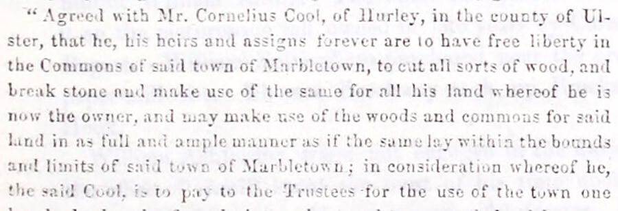
History of Ulster County, New York, with illustrations and biographical sketches of its prominent men and pioneers1880Read the page →
Read the text
“Agreed with Mr. Cornelius Cool, of Hurley, in the county of Ulster, that he, hiheirs and assigns forever are to have free liberty in the Commonof said town of Marbletown, to cat all sorts of wood, and break stone and make use of ti e sumo for all his land v. hereof he is now the owner, and may make use of the woods and commons for said kind in as full and ample manner as if !lic same lay within the bounds and limits of said tow a of Marbletown ; in consideration whereof ho, the said Cool, to pay to the Trustees for the use of the town one
Text read by machine from the scan; it may contain errors.
The history of Ulster County, New York1907 · page 277Read the page →
Read the text
The above Capt. Pawling was the first Sheriff of Ulster County, whose son, Capt. Levi Pawling, commanded the troops at the defense of Kingston, Oct. 16, 1776. Their names appear as residents of the town of Marbletown. Capt. Levi Pawling was an officer in the Old Marbletown Church, as was also Major Albert Pawling. Among the earlier settlers, according to researches made by the late Historian, J. W. Hasbrouck, were Christopher Bersford, Jan Joosten, Richard Cage, Jan Briggs, William Ashfordby, Frederick Hussey, Teunis Claes, Anthony Addison and
Text read by machine from the scan; it may contain errors.
Scans and text from the Internet Archive. Books published in 1930 or earlier, which are in the public domain.
Timeline
Marbletown, 1669 to 2000
Woven from the archive, old maps, post office records, the National Register and the people born here.
Nothing in the archives for these yearsWeddings on Main Street, storms, parades, school pictures, the old store. If it’s in your family album, it belongs here.
In 1669, according to Wikidata. Marbletown’s post office opened in 1817, and the census of 1820 counted 3,809 people here.
How does Marbletown rank for history?
Marbletown is among the most historic 1% of U.S. towns, #28 of 758 in New York. The History grade combines the town’s founding era, the share of homes built before 1940 and its National Register listings. It’s a character grade, so it isn’t part of the overall grade. How it works.
What is on the National Register in Marbletown?
9 listings: 5 buildings and 4 historic districts with 203 contributing buildings. 208 historic buildings in all.
How old are the homes in Marbletown?
30% of Marbletown’s homes were built before 1940 (Census estimate, ±5.4 points), against a typical 27% for a New York town; the median home was built in 1972.
Founding dates: Wikidata, Wikipedia, the U.S. post office records of Blevins & Helbock (CC0) and the Census. Homes by year built: Census ACS 2020–24. National Register of Historic Places: National Park Service (list of May 22, 2026). Old photos, postcards and papers: Wikimedia Commons, the Library of Congress and other public archives, credited on each item’s page. Maps: U.S. Geological Survey historical topographic maps (via Esri) and Sanborn fire-insurance maps (Library of Congress). History text and census tables: Wikipedia (CC BY-SA 4.0). Places that used to be: USGS Geographic Names Information System (2021).
From Wikimedia Commons (12), the National Register of Historic Places (9), Wikipedia, Wikidata and Wikipedia for famous people, U.S. Geological Survey historical maps, U.S. Census counts (via Wikipedia), the US Post Offices dataset (Blevins & Helbock), the USGS Geographic Names Information System and old county and town histories (Internet Archive). Archive images are copied here with their credits and licenses, shown on each photo’s page. Refreshed monthly.


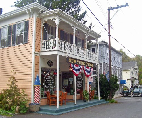




 1875
 1875
 1933
 1933
 1933
 1933
 1933
 1933
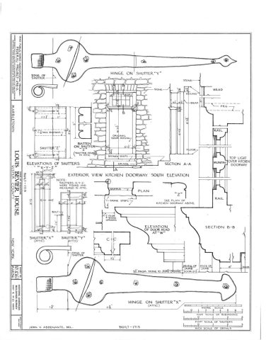 1933
 1933


