Hurley’s post office opened in 1837, and 13% of its homes were built before 1940
More historic than 78% of U.S. towns · #451 of 758 in New York. What drives it
2 places in town are on the National Register, among them the Hurley Historic District, a National Historic Landmark, and a historic district with 17 buildings. Below: 7 old photos and papers, maps from 1901 on, and the census since 1790.
The Hurley post office opened in 1837, the earliest record of the town by name. Another post office, Spillway (1915), opened inside today’s town and later closed.
First census: 847 in 17902020 census: 6,178189 years
How historic is Hurley?
A−
More historic than 78% of U.S. towns, on its age, its old homes and the National Register.
Founding year: the first Hurley post office (Blevins & Helbock, CC0).The full story ↓
History grade
What drives Hurley’s History grade
On its age, its old homes and the National Register, Hurley is more historic than 78% of U.S. towns, #451 of 758 in New York. All 3 inputs are above most U.S. towns; its age ranks highest and its share of homes from before 1940 lowest.
A−
HistoryA character grade: shown, never part of Hurley’s overall grade.
New York towns list more on the Register than most of the country (a typical New York town has 12.3 per 10,000 residents, the U.S. 2.4), so Hurley’s 29.2 sits near the middle of its state (61% of New York towns have fewer) while its 18 historic buildings outnumber those of 79% of U.S. towns.
How sure. Graded on any two of the three inputs instead, the letter would range from B+ to A−. The pre-1940 share is a Census survey estimate (±4.3 points). The founding year is the first post office, not a stated founding date.
Founding year: the first post office (other dates in Quick answers). Homes: Census ACS 2020–24. National Register: National Park Service, May 2026 list; each listing counted once (boundary changes and added documentation belong to their listing), and a historic district counts its contributing buildings. How TownRatings grades history →
What stands out about Hurley’s past
Read from the archive, the National Register and the record. The page puts what stands out first.
In the spring of 1662, Petrus Stuyvesant, Director General of New Netherland, established the village of Niew Dorp on the site of a Native American settlement. On June 7, 1663, during the Esopus Wars the Esopus attacked and destroyed that village, and took captives who were later released. The English acquired the Dutch colony on September 6, 1664. On September 17, 1669, the village, abandoned since the Esopus attack, was resettled and renamed Hurley. It has been stated that the resettled village was named after Francis Lovelace, Baron Hurley of Ireland. However, no such title existed and it is more likely that Lovelace renamed the settlement Hurley somehow in reference to, or solidarity with, his kinsmen and fellow royalists, the Barons Lovelace of Hurley in Berkshire, England (contemporaries as well as modern historians often confuse Francis Lovelace the colonial governor with a son o…
Passages that mention Hurley, cut from the printed page as they were published.
The history of Ulster County, New York1907 · page 61Read the page →
Read the text
1708 — Oct. 12 — Petition of Cornelius Cool and others of the town of Hurley, for a patent for a tract of land adjoining the town of New Paltz, Report thereon by Rip van Dam and other members of the Council recommending the issue of the patent, with the saving clause admitting the rest of the town of Hurley to share in its benefits.
Text read by machine from the scan; it may contain errors.
History of Ulster County, New York, with illustrations and biographical sketches of its prominent men and pioneers1880Read the page →
Read the text
“ Section- Two. All that part of the said town of Kingston described as follows : Beginning at a large pile of stones whore the j towns of Hurley, Woodstock, and Kingston adjoin each other, and | running thence south 10° aud twenty minutes wo.il along tho bounds I of the sai l town of Hurley one hundred and thirty-six chains; thence | south sixtv-two degrees and thirty minutes ra-d one hundred and twenty-seven chains to the most southerly corner of lot number 42 in tho Binncwater class of the commons of the town of Kingston; then
Text read by machine from the scan; it may contain errors.
History of Ulster County, New York, with illustrations and biographical sketches of its prominent men and pioneers1880Read the page →
Read the text
This town is composed of territory taken from three older towns, — Hurley, New Paltz, and Marbletown. The names of the first settlers upon this territory will be found in the chapters upon those several towns, and reference is made to them for this purpose. The memorandum of deeds given by the trustees of Hurley, 1720 to 17G0, the names of those constituting the Middle Road District of Hurley iu 17S1, include the early settlors upon that por-
Text read by machine from the scan; it may contain errors.
The history of Ulster County, New York1907 · page 380Read the page →
Read the text
of Saugerties. From the river it extends westward, embracing the lower portion of the Esopus Creek to the town of Kingston, with an extension between the city and town of Kingston which reaches the bounds of Hurley. Geographically, it is bounded on the north by the town of Saugerties; on the east by the Hudson river; on the south by the city of Kingston, and on the west by the towns of Hurley, Woodstock and Kingston. It was organized in 1880.
Text read by machine from the scan; it may contain errors.
Scans and text from the Internet Archive. Books published in 1930 or earlier, which are in the public domain.
Timeline
Hurley, 1800 to 1980
Woven from the archive, old maps, post office records, the National Register and the people born here.
Nothing in the archives for these yearsWeddings on Main Street, storms, parades, school pictures, the old store. If it’s in your family album, it belongs here.
The Hurley post office opened in 1837, the earliest record of the town by name (U.S. post office records).
How does Hurley rank for history?
Hurley is more historic than 78% of U.S. towns, #451 of 758 in New York. The History grade combines the town’s founding era, the share of homes built before 1940 and its National Register listings. It’s a character grade, so it isn’t part of the overall grade. How it works.
What is on the National Register in Hurley?
Two places: the Hurley Historic District (listed 1966) and the Maverick Concert Hall (1999).
How old are the homes in Hurley?
13% of Hurley’s homes were built before 1940 (Census estimate, ±4.3 points), against a typical 27% for a New York town; the median home was built in 1964.
Founding dates: Wikidata, Wikipedia, the U.S. post office records of Blevins & Helbock (CC0) and the Census. Homes by year built: Census ACS 2020–24. National Register of Historic Places: National Park Service (list of May 22, 2026). Old photos, postcards and papers: Wikimedia Commons, the Library of Congress and other public archives, credited on each item’s page. Maps: U.S. Geological Survey historical topographic maps (via Esri) and Sanborn fire-insurance maps (Library of Congress). History text and census tables: Wikipedia (CC BY-SA 4.0). Places that used to be: USGS Geographic Names Information System (2021).
From Wikimedia Commons (21), the Library of Congress (2), the National Register of Historic Places (2), Wikipedia, Wikidata and Wikipedia for famous people, U.S. Geological Survey historical maps, U.S. Census counts (via Wikipedia), the US Post Offices dataset (Blevins & Helbock), the USGS Geographic Names Information System and old county and town histories (Internet Archive). Archive images are copied here with their credits and licenses, shown on each photo’s page. Refreshed monthly.


 1875
 1894
 Date?
 Date?
 2021
 2021
 2020
 2020
 2020
 2020
 2020
 2017
 2017
 2017
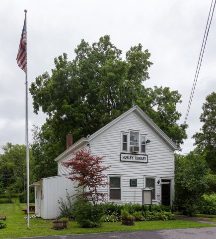 2017
 2017
 2012
 2012
 2012
 2010
 ★ Landmark