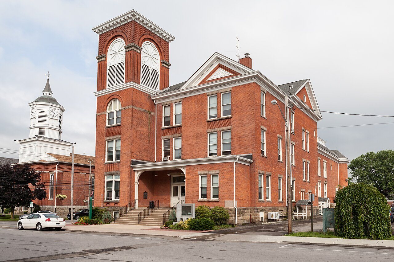
Pomfret dates to 1806, and 39% of its homes were built before 1940
More historic than 96% of U.S. towns · #111 of 758 in New York. What drives it
3 places in town are on the National Register, among them two historic districts with 200 buildings between them. Below: 1 old photo or paper, maps from 1900 on, and the census since 1820.
Founding year: Wikidata. First post office: 1806.The full story ↓
History grade
What drives Pomfret’s History grade
On its age, its old homes and the National Register, Pomfret is more historic than 96% of U.S. towns, #111 of 758 in New York. All 3 inputs are above most U.S. towns; its share of homes from before 1940 ranks highest and its age lowest.
A+
HistoryA character grade: shown, never part of Pomfret’s overall grade.
New York towns list more on the Register than most of the country (a typical New York town has 12.3 per 10,000 residents, the U.S. 2.4), so Pomfret’s 157 sits above most of its state (80% of New York towns have fewer) while its 201 historic buildings outnumber those of 93% of U.S. towns.
How sure. Graded on any two of the three inputs instead, the letter would range from A to A+. The pre-1940 share is a Census survey estimate (±5.8 points). Two sources give 1806.
Founding year: Wikidata (other dates in Quick answers). Homes: Census ACS 2020–24. National Register: National Park Service, May 2026 list; each listing counted once (boundary changes and added documentation belong to their listing), and a historic district counts its contributing buildings. How TownRatings grades history →
What stands out about Pomfret’s past
Read from the archive, the National Register and the record. The page puts what stands out first.
National Park Service, National Register of Historic Places. Photos from Wikimedia Commons, credited on each place’s page.
Places that used to be
Lost post offices, old corners, places now gone and burying grounds
Pomfret had its own post office from 1809 to 1817. Four other post offices opened and closed inside today’s town.
Canadaway
1806–1817
Pomfret
1809–1817
Fredonia
1817–today
Laona
1826–1905
Shumla
1830–1900
Lily Dale
1888–today
Lamberton
1891–1900
18001910today
Hamlets and corners on the map
CordovaFredoniaLambertonLaonaLily DaleMcCenithans Mobile Home ParkReed CornersShumlaVan Buren Bay
Gone or out of use
Barker Street Public SchoolschoolDistrict School Number 6schoolFredonia AcademyschoolItalian Baptist ChapelchurchNewton Memorial HospitalhospitalOur Lady of Lourdes SeminaryschoolSchool Number 14schoolSchool Number 16schoolSchool Number 4schoolSchool Number 5schoolSchool Number 7schoolVan Buren Drive-Inlocale
7cemeteries and burying grounds inside Pomfret
BachelorForest HillKelleyLaonaSaint AnthonyWebster RoadWest Main Street
US Post Offices dataset (Blevins & Helbock, CC0). Places and cemeteries from the USGS Geographic Names Information System (2021).
Help out
Start Pomfret’s collection
The first neighbors to add old photos shape how Pomfret’s history is told.
Decades since 1900 with photos
00s10s20s30s40s50s60s70s80s90s
0 of 10 decades. The empty ones are waiting for someone’s album.
The area was first settled around 1806. The town of Pomfret was formed in 1808 from the town of Chautauqua, being the first partition of Chautauqua after the county was formed. Pomfret later lost substantial parts of its territory during the formation of five new towns of the county.
Dunkirk was formed from Pomfret, Nov. 17, 1859, the division line being the north line of lots 2, 9, 15, 21, 26, 31, 35, 38. The town of Pomfret, at the time of the division, comprised the square township 4, of the 12th range, and the triangular township 5, lying north of it, containing a less area than a regular township. In the formation of Dunkirk, from the 5th township, the two southern tiers of lots were left to the town of Pomfret. Therefore Dunkirk contains only 6,632 acres, while Pomfret has an area of 28,899 acres. The probable reasons for such division are elsewhere stated. [See
Text read by machine from the scan; it may contain errors.
History of Chautauqua County, New York1894 · page 208Read the page →
Read the text
2,381, including 303 electors qualified by law to vote for senator. 1,039 the inhabitants including 90 electors were residents of the town of Chautauqua and 1,342 inhabitants, including 213 senatorial electors resided in the town of Pomfret. By this census it will be seen that the town of Pomfret (as then constituted substantially indentical with the eastern assembly district of the county as it has long existed,) contained a greater number of inhabitants than Chautaucpia* which was identical witli the western district.
Text read by machine from the scan; it may contain errors.
History of Chautauqua County, New York1875 · page 469Read the page →
Read the text
The early settlement of the town of Pomfret was chiefly on and north of the north line of township 5, range 12. The greater part of the village of Fredonia is north of that line, in township 6. Pomfret embraced both townships 5 and 6, until the formation of the town of Dunkirk, in 1859. In forming this town, the two south tiers of lots in township 6 were left in Pomfret ; the latter thus retaining an area of 28,899 acres, and the former containing only 6,632 acres. The reasons for so unequal a division of territory probably are — First, because most of the village of Fredonia was in township
Text read by machine from the scan; it may contain errors.
History of Chautauqua County, New York, and its people1921 · page 216Read the page →
Read the text
2l6 Pomfret. The village of Fredonia was principally in township 6, and extended north into the second tier of lots. In order to keep the entire village in the town of Pomfret, an unequal division of territory was necessary and unavoidable. Pomfret has an area of 28,899 acres, Dunkirk, 6,632.
Text read by machine from the scan; it may contain errors.
Scans and text from the Internet Archive. Books published in 1930 or earlier, which are in the public domain.
Timeline
Pomfret, 1806 to 1900
Woven from the archive, old maps, post office records, the National Register and the people born here.
In 1806, according to Wikidata. Pomfret’s post office opened in 1806, and the census of 1820 counted 2,306 people here.
How does Pomfret rank for history?
Pomfret is more historic than 96% of U.S. towns, #111 of 758 in New York. The History grade combines the town’s founding era, the share of homes built before 1940 and its National Register listings. It’s a character grade, so it isn’t part of the overall grade. How it works.
What is on the National Register in Pomfret?
Three places: the Fredonia Commons Historic District (listed 1978), the US Post Office-Fredonia (1988) and the Lily Dale Assembly Historic District (2022).
How old are the homes in Pomfret?
39% of Pomfret’s homes were built before 1940 (Census estimate, ±5.8 points), against a typical 27% for a New York town; the median home was built in 1956.
Founding dates: Wikidata, Wikipedia, the U.S. post office records of Blevins & Helbock (CC0) and the Census. Homes by year built: Census ACS 2020–24. National Register of Historic Places: National Park Service (list of May 22, 2026). Old photos, postcards and papers: Wikimedia Commons, the Library of Congress and other public archives, credited on each item’s page. Maps: U.S. Geological Survey historical topographic maps (via Esri) and Sanborn fire-insurance maps (Library of Congress). History text and census tables: Wikipedia (CC BY-SA 4.0). Places that used to be: USGS Geographic Names Information System (2021).
From Wikimedia Commons (1), the National Register of Historic Places (3), Wikipedia, Wikidata and Wikipedia for famous people, U.S. Geological Survey historical maps, U.S. Census counts (via Wikipedia), the US Post Offices dataset (Blevins & Helbock), the USGS Geographic Names Information System and old county and town histories (Internet Archive). Archive images are copied here with their credits and licenses, shown on each photo’s page. Refreshed monthly.