


 1974
 Date?
 Date?
The story
Read it all →How Islip came to be
From Wikipedia’s history of Islip.
Matthias Nicoll relocated to New York from Islip, Northamptonshire, England, in 1664.
Text from Wikipedia, licensed CC BY-SA 4.0.
Each edition grades its towns against each other only.
More historic than 76% of U.S. towns · #469 of 758 in New York. What drives it
Most of Islip was built recently: 9% of its homes predate 1940 and the median home dates from 1967. 27 places in town are on the National Register, among them 3 National Historic Landmarks and five historic districts with 35 buildings between them. Below: 27 old photos and papers, maps from 1890 on, and the census since 1790.
Islip dates its founding to 1683 (Wikidata). It appears in the first U.S. census, 1790.
More historic than 76% of U.S. towns, on its age, its old homes and the National Register.
On its age, its old homes and the National Register, Islip is more historic than 76% of U.S. towns, #469 of 758 in New York. Its age holds the grade up; its share of homes from before 1940 pulls it down.
Among the 400 U.S. cities of 100,000 or more, Islip ranks #141 on History.
New York towns list more on the Register than most of the country (a typical New York town has 12.3 per 10,000 residents, the U.S. 2.4), so Islip’s 2.2 sits below most of its state (26% of New York towns have fewer) while its 73 historic buildings outnumber those of 87% of U.S. towns.
Founding year: Wikidata (other dates in Quick answers). Homes: Census ACS 2020–24. National Register: National Park Service, May 2026 list; each listing counted once (boundary changes and added documentation belong to their listing), and a historic district counts its contributing buildings. How TownRatings grades history →
Read from the archive, the National Register and the record. The page puts what stands out first.
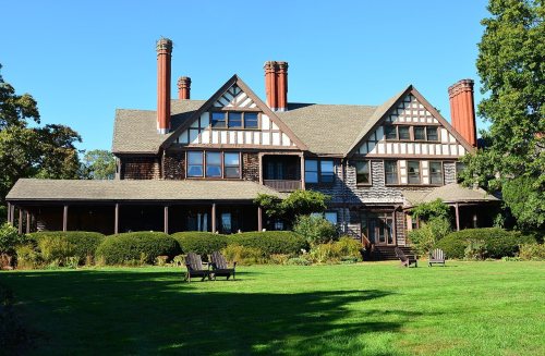
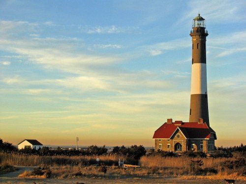
The country’s official list of buildings and places worth saving. 3 are National Historic Landmarks, the highest tier. Boundary changes and added documentation are counted with their listing.
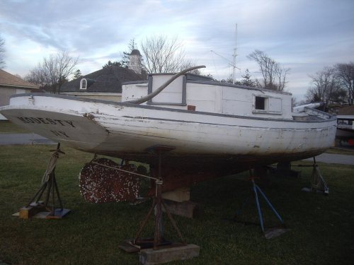 ★ Landmark
 ★ Landmark
 ★ Landmark



National Park Service, National Register of Historic Places. Photos from Wikimedia Commons, credited on each place’s page.
5 decades in the archive, from the 1870s to the 1970s. Scroll each row; tap a photo for its story.
 1873Islip, Suffolk, Co. - Islip, Town of Islip, Suffold C…Map
 1900St. Mark's Episcopal Church, 754 Montauk Highway
 1902Suffolk County, V. 1, Double Page Plate No. 12 (Map b…Map
 1914Paper Mill 20240301 105139
 1915Islip
 1915Islip
 1915New York. Long Island. Islip, Collins Pharmacy (inter…
 1915Tyler Morse and wife
 1915New York. Long Island. Islip, Collins Pharmacy (inter…
 1919Scene on Westbrook Farm
 1919Scene on Westbrook Farm
 1919Lake scene of J.F. Carlisle's Estate
 1939Arthur W. Rossiter, Jr., residence on St. Marks Lane,…
 1939Arthur W. Rossiter, Jr., residence on St. Marks Lane,…
 1939Arthur W. Rossiter, Jr., residence on St. Marks Lane,…
 1939Arthur W. Rossiter, Jr., residence on St. Marks Lane,…
 1939Arthur W. Rossiter, Jr., residence on St. Marks Lane,…
 1939Arthur W. Rossiter, Jr., residence on St. Marks Lane,…
 1939Arthur W. Rossiter, Jr., residence on St. Marks Lane,…
 1939Arthur W. Rossiter, Jr., residence on St. Marks Lane,…
 1939Arthur W. Rossiter, Jr., residence on St. Marks Lane,…
 1939Arthur W. Rossiter, Jr., residence on St. Marks Lane,…
 1939Arthur W. Rossiter, Jr., residence on St. Marks Lane,…
 2022Bayport Homans
 2020Gate Mask at Islip003
 2018Saint Marks Episcopal Church;
 2018S End NY 111 @ NY 27A;
 2018IHS-BIRDSEYE
 2018192 Moffett Boulevard, Islip, NY-3
 2018192 Moffett Boulevard, Islip, NY-2
 2018192 Moffett Boulevard, Islip, NY-1
 2016Long Island, United States (Unsplash)
 2015Mexicoke
 2014Untitled photo
 2012Suffolk County PD ESU; Ford F-550
 2012Islip Town Hall
 2012Islip Town Hall-Front Door
 2012Islip Town Hall Sign; West View
 2012Islip Town Hall Sign; East View
 2012Gibb Patent Plaque; Westbound
 2012Gibb Patent Plaque; Eastbound
 2011House front Winganhauppauge
 2010NY 27A westbound at NY 111
 201077 Saint Marks Lane
 2002Secretary Mel Martinez in
 2001OVERTONFH
Islip’s post office has been open since 1802. Five other post offices opened and closed inside today’s town.
US Post Offices dataset (Blevins & Helbock, CC0). Places and cemeteries from the USGS Geographic Names Information System (2021).
From Wikipedia’s history of Islip.
Matthias Nicoll relocated to New York from Islip, Northamptonshire, England, in 1664.
Text from Wikipedia, licensed CC BY-SA 4.0.
Passages that mention Islip, cut from the printed page as they were published.

Long Island Railroad, and running thence easterly and parallel with said Long Island Railroad until it reaches a point on the boundary line between the towns of Huntington and Islip one mile north of the Long Island Railroad; on the east by the town of Islip; on the south by the Atlantic Ocean, and on the west by the town of Oyster Bay; the eastern and western boundaries being the lines now established and recognized as the town
Text read by machine from the scan; it may contain errors.
Colonel Benajah Strong was a resident of Islip in 1772, owning nearly all the land on which the present village of Islip is located. He was chosen captain of the Islip Company, but, owing to the disastrous result, to the American side, of the battle of Long Island, August 27th 1776, he with others escaped to Connecticut. During the war he, together with Major Tallmadge, was engaged in many daring operations
Text read by machine from the scan; it may contain errors.
There are two villages in England bearing the name of Islip. One of them is in the vicinity of Oxford; the other is in Northamptonshire. It is from this northern village that our own Islip takes its origin, for it was from Islip in Northamptonshire that the Nicoll family came, bringing the name of their English home community.
Text read by machine from the scan; it may contain errors.
Of the “Town of Islip” we hear nothing until 1710, when an act was passed by the colonial legislature au¬ thorizing its organization. As the inhabitants, how¬ ever, were few, and more than half the territory in the hands of a single individual, these residents did not immediately avail themselves of the provisions of this charter. The first town meeting, of which there is any record, was held on the first Tuesday in April, 1720.
Text read by machine from the scan; it may contain errors.Scans and text from the Internet Archive. Books published in 1930 or earlier, which are in the public domain.
Woven from the archive, old maps, post office records, the National Register and the people born here.
BuiltFire Island Light Station is builtIn the archiveIslip, Suffolk, Co. - Islip, Town of Islip, Suffold Co. - Bay Port, Town of Islip, Suffol…In the archiveSt. Mark's Episcopal Church, 754 Montauk Highway On the mapFirst mapped by the U.S. Geological SurveyIn the archivePaper Mill 20240301 105139In the archiveArthur W. Rossiter, Jr., residence on St. Marks Lane, Islip, Long Island. LOC gsc.5a03329
 In the archive1972LesterSlone136
 Born hereTobias Harris is born here
 Born hereZillaKami is born here
Every edition of the U.S. Geological Survey’s map of Islip. Tap a year, or press play to watch the town change.

U.S. Geological Survey historical topographic maps (public domain), via Esri’s collection of the scans. The red ring marks the center of Islip.
Fire insurance maps drew every building, what it was made of and what it was used for, so insurers could price the risk of fire. Pick a year, then a sheet.
 1890Sheet 1 of 5
Sanborn Map Company, via the Library of Congress. Editions published in 1930 or earlier, which are in the public domain.
No then-and-now pairs yet. Take a photo from the same spot as an old one and they appear here side by side.

Find the spot, match the angle, and add your photo. It becomes the first then-and-now pair on Islip’s page.
Retake this view · +15Grew from 609 people in 1790 to 339,938 in 2020, more than tenfold.
24 censuses, 1790–2020.
U.S. Census Bureau decennial counts, from the census table on Islip’s Wikipedia page.
Writers, athletes, leaders and more, ranked by how widely they’re known.
Most archives stop around 1920. The photos from after that are in family albums, not libraries.
Each neighbor’s History grade, on the same three inputs.
In 1683, according to Wikidata. Islip’s post office opened in 1802, and the first U.S. census counted 609 people here in 1790.
Islip is more historic than 76% of U.S. towns, #469 of 758 in New York. The History grade combines the town’s founding era, the share of homes built before 1940 and its National Register listings. It’s a character grade, so it isn’t part of the overall grade. How it works.
27 listings, 3 of them National Historic Landmarks: 20 buildings, 5 historic districts with 35 contributing buildings, and 3 structures. 73 historic buildings in all.
9% of Islip’s homes were built before 1940 (Census estimate), against a typical 27% for a New York town; the median home was built in 1967.
What the archives can’t tell you, neighbors can.
Founding dates: Wikidata, Wikipedia, the U.S. post office records of Blevins & Helbock (CC0) and the Census. Homes by year built: Census ACS 2020–24. National Register of Historic Places: National Park Service (list of May 22, 2026). Old photos, postcards and papers: Wikimedia Commons, the Library of Congress and other public archives, credited on each item’s page. Maps: U.S. Geological Survey historical topographic maps (via Esri) and Sanborn fire-insurance maps (Library of Congress). History text and census tables: Wikipedia (CC BY-SA 4.0). Places that used to be: USGS Geographic Names Information System (2021).
From Wikimedia Commons (45), the Library of Congress (5), Wikidata (4), the National Register of Historic Places (28), Wikipedia, Wikidata and Wikipedia for famous people, U.S. Geological Survey historical maps, U.S. Census counts (via Wikipedia), the US Post Offices dataset (Blevins & Helbock), the USGS Geographic Names Information System, Sanborn fire insurance maps (Library of Congress) and old county and town histories (Internet Archive). Archive images are copied here with their credits and licenses, shown on each photo’s page. Refreshed monthly.


