Guest, Sign inJoin

Post to Huntington

We’ll email a one-tap link to publish your post. No password, and nothing is public until you click it.
Already a member? Sign in
AHistory
History · Huntington

Huntington dates to 1653, and 11% of its homes were built before 1940

More historic than 86% of U.S. towns · #327 of 758 in New York. What drives it

99 places in town are on the National Register, among them ten historic districts with 186 buildings between them. Below: 18 old photos and papers, maps from 1886 on, and the census since 1790.

1653founded
99on the National Register
11%homes built before 1940
18old photos & papers
81famous people
From Huntington’s archive · credits on each photo
Quick answers

How Huntington began

When was Huntington founded?

1653

Huntington dates its founding to 1653 (Wikidata). It appears in the first U.S. census, 1790.

First census: 3,260 in 17902020 census: 204,127373 years

How historic is Huntington?

A

More historic than 86% of U.S. towns, on its age, its old homes and the National Register.

What drives the grade ↓
Founding year: Wikidata. First post office: 1794.The full story ↓
History grade

What drives Huntington’s History grade

On its age, its old homes and the National Register, Huntington is more historic than 86% of U.S. towns, #327 of 758 in New York. Its age holds the grade up; its share of homes from before 1940 pulls it down.

A
HistoryA character grade: shown, never part of Huntington’s overall grade.
All U.S. towns we grade (21,289)Ahead of 86%
NewerOlder
New York towns of 2,500+ (758)Ahead of 57%

Among the 400 U.S. cities of 100,000 or more, Huntington ranks #96 on History.

New York towns list more on the Register than most of the country (a typical New York town has 12.3 per 10,000 residents, the U.S. 2.4), so Huntington’s 19.5 sits near the middle of its state (56% of New York towns have fewer) while its 397 historic buildings outnumber those of 96% of U.S. towns.

NoteThe founding year comes from Wikidata alone; no second source gives 1653.
How sure. Graded on any two of the three inputs instead, the letter would range from B+ to A+. The pre-1940 share (±0.8 points) is firm at this size.

Founding year: Wikidata (other dates in Quick answers). Homes: Census ACS 2020–24. National Register: National Park Service, May 2026 list; each listing counted once (boundary changes and added documentation belong to their listing), and a historic district counts its contributing buildings. How TownRatings grades history →

What stands out about Huntington’s past

Read from the archive, the National Register and the record. The page puts what stands out first.

★ What stands out · On the National Register

99 listings protect 397 historic buildings

The country’s official list of buildings and places worth saving. Boundary changes and added documentation are counted with their listing.

places listed
99
National Historic Landmarks
0
none yet
historic buildings protected
397
each building in a district counts
first listed
1973
Eatons Neck Light
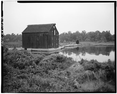
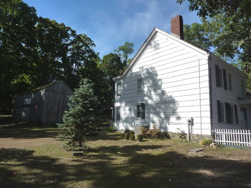
Eatons Neck Light, built 1798Joseph Lloyd House, built 1767Van Wyck-Lefferts Tide MillMarshall Field III EstateMarion Carll FarmFort Golgotha and the Old Burial Hill CemeteryB. Ketchum HouseBay Crest Historic DistrictBeaux Arts Park Historic DistrictBethel AME Church and ManseCarll House, built 1820Carll S. Burr MansionCharles M. Weeks HouseCharles Woodhull HouseChichester's InnCold Spring Harbor LibraryCommack Methodist Church and CemeteryDaniel Smith HouseDavid Conklin House, built 1750Delamater-Bevin MansionDowden TanneryEast Shore Road Historic DistrictEliphas Buffett HouseEzra Carll HomesteadGeorge McKesson Brown Estate-Coindre Hall, built 1939Gilsey MansionHarbor Road Historic DistrictHarry E. Donnell HouseHarry Wood HouseHeckscher ParkHenry Smith FarmsteadHenry Townsend HouseHenry Williams HouseIsaac Losee HouseJacob Smith HouseJarvis-Fleet HouseJohn Everit HouseJohn P. Kane MansionJohn Rogers HouseJoseph Buffett HouseMain Street Historic DistrictMichael Remp HouseN. J. Felix HouseN. Velzer House and Caretaker's CottageOld Town Green Historic DistrictOld Town Hall Historic DistrictPotter-Williams House, built 1827Prime HousePrime-Octagon HouseRogers HouseShore Road Historic DistrictSilas Sammis HouseTitus-Bunce HouseWalt Whitman HouseWest Neck Road Historic DistrictA. P. W. Kennan HouseOld First Church, built 1784Fort Hill EstateSuydam HouseUS Post Office-NorthportLloyd Harbor Lighthouse, built 1857Northport Public Library, built 1914Dove, Arthur-Torr, Helen, CottageCold Spring Harbor Fire District Hook and Ladder Company BuildingOheka, built 1919Charles Homer Davis HouseCold Spring Harbor Beach ClubEagle's NestBowes HouseBrush FarmsteadC. A. O'Donohue HouseCarll Burr Jr. HouseCharles Geoghegan HouseCharles Van Iderstine MansionGoose Hill Road Historic DistrictHalsey Estate-TallwoodHewlett HouseHouse at 200 Bay AvenueHouse at 244 Park AvenueIreland-Gardiner FarmJohn Green HouseJohn Harned HouseJohn Wood HouseJoseph Whitman HouseM. Baylis HouseSeaman FarmSweet Hollow Presbyterian Church ParsonageWallace K. Harrison EstateWhitman-Place HouseWiggins-Rolph HouseWilliam Wooden Wood HouseJohn Oakley HouseLITTLE JENNIE (Chesapeake Bay bugeye), built 1884Karpen HouseNorthport Veterans Administration Hospital Historic DistrictStanley H. Lowndes HouseJohn Bumpstead HouseSt. Paul’s Methodist Episcopal ChurchCrest, The
BuildingsDistrictsSitesStructures

Architectural styles listings

Greek Revival11
Colonial Revival9
Federal8
Late Victorian8
Second Empire6
Tudor Revival5
All 99 listings
Beaux Arts Park Historic DistrictDistrict · listed 1985Bethel AME Church and ManseBuilding · listed 1985Carll HouseBuilding · listed 1985Carll S. Burr MansionBuilding · listed 1985Charles M. Weeks HouseBuilding · listed 1985Charles Woodhull HouseBuilding · listed 1985Chichester's InnBuilding · listed 1985Cold Spring Harbor LibraryBuilding · listed 1985Commack Methodist Church and CemeteryBuilding · listed 1985Daniel Smith HouseBuilding · listed 1985David Conklin HouseBuilding · listed 1985Delamater-Bevin MansionBuilding · listed 1985Dowden TanneryBuilding · listed 1985East Shore Road Historic DistrictDistrict · listed 1985Eliphas Buffett HouseBuilding · listed 1985Ezra Carll HomesteadBuilding · listed 1985George McKesson Brown Estate-Coindre HallBuilding · listed 1985Gilsey MansionBuilding · listed 1985Harbor Road Historic DistrictDistrict · listed 1985Harry E. Donnell HouseBuilding · listed 1985Harry Wood HouseBuilding · listed 1985Heckscher ParkDistrict · listed 1985Henry Smith FarmsteadBuilding · listed 1985Henry Townsend HouseBuilding · listed 1985Henry Williams HouseBuilding · listed 1985Isaac Losee HouseBuilding · listed 1985Jacob Smith HouseBuilding · listed 1985Jarvis-Fleet HouseBuilding · listed 1985John Everit HouseBuilding · listed 1985John P. Kane MansionBuilding · listed 1985John Rogers HouseBuilding · listed 1985Joseph Buffett HouseBuilding · listed 1985Main Street Historic DistrictDistrict · listed 1985Michael Remp HouseBuilding · listed 1985N. J. Felix HouseBuilding · listed 1985N. Velzer House and Caretaker's CottageBuilding · listed 1985Old Town Green Historic DistrictDistrict · listed 1985Old Town Hall Historic DistrictDistrict · listed 1985Potter-Williams HouseBuilding · listed 1985Prime HouseBuilding · listed 1985Prime-Octagon HouseBuilding · listed 1985Rogers HouseBuilding · listed 1985Shore Road Historic DistrictDistrict · listed 1985Silas Sammis HouseBuilding · listed 1985Titus-Bunce HouseBuilding · listed 1985Walt Whitman HouseBuilding · listed 1985West Neck Road Historic DistrictBuilding · listed 1985A. P. W. Kennan HouseBuilding · listed 1985Old First ChurchBuilding · listed 1985Fort Hill EstateBuilding · listed 1988Suydam HouseBuilding · listed 1988US Post Office-NorthportBuilding · listed 1989Lloyd Harbor LighthouseStructure · listed 1989Northport Public LibraryBuilding · listed 1996Dove, Arthur-Torr, Helen, CottageBuilding · listed 2000Cold Spring Harbor Fire District Hook and Ladder Company BuildingBuilding · listed 2003OhekaBuilding · listed 2004Charles Homer Davis HouseBuilding · listed 2006Cold Spring Harbor Beach ClubBuilding · listed 2012Eagle's NestDistrict · listed 2021Bowes HouseBuilding · listed 1985Brush FarmsteadBuilding · listed 1985C. A. O'Donohue HouseBuilding · listed 1985Carll Burr Jr. HouseBuilding · listed 1985Charles Geoghegan HouseBuilding · listed 1985Charles Van Iderstine MansionBuilding · listed 1985Goose Hill Road Historic DistrictDistrict · listed 1985Halsey Estate-TallwoodBuilding · listed 1985Hewlett HouseBuilding · listed 1985House at 200 Bay AvenueBuilding · listed 1985House at 244 Park AvenueBuilding · listed 1985Ireland-Gardiner FarmBuilding · listed 1985John Green HouseBuilding · listed 1985John Harned HouseBuilding · listed 1985John Wood HouseBuilding · listed 1985Joseph Whitman HouseBuilding · listed 1985M. Baylis HouseBuilding · listed 1985Seaman FarmBuilding · listed 1985Sweet Hollow Presbyterian Church ParsonageBuilding · listed 1985Wallace K. Harrison EstateBuilding · listed 1985Whitman-Place HouseBuilding · listed 1985Wiggins-Rolph HouseBuilding · listed 1985William Wooden Wood HouseBuilding · listed 1985John Oakley HouseBuilding · listed 1985LITTLE JENNIE (Chesapeake Bay bugeye)Structure · listed 1986Karpen HouseBuilding · listed 2006Northport Veterans Administration Hospital Historic DistrictDistrict · listed 2012Stanley H. Lowndes HouseBuilding · listed 2019John Bumpstead HouseBuilding · listed 2021St. Paul’s Methodist Episcopal ChurchBuilding · listed 2021Crest, TheBuilding · listed 2022

National Park Service, National Register of Historic Places. Photos from Wikimedia Commons, credited on each place’s page.

Places that used to be

Lost post offices, old corners, places now gone and burying grounds

Huntington’s post office has been open since 1794. Eight other post offices opened and closed inside today’s town.

Huntington
1794–today
Dix Hills
1799–1871
Crab Meadow
1820–1840
Cold Spring Harbor
1825–today
West Hills
1826–1859
Cow Harbour
1831–1835
Centreport
1835–today
Northport
1840–today
Melville
1852–1906
Elwood
1870–1902
17901910today
Hamlets and corners on the map
AsharokenCenterportCold Spring HarborCommackCrab MeadowDix HillsEast NorthportEatons NeckElwoodFort HillGreenlawnHalesiteHalf HollowHuntington BayHuntington BeachHuntington StationLefferts MillLittle PlainsLloyd HarborLower MelvilleMelvilleNorthportSouth HuntingtonVernon Valley
Gone or out of use
Alice B Doscher EstatelocaleAnna Gould EstatelocaleBurrs Lane Junior High SchoolschoolCarls And Son HatcherylocaleCenterport SchoolschoolCentral Elementary SchoolschoolCentury's 110 Drive-InlocaleCoindre HallschoolCold Spring Harbor SchoolschoolCommack Grade SchoolschoolCross Roads FarmlocaleDeer Park SpeedwaylocaleDistrict 16 SchoolschoolDistrict Number 17 SchoolschoolEast Northport SchoolschoolEastern Military AcademyschoolElwood Grade SchoolschoolFriends World Collegeschool
18cemeteries and burying grounds inside Huntington
Bethel African Methodist Episcopal ChurchCarllCommackGenola RuralHuntingtonHuntington RuralLower MelvilleMelvilleMiddleville RoadMount GoldaNorthport RuralOld Burial HillOld NorthportPinelawnSaint PatricksSaint Phillip NeriScidmoreWest Hills Methodist Church

US Post Offices dataset (Blevins & Helbock, CC0). Places and cemeteries from the USGS Geographic Names Information System (2021).

Timeline

Huntington, 1653 to 1984

Woven from the archive, old maps, post office records, the National Register and the people born here.

  1. 17th century
  2. 1653
    FoundingHuntington is established
  3. 18th century
  4. 1750BuiltDavid Conklin House is built
  5. 1767BuiltJoseph Lloyd House is built
  6. 1794Post officeThe Huntington post office opens
  7. 1798BuiltEatons Neck Light is built
  8. 1799Post officeThe Dix Hills post office opens
  9. 19th century
  10. 1820BuiltCarll House is built
  11. 1820Post officeThe Crab Meadow post office opens
  12. 1834In the archiveUntitled photo
  13. 1840Post officeThe Crab Meadow post office closes
  14. 1871Post officeThe Dix Hills post office closes
  15. 20th century
  16. 1901On the mapFirst mapped by the U.S. Geological Survey
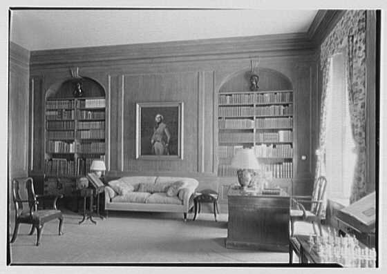
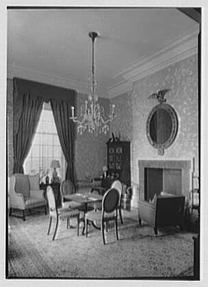
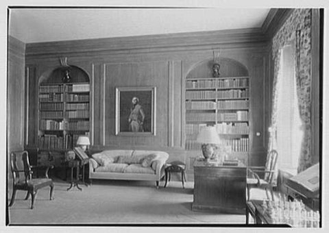
  17. 1927In the archiveMarshall Field, residence
  18. 1930In the archiveHotel Huntington
  19. 1961Born hereRalph Macchio is born here
  20. 1961Born hereCarey Lowell is born here
  21. 1981Born hereLP is born here
  22. 1984Born hereNatalie Kuckenburg is born here
The story

How Huntington came to be

From Wikipedia’s history of Huntington.

Read it all →

In 1653, three men from Oyster Bay – Richard Holbrook, Robert Williams, and Daniel Whitehead – purchased a parcel of land from the Matinecock tribe. This parcel has since come to be known as the "First Purchase" and included land bordered by Cold Spring Harbor on the west, Northport Harbor on the east, what is now known as Old Country Road to the south, and the Long Island Sound to the north. The three men immediately turned the land over to the settlers who had already been living there.

Text from Wikipedia, licensed CC BY-SA 4.0.

From the old history books

What they wrote about Huntington, 1872–1892

Passages that mention Huntington, cut from the printed page as they were published.

We come now to the main <piestion : Has the town title in lamls under tide waters? Ff 80, where is the outermost limit of siu-h title? and what is the nature of that title ? The public statutes describe the boundaries of the Town as follows: "The Town of Huntington shall contain all that part of sa…
An opinion upon the powers and duties of the trustees of the freeholders and commonalty of the town of Huntington1872 · page 27Read the page →
Read the text

We come now to the main <piestion : Has the town title in lamls under tide waters? Ff 80, where is the outermost limit of siu-h title? and what is the nature of that title ? The public statutes describe the boundaries of the Town as follows: "The Town of Huntington shall contain all that part of said County (Suffolk) called and knowfi by the name of Huntington, including Katon's Neck and Crab Meadow."

Text read by machine from the scan; it may contain errors.
In conformity to the opinion heretofore expressed, that the King of Kngland had power to grant, and did, through his subordinates, grant by virtue of the several charters and patents heretofore mentioned, to the Town of Huntington, title to the soil under nil the tide waters within
An opinion upon the powers and duties of the trustees of the freeholders and commonalty of the town of Huntington1872 · page 37Read the page →
Read the text

In conformity to the opinion heretofore expressed, that the King of Kngland had power to grant, and did, through his subordinates, grant by virtue of the several charters and patents heretofore mentioned, to the Town of Huntington, title to the soil under nil the tide waters within

Text read by machine from the scan; it may contain errors.
deg. S. 18 rods to Hampton line on Westfield mountain from Worthington line through Murrayfield eleven miles and one hundred and seventy-six rods to trees marked on the east side of the highway." The present highway from Norwich Bridge in Huntington to Westfield through Montgomery past the meeting-…
A history of the town of Murrayfield1892 · page 156Read the page →
Read the text

deg. S. 18 rods to Hampton line on Westfield mountain from Worthington line through Murrayfield eleven miles and one hundred and seventy-six rods to trees marked on the east side of the highway." The present highway from Norwich Bridge in Huntington to Westfield through Montgomery past the meeting-house is a part of the same highway.

Text read by machine from the scan; it may contain errors.

Scans and text from the Internet Archive. Books published in 1930 or earlier, which are in the public domain.

By decade

Huntington, decade by decade

4 decades in the archive, from the 1830s to the 1990s. Scroll each row; tap a photo for its story.

1940s–1980snothing yet
Nothing in the archives for these yearsWeddings on Main Street, storms, parades, school pictures, the old store. If it’s in your family album, it belongs here.
Add from your album
On the map

Huntington on the map, 1901 to 1979

Every edition of the U.S. Geological Survey’s map of Huntington. Tap a year, or press play to watch the town change.

Huntington on the 1901 USGS mapHuntington on the 1947 USGS mapHuntington on the 1954 USGS mapHuntington on the 1967 USGS mapHuntington on the 1979 USGS map1901Northport sheet · 1:62,500

U.S. Geological Survey historical topographic maps (public domain), via Esri’s collection of the scans. The red ring marks the center of Huntington.

Every building

Huntington, building by building, 1886–1922

Fire insurance maps drew every building, what it was made of and what it was used for, so insurers could price the risk of fire. Pick a year, then a sheet.

Huntington fire insurance map, 1886, sheet 11886Sheet 1 of 2
Edition
BrickWoodStone

Sanborn Map Company, via the Library of Congress. Editions published in 1930 or earlier, which are in the public domain.

Then & now

Stand where they stood

No then-and-now pairs yet. Take a photo from the same spot as an old one and they appear here side by side.

Marshall Field, residence
Retake this viewMarshall Field, residence, 1927

Find the spot, match the angle, and add your photo. It becomes the first then-and-now pair on Huntington’s page.

Retake this view · +15
People over time

Huntington, census by census

020,00040,00060,00080,000100,000120,000140,000160,000180,000200,000220,00018001850190019502000204,127

Grew from 3,260 people in 1790 to 204,127 in 2020, more than tenfold.

24 censuses, 1790–2020.

U.S. Census Bureau decennial counts, from the census table on Huntington’s Wikipedia page.

Famous people

81 famous people were born in Huntington

Writers, athletes, leaders and more, ranked by how widely they’re known.

See all →
Help out

Finish Huntington’s story

Most archives stop around 1920. The photos from after that are in family albums, not libraries.

Decades since 1900 with photos
00s10s20s30s40s50s60s70s80s90s
3 of 10 decades. The empty ones are waiting for someone’s album.
Stories next door

History across the town line

Each neighbor’s History grade, on the same three inputs.

Questions about Huntington’s history

What year was Huntington founded?

In 1653, according to Wikidata. Huntington’s post office opened in 1794, and the first U.S. census counted 3,260 people here in 1790.

How does Huntington rank for history?

Huntington is more historic than 86% of U.S. towns, #327 of 758 in New York. The History grade combines the town’s founding era, the share of homes built before 1940 and its National Register listings. It’s a character grade, so it isn’t part of the overall grade. How it works.

What is on the National Register in Huntington?

99 listings: 84 buildings, among them the Eatons Neck Light (listed 1973, the first), 12 historic districts with 186 contributing buildings, 1 site, and 2 structures. 397 historic buildings in all.

How old are the homes in Huntington?

11% of Huntington’s homes were built before 1940 (Census estimate), against a typical 27% for a New York town; the median home was built in 1963.

Memory lane

What the archives can’t tell you, neighbors can.

Town Square →
Start a conversation
Sources

Where this page comes from

Founding dates: Wikidata, Wikipedia, the U.S. post office records of Blevins & Helbock (CC0) and the Census. Homes by year built: Census ACS 2020–24. National Register of Historic Places: National Park Service (list of May 22, 2026). Old photos, postcards and papers: Wikimedia Commons, the Library of Congress and other public archives, credited on each item’s page. Maps: U.S. Geological Survey historical topographic maps (via Esri) and Sanborn fire-insurance maps (Library of Congress). History text and census tables: Wikipedia (CC BY-SA 4.0). Places that used to be: USGS Geographic Names Information System (2021).

From Wikimedia Commons (21), the Library of Congress (15), Wikidata (7), the National Register of Historic Places (99), Wikipedia, Wikidata and Wikipedia for famous people, U.S. Geological Survey historical maps, U.S. Census counts (via Wikipedia), the US Post Offices dataset (Blevins & Helbock), the USGS Geographic Names Information System, Sanborn fire insurance maps (Library of Congress) and old county and town histories (Internet Archive). Archive images are copied here with their credits and licenses, shown on each photo’s page. Refreshed monthly.