Among the most historic 1% of U.S. towns. What drives it
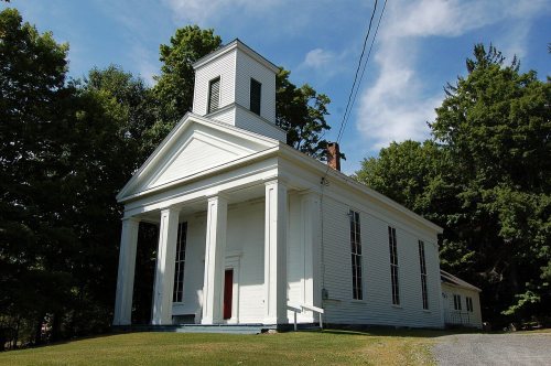
6 places in town are on the National Register, among them a historic district with 128 buildings. Below: 1 old photo or paper, maps from 1886 on, and the census since 1820.
On its age, its old homes and the National Register, Hillsdale is among the most historic 1% of U.S. towns. All 2 inputs put Hillsdale near the top nationally; its National Register listings ranks highest.
A+
HistoryA character grade: shown, never part of Hillsdale’s overall grade.
New York towns list more on the Register than most of the country (a typical New York town has 12.3 per 10,000 residents, the U.S. 2.4), so Hillsdale’s 747 sits above most of its state (94% of New York towns have fewer) while its 134 historic buildings outnumber those of 91% of U.S. towns.
How sure. Graded on two of the three inputs, so a change in either one moves the letter more than it would with three. The pre-1940 share is a Census survey estimate (±7.7 points).
Founding year: our sources. Homes: Census ACS 2020–24. National Register: National Park Service, May 2026 list; each listing counted once (boundary changes and added documentation belong to their listing), and a historic district counts its contributing buildings. How TownRatings grades history →
What stands out about Hillsdale’s past
Read from the archive, the National Register and the record. The page puts what stands out first.
Much of what would become the town of Hillsdale was part of the Manor of Rensselaerswyck. Due to overlapping boundary lines, portions of the eastern part were claimed by the Province of Massachusetts. Kakeout was established by settlers from New England who raised sheep. Around 1745, Martin Krum is reported to have purchased 800 acres in the western portion of the town from the Van Rensselaer family. Robert Noble and his associates procured the Indian title to land about five miles square in the eastern part and called it Nobletown. The Van Resselaers and the Livingstons leased land on their vast estates to tenant farmers, but those who had emigrated from Massachusetts did not recognized the landlords' titles. The dispute was not settled until 1773.
Passages that mention Hillsdale, cut from the printed page as they were published.
Portrait and biographical album of Hillsdale County, Mich.1888 · page 138Read the page →
Read the text
Hillsdale College was established in 1855 by the Free Baptists. The Michigan Central College, at Spring Arbor, was incorporated in 1845 It was kept in operation until it was merged into the present Hillsdale College. The site comprises 25 acres, beautifully situated on an eminence in the western part of the city of Hillsdale. The large and imposing building first erected was nearly destroyed by fire
Text read by machine from the scan; it may contain errors.
Portrait and biographical album of Hillsdale County, Mich.1888 · page 940Read the page →
Read the text
still in the employ of the same company, was stationed at Manchester in the same position, and a year later was promoted to the more responsible post of Agent at Hillsdale; two and one-half years later he resigned, and accepted a position with the same company as clerk in the freight office at Chicago; three months later went to Bryan, Ohio, on Air Line of the same road, where he officiated as Station
Text read by machine from the scan; it may contain errors.
History of Columbia County, New York. With illustrations and biographical sketches of some of its prominent men and pioneers1878Read the page →
Read the text
which provided " that from and after the passing of this act, such parts of the towns of Claverack, Kinderhook, and Chatham a-s are contained in the following bounds — beginning at the northwest corner of the town of Hillsdale, and running from thence southerly along the division line between Claverack and Hillsdale to the road opposite the cooper-shop of Solomon Strong ; thence westerly, in a straight line, to Claverack creek, at a place 11 chains and
Text read by machine from the scan; it may contain errors.
Scans and text from the Internet Archive. Books published in 1930 or earlier, which are in the public domain.
Timeline
Hillsdale, 1789 to 1907
Woven from the archive, old maps, post office records, the National Register and the people born here.
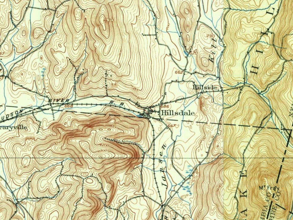
Every edition of the U.S. Geological Survey’s map of Hillsdale. Tap a year, or press play to watch the town change.
1902Copake sheet · 1:62,500
U.S. Geological Survey historical topographic maps (public domain), via Esri’s collection of the scans. The red ring marks the center of Hillsdale.
Every building
Hillsdale, building by building, 1886–1912
Fire insurance maps drew every building, what it was made of and what it was used for, so insurers could price the risk of fire. Pick a year, then a sheet.
1886Sheet 1 of 1
Edition
Sheets
BrickWoodStone
Sanborn Map Company, via the Library of Congress. Editions published in 1930 or earlier, which are in the public domain.
Then & now
Stand where they stood
No then-and-now pairs yet. Take a photo from the same spot as an old one and they appear here side by side.
Retake this viewHillsdale (Township), 1873
Find the spot, match the angle, and add your photo. It becomes the first then-and-now pair on Hillsdale’s page.
Hillsdale is among the most historic 1% of U.S. towns. The History grade combines the town’s founding era, the share of homes built before 1940 and its National Register listings. It’s a character grade, so it isn’t part of the overall grade. How it works.
What is on the National Register in Hillsdale?
6 listings: 5 buildings, among them the Emmanuel Lutheran Church of Harlemville and Cemetery (listed 2002, the first), and 1 historic district, the Hillsdale Hamlet Historic District, with 128 contributing buildings. 134 historic buildings in all.
How old are the homes in Hillsdale?
34% of Hillsdale’s homes were built before 1940 (Census estimate, ±7.7 points), against a typical 27% for a New York town; the median home was built in 1969.
Founding dates: Wikidata, Wikipedia, the U.S. post office records of Blevins & Helbock (CC0) and the Census. Homes by year built: Census ACS 2020–24. National Register of Historic Places: National Park Service (list of May 22, 2026). Old photos, postcards and papers: Wikimedia Commons, the Library of Congress and other public archives, credited on each item’s page. Maps: U.S. Geological Survey historical topographic maps (via Esri) and Sanborn fire-insurance maps (Library of Congress). History text and census tables: Wikipedia (CC BY-SA 4.0). Places that used to be: USGS Geographic Names Information System (2021).
From Wikimedia Commons (11), Wikidata (1), the National Register of Historic Places (6), Wikipedia, Wikidata and Wikipedia for famous people, U.S. Geological Survey historical maps, U.S. Census counts (via Wikipedia), the US Post Offices dataset (Blevins & Helbock), the USGS Geographic Names Information System, Sanborn fire insurance maps (Library of Congress) and old county and town histories (Internet Archive). Archive images are copied here with their credits and licenses, shown on each photo’s page. Refreshed monthly.




 2018
 2017
 2016
 2016
 2016
 2016
 2009
 2006
 2005
 2004