
The story
Read it all →How Austerlitz came to be
From Wikipedia’s history of Austerlitz.
Ellis, Capt. Franklin, "History of Columbia County, New York", (1878), page 381:
ChaptersPast residents of note
Text from Wikipedia, licensed CC BY-SA 4.0.
Each edition grades its towns against each other only.
More historic than 96% of U.S. towns. What drives it
7 places in town are on the National Register, among them the Steepletop, a National Historic Landmark, and two historic districts with 107 buildings between them. Below: 2 old photos and papers from 1873 on and old-book passages.
The Austerlitz post office opened in 1818, the earliest record of the town by name.
More historic than 96% of U.S. towns, on its age, its old homes and the National Register.
On its age, its old homes and the National Register, Austerlitz is more historic than 96% of U.S. towns. All 3 inputs are above most U.S. towns; its National Register listings ranks highest and its age lowest.
New York towns list more on the Register than most of the country (a typical New York town has 12.3 per 10,000 residents, the U.S. 2.4), so Austerlitz’s 716 sits above most of its state (94% of New York towns have fewer) while its 120 historic buildings outnumber those of 90% of U.S. towns.
Founding year: the first post office (other dates in Quick answers). Homes: Census ACS 2020–24. National Register: National Park Service, May 2026 list; each listing counted once (boundary changes and added documentation belong to their listing), and a historic district counts its contributing buildings. How TownRatings grades history →
Read from the archive, the National Register and the record. The page puts what stands out first.
The first neighbors to add old photos shape how Austerlitz’s history is told.
The country’s official list of buildings and places worth saving. One is a National Historic Landmark, the highest tier.
 ★ Landmark
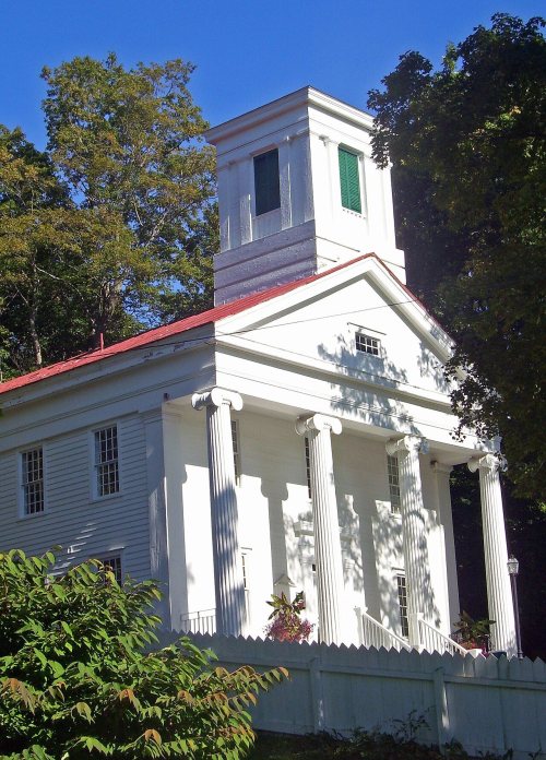

National Park Service, National Register of Historic Places. Photos from Wikimedia Commons, credited on each place’s page.
From Wikipedia’s history of Austerlitz.
Ellis, Capt. Franklin, "History of Columbia County, New York", (1878), page 381:
Text from Wikipedia, licensed CC BY-SA 4.0.
Passages that mention Austerlitz, cut from the printed page as they were published.

lem ville, where the Richmond Mills now stand. "Spafford's Gazetteer," published in 1813, says that there were then in the town (which included part of the present town of Austerlitz) "eleven grist-mills, ten saw-mills, four fulling-mills, and four carding-machines." Among the first fulling-mills were three on the Roeloff Jansen's Kill, in the Collin neighborhood. One of the first carding-machines was near the site of the Baily mill,
Text read by machine from the scan; it may contain errors.
It is claimed that the first mowing-machine was invented and constructed by a Mr. Beal, of Spencertowu, in the town of Austerlitz, between 1830 and 1810. It is mentioned that " it had a straight scythe, and was at least a good experiment in the right direction."
Text read by machine from the scan; it may contain errors.
The Supervisor from Hillsdale raised objections to prerogatives exercised by the District Attorney and jailer, which were ultimately sustained. The Supervisor from Stockport moved that the people of Austerlitz should be taxed for the support of an expensive bridge in Stockport, as the people of Austerlitz used it on their way to the Hudson market. The Supervisor of Hillsdale opposed the motion and was sustained. In 1811 it was
Text read by machine from the scan; it may contain errors.
The village of Austerlitz was formerly called " Upper Green River ;" but that name is now given to a little hamlet lying near the Hillsdale line, a mile north of " Green river" (formerly known as the " Lower Hollow"), in that town.
Text read by machine from the scan; it may contain errors.Scans and text from the Internet Archive. Books published in 1930 or earlier, which are in the public domain.
Woven from the archive, old maps, post office records, the National Register and the people born here.
BuiltSt. Peter's Presbyterian Church and Spencertown Cemetery is built In the archiveAncram (Village); Canaan Four Corners (Village); Spencertown (Village); Austerlitz (Villa…
One decade in the archive so far: the 1870s. Scroll each row; tap a photo for its story.
No then-and-now pairs yet. Take a photo from the same spot as an old one and they appear here side by side.

Find the spot, match the angle, and add your photo. It becomes the first then-and-now pair on Austerlitz’s page.
Retake this view · +15Austerlitz’s post office has been open since 1818.
US Post Offices dataset (Blevins & Helbock, CC0). Places and cemeteries from the USGS Geographic Names Information System (2021).
Each neighbor’s History grade, on the same three inputs.
The Austerlitz post office opened in 1818, the earliest record of the town by name (U.S. post office records).
Austerlitz is more historic than 96% of U.S. towns. The History grade combines the town’s founding era, the share of homes built before 1940 and its National Register listings. It’s a character grade, so it isn’t part of the overall grade. How it works.
7 listings: 5 buildings, among them the Steepletop (a National Historic Landmark since 1971), and 2 historic districts, the Austerlitz Historic District and the Spencertown Historic District, with 107 contributing buildings. 120 historic buildings in all.
33% of Austerlitz’s homes were built before 1940 (Census estimate, ±10.5 points), against a typical 27% for a New York town; the median home was built in 1969.
What the archives can’t tell you, neighbors can.
Founding dates: Wikidata, Wikipedia, the U.S. post office records of Blevins & Helbock (CC0) and the Census. Homes by year built: Census ACS 2020–24. National Register of Historic Places: National Park Service (list of May 22, 2026). Old photos, postcards and papers: Wikimedia Commons, the Library of Congress and other public archives, credited on each item’s page. Maps: U.S. Geological Survey historical topographic maps (via Esri) and Sanborn fire-insurance maps (Library of Congress). History text and census tables: Wikipedia (CC BY-SA 4.0). Places that used to be: USGS Geographic Names Information System (2021).
From Wikimedia Commons (4), Wikidata (1), the National Register of Historic Places (7), Wikipedia, the US Post Offices dataset (Blevins & Helbock), the USGS Geographic Names Information System and old county and town histories (Internet Archive). Archive images are copied here with their credits and licenses, shown on each photo’s page. Refreshed monthly.
 1873
 2016
 2007