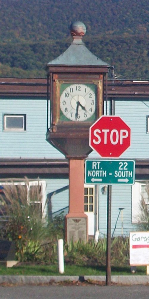
Copake’s post office opened in 1826, and 18% of its homes were built before 1940
More historic than 85% of U.S. towns · #344 of 758 in New York. What drives it
8 places in town are on the National Register, among them two historic districts with 20 buildings between them. Below: 2 old photos and papers, maps from 1902 on, and the census since 1830.
The Copake post office opened in 1826, the earliest record of the town by name. Another post office, North Copake (1851), opened inside today’s town and later closed.
First census: 1,675 in 18302020 census: 3,346200 years
How historic is Copake?
A
More historic than 85% of U.S. towns, on its age, its old homes and the National Register.
Founding year: the first Copake post office (Blevins & Helbock, CC0).The full story ↓
History grade
What drives Copake’s History grade
On its age, its old homes and the National Register, Copake is more historic than 85% of U.S. towns, #344 of 758 in New York. All 3 inputs are above most U.S. towns; its National Register listings ranks highest and its share of homes from before 1940 lowest.
A
HistoryA character grade: shown, never part of Copake’s overall grade.
New York towns list more on the Register than most of the country (a typical New York town has 12.3 per 10,000 residents, the U.S. 2.4), so Copake’s 84.5 sits above most of its state (73% of New York towns have fewer) while its 28 historic buildings outnumber those of 81% of U.S. towns.
How sure. Graded on any two of the three inputs instead, the letter would still be A−. The pre-1940 share is a Census survey estimate (±6.0 points). The founding year is the first post office, not a stated founding date.
Founding year: the first post office (other dates in Quick answers). Homes: Census ACS 2020–24. National Register: National Park Service, May 2026 list; each listing counted once (boundary changes and added documentation belong to their listing), and a historic district counts its contributing buildings. How TownRatings grades history →
What stands out about Copake’s past
Read from the archive, the National Register and the record. The page puts what stands out first.
Copake was part of the 1686 Taconic Grant to Robert Livingston, for approximately 400 acres (1.6 km2) of good land and 2,200 acres (8.9 km2) of woodland. After it was purchased from the Indians, it turned out to be 160,000 acres (650 km2), and he established the English-style Livingston Manor. The manor extended well into what is now Massachusetts. The first lease given by Livingston in Copake was for about 85 acres (340,000 m2) in 1687, to Matthews Abraham Van Deusen. Because New England claimed ownership west to the Hudson River, a border dispute broke out. The Massachusetts Bay Colony laid out three townships west of the Taconic Mountains in 1755. Most of the present town of Copake was in one of the townships. New settlers were given 100 acres (0.40 km2) free, and some of Livingston's tenants refused to pay rent. The border was settled in 1757 by the Lords Commissioners of Trade in …
Passages that mention Copake, cut from the printed page as they were published.
History of Columbia County, New York. With illustrations and biographical sketches of some of its prominent men and pioneers1878 · page 396Read the page →
Read the text
man emigrants, who were induced by the proprietor of the manor to lease farms from him. On a map published by Beatty, in 1714, the residences of families named VVitbeck, Class, and Brusie are located near Copake creek, but one of these, at least (the Whitbecks), was located in the present town of Copake. The general settlement of this part of the manor did not take place until several years later,- — • probably about 1750,- — -though from the meagre records
Text read by machine from the scan; it may contain errors.
History of Columbia County, New York. With illustrations and biographical sketches of some of its prominent men and pioneers1878 · page 388Read the page →
Read the text
The Rhinebeck and Connecticut railroad runs a distance of three and a quarter miles through the south part of the town. Copake Station, a half-mile south of Copake Flats, is the only station. The early settlers of this town were almost entirely of Dutch and German ancestry, and settled along the course of the creeks or the shores of the lakes and ponds. No doubt a few of them settled here some years before the
Text read by machine from the scan; it may contain errors.
A history of Hillsdale, Columbia County, New York1883 · page 27Read the page →
Read the text
George Birdsall was a distinguished physician and resided for a time in what is now the town of Copake. One of the kindred was a military officer and was assassinated at Greenbush. The daughters of Benjamin Bird-
Text read by machine from the scan; it may contain errors.
Scans and text from the Internet Archive. Books published in 1930 or earlier, which are in the public domain.
Timeline
Copake, 1826 to 2010
Woven from the archive, old maps, post office records, the National Register and the people born here.
Nothing in the archives for these yearsWeddings on Main Street, storms, parades, school pictures, the old store. If it’s in your family album, it belongs here.
The Copake post office opened in 1826, the earliest record of the town by name (U.S. post office records).
How does Copake rank for history?
Copake is more historic than 85% of U.S. towns, #344 of 758 in New York. The History grade combines the town’s founding era, the share of homes built before 1940 and its National Register listings. It’s a character grade, so it isn’t part of the overall grade. How it works.
What is on the National Register in Copake?
8 listings: 5 buildings, among them the Church of St. John in the Wilderness (listed 1995, the first), 2 historic districts, the Copake Iron Works Historic District and the Sweet-Sherman Homestead, with 20 contributing buildings, and 1 site. 28 historic buildings in all.
How old are the homes in Copake?
18% of Copake’s homes were built before 1940 (Census estimate, ±6.0 points), against a typical 27% for a New York town; the median home was built in 1970.
Founding dates: Wikidata, Wikipedia, the U.S. post office records of Blevins & Helbock (CC0) and the Census. Homes by year built: Census ACS 2020–24. National Register of Historic Places: National Park Service (list of May 22, 2026). Old photos, postcards and papers: Wikimedia Commons, the Library of Congress and other public archives, credited on each item’s page. Maps: U.S. Geological Survey historical topographic maps (via Esri) and Sanborn fire-insurance maps (Library of Congress). History text and census tables: Wikipedia (CC BY-SA 4.0). Places that used to be: USGS Geographic Names Information System (2021).
From Wikimedia Commons (22), the Library of Congress (1), the National Register of Historic Places (8), Wikipedia, Wikidata and Wikipedia for famous people, U.S. Geological Survey historical maps, U.S. Census counts (via Wikipedia), the US Post Offices dataset (Blevins & Helbock), the USGS Geographic Names Information System and old county and town histories (Internet Archive). Archive images are copied here with their credits and licenses, shown on each photo’s page. Refreshed monthly.


 2022
 2022
 2022
 2022
 2022
 2022
 2022
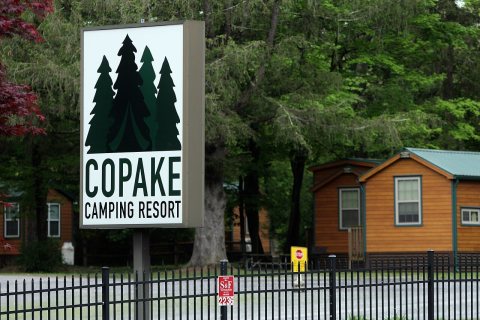 2022
 2022
 2022
 2022
 2022
 2022
 2022
 2022
 2022
 2018
 2013
 2009
 2009
 2005