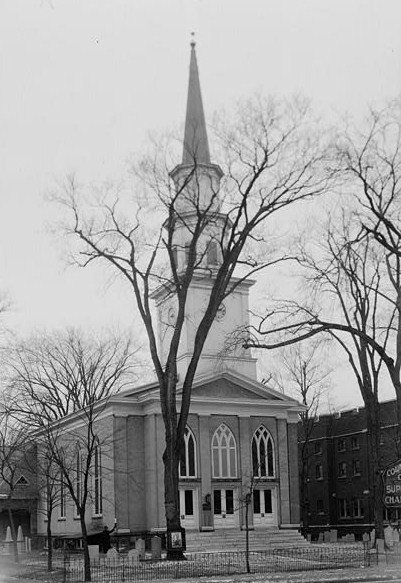
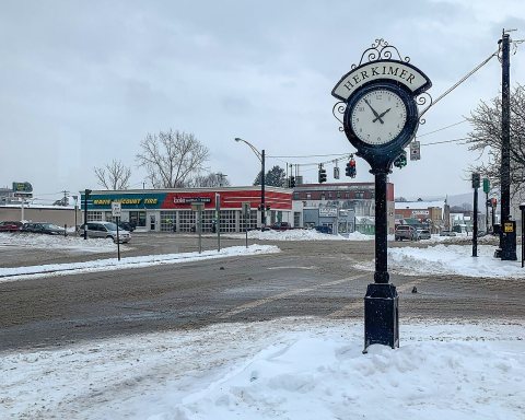
Herkimer dates to 1722, and 47% of its homes were built before 1940
More historic than 93% of U.S. towns · #202 of 758 in New York. What drives it
9 places in town are on the National Register, among them a historic district with 2 buildings. Below: 13 old photos and papers, maps from 1884 on, and the census since 1790.
Founding year: Wikipedia. First post office: 1798.The full story ↓
History grade
What drives Herkimer’s History grade
On its age, its old homes and the National Register, Herkimer is more historic than 93% of U.S. towns, #202 of 758 in New York. All 2 inputs are above most U.S. towns; its share of homes from before 1940 ranks highest and its National Register listings lowest.
A
HistoryA character grade: shown, never part of Herkimer’s overall grade.
New York towns list more on the Register than most of the country (a typical New York town has 12.3 per 10,000 residents, the U.S. 2.4), so Herkimer’s 12.6 sits near the middle of its state (50% of New York towns have fewer) while its 12 historic buildings outnumber those of 77% of U.S. towns.
NoteThe founding year comes from Wikipedia alone; no second source gives 1722.
How sure. Graded on two of the three inputs, so a change in either one moves the letter more than it would with three. The pre-1940 share is a Census survey estimate (±7.2 points).
Founding year: Wikipedia (other dates in Quick answers). Homes: Census ACS 2020–24. National Register: National Park Service, May 2026 list; each listing counted once (boundary changes and added documentation belong to their listing), and a historic district counts its contributing buildings. How TownRatings grades history →
What stands out about Herkimer’s past
Read from the archive, the National Register and the record. The page puts what stands out first.
Fire insurance maps drew every building, what it was made of and what it was used for, so insurers could price the risk of fire. Pick a year, then a sheet.
Herkimer was first settled c. 1722, in an area originally called "Stone Ridge", now the village of Herkimer. Early settlers were primarily German Palatines.
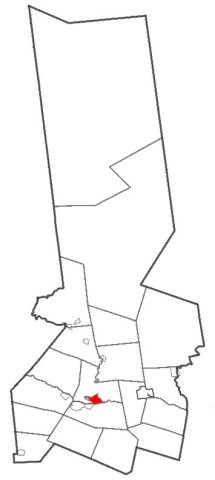
Johan Jost Herchheimer, a farmer who also engaged in trade and transport on the Mohawk River, settled in the German Flatts District of Albany County in 1725, on the south side of the Mohawk River, within the present-day town of German Flatts, incorporated in 1788. He owned 5,000 acres (20 km2) of the land, including a strategic portage around Little Falls on the Mohawk, where his eldest son Nicholas Herkimer established a farmstead. In 1788, the town of Herkimer, on the north side of the river, was incorporated and named after him.
Passages that mention Herkimer, cut from the printed page as they were published.
History of Herkimer county, New York1893 · page 222Read the page →
Read the text
The village of Herkimer is the oldest in the county, and was incorporated April 6, 1807, Geneva, Cooperstown and Utica then being the only villages west of Herkimer, and the two former antedated Herkimer by only a few days. The population at the date of incorporation was probably about 300. In 1820 it was 547 ; in 1872, 2,000, and at the present time about 4,000.
Text read by machine from the scan; it may contain errors.
The old stone mansion, the most important at Fort Herkimer, had been garrisoned at various periods since 1757, when the fort contained one hundred and fifty soldiers and two hundred settlers, the garrison remaining there until the close of the French war, part of the time under the command of Captain Nicholas Herkimer. In 1776 it had been again fitted up and garrisoned.
Text read by machine from the scan; it may contain errors.
History of Herkimer county, New York1893 · page 397Read the page →
Read the text
Town of schuylee. 397 THE town of Schuyler was formed from the town of Herkimer April 10, 1792. Since that date the town of Trenton was taken from it in 1797 ; Deerfield (Oneida county) in 1798, and a part of Newport in 1S06. A part of Herkimer was annexed in 1808, and reannexed to Herkimer in 181 1. (See New York session laws.) Schuyler is bounded on the north by Newport ; east by Herkimer ; south by the Mohawk River, and west by Oneida county. The valley of the Mohawk,
Text read by machine from the scan; it may contain errors.
2,324 acres of land on the south bank of the river, extending from Lindsay's patent to the easternmost Burnetts-field lots. In 1755 there were granted patents to John Joseph Herkimer and Nicholas Herkimer and fifteen others, a tract containing thirtyfour thousand acres of land, comprising most of the German-Flatts and including nearly the whole of the present town of Columbia.
Text read by machine from the scan; it may contain errors.
Scans and text from the Internet Archive. Books published in 1930 or earlier, which are in the public domain.
Timeline
Herkimer, 1722 to 1947
Woven from the archive, old maps, post office records, the National Register and the people born here.
Nothing in the archives for these yearsWeddings on Main Street, storms, parades, school pictures, the old store. If it’s in your family album, it belongs here.
Lost post offices, old corners, places now gone and burying grounds
Herkimer’s post office has been open since 1798. Two other post offices opened and closed inside today’s town.
Herkimer
1798–today
Eaton's Bush
1822–1830
Countryman
1895–1906
17901910today
Hamlets and corners on the map
East HerkimerKast BridgeNorth Ilion
Gone or out of use
East Herkimer SchoolschoolFiddlertown SchoolschoolHerkimer Memorial HospitalhospitalHildreth SchoolschoolKast Bridge SchoolschoolOsborne Hill SchoolschoolSchool Number 10schoolShells Bush Schoolschool
7cemeteries and burying grounds inside Herkimer
CalvaryEaton's BushHoly Spirit Polish CatholicOak HillSaint AgnesSaint MarysSaints Peter And Paul Orthodox
US Post Offices dataset (Blevins & Helbock, CC0). Places and cemeteries from the USGS Geographic Names Information System (2021).
Help out
Finish Herkimer’s story
Most archives stop around 1920. The photos from after that are in family albums, not libraries.
Decades since 1900 with photos
00s10s20s30s40s50s60s70s80s90s
3 of 10 decades. The empty ones are waiting for someone’s album.
In 1722, according to Wikipedia’s history of the town. Herkimer’s post office opened in 1798, and the first U.S. census counted 1,525 people here in 1790.
How does Herkimer rank for history?
Herkimer is more historic than 93% of U.S. towns, #202 of 758 in New York. The History grade combines the town’s founding era, the share of homes built before 1940 and its National Register listings. It’s a character grade, so it isn’t part of the overall grade. How it works.
What is on the National Register in Herkimer?
9 listings: 8 buildings, among them the Herkimer County Courthouse (listed 1972, the first), and 1 historic district, the Oak Hill Cemetery, with 2 contributing buildings. 12 historic buildings in all.
How old are the homes in Herkimer?
47% of Herkimer’s homes were built before 1940 (Census estimate, ±7.2 points), against a typical 27% for a New York town; the median home was built in 1944.
Founding dates: Wikidata, Wikipedia, the U.S. post office records of Blevins & Helbock (CC0) and the Census. Homes by year built: Census ACS 2020–24. National Register of Historic Places: National Park Service (list of May 22, 2026). Old photos, postcards and papers: Wikimedia Commons, the Library of Congress and other public archives, credited on each item’s page. Maps: U.S. Geological Survey historical topographic maps (via Esri) and Sanborn fire-insurance maps (Library of Congress). History text and census tables: Wikipedia (CC BY-SA 4.0). Places that used to be: USGS Geographic Names Information System (2021).
From Wikimedia Commons (13), the Library of Congress (11), the National Register of Historic Places (9), Wikipedia, Wikidata and Wikipedia for famous people, U.S. Geological Survey historical maps, U.S. Census counts (via Wikipedia), the US Post Offices dataset (Blevins & Helbock), the USGS Geographic Names Information System, Sanborn fire insurance maps (Library of Congress) and old county and town histories (Internet Archive). Archive images are copied here with their credits and licenses, shown on each photo’s page. Refreshed monthly.


 1900
 1901
 1902
 1905
 1905
 1905
 1905
 1905
 1905
 1905
 2025
 2022
 2019
 2019
 2018
 2018
 2018
 2018
 2012
 2010
 2009