More historic than 44% of U.S. towns · #696 of 758 in New York. What drives it
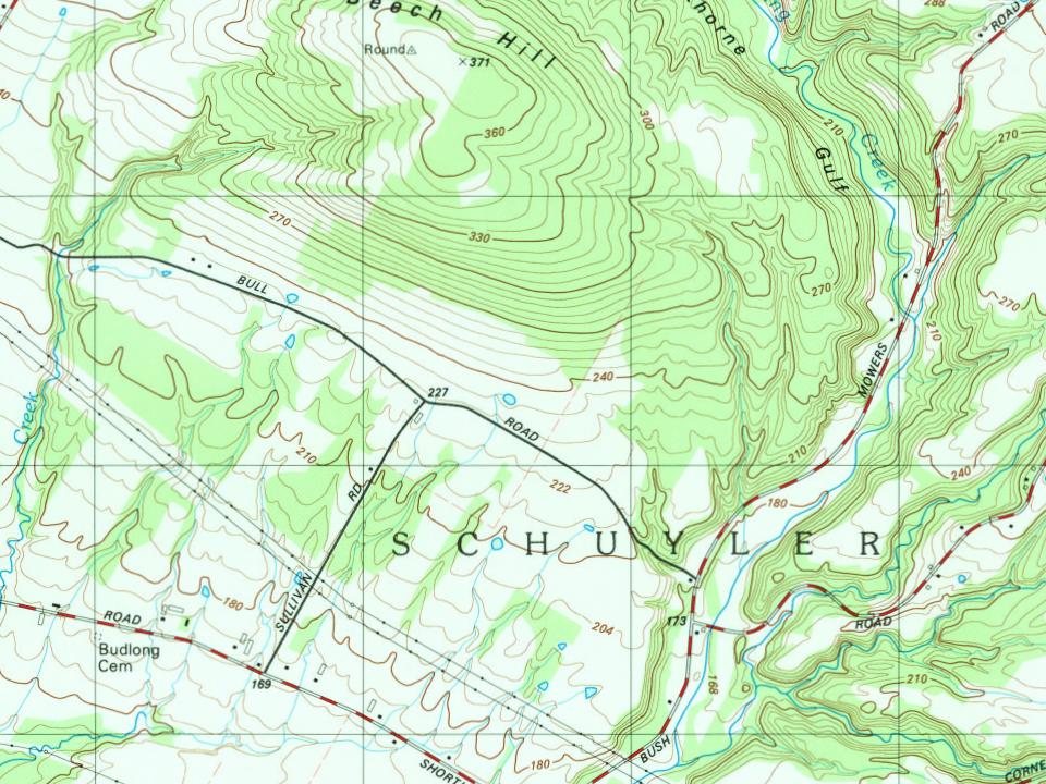
Most of Schuyler was built recently: 10% of its homes predate 1940 and the median home dates from 1986. Below: maps from 1898 on and the census since 1820.
Photo: Webb_Herkimer_NY.png: Schzmo *derivative work: Liesel · Public domain
Quick answers
How Schuyler began
When was Schuyler founded?
1825
The Schuyler post office opened in 1825, the earliest record of the town by name. Two smaller post offices, East Schuyler (1825) and West Schuyler (1825), opened inside today’s town and later closed.
First census: 1,837 in 18202020 census: 3,296201 years
How historic is Schuyler?
C+
More historic than 44% of U.S. towns, on its age, its old homes and the National Register.
Founding year: the first Schuyler post office (Blevins & Helbock, CC0).The full story ↓
History grade
What drives Schuyler’s History grade
On its age, its old homes and the National Register, Schuyler is more historic than 44% of U.S. towns, #696 of 758 in New York. Its age holds the grade up; its National Register listings pull it down.
C+
HistoryA character grade: shown, never part of Schuyler’s overall grade.
New York towns list more on the Register than most of the country (a typical New York town has 12.3 per 10,000 residents, the U.S. 2.4), so Schuyler’s 0.0 sits below most of its state (10% of New York towns have fewer) while its 0 listings outnumber those of 23% of U.S. towns.
How sure. Graded on any two of the three inputs instead, the letter would range from C− to B. The pre-1940 share is a Census survey estimate (±6.4 points). The founding year is the first post office, not a stated founding date.
Founding year: the first post office (other dates in Quick answers). Homes: Census ACS 2020–24. National Register: National Park Service, May 2026 list; each listing counted once (boundary changes and added documentation belong to their listing), and a historic district counts its contributing buildings. How TownRatings grades history →
What stands out about Schuyler’s past
Read from the archive, the National Register and the record. The page puts what stands out first.
Lost half of its people between 1830 and 1920, then grew 3-fold.
20 censuses, 1820–2010.
U.S. Census Bureau decennial counts, from the census table on Schuyler’s Wikipedia page.
Places that used to be
Lost post offices, old corners, places now gone and burying grounds
Schuyler had its own post office from 1825 to 1825. Two other post offices opened and closed inside today’s town.
East Schuyler
1825–1901
Schuyler
1825–1825
West Schuyler
1825–1901
18201920today
Hamlets and corners on the map
Baker CornersCountry Meadows Mobile Home ParkEast SchuylerJohnson CornersNorth FrankfortWest Schuyler
Gone or out of use
Little Red SchoolschoolSchool Number 1schoolSchool Number 1schoolSchool Number 4schoolSchool Number 6schoolSchool Number 7schoolSchool Number 8schoolSchuyler Drive-InlocaleShort Lots SchoolschoolStone Schoolhouseschool
The area was first settled around 1765. The town of Schuyler was formed in 1792 from part of the town of Herkimer. In 1797, part of Schuyler was taken to form the newer town of Trenton. Schuyler was further reduced in 1798 to form the town of Deerfield (Oneida County) and in 1806 to form the town of Newport.
Passages that mention Schuyler, cut from the printed page as they were published.
An outline history of Tioga and Bradford counties in Pennsylvania, Chemung, Steuben, Tioga, Tompkins and Schuyler in New York1885 · page 247Read the page →
Read the text
and by an aci of the legislature passed April 20, 1836, the eastern portion of Jersey township was formed into a town under the name of Orange. A portion of Hornby was annexed April 11, 1842, and part of Bradford township annexed April 17, 1854. It became a town of Schuyler county at its formation in the year 1854. It is bounded on the north by Tyrone and Reading, on the east by Catlin in Chemung county, and Dix and Reading in Schuyler county, on the south by Steuben county, and west by Steuben county. Its principal stream is Mead's creek, which flows south and west
Text read by machine from the scan; it may contain errors.
An outline history of Tioga and Bradford counties in Pennsylvania, Chemung, Steuben, Tioga, Tompkins and Schuyler in New York1885 · page 250Read the page →
Read the text
At the forty-fifth annual session of the legislature of New York, Api'il 16, 1822, the town of Tyrone was formed as a township in the county of Steuben— taken from Wayne township. By the act of the legislature in 1845 it became a town in the county of Schuyler. It is situated in the north west corner of the county of Schuyler, and is bounded <m the north by the county of Yates, on the east by Yates and the town of Reading, on the south by Orange, on the west by Steuben county. There are two small lakes in the town, known as Lake Lamoka and Lake Wanetta, otherwise Mud Lake or
Text read by machine from the scan; it may contain errors.
Portrait and biographical record of Seneca and Schuyler Counties, New York. Containing portraits and biographical sketches of prominent1895 · page 298Read the page →
Read the text
cumstances, and Jacob was therefore compelled to work for wages at whatsoever he could find to do. About 1825, in company with his elder brother, Abraham, he came to Schuyler County and bought land on Sugar Hill, in the town of Orange, and made his home with him until his marriage. His brother was a man of some note in Schuyler County, and held ofiice for many
Text read by machine from the scan; it may contain errors.
Scans and text from the Internet Archive. Books published in 1930 or earlier, which are in the public domain.
Timeline
Schuyler, 1819 to 1990
Woven from the archive, old maps, post office records, the National Register and the people born here.
The Schuyler post office opened in 1825, the earliest record of the town by name (U.S. post office records).
How does Schuyler rank for history?
Schuyler is more historic than 44% of U.S. towns, #696 of 758 in New York. The History grade combines the town’s founding era, the share of homes built before 1940 and its National Register listings. It’s a character grade, so it isn’t part of the overall grade. How it works.
How old are the homes in Schuyler?
10% of Schuyler’s homes were built before 1940 (Census estimate, ±6.4 points), against a typical 27% for a New York town; the median home was built in 1986.
Founding dates: Wikidata, Wikipedia, the U.S. post office records of Blevins & Helbock (CC0) and the Census. Homes by year built: Census ACS 2020–24. National Register of Historic Places: National Park Service (list of May 22, 2026). Old photos, postcards and papers: Wikimedia Commons, the Library of Congress and other public archives, credited on each item’s page. Maps: U.S. Geological Survey historical topographic maps (via Esri) and Sanborn fire-insurance maps (Library of Congress). History text and census tables: Wikipedia (CC BY-SA 4.0). Places that used to be: USGS Geographic Names Information System (2021).
From Wikipedia, Wikidata and Wikipedia for famous people, U.S. Geological Survey historical maps, U.S. Census counts (via Wikipedia), the US Post Offices dataset (Blevins & Helbock), the USGS Geographic Names Information System and old county and town histories (Internet Archive). Archive images are copied here with their credits and licenses, shown on each photo’s page. Refreshed monthly.