Founding year: the first Ilion post office (Blevins & Helbock, CC0).The full story ↓
History grade
What drives Ilion’s History grade
On its age, its old homes and the National Register, Ilion is more historic than 91% of U.S. towns, #238 of 758 in New York. All 3 inputs are above most U.S. towns; its share of homes from before 1940 ranks highest and its National Register listings lowest.
A
HistoryA character grade: shown, never part of Ilion’s overall grade.
New York towns list more on the Register than most of the country (a typical New York town has 12.3 per 10,000 residents, the U.S. 2.4), so Ilion’s 11.9 sits near the middle of its state (49% of New York towns have fewer) while its 9 historic buildings outnumber those of 75% of U.S. towns.
How sure. Graded on any two of the three inputs instead, the letter would range from A− to A+. The pre-1940 share is a Census survey estimate (±7.4 points). The founding year is the first post office, not a stated founding date.
Founding year: the first post office (other dates in Quick answers). Homes: Census ACS 2020–24. National Register: National Park Service, May 2026 list; each listing counted once (boundary changes and added documentation belong to their listing), and a historic district counts its contributing buildings. How TownRatings grades history →
What stands out about Ilion’s past
Read from the archive, the National Register and the record. The page puts what stands out first.
Fire insurance maps drew every building, what it was made of and what it was used for, so insurers could price the risk of fire. Pick a year, then a sheet.
The area where Ilion is located was first settled by Palatine Germans under the Burnetsfield Patent around 1725. Settlers first took plots along Steele Creek, which flows into the Mohawk River. Gradually they built many mills along the creek. After the American Revolution, a small community was set up in the area named "New London". This area of the village still has buildings which use the name "London".
The community began to flourish starting around 1816 when Eliphalet Remington created his first rifle. He developed the Remington Arms manufacturing company. The community was stimulated in growth by the completion in 1825 of the Erie Canal, which completed area trade and connection with products from the Great Lakes region.
Passages that mention Ilion, cut from the printed page as they were published.
History of Herkimer county, New York1893 · page 473Read the page →
Read the text
The story of the inception and development of the great industries founded in Ilion by Eliphalet Remington and perpetuated by his sons, Philo, Samuel, and Eliphalet, jr., has been told in detail in the preceding history of the village of Ilion. On that account this sketch of Philo Remington may be principally confined to his personal life.
Text read by machine from the scan; it may contain errors.
History of Herkimer county, New York1893 · page 199Read the page →
Read the text
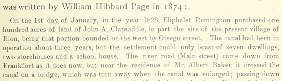
was written by William Hibbard Page in 1874: On the 1st day of January, in the year 1828, Eliphalet Remington purchased one hundred acres of land of John A. Clapsaddle, in part the site of the present village of Ilion, being that portion bounded on the west by Otsego street. The canal had been in operation about three years, but the settlement could only boast of seven dwellings, two storehouses and a school-house. The river road (Main street) came down from Frankfort as it does now, but near the residence of Mr. Albert Baker it crossed the canal on a bridge, which was torn away when the canal was enlarged; passing down
Text read by machine from the scan; it may contain errors.
A history of Herkimer county, including the upper Mohawk valley, from the earliest period to the present time1856 · page 224Read the page →
Read the text
The Ilion Independent, the last to be now chronicled in history, was brought out in February, 1855, at the village of Ilion by Mr. George W. Bungay. It seems to be devoted to temperance and advocates the prohibitory liquor law. Its motto, " Liberty, Equality and Fraternity " show an enlarged and comprehensive benevolence.
Text read by machine from the scan; it may contain errors.
A history of Herkimer county, including the upper Mohawk valley, from the earliest period to the present time1856 · page 214Read the page →
Read the text
perhaps, for the information of any inhabitant of the county, that the Erie canal traverses its territory, from west to east, on the south side of the Mohawk river, passing through the villages of Frankfort, Ilion, Mohawk and the town of Danube ; nor that the New York central rail road traverses the county from east to west, on the north side of the river, passing through the town of Manheim, the villages of Little Falls and Herkimer, and part of the town of Schuyler, cross-
Text read by machine from the scan; it may contain errors.
Scans and text from the Internet Archive. Books published in 1930 or earlier, which are in the public domain.
Timeline
Ilion, 1858 to 1974
Woven from the archive, old maps, post office records, the National Register and the people born here.
Nothing in the archives for these yearsWeddings on Main Street, storms, parades, school pictures, the old store. If it’s in your family album, it belongs here.
The Ilion post office opened in 1844, the earliest record of the town by name (U.S. post office records).
How does Ilion rank for history?
Ilion is more historic than 91% of U.S. towns, #238 of 758 in New York. The History grade combines the town’s founding era, the share of homes built before 1940 and its National Register listings. It’s a character grade, so it isn’t part of the overall grade. How it works.
How old are the homes in Ilion?
56% of Ilion’s homes were built before 1940 (Census estimate, ±7.4 points), against a typical 27% for a New York town; the median home was built in 1938.
Founding dates: Wikidata, Wikipedia, the U.S. post office records of Blevins & Helbock (CC0) and the Census. Homes by year built: Census ACS 2020–24. National Register of Historic Places: National Park Service (list of May 22, 2026). Old photos, postcards and papers: Wikimedia Commons, the Library of Congress and other public archives, credited on each item’s page. Maps: U.S. Geological Survey historical topographic maps (via Esri) and Sanborn fire-insurance maps (Library of Congress). History text and census tables: Wikipedia (CC BY-SA 4.0). Places that used to be: USGS Geographic Names Information System (2021).
From Wikimedia Commons (5), the Library of Congress (1), Wikipedia, Wikidata and Wikipedia for famous people, U.S. Geological Survey historical maps, U.S. Census counts (via Wikipedia), Sanborn fire insurance maps (Library of Congress) and old county and town histories (Internet Archive). Archive images are copied here with their credits and licenses, shown on each photo’s page. Refreshed monthly.




 2017
 2017
 2012
