Founding year: Wikidata; Wikipedia’s history section gives the same year. First post office: 1826.The full story ↓
History grade
What drives Little Falls’ History grade
On its age, its old homes and the National Register, Little Falls is more historic than 68% of U.S. towns. Its age holds the grade up; its National Register listings pull it down.
B+
HistoryA character grade: shown, never part of Little Falls’ overall grade.
New York towns list more on the Register than most of the country (a typical New York town has 12.3 per 10,000 residents, the U.S. 2.4), so Little Falls’ 0.0 sits below most of its state (10% of New York towns have fewer) while its 0 listings outnumber those of 23% of U.S. towns.
How sure. Graded on any two of the three inputs instead, the letter would range from C+ to A. The pre-1940 share is a Census survey estimate (±5.7 points). Two sources give 1723.
Founding year: Wikidata (other dates in Quick answers). Homes: Census ACS 2020–24. National Register: National Park Service, May 2026 list; each listing counted once (boundary changes and added documentation belong to their listing), and a historic district counts its contributing buildings. How TownRatings grades history →
What stands out about Little Falls’ past
Read from the archive, the National Register and the record. The page puts what stands out first.
Fire insurance maps drew every building, what it was made of and what it was used for, so insurers could price the risk of fire. Pick a year, then a sheet.
Little Falls was first settled by Europeans around 1723, when German Palatines were granted land under the Burnetsfield Patent. It was then the westernmost European settlement in the colony of New York. The need to portage around the falls promoted a trading location on the site of the future city. It was the first settlement in the town. The settlers were attacked during the French and Indian War, but rebuilt their farms.
Passages that mention Little Falls, cut from the printed page as they were published.
A history of Herkimer county, including the upper Mohawk valley, from the earliest period to the present time1856 · page 436Read the page →
Read the text
colonists, and of that splendid colonial French empire, already struck from the French crown, and which had cost so much of blood and treasure to establish and uphold. Between 1790 and 1796, he built the first bridge across the Mohawk river, at Little Falls, the old red grist mill at that place, the first bridge over the gulf, east of the academy, mills for Richard Van Home, at Van Hornesville. and for Col. Freye, at Canajoharie, a bridge over the West Canada creek, and the court house and jail, which were burned up in 1833 or 1834, a bridge across the Mohawk river, at Fort Plain, and a bridge
Text read by machine from the scan; it may contain errors.
A history of Herkimer county, including the upper Mohawk valley, from the earliest period to the present time1856 · page 428Read the page →
Read the text
" The First Presbyterian society of the village of Little Falls in the town of Little Falls in the county of Herkimer," was incorporated April 16, 1831, under the statute passed April 5, 1813, and Robert Stewart, David Petrie, Charles Smith, Daniel Mcintosh, Hozea Hamilton, John Scullen and William Hammell were elected the first lay trustees, and at the first meting of the trustees after their election, Elisha S.
Text read by machine from the scan; it may contain errors.
History of Herkimer county, New York1893 · page 188Read the page →
Read the text
down and they invited their German neighbors to a logging bee and the whole five acres were cleared for them in one day. In the summer of 1798 a saw-mill was built there, and not long afterward Mr. Paine built a grist-mill, thus saving further journeys to Little Falls or Van Hornesville. The settlement at Paine's Hollow grew and comprised at one time three saw-mills, the grist-mill, a fulling-mill, a store, tavern, a post-office and about two hundred inhabitants. The first post-office in the town was here and was called German Flats, with John Paine as
Text read by machine from the scan; it may contain errors.
History of Herkimer county, New York1893 · page 73Read the page →
Read the text
sive farmer. His homestead was set off into the town of Little Falls when it was erected in 1828. He was many times chosen for the office of supervisor and justice of the peace; was four times elected member of Assembly within fourteen years. In 1821 he was again a candidate for the Assembly and received the certificate of election, but was unseated soon after the organization of the house upon a technical construction of the returns. In the fall of 1823 he was elected to tlie Assembly, and it devolved upon that body to choose the electors of
Text read by machine from the scan; it may contain errors.
Scans and text from the Internet Archive. Books published in 1930 or earlier, which are in the public domain.
Timeline
Little Falls, 1723 to 1949
Woven from the archive, old maps, post office records, the National Register and the people born here.
Nothing in the archives for these yearsWeddings on Main Street, storms, parades, school pictures, the old store. If it’s in your family album, it belongs here.
In 1723, according to Wikidata and Wikipedia’s history of the town. Little Falls’ post office opened in 1826, and the census of 1870 counted 5,387 people here.
How does Little Falls rank for history?
Little Falls is more historic than 68% of U.S. towns. The History grade combines the town’s founding era, the share of homes built before 1940 and its National Register listings. It’s a character grade, so it isn’t part of the overall grade. How it works.
How old are the homes in Little Falls?
20% of Little Falls’ homes were built before 1940 (Census estimate, ±5.7 points), against a typical 27% for a New York town; the median home was built in 1971.
Founding dates: Wikidata, Wikipedia, the U.S. post office records of Blevins & Helbock (CC0) and the Census. Homes by year built: Census ACS 2020–24. National Register of Historic Places: National Park Service (list of May 22, 2026). Old photos, postcards and papers: Wikimedia Commons, the Library of Congress and other public archives, credited on each item’s page. Maps: U.S. Geological Survey historical topographic maps (via Esri) and Sanborn fire-insurance maps (Library of Congress). History text and census tables: Wikipedia (CC BY-SA 4.0). Places that used to be: USGS Geographic Names Information System (2021).
From Wikimedia Commons (6), the Library of Congress (6), Wikipedia, Wikidata and Wikipedia for famous people, U.S. Geological Survey historical maps, U.S. Census counts (via Wikipedia), the US Post Offices dataset (Blevins & Helbock), the USGS Geographic Names Information System, Sanborn fire insurance maps (Library of Congress) and old county and town histories (Internet Archive). Archive images are copied here with their credits and licenses, shown on each photo’s page. Refreshed monthly.


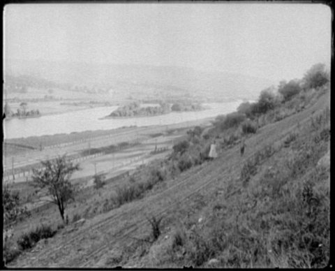


 1838
 1880
 1880
 1881
 1890
 1935

