Cambria dates to 1808, and 16% of its homes were built before 1940
More historic than 77% of U.S. towns · #460 of 758 in New York. What drives it
2 places in town are on the National Register, among them a historic district with 6 buildings. Below: 1 old photo or paper, maps from 1897 on, and the census since 1820.
Founding year: Wikidata. First post office: 1816.The full story ↓
History grade
What drives Cambria’s History grade
On its age, its old homes and the National Register, Cambria is more historic than 77% of U.S. towns, #460 of 758 in New York. All 3 inputs are above most U.S. towns; its age ranks highest and its National Register listings lowest.
A−
HistoryA character grade: shown, never part of Cambria’s overall grade.
New York towns list more on the Register than most of the country (a typical New York town has 12.3 per 10,000 residents, the U.S. 2.4), so Cambria’s 12.2 sits near the middle of its state (49% of New York towns have fewer) while its 7 historic buildings outnumber those of 73% of U.S. towns.
How sure. Graded on any two of the three inputs instead, the letter would range from B+ to A−. The pre-1940 share is a Census survey estimate (±5.4 points). Two sources give 1808.
Founding year: Wikidata (other dates in Quick answers). Homes: Census ACS 2020–24. National Register: National Park Service, May 2026 list; each listing counted once (boundary changes and added documentation belong to their listing), and a historic district counts its contributing buildings. How TownRatings grades history →
What stands out about Cambria’s past
Read from the archive, the National Register and the record. The page puts what stands out first.
Bassett FieldairportCambria AirportairportLockport Air Force StationmilitaryLockport Cambria AirportairportNike Site NF-16CmilitaryNike Site NF-16LmilitaryNike Site NF-17DCmilitarySchool Number 1schoolSchool Number 10schoolSchool Number 11schoolSchool Number 2schoolSchool Number 3schoolSchool Number 4schoolSchool Number 5schoolSchool Number 6schoolSchool Number 7schoolSchool Number 8schoolSchool Number 9school
9cemeteries and burying grounds inside Cambria
BuddCampbellHillside Cemetery of CambriaMolyneauxMount ViewNorth RidgeSaint Andrew LutheranSaint Peter LutheranWeaver Cemetery Number 1
US Post Offices dataset (Blevins & Helbock, CC0). Places and cemeteries from the USGS Geographic Names Information System (2021).
Help out
Start Cambria’s collection
The first neighbors to add old photos shape how Cambria’s history is told.
Decades since 1900 with photos
00s10s20s30s40s50s60s70s80s90s
0 of 10 decades. The empty ones are waiting for someone’s album.
Some of the early settlers were from Wales, and gave the town the name of their origin.
The Town of Cambria was established in 1808 when Niagara county was formed. Cambria was the original town of Niagara County; all other towns were formed from its territory after 1812.
When Genesee County, New York was formed in 1802, all of Niagara County was included and was part of the Town of Batavia. Subsequently, Erie County was created by removing the Towns of Willink and Clarence, both towns having been created from Cambria in Niagara County.
Passages that mention Cambria, cut from the printed page as they were published.
Biographical and portrait cyclopedia of Cambria County, Pennsylvania, comprising five hundred sketches of the prominent1896Read the page →
Read the text
ford and Bridgeport Railroad under the Pennsylvania Railroad company. In 1874 he came to Johnstown, and until 18S7 was general mining engineer of the Cambria Iron company. He was general superintendent of the Cambria Iron company from 1887 to 1888, and general manager of the company from
Text read by machine from the scan; it may contain errors.
History of Niagara county, N. Y., with illustrations descriptive of its scenery, private residences, public buildings, fine blocks, and important manufactories, and portraits of old pioneers and prominent residents1878 · page 256Read the page →
Read the text
" Be it enacted, by the people of the State of New York, represented in Senate and Assembly, that from and after the first day of April next, all that part of the town of Cambria lying west of a line beginning at the northwest corner of section number thirty-two, township fourteen, in the eighth range of townships, thence running southerly on the west line of said section thirtytwo in a direct line to the south bounds of said town of
Text read by machine from the scan; it may contain errors.
Souvenir history of Niagara County, New York1902 · page 180Read the page →
Read the text
sion Bridge and a portion of the Town of Niagara, the whole forming four wards, which have since been increased to six. Originally, the Town of Niagara was taken from the Town of Cambria, on June 1, 1812. At that time it was called “Schlosser,” and continued to he known by this name until February 14, 1816, when it became the Town of Niagara. The area of the territory within the boundaries of the town were sufficient to allow of the creation of the
Text read by machine from the scan; it may contain errors.
History of Niagara county, N. Y., with illustrations descriptive of its scenery, private residences, public buildings, fine blocks, and important manufactories, and portraits of old pioneers and prominent residents1878 · page 236Read the page →
Read the text
of New York, entitled an act to divide the town of Cambria, in Niagara county, into several towns : " And be it further enacted that all that part of the town of Cambria bounded east by the meridian line dividing the said town of Cambria from the county of Genesee, betweeen the fourth and fifth rani;es of townships, and south by the main stream of the Tonawanta creek, be erected into a separate town by the name of
Text read by machine from the scan; it may contain errors.
Scans and text from the Internet Archive. Books published in 1930 or earlier, which are in the public domain.
Timeline
Cambria, 1808 to 2010
Woven from the archive, old maps, post office records, the National Register and the people born here.
In 1808, according to Wikidata. Cambria’s post office opened in 1816, and the census of 1820 counted 1,134 people here.
How does Cambria rank for history?
Cambria is more historic than 77% of U.S. towns, #460 of 758 in New York. The History grade combines the town’s founding era, the share of homes built before 1940 and its National Register listings. It’s a character grade, so it isn’t part of the overall grade. How it works.
What is on the National Register in Cambria?
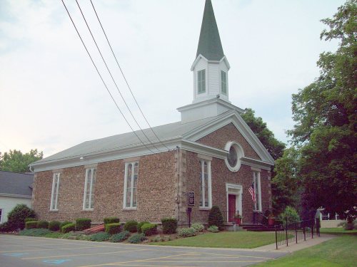
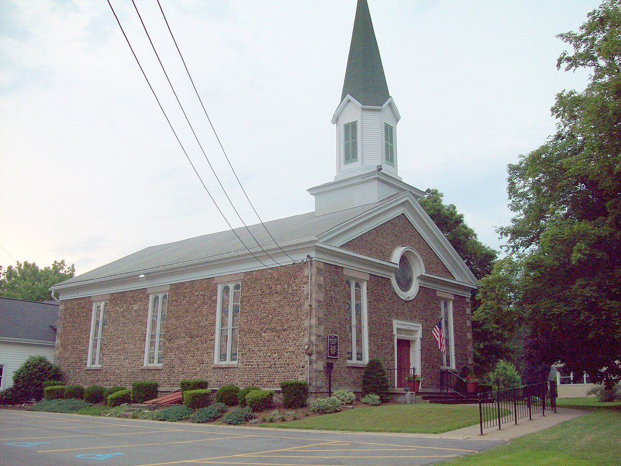
Two places: the North Ridge United Methodist Church (listed 2002) and the Forsyth-Warren Farm (2020).
How old are the homes in Cambria?
16% of Cambria’s homes were built before 1940 (Census estimate, ±5.4 points), against a typical 27% for a New York town; the median home was built in 1974.
Founding dates: Wikidata, Wikipedia, the U.S. post office records of Blevins & Helbock (CC0) and the Census. Homes by year built: Census ACS 2020–24. National Register of Historic Places: National Park Service (list of May 22, 2026). Old photos, postcards and papers: Wikimedia Commons, the Library of Congress and other public archives, credited on each item’s page. Maps: U.S. Geological Survey historical topographic maps (via Esri) and Sanborn fire-insurance maps (Library of Congress). History text and census tables: Wikipedia (CC BY-SA 4.0). Places that used to be: USGS Geographic Names Information System (2021).
From Wikimedia Commons (5), the National Register of Historic Places (2), Wikipedia, U.S. Geological Survey historical maps, U.S. Census counts (via Wikipedia), the US Post Offices dataset (Blevins & Helbock), the USGS Geographic Names Information System and old county and town histories (Internet Archive). Archive images are copied here with their credits and licenses, shown on each photo’s page. Refreshed monthly.


 2018
 2018
 2018
 2006