How Brownville began, and where its name came from
When was Brownville founded?
1799
Brownville dates its founding to 1799 (Wikipedia’s history). The census first counted it in 1820.
First census: 3,990 in 18202020 census: 5,842227 years
How did Brownville get its name?
Brownville’s name is derived from the founder and first settler, Jacob Brown, who was a major-general in the United States Army and is considered to be a heroic figure in the War of 1812.
How historic is Brownville?
A
More historic than 86% of U.S. towns, on its age, its old homes and the National Register.
On its age, its old homes and the National Register, Brownville is more historic than 86% of U.S. towns, #335 of 758 in New York. All 3 inputs are above most U.S. towns; its share of homes from before 1940 ranks highest and its National Register listings lowest.
A
HistoryA character grade: shown, never part of Brownville’s overall grade.
New York towns list more on the Register than most of the country (a typical New York town has 12.3 per 10,000 residents, the U.S. 2.4), so Brownville’s 13.8 sits near the middle of its state (51% of New York towns have fewer) while its 8 historic buildings outnumber those of 74% of U.S. towns.
How sure. Graded on any two of the three inputs instead, the letter would range from A− to A. The pre-1940 share is a Census survey estimate (±6.3 points). Two sources give 1799.
Founding year: Wikipedia (other dates in Quick answers). Homes: Census ACS 2020–24. National Register: National Park Service, May 2026 list; each listing counted once (boundary changes and added documentation belong to their listing), and a historic district counts its contributing buildings. How TownRatings grades history →
What stands out about Brownville’s past
Read from the archive, the National Register and the record. The page puts what stands out first.
Lost post offices, old corners, places now gone and burying grounds
Brownville’s post office has been open since 1803. Three other post offices opened and closed inside today’s town.
Brownville
1803–today
Perch River
1823–1912
Limerick
1824–today
Dexter
1838–today
Pillar Point
1838–1901
Glenpark
1896–1925
18001910today
Hamlets and corners on the map
Adams CoveBreezy Knoll Mobile Home ParkDexterGlen ParkLimerickPerch RiverPillar Point
Gone or out of use
Northside Drive-InlocaleSchool Number 10schoolSchool Number 11schoolSchool Number 12schoolSchool Number 15schoolSchool Number 16schoolSchool Number 17schoolSchool Number 18schoolSchool Number 4schoolSchool Number 5schoolSchool Number 6schoolSchool Number 8schoolSchool Number 9school
10cemeteries and burying grounds inside Brownville
The town was settled around 1799 near Brownville village. It was one of the first towns in the county. Its name is derived from the founder and first settler, Jacob Brown, who was a major-general in the United States Army and is considered to be a heroic figure in the War of 1812.
The town was formed in 1802 from the town of Leyden while still part of Herkimer County.
Many of the northern towns of the county were established, or partly established, from parts of Brownville, including Le Ray (1806), Lyme (1818), Pamelia (1819), Orleans (1821), and Alexandria (1821).
In 1828, the community of Brownville set itself off from the town by incorporating as a village.
Passages that mention Brownville, cut from the printed page as they were published.
A history of Jefferson County in the state of New York1854 · page 203Read the page →
Read the text
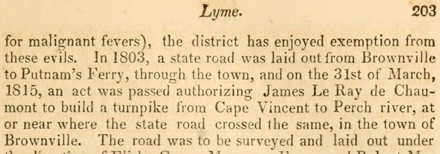
Lyme. 203 for malignant fevers), the district has enjoyed exemption from these evils. In 1803, a state road was laid out from Brownville to Putnam's Ferry, through the town, and on the 31st of March, 1815, an act was passed authorizing James Le Ray de Chaumont to build a turnpike from Cape Vincent to Perch river, at or near where the state road crossed the same, in the town of Brownville. The road was to be surveyed and laid out under
Text read by machine from the scan; it may contain errors.
A history of Jefferson County in the state of New York1854 · page 97Read the page →
Read the text
At the town meeting, in 1821, the clerk read three notices for the division of the town, which were not voted. The first was to annex a part of Brownville to Pamelia; the second, a part of Brownville to Le Ray, and the third to erect four new towns from Brownville and Le Ray. In 1822, a motion to annex Pamelia to Brownville was defeated.
Text read by machine from the scan; it may contain errors.
History of Jefferson County, New York1878 · page 116Read the page →
Read the text
" Your petitioner therefore humbly requests your honorable body to authorize him, by law, to make a turnpike road from the village of Chaumont, in the town of Brownville, to the village of Cape Vincent, on the River St. Lawrence, and from the Black River, opposite the village of Watertown, to intersect the St. Lawrence Turnpike Road at or near where the same crosses the Indian River, in the town of Le Ray; upon such conditions and under such limitations and restrictions as you, in your wisdom, shall think fit to impose. And he,
Text read by machine from the scan; it may contain errors.
History of Jefferson County, New York1878 · page 299Read the page →
Read the text
The first was to annex a part of Brownville to Pamelia ; the second, a part of Brownville to Le Ray ; and a third, to erect four new towns from Brownville and Le Ray. In 1822 a motion to annex Pamelia to Brownville was defeated.
Text read by machine from the scan; it may contain errors.
Scans and text from the Internet Archive. Books published in 1930 or earlier, which are in the public domain.
Timeline
Brownville, 1799 to 2010
Woven from the archive, old maps, post office records, the National Register and the people born here.
Every edition of the U.S. Geological Survey’s map of Brownville. Tap a year, or press play to watch the town change.
1943Brownville sheet · 1:31,680
U.S. Geological Survey historical topographic maps (public domain), via Esri’s collection of the scans. The red ring marks the center of Brownville.
Every building
Brownville, building by building, 1884–1915
Fire insurance maps drew every building, what it was made of and what it was used for, so insurers could price the risk of fire. Pick a year, then a sheet.
1884Sheet 1 of 1
Edition
Sheets
BrickWoodStone
Sanborn Map Company, via the Library of Congress. Editions published in 1930 or earlier, which are in the public domain.
On the National Register
7 historic places in Brownville
The country’s official list of buildings and places worth saving.
In 1799, according to Wikipedia’s history of the town. Brownville’s post office opened in 1803, and the census of 1820 counted 3,990 people here.
How does Brownville rank for history?
Brownville is more historic than 86% of U.S. towns, #335 of 758 in New York. The History grade combines the town’s founding era, the share of homes built before 1940 and its National Register listings. It’s a character grade, so it isn’t part of the overall grade. How it works.
What is on the National Register in Brownville?
7 listings: 7 buildings, among them the Gen. Jacob Brown Mansion (listed 1980, the first). 8 historic buildings in all.
How old are the homes in Brownville?
28% of Brownville’s homes were built before 1940 (Census estimate, ±6.3 points), against a typical 27% for a New York town; the median home was built in 1977.
Founding dates: Wikidata, Wikipedia, the U.S. post office records of Blevins & Helbock (CC0) and the Census. Homes by year built: Census ACS 2020–24. National Register of Historic Places: National Park Service (list of May 22, 2026). Old photos, postcards and papers: Wikimedia Commons, the Library of Congress and other public archives, credited on each item’s page. Maps: U.S. Geological Survey historical topographic maps (via Esri) and Sanborn fire-insurance maps (Library of Congress). History text and census tables: Wikipedia (CC BY-SA 4.0). Places that used to be: USGS Geographic Names Information System (2021).
From the National Register of Historic Places (7), Wikipedia, Wikidata and Wikipedia for famous people, U.S. Geological Survey historical maps, U.S. Census counts (via Wikipedia), the US Post Offices dataset (Blevins & Helbock), the USGS Geographic Names Information System, Sanborn fire insurance maps (Library of Congress) and old county and town histories (Internet Archive). Archive images are copied here with their credits and licenses, shown on each photo’s page. Refreshed monthly.