Guest, Sign inJoin

Post to Broome

We’ll email a one-tap link to publish your post. No password, and nothing is public until you click it.
Already a member? Sign in
–Not graded
History · Broome

Broome’s post office opened in 1810, and 23% of its homes were built before 1940

Its Register listings are the Livingstonville Community Church and the Bates Christian Church. Below: 1 old photo or paper, maps from 1898 on, and the census since 1800.

1810first post office
2on the National Register
23%homes built before 1940
1old photo or paper
Quick answers

How Broome began

When was Broome founded?

1810

The Broome post office opened in 1810, the earliest record of the town by name. Three smaller post offices, Livingstonville (1818), Franklinton (1830) and Bates (1881), opened inside today’s town and later closed.

First census: 1,078 in 18002020 census: 863216 years
Founding year: the first Broome post office (Blevins & Helbock, CC0).The full story ↓

What stands out about Broome’s past

Read from the archive, the National Register and the record. The page puts what stands out first.

★ What stands out · Help out

Start Broome’s collection

The first neighbors to add old photos shape how Broome’s history is told.

Decades since 1900 with photos
00s10s20s30s40s50s60s70s80s90s
0 of 10 decades. The empty ones are waiting for someone’s album.
Places that used to be

Lost post offices, old corners, places now gone and burying grounds

Broome had its own post office from 1810 to 1836. Three other post offices opened and closed inside today’s town.

Broome
1810–1836
Livingstonville
1818–1943
Franklinton
1830–1918
Bates
1881–1913
18101920today
Hamlets and corners on the map
BatesFranklintonHawversvilleLivingstonvillePine Grove
Gone or out of use
School Number 12schoolSchool Number 6school
8cemeteries and burying grounds inside Broome
Bates Hollow ChurchBorthwickEllisFranklintonKeyserkillLivingstonvilleLivingstonville PresbyterianScott Patent

US Post Offices dataset (Blevins & Helbock, CC0). Places and cemeteries from the USGS Geographic Names Information System (2021).

On the map

Broome on the map, 1898 to 1980

Every edition of the U.S. Geological Survey’s map of Broome. Tap a year, or press play to watch the town change.

Broome on the 1898 USGS mapBroome on the 1944 USGS mapBroome on the 1980 USGS map1898Schoharie sheet · 1:62,500

U.S. Geological Survey historical topographic maps (public domain), via Esri’s collection of the scans. The red ring marks the center of Broome.

The story

How Broome came to be

From Wikipedia’s history of Broome.

Read it all →

The town was one of the six original towns when the county was formed in 1797. Originally named Bristol, the town name was changed to Broome in 1808. Parts of Broome town were taken to form part of Conesville town in 1836 and part of Gilboa town in 1848 and small parts annexed to Broome town from Middleburgh town in 1849.

Few settlers came to Broome until after the American Revolution.

Text from Wikipedia, licensed CC BY-SA 4.0.

From the old history books

What they wrote about Broome, 1882–1894

Passages that mention Broome, cut from the printed page as they were published.

Owing to the large territory of the town of Broome and the distance the people of a goodly portion of the town were compelled to go to transact town business, a petition was forwarded to the Legislature for the formation of a new town. On the 3d of March, 1836, an act was passed to divide the town …
1713. History of Schoharie County, New York, with illustrations and biographical sketches of some of its prominent men and pioneers1882 · page 130Read the page →
Read the text

Owing to the large territory of the town of Broome and the distance the people of a goodly portion of the town were compelled to go to transact town business, a petition was forwarded to the Legislature for the formation of a new town. On the 3d of March, 1836, an act was passed to divide the town of Broome and the town of Durham : —

Text read by machine from the scan; it may contain errors.
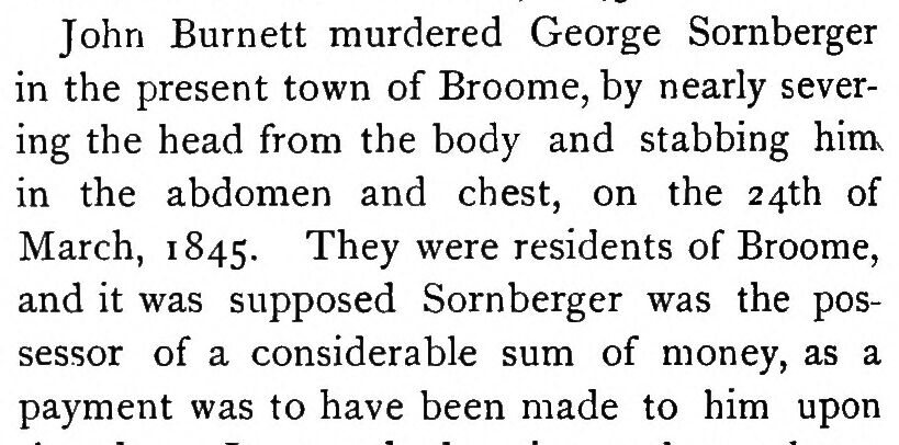
John Burnett murdered George Sornberger in the present town of Broome, by nearly severing the head from the body and stabbing hinK in the abdomen and chest, on the 24th of March, 1 845. They were residents of Broome, and it was supposed Sornberger was the possessor of a considerable sum of money, a…
1713. History of Schoharie County, New York, with illustrations and biographical sketches of some of its prominent men and pioneers1882 · page 84Read the page →
Read the text

John Burnett murdered George Sornberger in the present town of Broome, by nearly severing the head from the body and stabbing hinK in the abdomen and chest, on the 24th of March, 1 845. They were residents of Broome, and it was supposed Sornberger was the possessor of a considerable sum of money, as a payment was to have been made to him upon

Text read by machine from the scan; it may contain errors.
Broome, in which he expresses his "high appreciation of the valualjle services and licarty co-operation reiulcred to him on that occasion," referring to the vvliiskey raid of Novemljer, 1870, on wliich occasion the United States marines, under Colonel Hroome's command, were associated with those of…
Biographical review1894Read the page →
Read the text

Broome, in which he expresses his "high appreciation of the valualjle services and licarty co-operation reiulcred to him on that occasion," referring to the vvliiskey raid of Novemljer, 1870, on wliich occasion the United States marines, under Colonel Hroome's command, were associated with those of the United States Army, under

Text read by machine from the scan; it may contain errors.

Scans and text from the Internet Archive. Books published in 1930 or earlier, which are in the public domain.

Timeline

Broome, 1810 to 1943

Woven from the archive, old maps, post office records, the National Register and the people born here.

  1. 19th century
  2. 1810Post officeThe Broome post office opens
  3. 1818Post officeThe Livingstonville post office opens
  4. 1830Post officeThe Franklinton post office opens
  5. 1830CensusPopulation peaks at 3,167
  6. 1836Post officeThe Broome post office closes
  7. 1866In the archiveBroome (Township)
  8. 1898On the mapFirst mapped by the U.S. Geological Survey
  9. 20th century
  10. 1918Post officeThe Franklinton post office closes
  11. 1943Post officeThe Livingstonville post office closes
By decade

Broome, decade by decade

One decade in the archive so far: the 1860s. Scroll each row; tap a photo for its story.

Then & now

Stand where they stood

No then-and-now pairs yet. Take a photo from the same spot as an old one and they appear here side by side.

Broome (Township)
Retake this viewBroome (Township), 1866

Find the spot, match the angle, and add your photo. It becomes the first then-and-now pair on Broome’s page.

Retake this view · +15
On the National Register

2 historic places in Broome

The country’s official list of buildings and places worth saving.

places listed
2
National Historic Landmarks
0
none yet
historic buildings protected
2
each building in a district counts
first listed
2008
Livingstonville Community Church
Buildings

Architectural styles listings

Greek Revival1
All 2 listings

National Park Service, National Register of Historic Places. Photos from Wikimedia Commons, credited on each place’s page.

People over time

Broome, census by census

05001,0001,5002,0002,5003,0003,50018001850190019502000Peak: 3,167

Peaked at 3,167 in 1830; 863 people lived here in 2020.

23 censuses, 1800–2020.

U.S. Census Bureau decennial counts, from the census table on Broome’s Wikipedia page.

Famous people

Famous people close to Broome

Nobody well known was born in Broome itself, so here are the best known from just nearby.

See all →
Stories next door

History across the town line

Each neighbor’s History grade, on the same three inputs.

Questions about Broome’s history

What year was Broome founded?

The Broome post office opened in 1810, the earliest record of the town by name (U.S. post office records).

What is on the National Register in Broome?

Two places: the Livingstonville Community Church (listed 2008) and the Bates Christian Church (2023).

Memory lane

What the archives can’t tell you, neighbors can.

Town Square →
Start a conversation
Sources

Where this page comes from

Founding dates: Wikidata, Wikipedia, the U.S. post office records of Blevins & Helbock (CC0) and the Census. Homes by year built: Census ACS 2020–24. National Register of Historic Places: National Park Service (list of May 22, 2026). Old photos, postcards and papers: Wikimedia Commons, the Library of Congress and other public archives, credited on each item’s page. Maps: U.S. Geological Survey historical topographic maps (via Esri) and Sanborn fire-insurance maps (Library of Congress). History text and census tables: Wikipedia (CC BY-SA 4.0). Places that used to be: USGS Geographic Names Information System (2021). How TownRatings grades history →

From Wikimedia Commons (1), the National Register of Historic Places (2), Wikipedia, U.S. Geological Survey historical maps, U.S. Census counts (via Wikipedia), the US Post Offices dataset (Blevins & Helbock), the USGS Geographic Names Information System and old county and town histories (Internet Archive). Archive images are copied here with their credits and licenses, shown on each photo’s page. Refreshed monthly.