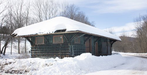
Its Register listings are the South Gilboa Railroad Station and the Forks in the Road Schoolhouse. Below: 1 old photo or paper, maps from 1887 on, and the census since 1850.
The Gilboa post office opened in 1823, the earliest record of the town by name. Wikidata gives 1848. Three smaller post offices, Broome Centre (1848), South Gilboa (1851) and Mackey (1884), opened inside today’s town and later closed.
First census: 3,024 in 18502020 census: 1,111203 years
How historic is Gilboa?
A−
More historic than 81% of U.S. towns, on its age, its old homes and the National Register.
Founding year: the first Gilboa post office (Blevins & Helbock, CC0). Wikidata: 1848.The full story ↓
History grade
What drives Gilboa’s History grade
On its age, its old homes and the National Register, Gilboa is more historic than 81% of U.S. towns. All 3 inputs are above most U.S. towns; its age ranks highest and its National Register listings lowest.
A−
HistoryA character grade: shown, never part of Gilboa’s overall grade.
New York towns list more on the Register than most of the country (a typical New York town has 12.3 per 10,000 residents, the U.S. 2.4), so Gilboa’s 22.3 sits near the middle of its state (58% of New York towns have fewer) while its 3 historic buildings outnumber those of 65% of U.S. towns.
How sure. Graded on any two of the three inputs instead, the letter would range from B+ to A−. The pre-1940 share is a Census survey estimate (±5.3 points). The founding year is the first post office, not a stated founding date; Wikidata’s 1848 falls in the same era, so the grade doesn’t depend on which one is used.
Founding year: the first post office (other dates in Quick answers). Homes: Census ACS 2020–24. National Register: National Park Service, May 2026 list; each listing counted once (boundary changes and added documentation belong to their listing), and a historic district counts its contributing buildings. How TownRatings grades history →
What stands out about Gilboa’s past
Read from the archive, the National Register and the record. The page puts what stands out first.
The Town of Gilboa was formed in 1848 from regions taken from the Towns of Blenheim and Broome. The name "Gilboa" is from Mount Gilboa, a biblical site in Israel, where King Saul's sons were killed by the Philistines, and Saul killed himself (1 Samuel 31:4)
A cotton mill in the community of Gilboa was a major contributor to the early economy of the town, but it was destroyed by a flood in 1869.
In 1926, the Schoharie Creek was dammed to form the Schoharie Reservoir. The original settlement of Gilboa was razed and flooded as part of this project. A new settlement was established north of the reservoir.
Passages that mention Gilboa, cut from the printed page as they were published.
1713. History of Schoharie County, New York, with illustrations and biographical sketches of some of its prominent men and pioneers1882Read the page →
Read the text
keep over ten head of cattle. Mr. Colby has so improved it that it now keeps over sixty head, and is one of the best farms in the town of Gilboa. It is situated on the line of the Ulster & Delaware Railroad, which runs in the valley below, but a few hundred yards off. His residence is located in plain view of the Catskill mountains which give it a pleasant and picturesque appear-
Text read by machine from the scan; it may contain errors.
History of Schoharie County, New York, 1713-18821882 · page 122Read the page →
Read the text
battle of Monmouth, under Colonel Butler, as before stated. When he settled here the territory was in the town of Broome, but by the division of 1848 it belongs to Gilboa. Some time toward the close of the patriot's life, some writer, unknown to us, published a pamphlet in which is recorded a few of the hero's exploits, said to be dictated by himself. It was entitled,
Text read by machine from the scan; it may contain errors.
1713. History of Schoharie County, New York, with illustrations and biographical sketches of some of its prominent men and pioneers1882 · page 122Read the page →
Read the text
Gilboa Bridge.— Upon the advent of Archibald Croswell a trestle bridge was built across the creek which was carried away by high water and replaced by a lattice one when the turnpike was built, that was also carried away in October, 1869, and the present iron structure, the finest one in the County, took its place at a cost of nearly thirteen thousand dollars.
Text read by machine from the scan; it may contain errors.
Scans and text from the Internet Archive. Books published in 1930 or earlier, which are in the public domain.
Timeline
Gilboa, 1823 to 1958
Woven from the archive, old maps, post office records, the National Register and the people born here.
Fire insurance maps drew every building, what it was made of and what it was used for, so insurers could price the risk of fire. Pick a year, then a sheet.
1887Sheet 1 of 1
Edition
Sheets
BrickWoodStone
Sanborn Map Company, via the Library of Congress. Editions published in 1930 or earlier, which are in the public domain.
Then & now
Stand where they stood
No then-and-now pairs yet. Take a photo from the same spot as an old one and they appear here side by side.
Retake this viewGilboa (Township), 1866
Find the spot, match the angle, and add your photo. It becomes the first then-and-now pair on Gilboa’s page.
The Gilboa post office opened in 1823, the earliest record of the town by name (U.S. post office records). Wikidata gives 1848.
How does Gilboa rank for history?
Gilboa is more historic than 81% of U.S. towns. The History grade combines the town’s founding era, the share of homes built before 1940 and its National Register listings. It’s a character grade, so it isn’t part of the overall grade. How it works.
What is on the National Register in Gilboa?
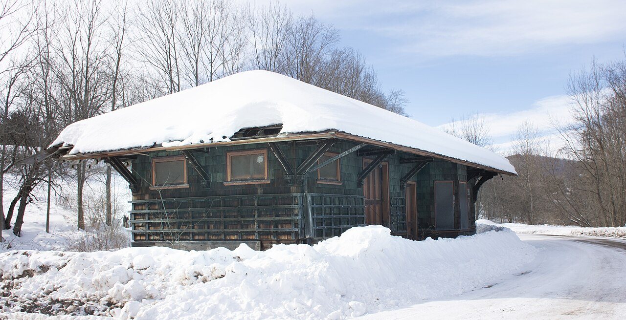
Two places: the South Gilboa Railroad Station (listed 2000) and the Forks in the Road Schoolhouse (2005).
How old are the homes in Gilboa?
20% of Gilboa’s homes were built before 1940 (Census estimate, ±5.3 points), against a typical 27% for a New York town; the median home was built in 1977.
Founding dates: Wikidata, Wikipedia, the U.S. post office records of Blevins & Helbock (CC0) and the Census. Homes by year built: Census ACS 2020–24. National Register of Historic Places: National Park Service (list of May 22, 2026). Old photos, postcards and papers: Wikimedia Commons, the Library of Congress and other public archives, credited on each item’s page. Maps: U.S. Geological Survey historical topographic maps (via Esri) and Sanborn fire-insurance maps (Library of Congress). History text and census tables: Wikipedia (CC BY-SA 4.0). Places that used to be: USGS Geographic Names Information System (2021).
From Wikimedia Commons (12), the National Register of Historic Places (2), Wikipedia, U.S. Geological Survey historical maps, U.S. Census counts (via Wikipedia), the US Post Offices dataset (Blevins & Helbock), the USGS Geographic Names Information System, Sanborn fire insurance maps (Library of Congress) and old county and town histories (Internet Archive). Archive images are copied here with their credits and licenses, shown on each photo’s page. Refreshed monthly.


 2007
 2006
 2006
 2006
 2006
 2006
 2006
 2006
 2006
 2006
 2006