On its age, its old homes and the National Register, Middleburgh is more historic than 92% of U.S. towns, #211 of 758 in New York. All 2 inputs are above most U.S. towns; its share of homes from before 1940 ranks highest and its National Register listings lowest.
A
HistoryA character grade: shown, never part of Middleburgh’s overall grade.
New York towns list more on the Register than most of the country (a typical New York town has 12.3 per 10,000 residents, the U.S. 2.4), so Middleburgh’s 35.1 sits near the middle of its state (63% of New York towns have fewer) while its 11 historic buildings outnumber those of 76% of U.S. towns.
How sure. Graded on two of the three inputs, so a change in either one moves the letter more than it would with three. The pre-1940 share is a Census survey estimate (±9.4 points).
Founding year: our sources. Homes: Census ACS 2020–24. National Register: National Park Service, May 2026 list; each listing counted once (boundary changes and added documentation belong to their listing), and a historic district counts its contributing buildings. How TownRatings grades history →
What stands out about Middleburgh’s past
Read from the archive, the National Register and the record. The page puts what stands out first.
US Post Offices dataset (Blevins & Helbock, CC0). Places and cemeteries from the USGS Geographic Names Information System (2021).
Every building
Middleburgh, building by building, 1884–1909
Fire insurance maps drew every building, what it was made of and what it was used for, so insurers could price the risk of fire. Pick a year, then a sheet.
1884Sheet 1 of 1
Edition
Sheets
BrickWoodStone
Sanborn Map Company, via the Library of Congress. Editions published in 1930 or earlier, which are in the public domain.
Settlement took place circa 1712 near Middleburgh village, but the early years were marred by several competing claims to the site, once called Weiser's Dorf, named after its founder, Johann Conrad Weiser, Sr.
The American Revolution caused great hardship due to raids from British territory.
The town was formed along with the county in 1797 from the town of Schoharie and is one of the original towns of Schoharie County. It was called "Middletown" until 1801.
In 1881, the community of Middleburgh set itself off from the town by incorporating as a village.
Passages that mention Middleburgh, cut from the printed page as they were published.
1713. History of Schoharie County, New York, with illustrations and biographical sketches of some of its prominent men and pioneers1882 · page 28Read the page →
Read the text
tradition has intimated, as they were too destitute and uncertain of their lands. The first settlement was made where the beautiful village of Middleburgh now stands, and was named after the " ringleader of Rebellious practices," and known as " Weiser's Dorf."
Text read by machine from the scan; it may contain errors.
History of Schoharie county and border wars of New York1845Read the page →
Read the text
the word from which that was derived, when originated, not only signified /7oofi?-ti'ooc?, but a certain body of flood-wood. At a distance of about half a mile above the bridge which now crosses the Schoharie in the present town of Middleburgh, two small streams run into the river directly opposite each other. The one on the west side, coming from a north-west course, was formerly 3
Text read by machine from the scan; it may contain errors.
Scans and text from the Internet Archive. Books published in 1930 or earlier, which are in the public domain.
Timeline
Middleburgh, 1729 to 1928
Woven from the archive, old maps, post office records, the National Register and the people born here.
Nothing in the archives for these yearsWeddings on Main Street, storms, parades, school pictures, the old store. If it’s in your family album, it belongs here.
Middleburgh is more historic than 92% of U.S. towns, #211 of 758 in New York. The History grade combines the town’s founding era, the share of homes built before 1940 and its National Register listings. It’s a character grade, so it isn’t part of the overall grade. How it works.
What is on the National Register in Middleburgh?
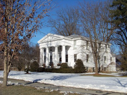
5 listings: 4 buildings, among them the US Post Office-Middleburgh (listed 1989, the first), and 1 site. 11 historic buildings in all.
How old are the homes in Middleburgh?
35% of Middleburgh’s homes were built before 1940 (Census estimate, ±9.4 points), against a typical 27% for a New York town; the median home was built in 1972.
Founding dates: Wikidata, Wikipedia, the U.S. post office records of Blevins & Helbock (CC0) and the Census. Homes by year built: Census ACS 2020–24. National Register of Historic Places: National Park Service (list of May 22, 2026). Old photos, postcards and papers: Wikimedia Commons, the Library of Congress and other public archives, credited on each item’s page. Maps: U.S. Geological Survey historical topographic maps (via Esri) and Sanborn fire-insurance maps (Library of Congress). History text and census tables: Wikipedia (CC BY-SA 4.0). Places that used to be: USGS Geographic Names Information System (2021).
From Wikimedia Commons (3), the Library of Congress (9), the National Register of Historic Places (5), Wikipedia, Wikidata and Wikipedia for famous people, U.S. Geological Survey historical maps, U.S. Census counts (via Wikipedia), the US Post Offices dataset (Blevins & Helbock), the USGS Geographic Names Information System, Sanborn fire insurance maps (Library of Congress) and old county and town histories (Internet Archive). Archive images are copied here with their credits and licenses, shown on each photo’s page. Refreshed monthly.


 1905
 1905
 1905
 1905
 1905
 1911
 1911
 2008