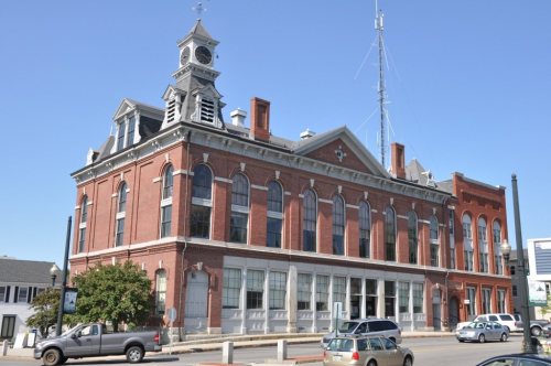
Founding year: Wikidata. First post office: 1822.The full story ↓
History grade
What drives Milford’s History grade
On its age, its old homes and the National Register, Milford is more historic than 75% of U.S. towns, #75 of 126 in New Hampshire. All 3 inputs are above most U.S. towns; its age ranks highest and its National Register listings lowest.
A−
HistoryA character grade: shown, never part of Milford’s overall grade.
New Hampshire towns list more on the Register than most of the country (a typical New Hampshire town has 9.5 per 10,000 residents, the U.S. 2.4), so Milford’s 4.9 sits near the middle of its state (35% of New Hampshire towns have fewer) while its 8 historic buildings outnumber those of 74% of U.S. towns.
NoteThe founding year comes from Wikidata alone; no second source gives 1794.
How sure. Graded on any two of the three inputs instead, the letter would range from B+ to A−. The pre-1940 share is a Census survey estimate (±3.8 points).
Founding year: Wikidata (other dates in Quick answers). Homes: Census ACS 2020–24. National Register: National Park Service, May 2026 list; each listing counted once (boundary changes and added documentation belong to their listing), and a historic district counts its contributing buildings. How TownRatings grades history →
What stands out about Milford’s past
Read from the archive, the National Register and the record. The page puts what stands out first.
Fire insurance maps drew every building, what it was made of and what it was used for, so insurers could price the risk of fire. Pick a year, then a sheet.
Milford separated from neighboring Amherst in 1794. Like most towns named Milford in the United States, its name comes from the fact that it grew around a mill built on a ford—in this case on the Souhegan River.
Milford was once home to numerous granite quarries, which produced a stone that was used, among other things, to make the pillars for the U.S. Treasury in Washington, D.C. —as seen on the back of the American $10 bill. Its nickname remains "The Granite Town", although only one small quarry is in operation as of 2017.
Passages that mention Milford, cut from the printed page as they were published.
History of Hillsborough County, New Hampshire1885 · page 553Read the page →
Read the text
"Provided always that nothing in this act contained shall, in any wise, release the inhabitants of the said Southwest Parish in Amherst (part of said Milford) from paying their proportion of all debts now due from the town of Amherst, or their proportion of the support of the Present Poor of said Town and Parish, or any taxes now assessed on them as inhabitants of the said Town of Amherst ; but the same may be levied and collected from the inhabitants of the said Southwest Parish (now part of Milford aforesaid) in the same way and manner as if this
Text read by machine from the scan; it may contain errors.
History of the town of Amherst, Hillsborough County, New Hampshire1883 · page 164Read the page →
Read the text
versary occurred, it was judged best to defer its celebration until a more favorable season of the year. Accordingly the 30th day of May, 1860 was selected for the purpose, and an invitation was extended to the towns of Milford and Mont Vernon, formerly parts of Amherst, to unite with the parent town in the observances of the day. The invitation was accepted by the town of Milford at the annual meeting held 10 March, 1860, but declined by the town of
Text read by machine from the scan; it may contain errors.
History of the town of Amherst, Hillsborough County, New Hampshire1883 · page 87Read the page →
Read the text
The consent of the town of Amherst having been obtained, an act was passed by the General Court on the eleventh day of January, 1794, incorporating the town of Milford, including in the new town the South-west parish of Amherst, the Mile Slip, Duxbury school farm, and a part of Hollis, the boundaries being as follows : Beginning at the south-west corner of the North-west parish in Amherst, on Lyncleborough line, thence running
Text read by machine from the scan; it may contain errors.
History of Hillsborough County, New Hampshire1885 · page 381Read the page →
Read the text
this country prior to 1740. He received a better education in the schools of his native town than fell to the lot of most young men of that day. When about twenty-one years of age he came to Milford, N. H., or the territory which was soon after incorporated into the town of Milford. In 1793 he married Sarah Lewis, daughter of Benjamin Lewis, who then resided on the banks of the Souhegan River,
Text read by machine from the scan; it may contain errors.
Scans and text from the Internet Archive. Books published in 1930 or earlier, which are in the public domain.
Timeline
Milford, 1794 to 1995
Woven from the archive, old maps, post office records, the National Register and the people born here.
Nothing in the archives for these yearsWeddings on Main Street, storms, parades, school pictures, the old store. If it’s in your family album, it belongs here.
In 1794, according to Wikidata. Milford’s post office opened in 1822, and the census of 1800 counted 939 people here.
How does Milford rank for history?
Milford is more historic than 75% of U.S. towns, #75 of 126 in New Hampshire. The History grade combines the town’s founding era, the share of homes built before 1940 and its National Register listings. It’s a character grade, so it isn’t part of the overall grade. How it works.
What is on the National Register in Milford?
5 listings: 4 buildings, among them the William Peabody House (listed 1979, the first), and 1 structure. 8 historic buildings in all.
How old are the homes in Milford?
17% of Milford’s homes were built before 1940 (Census estimate, ±3.8 points), against a typical 17% for a New Hampshire town; the median home was built in 1982.
Founding dates: Wikidata, Wikipedia, the U.S. post office records of Blevins & Helbock (CC0) and the Census. Homes by year built: Census ACS 2020–24. National Register of Historic Places: National Park Service (list of May 22, 2026). Old photos, postcards and papers: Wikimedia Commons, the Library of Congress and other public archives, credited on each item’s page. Maps: U.S. Geological Survey historical topographic maps (via Esri) and Sanborn fire-insurance maps (Library of Congress). History text and census tables: Wikipedia (CC BY-SA 4.0). Places that used to be: USGS Geographic Names Information System (2021).
From Wikimedia Commons (12), the National Register of Historic Places (5), Wikipedia, Wikidata and Wikipedia for famous people, U.S. Geological Survey historical maps, U.S. Census counts (via Wikipedia), the US Post Offices dataset (Blevins & Helbock), the USGS Geographic Names Information System, Sanborn fire insurance maps (Library of Congress) and old county and town histories (Internet Archive). Archive images are copied here with their credits and licenses, shown on each photo’s page. Refreshed monthly.


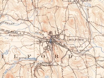


 1886
 c. 1907
 1907–1915
 2014
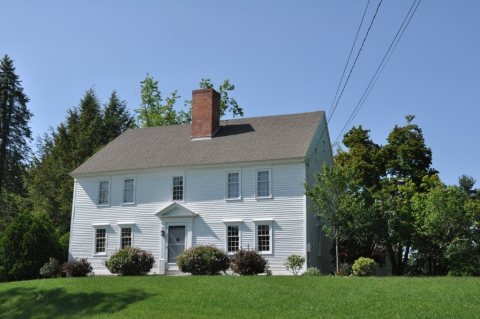 2012
 2012
 2009
 2008