Amherst dates to 1760, and 11% of its homes were built before 1940
More historic than 90% of U.S. towns · #43 of 126 in New Hampshire. What drives it
1 place in town is on the National Register, among them a historic district with 120 buildings. Below: 3 old photos and papers, maps from 1906 on, and the census since 1790.
Founding year: Wikidata. First post office: 1828.The full story ↓
History grade
What drives Amherst’s History grade
On its age, its old homes and the National Register, Amherst is more historic than 90% of U.S. towns, #43 of 126 in New Hampshire. Its age holds the grade up; its share of homes from before 1940 pulls it down.
A
HistoryA character grade: shown, never part of Amherst’s overall grade.
New Hampshire towns list more on the Register than most of the country (a typical New Hampshire town has 9.5 per 10,000 residents, the U.S. 2.4), so Amherst’s 101 sits above most of its state (83% of New Hampshire towns have fewer) while its 120 historic buildings outnumber those of 90% of U.S. towns.
NoteThe founding year comes from Wikidata alone; no second source gives 1760.
How sure. Graded on any two of the three inputs instead, the letter would range from A− to A+. The pre-1940 share is a Census survey estimate (±4.8 points).
Founding year: Wikidata (other dates in Quick answers). Homes: Census ACS 2020–24. National Register: National Park Service, May 2026 list; each listing counted once (boundary changes and added documentation belong to their listing), and a historic district counts its contributing buildings. How TownRatings grades history →
What stands out about Amherst’s past
Read from the archive, the National Register and the record. The page puts what stands out first.
Like many towns in New England, Amherst was founded via a land grant issued to members of the colonial militia; the land grant which led to the town's foundation was issued in 1728 to veterans of King Philip's War. A colonial settlement was established at the land grant's location five years later in 1733, being initially named "Narragansett Number 3" and later "Souhegan Number 3". In 1741, the settlement's inhabitants established a Congregational church and hired a minister to preach in the settlement. On January 18, 1760, the settlement was chartered by the governor of New Hampshire Benning Wentworth, who renamed it after General Jeffery Amherst, who served as Commander-in-Chief, North America during the French and Indian War. Wentworth chartered Amherst as part of a wave of land grants he issued during the mid-18th century.
Passages that mention Amherst, cut from the printed page as they were published.
Historical discourse delivered at Amherst, N.H., on the hundredth anniversary of the dedication of the Congregational Meeting-House1874 · page 107Read the page →
Read the text
was so popular, was not of long continuance, for in January of this year about thirty of the most prominent of those that were last year annexed petitioned the governor and council for a division of Amherst. They recite in their petition, — " That the town of Amherst is about nine miles in length, by reason that about half the town of Monson was of late annexed to it, and is capable of being divided into two towns or parishes without prejudice to or spoiling the same; that many of us live in that
Text read by machine from the scan; it may contain errors.
History of the town of Amherst, Hillsborough County, New Hampshire1883 · page 87Read the page →
Read the text
The consent of the town of Amherst having been obtained, an act was passed by the General Court on the eleventh day of January, 1794, incorporating the town of Milford, including in the new town the South-west parish of Amherst, the Mile Slip, Duxbury school farm, and a part of Hollis, the boundaries being as follows : Beginning at the south-west corner of the North-west parish in Amherst, on Lyncleborough line, thence running
Text read by machine from the scan; it may contain errors.
History of the town of Amherst, Hillsborough County, New Hampshire1883 · page 90Read the page →
Read the text
Rebecca Upton, 8 March, 1886. The town of Amherst appointed David Stewart agent to oppose the petition, then pending in the legislature, of Daniel Holt and others, asking to be set off from Amherst and joined to Milforcl. After some delay the legislature passed an act, approved 20 December, 1842, by which a tract of land, bounded as follows, was severed from Amherst and annexed to Milford : commencing at a
Text read by machine from the scan; it may contain errors.
An historical sketch of Amherst, in the county of Hillsborough, in New-Hampshire, from the first settlement to the present period1820 · page 28Read the page →
Read the text
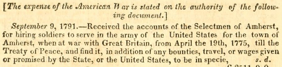
[The expense of tfte American liar is slated on Hit authority of the folloW' ing document.] September 9, 1791. — Received the accounts of the Selectmen of Amherst, for hiring soldiers to serve in the anny of the United States for the town of Amherst, when at war with Great Britain, from April the 19th, 1775, till the Treaty of Peace, and find it, in addition of any bounties, travel, or wages given or promised by the State, or the United States, to be in specie, s. d.
Text read by machine from the scan; it may contain errors.
Scans and text from the Internet Archive. Books published in 1930 or earlier, which are in the public domain.
Timeline
Amherst, 1760 to 2020
Woven from the archive, old maps, post office records, the National Register and the people born here.
In 1760, according to Wikidata. Amherst’s post office opened in 1828, and the first U.S. census counted 2,369 people here in 1790.
How does Amherst rank for history?
Amherst is more historic than 90% of U.S. towns, #43 of 126 in New Hampshire. The History grade combines the town’s founding era, the share of homes built before 1940 and its National Register listings. It’s a character grade, so it isn’t part of the overall grade. How it works.
What is on the National Register in Amherst?
One place: the Amherst Village Historic District (listed 1982).
How old are the homes in Amherst?
11% of Amherst’s homes were built before 1940 (Census estimate, ±4.8 points), against a typical 17% for a New Hampshire town; the median home was built in 1978.
Founding dates: Wikidata, Wikipedia, the U.S. post office records of Blevins & Helbock (CC0) and the Census. Homes by year built: Census ACS 2020–24. National Register of Historic Places: National Park Service (list of May 22, 2026). Old photos, postcards and papers: Wikimedia Commons, the Library of Congress and other public archives, credited on each item’s page. Maps: U.S. Geological Survey historical topographic maps (via Esri) and Sanborn fire-insurance maps (Library of Congress). History text and census tables: Wikipedia (CC BY-SA 4.0). Places that used to be: USGS Geographic Names Information System (2021).
From Wikimedia Commons (14), the National Register of Historic Places (1), Wikipedia, Wikidata and Wikipedia for famous people, U.S. Geological Survey historical maps, U.S. Census counts (via Wikipedia), the US Post Offices dataset (Blevins & Helbock), the USGS Geographic Names Information System, Sanborn fire insurance maps (Library of Congress) and old county and town histories (Internet Archive). Archive images are copied here with their credits and licenses, shown on each photo’s page. Refreshed monthly.




 Date?
 2022
 2018
 2018
 2017
 2016
 2016
 2016
 2016
 2014
 2014
 2006


