Keene dates to 1736, and 34% of its homes were built before 1940
More historic than 95% of U.S. towns · #21 of 126 in New Hampshire. What drives it
17 places in town are on the National Register, among them a historic district with 5 buildings. Below: 16 old photos and papers, maps from 1884 on, and the census since 1790.
Founding year: Wikidata; Wikipedia’s history section gives the same year. First post office: 1791.The full story ↓
History grade
What drives Keene’s History grade
On its age, its old homes and the National Register, Keene is more historic than 95% of U.S. towns, #21 of 126 in New Hampshire. All 3 inputs are above most U.S. towns; its age ranks highest and its National Register listings lowest.
A+
HistoryA character grade: shown, never part of Keene’s overall grade.
New Hampshire towns list more on the Register than most of the country (a typical New Hampshire town has 9.5 per 10,000 residents, the U.S. 2.4), so Keene’s 10.5 sits near the middle of its state (49% of New Hampshire towns have fewer) while its 24 historic buildings outnumber those of 80% of U.S. towns.
How sure. Graded on any two of the three inputs instead, the letter would range from A to A+. The pre-1940 share is a Census survey estimate (±3.8 points). Two sources give 1736.
Founding year: Wikidata (other dates in Quick answers). Homes: Census ACS 2020–24. National Register: National Park Service, May 2026 list; each listing counted once (boundary changes and added documentation belong to their listing), and a historic district counts its contributing buildings. How TownRatings grades history →
What stands out about Keene’s past
Read from the archive, the National Register and the record. The page puts what stands out first.
National Park Service, National Register of Historic Places. Photos from Wikimedia Commons, credited on each place’s page.
Every building
Keene, building by building, 1884–1913
Fire insurance maps drew every building, what it was made of and what it was used for, so insurers could price the risk of fire. Pick a year, then a sheet.
In 1735, colonial Governor Jonathan Belcher granted lots in the township of "Upper Ashuelot" to 63 settlers who paid £5 each (equivalent to US$1,282.19 in 2025). It was settled after 1736 on Equivalent Lands.
In 1747, during King George's War, the village was attacked and burned by Natives. Colonists fled to safety, but would return to rebuild in 1749. It was regranted to its inhabitants in 1753 by Governor Benning Wentworth, who renamed it "Keene" after Sir Benjamin Keene, a principal of the South Sea Trading Company, whose primary business was slave trading.
Passages that mention Keene, cut from the printed page as they were published.
A history of the town of Keene from 1732, when the township was granted by Massachusetts, to 1874, when it became a city1904 · page 301Read the page →
Read the text
was making an effort to have the new courthouse built near his tavern — in the Haymarket. At the next annual meeting, in 1796. the town "Voted as the opinion of the Inhabitants of Keene that it would be most convenient for the Town of Keene, and for the County of Cheshire, to have a Court house built where the Old one now stands on the Common in Keene; and to instruct their Representative to use his Influence in the Convention of said County
Text read by machine from the scan; it may contain errors.
A history of the town of Keene from 1732, when the township was granted by Massachusetts, to 1874, when it became a city1904 · page 468Read the page →
Read the text
The following paragraph was written from Keene about this time by a correspondent of the Christian Freeman : "Nearly in the middle of the county, on a broad plain where once was the bottom of a lake, surrounded by hills, is the smart and beautiful village of Keene. Its broad, straight, well made streets and sidewalks; its many large and ornamental trees ; its elegant dwelling houses and fine gardens; its convenient 'Square' and miniature park ren-
Text read by machine from the scan; it may contain errors.
Annals of the town of Keene, from its first settlement, in 1734, to the year 17901851 · page 96Read the page →
Read the text
The town of Eoxbury was this year incorporated, formed of parts of each of the towns of Packersfield, Marlborough and Keene. An earnest remonstrance from Keene against the division of the town was addressed to the Legislature, but it proved unavailing. The territory taken from Keene consisted of 1472 acres.
Text read by machine from the scan; it may contain errors.
Scans and text from the Internet Archive. Books published in 1930 or earlier, which are in the public domain.
Timeline
Keene, 1736 to 1990
Woven from the archive, old maps, post office records, the National Register and the people born here.
Nothing in the archives for these yearsWeddings on Main Street, storms, parades, school pictures, the old store. If it’s in your family album, it belongs here.
In 1736, according to Wikidata and Wikipedia’s history of the town. Keene’s post office opened in 1791, and the first U.S. census counted 1,314 people here in 1790.
How does Keene rank for history?
Keene is more historic than 95% of U.S. towns, #21 of 126 in New Hampshire. The History grade combines the town’s founding era, the share of homes built before 1940 and its National Register listings. It’s a character grade, so it isn’t part of the overall grade. How it works.
What is on the National Register in Keene?
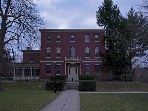
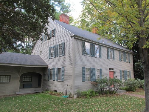
17 listings: 15 buildings, among them the Wyman Tavern (listed 1972, the first), 1 historic district, the Beaver Mills, with 5 contributing buildings, and 1 structure. 24 historic buildings in all.
How old are the homes in Keene?
34% of Keene’s homes were built before 1940 (Census estimate, ±3.8 points), against a typical 17% for a New Hampshire town; the median home was built in 1961.
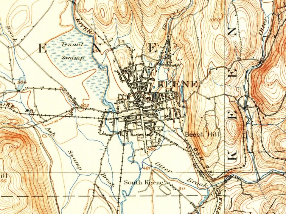
Founding dates: Wikidata, Wikipedia, the U.S. post office records of Blevins & Helbock (CC0) and the Census. Homes by year built: Census ACS 2020–24. National Register of Historic Places: National Park Service (list of May 22, 2026). Old photos, postcards and papers: Wikimedia Commons, the Library of Congress and other public archives, credited on each item’s page. Maps: U.S. Geological Survey historical topographic maps (via Esri) and Sanborn fire-insurance maps (Library of Congress). History text and census tables: Wikipedia (CC BY-SA 4.0). Places that used to be: USGS Geographic Names Information System (2021).
From Wikimedia Commons (10), the Library of Congress (6), the National Register of Historic Places (17), Wikipedia, Wikidata and Wikipedia for famous people, U.S. Geological Survey historical maps, U.S. Census counts (via Wikipedia), the US Post Offices dataset (Blevins & Helbock), the USGS Geographic Names Information System, Sanborn fire insurance maps (Library of Congress) and old county and town histories (Internet Archive). Archive images are copied here with their credits and licenses, shown on each photo’s page. Refreshed monthly.










 1898
 1898
 1898
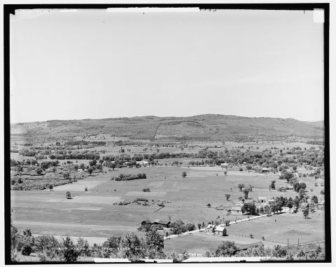 1900
 1901–1907
 1905
 1905
 1905
 1905
 1907
 1907
 c. 1908
