Guest, Sign inJoin

Post to Westmoreland

We’ll email a one-tap link to publish your post. No password, and nothing is public until you click it.
Already a member? Sign in
High Tops SchoolHigh Tops School · Photo: Magicpiano · CC BY-SA 3.0
AHistory
History · Westmoreland

Westmoreland dates to 1752, and 27% of its homes were built before 1940

More historic than 89% of U.S. towns. What drives it

Its Register listings are the Park Hill Meetinghouse and the High Tops School. Below: 2 old photos and papers, maps from 1898 on, and the census since 1790.

1752founded
2on the National Register
27%homes built before 1940
2old photos & papers
8famous people
From Westmoreland’s archive · credits on each photo
Quick answers

How Westmoreland began

When was Westmoreland founded?

1752

Westmoreland dates its founding to 1752 (Wikidata). It appears in the first U.S. census, 1790.

First census: 2,018 in 17902020 census: 1,706274 years

How historic is Westmoreland?

A

More historic than 89% of U.S. towns, on its age, its old homes and the National Register.

What drives the grade ↓
Founding year: Wikidata. First post office: 1807.The full story ↓
History grade

What drives Westmoreland’s History grade

On its age, its old homes and the National Register, Westmoreland is more historic than 89% of U.S. towns. All 3 inputs are above most U.S. towns; its age ranks highest and its National Register listings lowest.

A
HistoryA character grade: shown, never part of Westmoreland’s overall grade.
All U.S. towns we grade (21,289)Ahead of 89%
NewerOlder

New Hampshire towns list more on the Register than most of the country (a typical New Hampshire town has 9.5 per 10,000 residents, the U.S. 2.4), so Westmoreland’s 8.9 sits near the middle of its state (46% of New Hampshire towns have fewer) while its 2 listings outnumber those of 60% of U.S. towns.

NoteThe founding year comes from Wikidata alone; no second source gives 1752.
How sure. Graded on any two of the three inputs instead, the letter would range from A− to A+. The pre-1940 share is a Census survey estimate (±7.9 points).

Founding year: Wikidata (other dates in Quick answers). Homes: Census ACS 2020–24. National Register: National Park Service, May 2026 list; each listing counted once (boundary changes and added documentation belong to their listing), and a historic district counts its contributing buildings. How TownRatings grades history →

What stands out about Westmoreland’s past

Read from the archive, the National Register and the record. The page puts what stands out first.

★ What stands out · Help out

Start Westmoreland’s collection

The first neighbors to add old photos shape how Westmoreland’s history is told.

Decades since 1900 with photos
00s10s20s30s40s50s60s70s80s90s
1 of 10 decades. The empty ones are waiting for someone’s album.
People over time

Westmoreland, census by census

05001,0001,5002,000180018501900195020002,066 in 1800Low: 615

Lost two-thirds of its people between 1800 and 1920, then more than doubled.

24 censuses, 1790–2020.

U.S. Census Bureau decennial counts, from the census table on Westmoreland’s Wikipedia page.

Places that used to be

Lost post offices, old corners and burying grounds

Westmoreland’s post office has been open since 1807. Two other post offices opened and closed inside today’s town.

Westmoreland
1807–today
East Westmoreland
1843–1955
Westmoreland Depot
1851–1954
18001910today
Hamlets and corners on the map
East WestmorelandGilboaPoochamWestmoreland Depot
2cemeteries and burying grounds inside Westmoreland
NorthSouth Village

US Post Offices dataset (Blevins & Helbock, CC0). Places and cemeteries from the USGS Geographic Names Information System (2021).

The story

How Westmoreland came to be

From Wikipedia’s history of Westmoreland.

Read it all →

Prior to European colonization, present-day Westmoreland was inhabited by numerous indigenous tribes. The upper Connecticut River valley was a popular region for short-term Indigenous villages mostly used for hunting and fishing. Tribes such as the Pennacook Confederation and the Abenaki were frequent visitors to the area. In the 1670s, King Philip's War led to the migration of most indigenous tribes to Canada. Indigenous peoples did not understand the concept of individual land ownership, which resulted in numerous misunderstandings and conflict between them and English settlers. The English settlers purchase of land and construction of permanent settlements disrupted the hunting and fishing traditions of the indigenous tribes.

Text from Wikipedia, licensed CC BY-SA 4.0.

From the old history books

What they wrote about Westmoreland in 1925

Passages that mention Westmoreland, cut from the printed page as they were published.

vi. Philip. (5) 4. JOSEPH' WILBUR (Shadrach\ Shadrach=, SamueP) b. Raynham, Mass. abt. 1719/20, d. S. June 27, 1809, aged abt. 90 years. He was an early settler in Westmoreland where he signed the Association Test, 1776; his name heads a petition to the General Court, June 8, 1781, "of sundry citiz…
History of the town of Surry, Cheshire County, New Hampshire1925 · page 935Read the page →
Read the text

vi. Philip. (5) 4. JOSEPH' WILBUR (Shadrach\ Shadrach=, SamueP) b. Raynham, Mass. abt. 1719/20, d. S. June 27, 1809, aged abt. 90 years. He was an early settler in Westmoreland where he signed the Association Test, 1776; his name heads a petition to the General Court, June 8, 1781, "of sundry citizens against a union with Vermont"; was representative in General Court from Westmoreland, 1775 and 1784; selectman 1779, and came to S. after 1806. He m. (1) Susanna Leonard; m. (2) Westmoreland, June 18, 1793, Sarah West,

Text read by machine from the scan; it may contain errors.
LAWSUITS The town has been defendant in several lawsuits: In 1789 with J. Cheever Fowler over his paying tax for support of the minister. In 1811, with the town of Westmoreland over the support of Widow Sarah Wilbur. Darius Porter of Alstead claimed damage, 1883, for running off the highway near Sc…
History of the town of Surry, Cheshire County, New Hampshire1925 · page 160Read the page →
Read the text

LAWSUITS The town has been defendant in several lawsuits: In 1789 with J. Cheever Fowler over his paying tax for support of the minister. In 1811, with the town of Westmoreland over the support of Widow Sarah Wilbur. Darius Porter of Alstead claimed damage, 1883, for running off the highway near Scripture's mill. Another was the Kellogg case in 1921.

Text read by machine from the scan; it may contain errors.

Scans and text from the Internet Archive. Books published in 1930 or earlier, which are in the public domain.

Timeline

Westmoreland, 1752 to 1984

Woven from the archive, old maps, post office records, the National Register and the people born here.

  1. 18th century
  2. 1752
    FoundingWestmoreland is established
  3. 19th century
  4. 1800CensusPopulation peaks at 2,066
  5. 1807Post officeThe Westmoreland post office opens
  6. 1823Born hereGoldsmith Bailey is born here
  7. 1831Born hereClinton Babbitt is born here
  8. 1841Born hereLevi Knight Fuller is born here
  9. 1843Post officeThe East Westmoreland post office opens
  10. 1851Post officeThe Westmoreland Depot post office opens
  11. 1870In the archiveScene along the Connecticut River, Westmorelandlabel QS:Len,"Scene along the Connecticut …
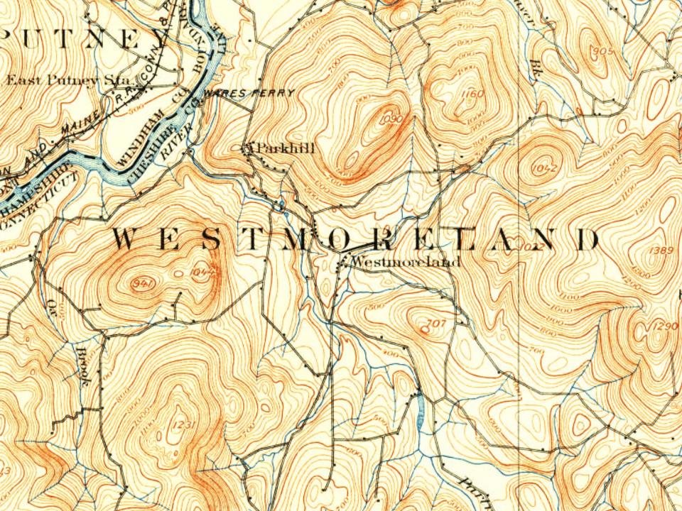
  12. 1898On the mapFirst mapped by the U.S. Geological Survey
  13. 20th century
  14. 1915In the archiveUnion Church, East
  15. 1954Post officeThe Westmoreland Depot post office closes
  16. 1955Post officeThe East Westmoreland post office closes
  17. 1984Born hereDavita Prendergast is born here
By decade

Westmoreland, decade by decade

2 decades in the archive, from the 1870s to the 1910s. Scroll each row; tap a photo for its story.

1920s–1990snothing yet
Nothing in the archives for these yearsWeddings on Main Street, storms, parades, school pictures, the old store. If it’s in your family album, it belongs here.
Add from your album
On the map

Westmoreland on the map, 1898 to 1998

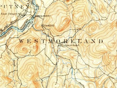
Every edition of the U.S. Geological Survey’s map of Westmoreland. Tap a year, or press play to watch the town change.

Westmoreland on the 1898 USGS mapWestmoreland on the 1932 USGS mapWestmoreland on the 1958 USGS mapWestmoreland on the 1984 USGS mapWestmoreland on the 1998 USGS map1898Keene sheet · 1:62,500

U.S. Geological Survey historical topographic maps (public domain), via Esri’s collection of the scans. The red ring marks the center of Westmoreland.

Then & now

Stand where they stood

No then-and-now pairs yet. Take a photo from the same spot as an old one and they appear here side by side.

Scene along the Connecticut River, Westmorelandlabel QS:Len,"Scene along the Connecticut River, Westmoreland"
Retake this viewScene along the Connecticut River, Westmorelandlabel QS:Len,"Scene along the Connecticut River, Westmoreland", c. 1870

Find the spot, match the angle, and add your photo. It becomes the first then-and-now pair on Westmoreland’s page.

Retake this view · +15
On the National Register

2 historic places in Westmoreland

The country’s official list of buildings and places worth saving.

places listed
2
National Historic Landmarks
0
none yet
historic buildings protected
2
each building in a district counts
first listed
1980
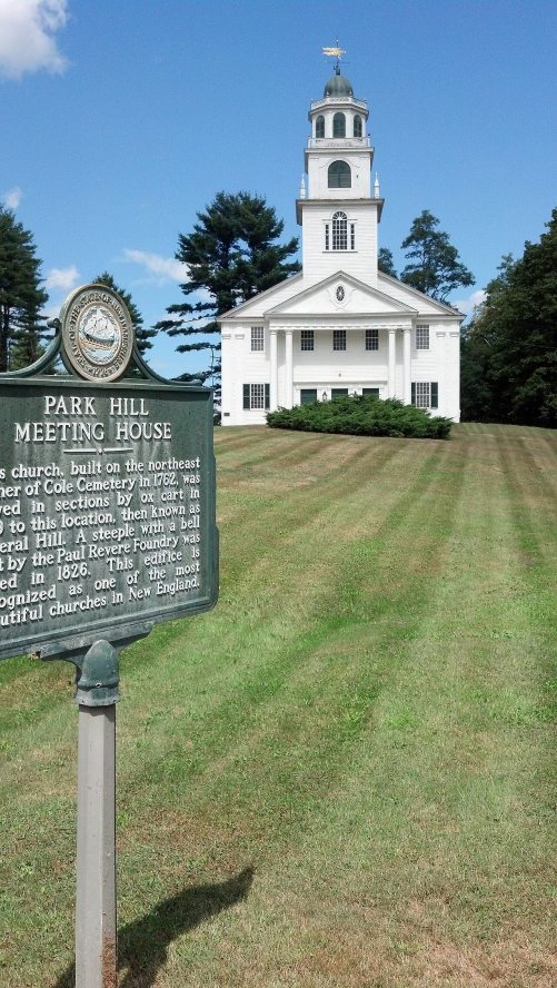
Park Hill Meetinghouse
Buildings

Architectural styles listings

Greek Revival2

National Park Service, National Register of Historic Places. Photos from Wikimedia Commons, credited on each place’s page.

Famous people

8 famous people were born in Westmoreland

Writers, athletes, leaders and more, ranked by how widely they’re known.

See all →
Stories next door

History across the town line

Each neighbor’s History grade, on the same three inputs.

Questions about Westmoreland’s history

What year was Westmoreland founded?

In 1752, according to Wikidata. Westmoreland’s post office opened in 1807, and the first U.S. census counted 2,018 people here in 1790.

How does Westmoreland rank for history?

Westmoreland is more historic than 89% of U.S. towns. The History grade combines the town’s founding era, the share of homes built before 1940 and its National Register listings. It’s a character grade, so it isn’t part of the overall grade. How it works.

What is on the National Register in Westmoreland?

Two places: the Park Hill Meetinghouse (listed 1980) and the High Tops School (1984).

How old are the homes in Westmoreland?

27% of Westmoreland’s homes were built before 1940 (Census estimate, ±7.9 points), against a typical 17% for a New Hampshire town; the median home was built in 1975.

Memory lane

What the archives can’t tell you, neighbors can.

Town Square →
Start a conversation
Sources

Where this page comes from

Founding dates: Wikidata, Wikipedia, the U.S. post office records of Blevins & Helbock (CC0) and the Census. Homes by year built: Census ACS 2020–24. National Register of Historic Places: National Park Service (list of May 22, 2026). Old photos, postcards and papers: Wikimedia Commons, the Library of Congress and other public archives, credited on each item’s page. Maps: U.S. Geological Survey historical topographic maps (via Esri) and Sanborn fire-insurance maps (Library of Congress). History text and census tables: Wikipedia (CC BY-SA 4.0). Places that used to be: USGS Geographic Names Information System (2021).

From Wikimedia Commons (6), the National Register of Historic Places (2), Wikipedia, Wikidata and Wikipedia for famous people, U.S. Geological Survey historical maps, U.S. Census counts (via Wikipedia), the US Post Offices dataset (Blevins & Helbock), the USGS Geographic Names Information System and old county and town histories (Internet Archive). Archive images are copied here with their credits and licenses, shown on each photo’s page. Refreshed monthly.