Dover dates to 1623, and 26% of its homes were built before 1940
More historic than 94% of U.S. towns · #25 of 126 in New Hampshire. What drives it
19 places in town are on the National Register, among them two historic districts with 22 buildings between them. Below: 6 old photos and papers, maps from 1889 on, and the census since 1790.
On its age, its old homes and the National Register, Dover is more historic than 94% of U.S. towns, #25 of 126 in New Hampshire. All 3 inputs are above most U.S. towns; its age ranks highest and its National Register listings lowest.
A
HistoryA character grade: shown, never part of Dover’s overall grade.
New Hampshire towns list more on the Register than most of the country (a typical New Hampshire town has 9.5 per 10,000 residents, the U.S. 2.4), so Dover’s 14.1 sits near the middle of its state (54% of New Hampshire towns have fewer) while its 47 historic buildings outnumber those of 84% of U.S. towns.
NoteThe founding year comes from Wikidata alone; no second source gives 1623.
How sure. Graded on any two of the three inputs instead, the letter would range from A− to A+. The pre-1940 share is a Census survey estimate (±3.6 points).
Founding year: Wikidata (other dates in Quick answers). Homes: Census ACS 2020–24. National Register: National Park Service, May 2026 list; each listing counted once (boundary changes and added documentation belong to their listing), and a historic district counts its contributing buildings. How TownRatings grades history →
What stands out about Dover’s past
Read from the archive, the National Register and the record. The page puts what stands out first.
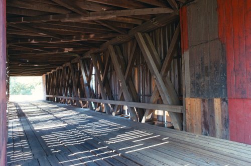
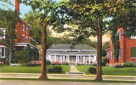
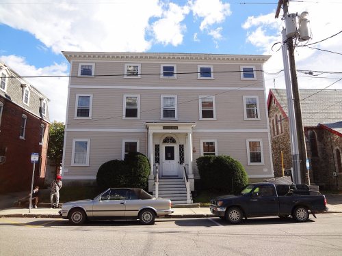
National Park Service, National Register of Historic Places. Photos from Wikimedia Commons, credited on each place’s page.
Every building
Dover, building by building, 1889–1912
Fire insurance maps drew every building, what it was made of and what it was used for, so insurers could price the risk of fire. Pick a year, then a sheet.
The first known European to explore the region was Martin Pring from Bristol, England, in 1603.
In 1623, brothers William and Edward Hilton settled at Pomeroy Cove on Dover Point, near the confluence of the Bellamy and Piscataqua rivers. This first settlement makes Dover the oldest permanent settlement in New Hampshire, and seventh in the United States.
Passages that mention Dover, cut from the printed page as they were published.
Historical memoranda concerning persons & places in old Dover, N.H.1900 · page 63Read the page →
Read the text
The dismembered town of Dover had a little rest after Durham was taken off until May 10, 1743, "sundry Persons Inhabitants of the Westerly part of the town of Dover & the Northerly part of Durham" petitioned to be set off as a Parish alleging particularly as a reason their distance from the meeting houses in
Text read by machine from the scan; it may contain errors.
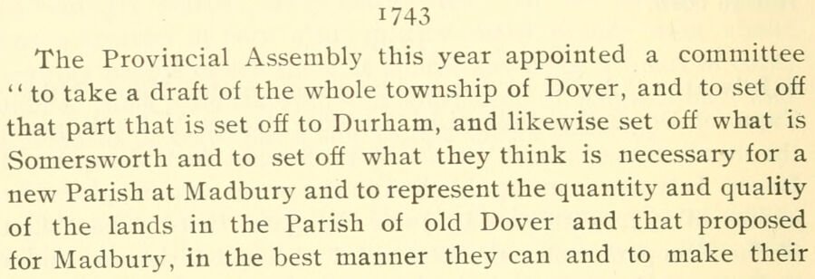
Notable events in the history of Dover, New Hampshire, from the first settlement in 1623 to 18651913 · page 138Read the page →
Read the text
1743 The Provincial Assembly this year appointed a committee " to take a draft of the whole township of Dover, and to set off that part that is set off to Durham, and likewise set off what is Somersworth and to set off what they think is necessary for a new Parish at Madbury and to represent the quantity and quality of the lands in the Parish of old Dover and that proposed for Madbury, in the best manner they can and to make their
Text read by machine from the scan; it may contain errors.
Historical memoranda concerning persons & places in old Dover, N.H.1900 · page 61Read the page →
Read the text
erly side of a West Northwest half a point north line from Johnson's creek at tbe Bridge in the county Rhoade, to the head lino of Dover township and from the said Bridge South East & by East down to a Pine tree on a point or Neck of land called Cedar Point on the West side of the mouth of t'je Back River in Dover, be
Text read by machine from the scan; it may contain errors.
Notable events in the history of Dover, New Hampshire, from the first settlement in 1623 to 18651913 · page 49Read the page →
Read the text
of the ministry, as appears by the following document on record : We whose names are hereunder written being chosen by the Town of Dover are appointed by their order to hear and determine all such differences as appear betwixt the inhabitants of the two thirds of the Town of Dover and the one third of the town in Oyster River, do conclude at present as foUoweth, that is to say : ily. That from the first of April 1657 and so forward from year to
Text read by machine from the scan; it may contain errors.
Scans and text from the Internet Archive. Books published in 1930 or earlier, which are in the public domain.
By decade
Dover, decade by decade
4 decades in the archive, from the 1700s to the 1900s. Scroll each row; tap a photo for its story.
Nothing in the archives for these yearsWeddings on Main Street, storms, parades, school pictures, the old store. If it’s in your family album, it belongs here.
In 1623, according to Wikidata. Dover’s post office opened in 1795, and the first U.S. census counted 1,998 people here in 1790.
How does Dover rank for history?
Dover is more historic than 94% of U.S. towns, #25 of 126 in New Hampshire. The History grade combines the town’s founding era, the share of homes built before 1940 and its National Register listings. It’s a character grade, so it isn’t part of the overall grade. How it works.
What is on the National Register in Dover?
19 listings: 14 buildings, 2 historic districts, the Sawyer Woolen Mills and the Cocheco Mills, with 22 contributing buildings, 2 sites, and 1 structure. 47 historic buildings in all.
How old are the homes in Dover?
26% of Dover’s homes were built before 1940 (Census estimate, ±3.6 points), against a typical 17% for a New Hampshire town; the median home was built in 1976.
Founding dates: Wikidata, Wikipedia, the U.S. post office records of Blevins & Helbock (CC0) and the Census. Homes by year built: Census ACS 2020–24. National Register of Historic Places: National Park Service (list of May 22, 2026). Old photos, postcards and papers: Wikimedia Commons, the Library of Congress and other public archives, credited on each item’s page. Maps: U.S. Geological Survey historical topographic maps (via Esri) and Sanborn fire-insurance maps (Library of Congress). History text and census tables: Wikipedia (CC BY-SA 4.0). Places that used to be: USGS Geographic Names Information System (2021).
From Wikimedia Commons (6), the National Register of Historic Places (19), Wikipedia, Wikidata and Wikipedia for famous people, U.S. Geological Survey historical maps, U.S. Census counts (via Wikipedia), the US Post Offices dataset (Blevins & Helbock), the USGS Geographic Names Information System, Sanborn fire insurance maps (Library of Congress) and old county and town histories (Internet Archive). Archive images are copied here with their credits and licenses, shown on each photo’s page. Refreshed monthly.








 1888
 1907–1915


