Photo: Unknown authorUnknown author · Public domain
–Not graded
History · Newington
Newington dates to 1764, and 22% of its homes were built before 1940
3 places in town are on the National Register, among them two historic districts with 13 buildings between them. Below: 4 old photos and papers, maps from 1916 on, and the census since 1790.
Originally a part of Dover, boundary disputes among early river settlers caused this area to be called "Bloody Point". By 1640, Trickey's Ferry operated between Bloody Point and Hilton's Point in Dover. On August 22, 1690, Fox Point suffered an Indian raid during King William's War, in which 14 people were killed and six were captured.
In 1712, the meetinghouse was erected and the parish set off, named "Newington" for an English village, whose residents sent the bell for the meetinghouse. Behind the meetinghouse is a row of horse sheds, once commonplace. About 1725, the parsonage was built near the Town Forest, considered one of the oldest in the United States.
Passages that mention Newington, cut from the printed page as they were published.
History of Rockingham County, New Hampshire1915 · page 567Read the page →
Read the text
Newington was settled in about the year 1670, and soon became an important adjunct to the settlements at Portsmouth and Dover. The year 1690 was a sad one for the little settlement which had been gathered at Fox Point.
Text read by machine from the scan; it may contain errors.
History of Rockingham County, New Hampshire1915 · page 568Read the page →
Read the text
remodeled about fifty years ago, but with this exception is the same building that was originally erected. After the destruction by fire of the Methodist meeting house, about i860, it has continued to be the only meeting house in town until the present time. Its bell originally came from Newington, in England, being given and sent over the Atlantic by the people of that place. It afterwards cracked, but was recast and is still in use. In former times a sun-dial on the building answered the purpose of a clock.
Text read by machine from the scan; it may contain errors.
Scans and text from the Internet Archive. Books published in 1930 or earlier, which are in the public domain.
Timeline
Newington, 1737 to 1960
Woven from the archive, old maps, post office records, the National Register and the people born here.
Nothing in the archives for these yearsWeddings on Main Street, storms, parades, school pictures, the old store. If it’s in your family album, it belongs here.
Founding dates: Wikidata, Wikipedia, the U.S. post office records of Blevins & Helbock (CC0) and the Census. Homes by year built: Census ACS 2020–24. National Register of Historic Places: National Park Service (list of May 22, 2026). Old photos, postcards and papers: Wikimedia Commons, the Library of Congress and other public archives, credited on each item’s page. Maps: U.S. Geological Survey historical topographic maps (via Esri) and Sanborn fire-insurance maps (Library of Congress). History text and census tables: Wikipedia (CC BY-SA 4.0). Places that used to be: USGS Geographic Names Information System (2021). How TownRatings grades history →
From Wikimedia Commons (12), the Library of Congress (7), Wikidata (2), the National Register of Historic Places (3), Wikipedia, Wikidata and Wikipedia for famous people, U.S. Geological Survey historical maps, U.S. Census counts (via Wikipedia), the US Post Offices dataset (Blevins & Helbock), the USGS Geographic Names Information System and old county and town histories (Internet Archive). Archive images are copied here with their credits and licenses, shown on each photo’s page. Refreshed monthly.


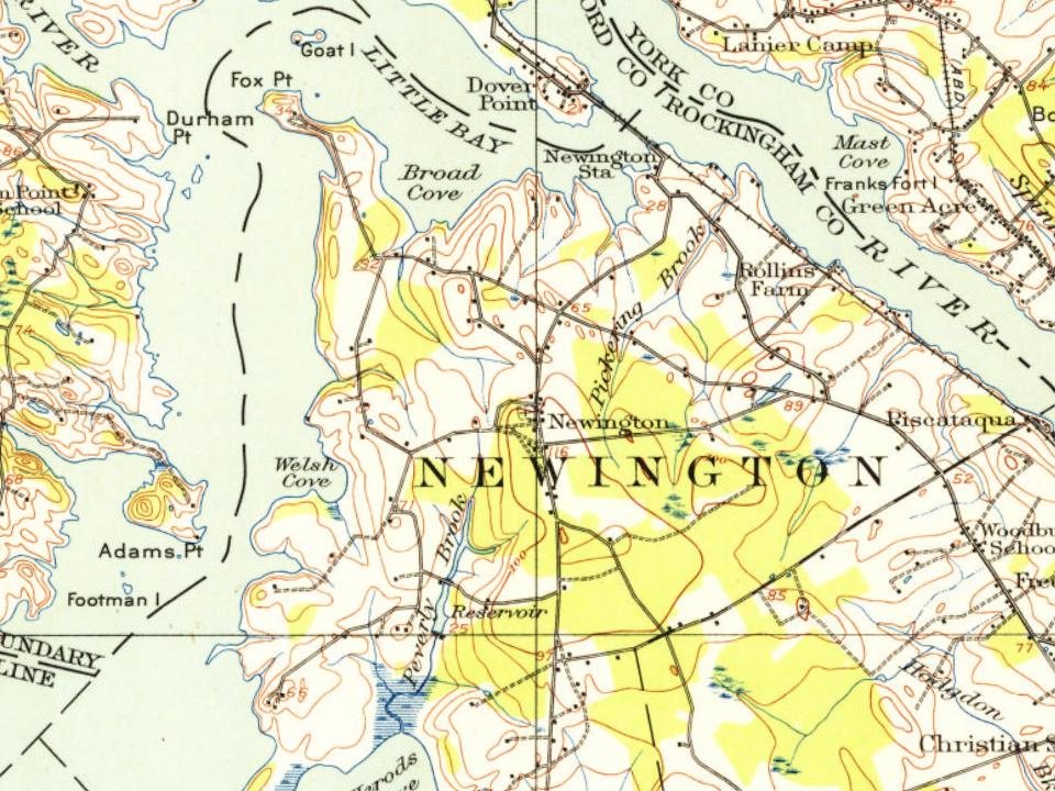
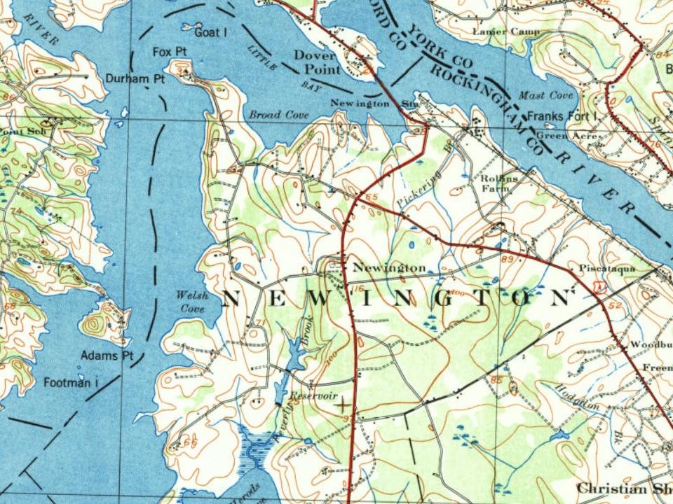
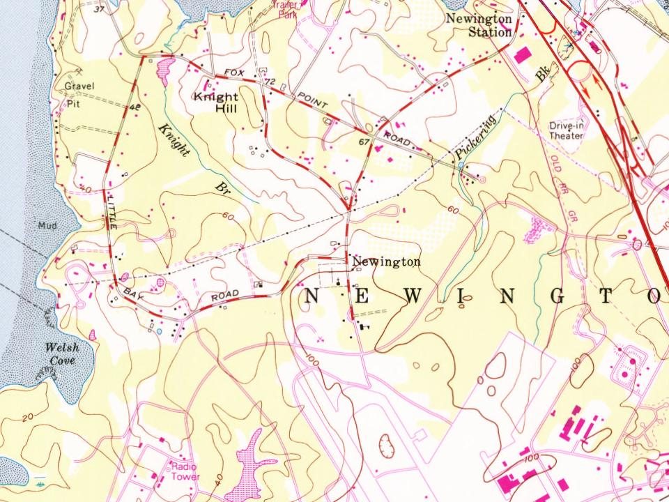
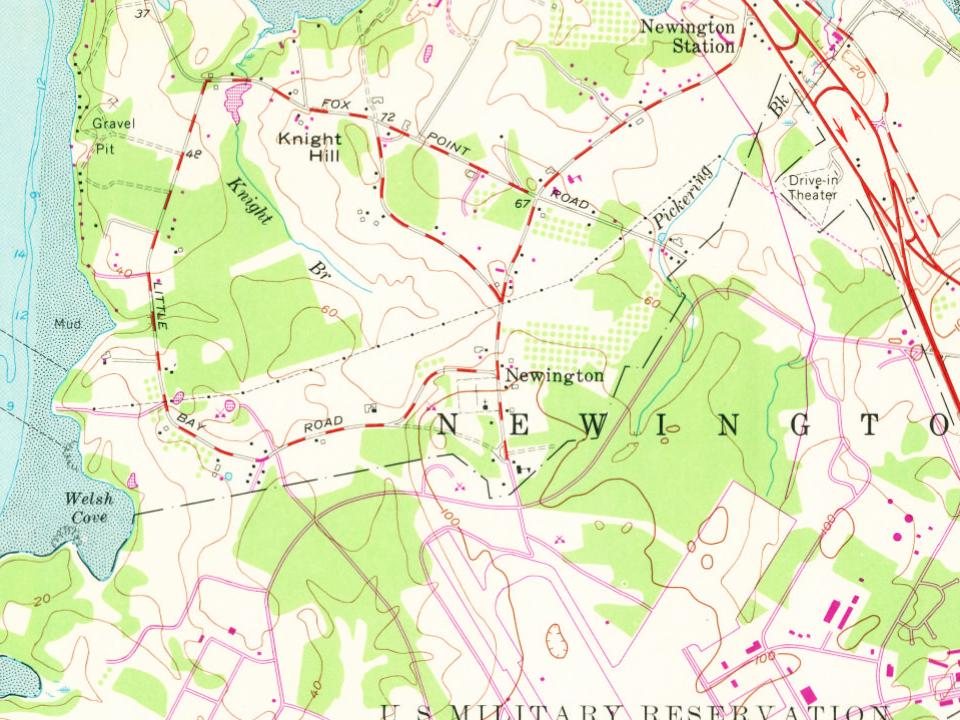


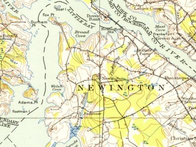
 1915
 Date?
 Date?
 2025
 2025
 2025
 2025
 2021
 2019
 2019
 2017
 2017
 2017
 2017
 2013
 2013
 2009
 2006

