More historic than 52% of U.S. towns · #125 of 143 in Maine. What drives it
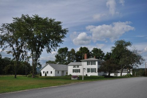
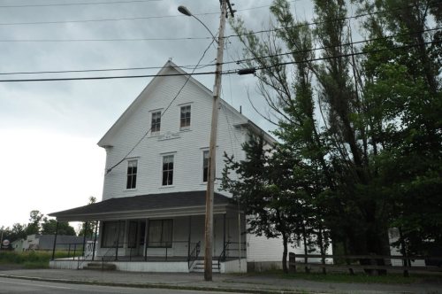
Its Register listings are the Holmes-Crafts Homestead, the North Jay Grange Store and the Jay-Niles Memorial Library. Below: 5 old photos and papers, maps from 1917 on, and the census since 1800.
On its age, its old homes and the National Register, Jay is more historic than 52% of U.S. towns, #125 of 143 in Maine. Its share of homes from before 1940 holds the grade up; its National Register listings pull it down.
B−
HistoryA character grade: shown, never part of Jay’s overall grade.
Maine towns list more on the Register than most of the country (a typical Maine town has 15.9 per 10,000 residents, the U.S. 2.4), so Jay’s 6.4 sits below most of its state (31% of Maine towns have fewer) while its 3 listings outnumber those of 65% of U.S. towns.
How sure. Graded on two of the three inputs, so a change in either one moves the letter more than it would with three. The pre-1940 share is a Census survey estimate (±7.4 points).
Founding year: our sources. Homes: Census ACS 2020–24. National Register: National Park Service, May 2026 list; each listing counted once (boundary changes and added documentation belong to their listing), and a historic district counts its contributing buildings. How TownRatings grades history →
What stands out about Jay’s past
Read from the archive, the National Register and the record. The page puts what stands out first.
This was once territory of the Anasagunticook (or Androscoggin) Abenaki Indians, whose main village was Rockameko, located on Canton Point. They were decimated by smallpox in 1757. The township was then granted by the Massachusetts General Court to Captain Joseph Phipps and 63 others for their services in the French and Indian War. Called Phipps-Canada, the plantation was not settled until after the Revolutionary War. On February 26, 1795, Phipps-Canada was incorporated as Jay for John Jay, the first chief justice of the Supreme Court.
Passages that mention Jay, cut from the printed page as they were published.
History of Jay, Franklin County, Maine1912 · page 7Read the page →
Read the text
tion of all public property and of the ministerial and school funds, also to hold all public lands that fell within her borders; likewise, she assumed one-third of the liabilities of the town of Jay at the time of separation. James Starr, Esq., of Jay Hill, issued the first warrant for a town meeting in the new town; this he directed to Joseph Holland, the meeting to be held in the schoolhouse near Mr. Holland's, at Canton Point, March 28, 1821. At this meeting John Hersey presided
Text read by machine from the scan; it may contain errors.
SEPARATION OF THE TOWN OF CANTON The following is copied from the Jay Register published by T. H. Mitchell Company, 1905: "On February 5, 1821, an act to divide the town of Jay and to incorporate the westerly part into a township by the name of Canton, for Canton, in Massachusetts, was passed by the Maine legislature and signed by the first governor of the state. The dividing line between Jay and Canton estab-
Text read by machine from the scan; it may contain errors.
Scans and text from the Internet Archive. Books published in 1930 or earlier, which are in the public domain.
Timeline
Jay, 1837 to 1950
Woven from the archive, old maps, post office records, the National Register and the people born here.
Jay is more historic than 52% of U.S. towns, #125 of 143 in Maine. The History grade combines the town’s founding era, the share of homes built before 1940 and its National Register listings. It’s a character grade, so it isn’t part of the overall grade. How it works.
What is on the National Register in Jay?
Three places: the Holmes-Crafts Homestead (listed 1973), the North Jay Grange Store (1974) and the Jay-Niles Memorial Library (1987).
How old are the homes in Jay?
12% of Jay’s homes were built before 1940 (Census estimate, ±7.4 points), against a typical 19% for a Maine town; the median home was built in 1980.
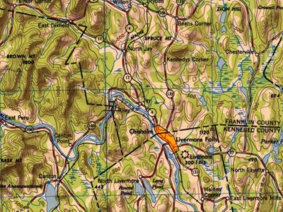
Founding dates: Wikidata, Wikipedia, the U.S. post office records of Blevins & Helbock (CC0) and the Census. Homes by year built: Census ACS 2020–24. National Register of Historic Places: National Park Service (list of May 22, 2026). Old photos, postcards and papers: Wikimedia Commons, the Library of Congress and other public archives, credited on each item’s page. Maps: U.S. Geological Survey historical topographic maps (via Esri) and Sanborn fire-insurance maps (Library of Congress). History text and census tables: Wikipedia (CC BY-SA 4.0). Places that used to be: USGS Geographic Names Information System (2021).
From Wikimedia Commons (12), the National Register of Historic Places (3), Wikipedia, Wikidata and Wikipedia for famous people, U.S. Geological Survey historical maps, U.S. Census counts (via Wikipedia), the US Post Offices dataset (Blevins & Helbock), the USGS Geographic Names Information System, Sanborn fire insurance maps (Library of Congress) and old county and town histories (Internet Archive). Archive images are copied here with their credits and licenses, shown on each photo’s page. Refreshed monthly.


 Date?
 Date?
 Date?
 Date?
 Date?
 2014
 2014
 2014
 2012
 2012
 2008
 2008