Founding year: Wikipedia. First post office: 1894.The full story ↓
History grade
What drives Livermore Falls’ History grade
On its age, its old homes and the National Register, Livermore Falls is more historic than 77% of U.S. towns, #86 of 143 in Maine. All 3 inputs are above most U.S. towns; its age ranks highest and its National Register listings lowest.
A−
HistoryA character grade: shown, never part of Livermore Falls’ overall grade.
Maine towns list more on the Register than most of the country (a typical Maine town has 15.9 per 10,000 residents, the U.S. 2.4), so Livermore Falls’ 9.7 sits near the middle of its state (41% of Maine towns have fewer) while its 3 historic buildings outnumber those of 65% of U.S. towns.
NoteThe founding year comes from Wikipedia alone; no second source gives 1786.
How sure. Graded on any two of the three inputs instead, the letter would range from B+ to A−. The pre-1940 share is a Census survey estimate (±8.5 points).
Founding year: Wikipedia (other dates in Quick answers). Homes: Census ACS 2020–24. National Register: National Park Service, May 2026 list; each listing counted once (boundary changes and added documentation belong to their listing), and a historic district counts its contributing buildings. How TownRatings grades history →
What stands out about Livermore Falls’ past
Read from the archive, the National Register and the record. The page puts what stands out first.
Fire insurance maps drew every building, what it was made of and what it was used for, so insurers could price the risk of fire. Pick a year, then a sheet.
1885Sheet 1 of 1
Edition
Sheets
BrickWoodStone
Sanborn Map Company, via the Library of Congress. Editions published in 1930 or earlier, which are in the public domain.
Places that used to be
Lost post offices, old corners, places now gone and burying grounds
Another post office, Strickland, opened and closed inside today’s town.
Hamlets and corners on the map
East LivermoreHaines CornerShy CornerStricklands
Gone or out of use
Livermore Falls Middle Schoolschool
9cemeteries and burying grounds inside Livermore Falls
Holy CrossLivermore FallsMoose HillPleasant HillPleasant ValleyPleasant ViewShuy YardStricklandTreat Memorial
US Post Offices dataset (Blevins & Helbock, CC0). Places and cemeteries from the USGS Geographic Names Information System (2021).
On the map
Livermore Falls on the map, 1910 to 1967
Every edition of the U.S. Geological Survey’s map of Livermore Falls. Tap a year, or press play to watch the town change.
1910Livermore sheet · 1:62,500
U.S. Geological Survey historical topographic maps (public domain), via Esri’s collection of the scans. The red ring marks the center of Livermore Falls.
The area was once part of the Abenaki Indian territory called Rockemeka, meaning "great corn place". It would be granted by the General Court of Massachusetts in 1771 as Port Royal, awarded to heirs of veterans who served in the campaign against the Acadian capital of Port Royal in 1710. It was settled in 1786, then incorporated in 1795 as Livermore after Deacon Elijah Livermore, one of the first English settlers. The county line, determined by the Androscoggin River, divided the town. West of the river was Oxford County, and east was Kennebec County. Consequently, East Livermore (which encompassed a quarter of the original Port Royal grant) was set off and incorporated on March 1, 1844. It became part of Androscoggin County on March 31, 1854. On March 15, 1929, East Livermore was renamed Livermore Falls.
Passages that mention Livermore Falls, cut from the printed page as they were published.
History of Androscoggin County, Maine ..1891 · page 862Read the page →
Read the text
The northeast corner of Livermore is developing extensive business, and the village of Livermore Falls is crowding across the bridge into this town. The Umbagog Pulp Co. has this season built a large brick mill on the site of its old mill to produce 50 tons of pulp where it made only 30 in the old one.
Text read by machine from the scan; it may contain errors.
History of Androscoggin County, Maine ..1891 · page 842Read the page →
Read the text
centre, and Brettun's in the southwest part. There are several streams; two furnish a fair supply of water in ordinary seasons for grist and saw mills, and (in their day) furnished it for carding and clothing mills. There are excellent powers on the Androscoggin river, one at Livermore Falls, and another a short distance above. Livermore is 20 miles north of Lewiston, 25 west of Augusta, and for some time after its settlement bore the name Port Royal, and, for a brief space, Liverton. Livermore is surrounded: east by East Livermore and Leeds, south by Leeds and Turner, west and
Text read by machine from the scan; it may contain errors.
History of the town of Leeds, Androscoggin County, Maine, from its settlement June 10, 17801901Read the page →
Read the text
lege), and at the age of seventeen commenced teaching, in which capacity he was very successful. In 1864. he purchased a farm at East Livermore, and two years later he sold this and purcliased the grist-mill at Livermore Falls, which he operated in connection with the "feed business." for twenty years ; since which time he has been in the wood and coal business.
Text read by machine from the scan; it may contain errors.
History of the town of Leeds, Androscoggin County, Maine, from its settlement June 10, 17801901Read the page →
Read the text
3. Thomas C, b. March 18, 1829; m. Dec. 12, 1854, Elizabeth Cobb, of Leeds, b. July 13, 1835. About the time of his marriage and the construction of the railroad from Leeds Junction to Livermore Falls, he built a house, stable and store at North Leeds, where he engaged in trade, in which business and place he continued during the remainder of his life, making a specialty of wool buying.
Text read by machine from the scan; it may contain errors.
Scans and text from the Internet Archive. Books published in 1930 or earlier, which are in the public domain.
Timeline
Livermore Falls, 1786 to 1973
Woven from the archive, old maps, post office records, the National Register and the people born here.
Nothing in the archives for these yearsWeddings on Main Street, storms, parades, school pictures, the old store. If it’s in your family album, it belongs here.
Nothing in the archives for these yearsWeddings on Main Street, storms, parades, school pictures, the old store. If it’s in your family album, it belongs here.
In 1786, according to Wikipedia’s history of the town. Livermore Falls’ post office opened in 1894, and the census of 1890 counted 963 people here.
How does Livermore Falls rank for history?
Livermore Falls is more historic than 77% of U.S. towns, #86 of 143 in Maine. The History grade combines the town’s founding era, the share of homes built before 1940 and its National Register listings. It’s a character grade, so it isn’t part of the overall grade. How it works.
What is on the National Register in Livermore Falls?
Two places: the Lamb Block (listed 2012) and the Judson Record House (2015).
How old are the homes in Livermore Falls?
20% of Livermore Falls’ homes were built before 1940 (Census estimate, ±8.5 points), against a typical 19% for a Maine town; the median home was built in 1972.
Founding dates: Wikidata, Wikipedia, the U.S. post office records of Blevins & Helbock (CC0) and the Census. Homes by year built: Census ACS 2020–24. National Register of Historic Places: National Park Service (list of May 22, 2026). Old photos, postcards and papers: Wikimedia Commons, the Library of Congress and other public archives, credited on each item’s page. Maps: U.S. Geological Survey historical topographic maps (via Esri) and Sanborn fire-insurance maps (Library of Congress). History text and census tables: Wikipedia (CC BY-SA 4.0). Places that used to be: USGS Geographic Names Information System (2021).
From Wikimedia Commons (20), the Library of Congress (1), Wikidata (2), the National Register of Historic Places (2), Wikipedia, Wikidata and Wikipedia for famous people, U.S. Geological Survey historical maps, U.S. Census counts (via Wikipedia), the US Post Offices dataset (Blevins & Helbock), the USGS Geographic Names Information System, Sanborn fire insurance maps (Library of Congress) and old county and town histories (Internet Archive). Archive images are copied here with their credits and licenses, shown on each photo’s page. Refreshed monthly.

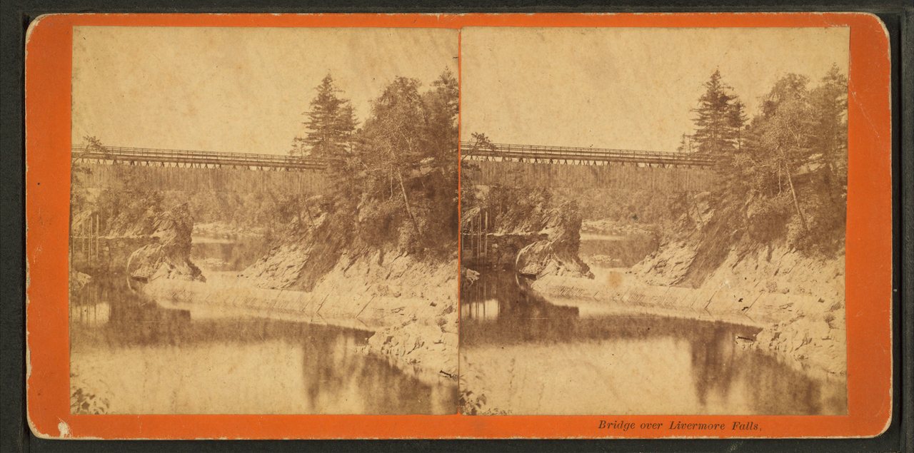




 c. 1869
 1889
 1889
 1889
 1973
 Date?
 Date?
 Date?
 2022
 2022
 2022
 2022
 2019
 2014
 2014
 2011
 2011
 2008