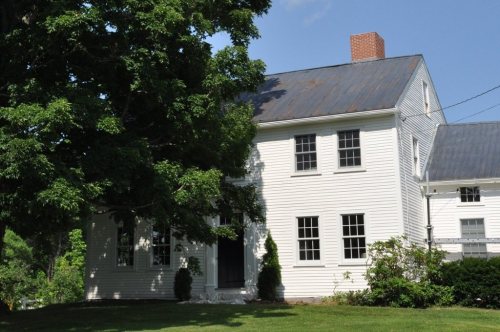
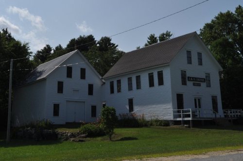
Most of Hartford was built recently: 9% of its homes predate 1940 and the median home dates from 1990. Its Register listings are the David Warren House, the J. & O. Irish Store and the Union School. Its Register listings are the David Warren House, the J. & O. Irish Store and the Union School. Below: 1 old photo or paper, maps from 1911 on, and the census since 1810.
Founding year: the first Hartford post office (Blevins & Helbock, CC0).
History grade
What drives Hartford’s History grade
On its age, its old homes and the National Register, Hartford is more historic than 74% of U.S. towns. Its age holds the grade up; its share of homes from before 1940 pulls it down.
B+
HistoryA character grade: shown, never part of Hartford’s overall grade.
Maine towns list more on the Register than most of the country (a typical Maine town has 15.9 per 10,000 residents, the U.S. 2.4), so Hartford’s 45.7 sits above most of its state (74% of Maine towns have fewer) while its 6 historic buildings outnumber those of 72% of U.S. towns.
How sure. Graded on any two of the three inputs instead, the letter would range from B to A−. The pre-1940 share is a Census survey estimate (±4.6 points). The founding year is the first post office, not a stated founding date.
Founding year: the first post office (other dates in Quick answers). Homes: Census ACS 2020–24. National Register: National Park Service, May 2026 list; each listing counted once (boundary changes and added documentation belong to their listing), and a historic district counts its contributing buildings. How TownRatings grades history →
What stands out about Hartford’s past
Read from the archive, the National Register and the record. The page puts what stands out first.
Lost two-thirds of its people between 1840 and 1970, then grew 3-fold.
22 censuses, 1810–2020.
U.S. Census Bureau decennial counts, from the census table on Hartford’s Wikipedia page.
On the map
Hartford on the map, 1911 to 1967
Every edition of the U.S. Geological Survey’s map of Hartford. Tap a year, or press play to watch the town change.
1911Buckfield sheet · 1:62,500
U.S. Geological Survey historical topographic maps (public domain), via Esri’s collection of the scans. The red ring marks the center of Hartford.
The story so far
Hartford, in brief
Wikipedia doesn’t have a history of Hartford yet. The photos, dates and memories neighbors add here are how it gets written.
Hartford is a town in Oxford County, Maine, United States. Hartford is included in the Lewiston-Auburn, Maine metropolitan New England City and Town Area. The population was 1,203 at the 2020 census.
Its first post office opened in 1807. Its population held steady between the last two censuses: 1,185 in 2010, 1,203 in 2020.
Intro from Wikipedia. Population: U.S. Census Bureau.
From the old history books
What they wrote about Hartford, 1890–1915
Passages that mention Hartford, cut from the printed page as they were published.
A history of Buckfield, Oxford County, Maine, from the earliest explorations to the close of the year 19001915 · page 423Read the page →
Read the text
Noah Prince was chosen agent to defend the suit of Capt. Joseph Turner against the town. — It was voted to set off all the territory formerly belonging to the town of Hartford, together with its inhabitants, for the purpose of forming a school district with a section of Hartford. — The town lines were perambulated this year. — Mrs. Maria Churchill, widow of Jabez Churchill, a Revolutionary soldier, died Oct. 24, aged 94 years. She was born in Wareham, Mass., Aug. 10, 1765, and was the daughter of Elnathan and Sarah Benson.
Text read by machine from the scan; it may contain errors.
A history of Buckfield, Oxford County, Maine, from the earliest explorations to the close of the year 19001915 · page 750Read the page →
Read the text
(tavern), Dominicus Record's Heirs, Josiah Parris, John Loring, Benjamin Milliken, Henry Farwell, Hall's Bridge, Guide lioard. Turner Lower Road, past Drake's to schoolhouse and county road, past Decoster's to Lincoln's, Nathan Hall, Herman Wood to Hartford line. From Hall's Bridge, the road was afterward changed to pass by Enoch Hall's and through Turner by a different location. In 1833, T. Waterman and others sought to have the road changed to avoid the Hall Hill, and also to have an alteration made in Turner. They set forth in their petition,
Text read by machine from the scan; it may contain errors.
History of Rumford, Oxford County, Maine, from its first settlement in 1779, to the present time1890 · page 53Read the page →
Read the text
from Andover, Massachusetts, in 1786, and was the sole occupant of that region, save straggling Indians, for over two years. Paris was settled in 1781, Buckfield in 1777, and Jay about the same time as Paris. Sumner and Hartford, the territory of which was originally called Butterfleld, were settled soon after 1780. The small party of first settlers in Rumford, therefore, had neighbors not very far distant, but there were no roads connecting the different colonies, and no communication was feasible, except on foot, through
Text read by machine from the scan; it may contain errors.
Scans and text from the Internet Archive. Books published in 1930 or earlier, which are in the public domain.
Timeline
Hartford, 1807 to 1934
Woven from the archive, old maps, post office records, the National Register and the people born here.
The Hartford post office opened in 1807, the earliest record of the town by name (U.S. post office records).
How does Hartford rank for history?
Hartford is more historic than 74% of U.S. towns. The History grade combines the town’s founding era, the share of homes built before 1940 and its National Register listings. It’s a character grade, so it isn’t part of the overall grade. How it works.
What is on the National Register in Hartford?
Three places: the David Warren House (listed 1983), the J. & O. Irish Store (1983) and the Union School (2018).
How old are the homes in Hartford?
9% of Hartford’s homes were built before 1940 (Census estimate, ±4.6 points), against a typical 19% for a Maine town; the median home was built in 1990.
Founding dates: Wikidata, Wikipedia, the U.S. post office records of Blevins & Helbock (CC0) and the Census. Homes by year built: Census ACS 2020–24. National Register of Historic Places: National Park Service (list of May 22, 2026). Old photos, postcards and papers: Wikimedia Commons, the Library of Congress and other public archives, credited on each item’s page. Maps: U.S. Geological Survey historical topographic maps (via Esri) and Sanborn fire-insurance maps (Library of Congress). History text and census tables: Wikipedia (CC BY-SA 4.0). Places that used to be: USGS Geographic Names Information System (2021).
From Wikimedia Commons (3), Wikidata (1), the National Register of Historic Places (3), Wikidata and Wikipedia for famous people, U.S. Geological Survey historical maps, U.S. Census counts (via Wikipedia), the US Post Offices dataset (Blevins & Helbock), the USGS Geographic Names Information System and old county and town histories (Internet Archive). Archive images are copied here with their credits and licenses, shown on each photo’s page. Refreshed monthly.
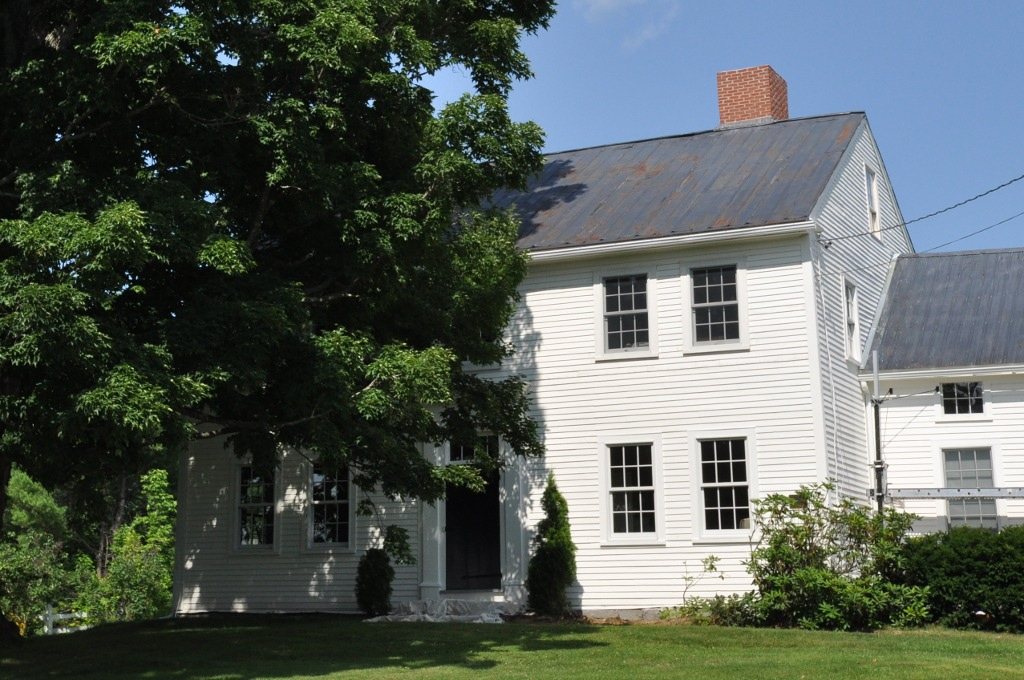
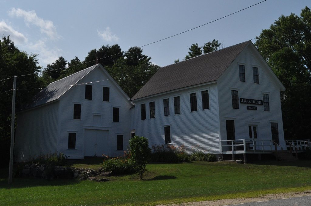


 Date?
 2012
 2009