Auburn dates to 1786, and 38% of its homes were built before 1940
More historic than 92% of U.S. towns · #34 of 143 in Maine. What drives it
25 places in town are on the National Register, among them three historic districts with 22 buildings between them. Below: 3 old photos and papers, maps from 1886 on, and the census since 1850.
Founding year: Wikipedia. First post office: 1854.The full story ↓
History grade
What drives Auburn’s History grade
On its age, its old homes and the National Register, Auburn is more historic than 92% of U.S. towns, #34 of 143 in Maine. All 3 inputs are above most U.S. towns; its share of homes from before 1940 ranks highest and its National Register listings lowest.
A
HistoryA character grade: shown, never part of Auburn’s overall grade.
Maine towns list more on the Register than most of the country (a typical Maine town has 15.9 per 10,000 residents, the U.S. 2.4), so Auburn’s 19.5 sits near the middle of its state (57% of Maine towns have fewer) while its 48 historic buildings outnumber those of 85% of U.S. towns.
NoteThe founding year comes from Wikipedia alone; no second source gives 1786.
How sure. Graded on any two of the three inputs instead, the letter would range from A− to A. The pre-1940 share is a Census survey estimate (±3.9 points).
Founding year: Wikipedia (other dates in Quick answers). Homes: Census ACS 2020–24. National Register: National Park Service, May 2026 list; each listing counted once (boundary changes and added documentation belong to their listing), and a historic district counts its contributing buildings. How TownRatings grades history →
What stands out about Auburn’s past
Read from the archive, the National Register and the record. The page puts what stands out first.
Auburn Drive-InlocaleNaval Auxiliary Air Facility Lewistonmilitary
28family graveyards and cemeteries inside Auburn
Auburn PlainsBeth AbrahamBriggsBrookvaleDavisDillinghamEvergreenFitzFletcher RoadGracelawn Memorial ParkLeightonLibbyLibby Number 2McKenneyMcKenneyMount AuburnMountain ViewNorth AuburnNorth River RoadOak HillOld Hotel RoadPenley CornerPine StreetPlummerRubyTabor FarmUnionWag
See all 28
Auburn Plains Cemetery · Beth Abraham Cemetery · Briggs Cemetery · Brookvale Cemetery · Davis Cemetery · Dillingham Cemetery · Evergreen Cemetery · Fitz Cemetery · Fletcher Road Cemetery · Gracelawn Memorial Park · Leighton Cemetery · Libby Cemetery · Libby Number 2 Cemetery · McKenney Cemetery · McKenney Cemetery · Mount Auburn Cemetery · Mountain View Cemetery · North Auburn Cemetery · North River Road Cemetery · Oak Hill Cemetery · Old Hotel Road Cemetery · Penley Corner Cemetery · Pine Street Cemetery · Plummer Cemetery · Ruby Cemetery · Tabor Farm Cemetery · Union Cemetery · Wag Cemetery
US Post Offices dataset (Blevins & Helbock, CC0). Places and cemeteries from the USGS Geographic Names Information System (2021).
Help out
Start Auburn’s collection
The first neighbors to add old photos shape how Auburn’s history is told.
Decades since 1900 with photos
00s10s20s30s40s50s60s70s80s90s
2 of 10 decades. The empty ones are waiting for someone’s album.
The area was originally part of the Pejepscot Purchase, land bought in 1714 by an association of people from Boston and Portsmouth following the Treaty of Portsmouth, which brought peace between the Abenaki Indians and the settlers of present-day Maine. In 1736, however, the Massachusetts General Court granted a large section of the land to veterans of the 1690 Battle of Quebec. Conflicting claims led to prolonged litigation; consequently, settlement was delayed until after the French and Indian Wars.
Passages that mention Auburn, cut from the printed page as they were published.
History of Androscoggin County, Maine ..1891 · page 604Read the page →
Read the text
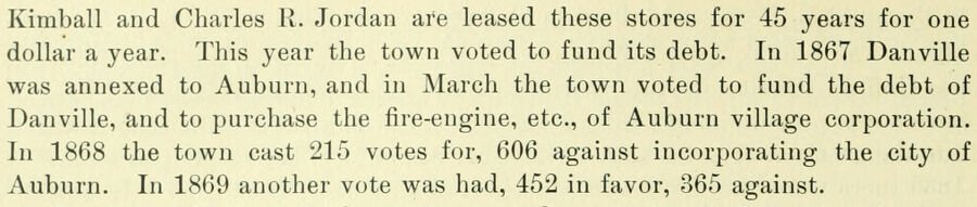
Kimball and Charles R. Jordan are leased these stores for 45 years for one dollar a year. This year the town voted to fund its debt. In 1867 Danville was annexed to Auburn, and in Marcli the town voted to fund the debt of Danville, and to purchase the fire-engine, etc., of Auburn village corporation. In 1868 the town cast 215 votes for, 606 against incorporating the city of Auburn. In 1869 another vote was had, 452 in favor, 365 against.
Text read by machine from the scan; it may contain errors.
History of Androscoggin County, Maine ..1891 · page 646Read the page →
Read the text
Auburn Board of Trade. — This organization is one of the strongest elements of Auburn's business prosperity. It was organized April 6, 1887, with 86 members. The leading business men belong to it, and, although on ordinary occasions the meetings may be thinly attended, and not much interest apparently manifested, yet when the need of action comes and a movement is demanded to add to Auburn's prosperity, this Board of Trade furnishes organized and concentred activity that fails not to accomplish the end in view ; the Auburn Public Library is a conspicuous example of its successful work.
Text read by machine from the scan; it may contain errors.
Scans and text from the Internet Archive. Books published in 1930 or earlier, which are in the public domain.
Timeline
Auburn, 1786 to 1973
Woven from the archive, old maps, post office records, the National Register and the people born here.
Nothing in the archives for these yearsWeddings on Main Street, storms, parades, school pictures, the old store. If it’s in your family album, it belongs here.
Nothing in the archives for these yearsWeddings on Main Street, storms, parades, school pictures, the old store. If it’s in your family album, it belongs here.
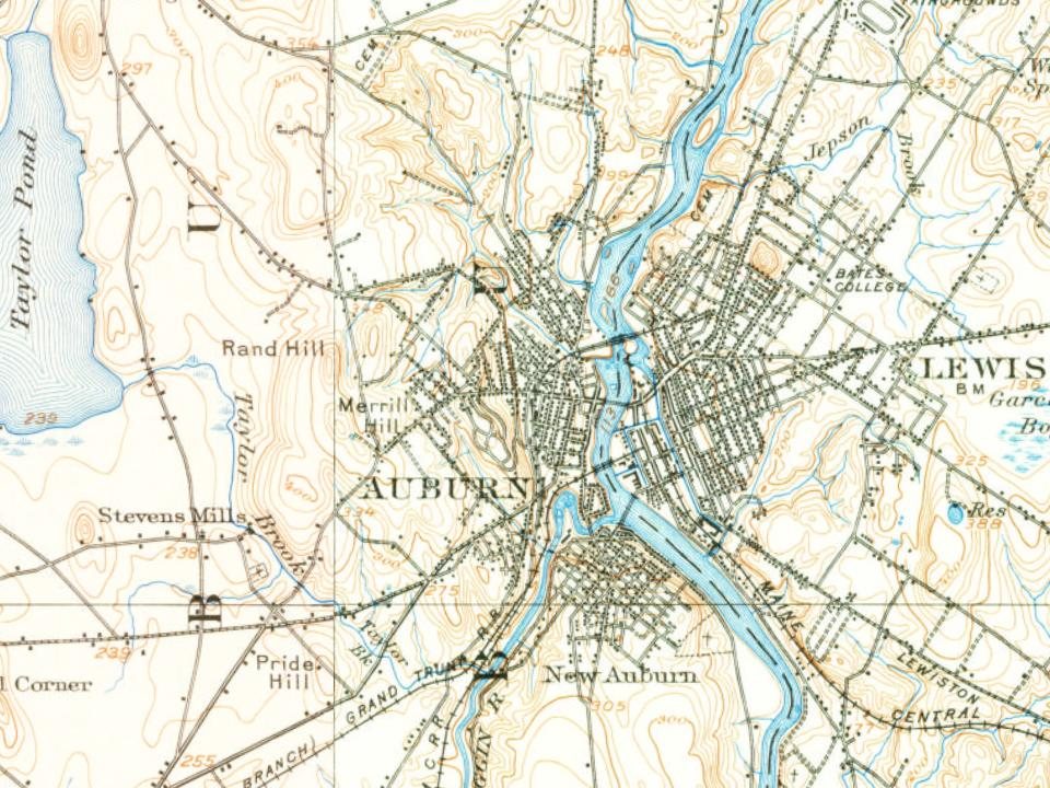
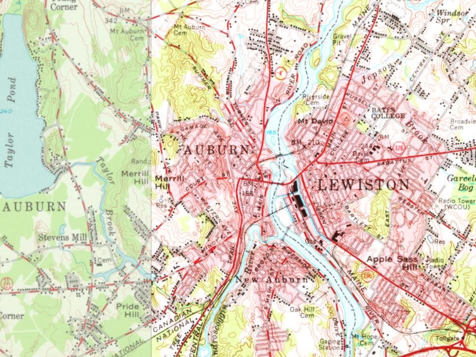
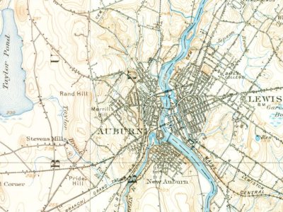
Every edition of the U.S. Geological Survey’s map of Auburn. Tap a year, or press play to watch the town change.
1908Lewiston sheet · 1:62,500
U.S. Geological Survey historical topographic maps (public domain), via Esri’s collection of the scans. The red ring marks the center of Auburn.
Every building
Auburn, building by building, 1886–1914
Fire insurance maps drew every building, what it was made of and what it was used for, so insurers could price the risk of fire. Pick a year, then a sheet.
In 1786, according to Wikipedia’s history of the town. Auburn’s post office opened in 1854, and the census of 1850 counted 2,840 people here.
How does Auburn rank for history?
Auburn is more historic than 92% of U.S. towns, #34 of 143 in Maine. The History grade combines the town’s founding era, the share of homes built before 1940 and its National Register listings. It’s a character grade, so it isn’t part of the overall grade. How it works.
What is on the National Register in Auburn?
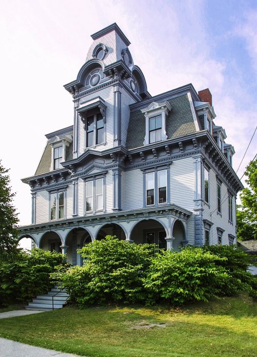
25 listings: 22 buildings, among them the Charles A. Jordan House (listed 1974, the first), and 3 historic districts, the Main Street Historic District, the Free Baptist Church and the Auburn Commercial Historic District, with 22 contributing buildings. 48 historic buildings in all.
How old are the homes in Auburn?
38% of Auburn’s homes were built before 1940 (Census estimate, ±3.9 points), against a typical 19% for a Maine town; the median home was built in 1954.
Founding dates: Wikidata, Wikipedia, the U.S. post office records of Blevins & Helbock (CC0) and the Census. Homes by year built: Census ACS 2020–24. National Register of Historic Places: National Park Service (list of May 22, 2026). Old photos, postcards and papers: Wikimedia Commons, the Library of Congress and other public archives, credited on each item’s page. Maps: U.S. Geological Survey historical topographic maps (via Esri) and Sanborn fire-insurance maps (Library of Congress). History text and census tables: Wikipedia (CC BY-SA 4.0). Places that used to be: USGS Geographic Names Information System (2021).
From Wikimedia Commons (9), Wikidata (3), the National Register of Historic Places (25), Wikipedia, Wikidata and Wikipedia for famous people, U.S. Geological Survey historical maps, U.S. Census counts (via Wikipedia), the US Post Offices dataset (Blevins & Helbock), the USGS Geographic Names Information System, Sanborn fire insurance maps (Library of Congress) and old county and town histories (Internet Archive). Archive images are copied here with their credits and licenses, shown on each photo’s page. Refreshed monthly.






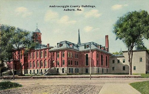

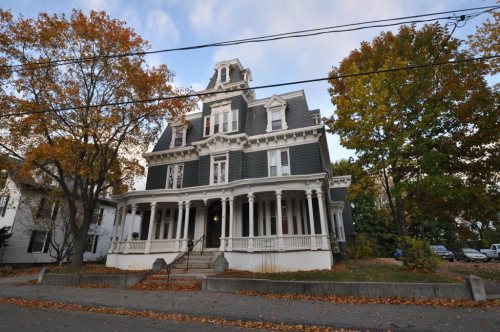




 2012
 2010
 2010
 2007
 2005
 2005