Wrentham dates to 1660, and 16% of its homes were built before 1940
More historic than 78% of U.S. towns · #230 of 283 in Massachusetts. What drives it
Its Register listings are the Roebuck Tavern, the Plimpton-Winter House and the Original Congregational Church of Wrentham. Below: 6 old photos and papers, maps from 1887 on, and the census since 1790.
Founding year: Wikidata. First post office: 1798.The full story ↓
History grade
What drives Wrentham’s History grade
On its age, its old homes and the National Register, Wrentham is more historic than 78% of U.S. towns, #230 of 283 in Massachusetts. Its age holds the grade up; its National Register listings pull it down.
A−
HistoryA character grade: shown, never part of Wrentham’s overall grade.
Massachusetts towns list more on the Register than most of the country (a typical Massachusetts town has 46.0 per 10,000 residents, the U.S. 2.4), so Wrentham’s 3.3 sits below most of its state (18% of Massachusetts towns have fewer) while its 4 historic buildings outnumber those of 68% of U.S. towns.
NoteThe founding year comes from Wikidata alone; no second source gives 1660.
How sure. Graded on any two of the three inputs instead, the letter would range from B− to A. The pre-1940 share is a Census survey estimate (±3.3 points).
Founding year: Wikidata (other dates in Quick answers). Homes: Census ACS 2020–24. National Register: National Park Service, May 2026 list; each listing counted once (boundary changes and added documentation belong to their listing), and a historic district counts its contributing buildings. How TownRatings grades history →
What stands out about Wrentham’s past
Read from the archive, the National Register and the record. The page puts what stands out first.
In 1660, five men from Dedham were sent to explore the lakes near George Indian's wigwam and to report back to the selectmen what they found. The report of those men, Daniel Fisher, Anthony Fisher, Sgt. Fuller, Richard Ellis, and Richard Wheeler, was received with such enthusiasm that in March 1661 it was voted to start a new settlement there. The Town then voted to send Ellis and Timothy Dwight to go negotiate with King Philip to purchase the title to the area known as Wollomonopoag.
Passages that mention Wrentham, cut from the printed page as they were published.
History of Norfolk County, Massachusetts, 1622-19181918 · page 235Read the page →
Read the text
Town of Wrentham, or that may hereafter be received from taxes now assessed, shall be applied to the purposes for which they were raised and assessed, in the same manner as if this act had not been passed ; and until the next state valuation the Town of Plainville shall annually, in the month of November, pay to the Town of Wrentham its proportion of such state and county taxes as may be assessed upon the Town of Wrentham, said proportion to be ascertained and determined by the last valuation of the Town of Wrentham; and the assessors of the Town of Wrentham shall make return of said valuation
Text read by machine from the scan; it may contain errors.
History of Norfolk County, Massachusetts, 1622-19181918 · page 234Read the page →
Read the text
THE ORGANIC ACT "Be it enacted, etc., as follows: "Section 1. All the territory now within the Town of Wrentham which lies south of the following described line, to wit: — A straight line drawn from a stone monument in the boundary line between the Town of Wrentham and the Town of Cumberland in the State of Rhode Island, which monument is at the intersection of the lines forming the northeast corner of the State of Rhode Island, to a point where the southerly line of Thurston Street in the Town of
Text read by machine from the scan; it may contain errors.
History of Norfolk County, Massachusetts, with biographical sketches of many of its pioneers and prominent men1884 · page 165Read the page →
Read the text
that Towns in this State do or may enjoy. And be it further said Town of Franklin shall pay their proportion of all State, County, and Town charges already granted to be raised in the Town of Wrentham and also their proportion of the pay of the Representatives for the present year; and the said Town of Wrentham and Town of Franklin shall be severally held punc- Contained and Expressed in a vote of the Town of Wrentham passed at Publick Town-meeting the sixteenth Day of Feb-
Text read by machine from the scan; it may contain errors.
History of Norfolk County, Massachusetts, with biographical sketches of many of its pioneers and prominent men1884 · page 673Read the page →
Read the text
43 The dismemberment began in 1724, when the southwest portion of the South Precinct was set off to Wrentham, formerly a part of Dedham, incorporated in 1673. The petitioners gave for cause, “that they lye thirty miles from the old meeting house, and fifteen from the southern meeting house of Puncapaug, so that they are under great disadvantages for attend-
Text read by machine from the scan; it may contain errors.
Scans and text from the Internet Archive. Books published in 1930 or earlier, which are in the public domain.
By decade
Wrentham, decade by decade
2 decades in the archive, from the 1890s to the 1970s. Scroll each row; tap a photo for its story.
Nothing in the archives for these yearsWeddings on Main Street, storms, parades, school pictures, the old store. If it’s in your family album, it belongs here.
Nothing in the archives for these yearsWeddings on Main Street, storms, parades, school pictures, the old store. If it’s in your family album, it belongs here.
In 1660, according to Wikidata. Wrentham’s post office opened in 1798, and the first U.S. census counted 1,767 people here in 1790.
How does Wrentham rank for history?
Wrentham is more historic than 78% of U.S. towns, #230 of 283 in Massachusetts. The History grade combines the town’s founding era, the share of homes built before 1940 and its National Register listings. It’s a character grade, so it isn’t part of the overall grade. How it works.
What is on the National Register in Wrentham?
Three places: the Roebuck Tavern (listed 1984), the Plimpton-Winter House (1985) and the Original Congregational Church of Wrentham (2014).
How old are the homes in Wrentham?
16% of Wrentham’s homes were built before 1940 (Census estimate, ±3.3 points), against a typical 21% for a Massachusetts town; the median home was built in 1984.
Founding dates: Wikidata, Wikipedia, the U.S. post office records of Blevins & Helbock (CC0) and the Census. Homes by year built: Census ACS 2020–24. National Register of Historic Places: National Park Service (list of May 22, 2026). Old photos, postcards and papers: Wikimedia Commons, the Library of Congress and other public archives, credited on each item’s page. Maps: U.S. Geological Survey historical topographic maps (via Esri) and Sanborn fire-insurance maps (Library of Congress). History text and census tables: Wikipedia (CC BY-SA 4.0). Places that used to be: USGS Geographic Names Information System (2021).
From Wikimedia Commons (14), the Library of Congress (1), Wikidata (3), the National Register of Historic Places (3), Wikipedia, Wikidata and Wikipedia for famous people, U.S. Geological Survey historical maps, U.S. Census counts (via Wikipedia), the US Post Offices dataset (Blevins & Helbock), the USGS Geographic Names Information System, Sanborn fire insurance maps (Library of Congress) and old county and town histories (Internet Archive). Archive images are copied here with their credits and licenses, shown on each photo’s page. Refreshed monthly.


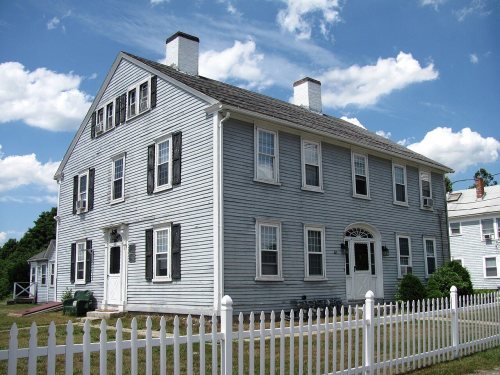


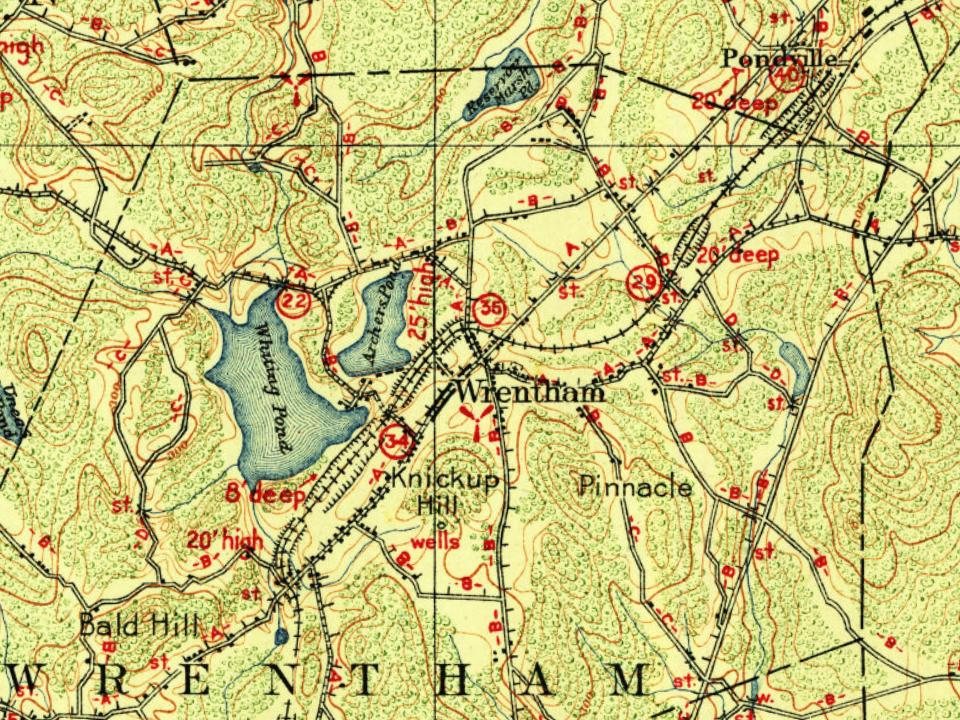


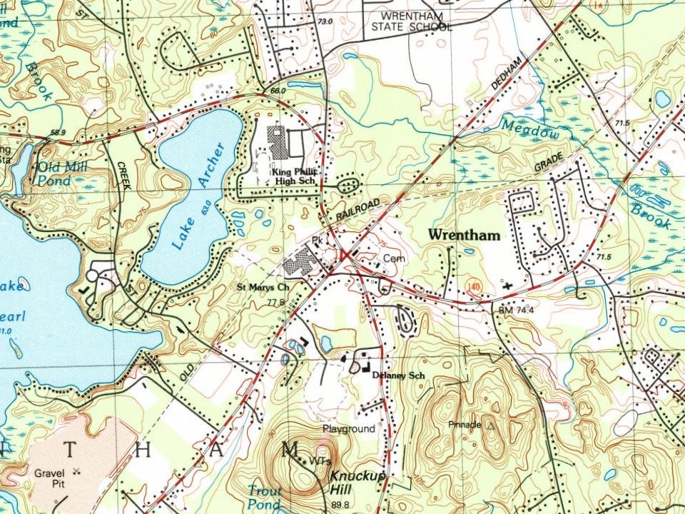


 1973
 1973
 Date?
 Date?
 2021
 2021
 2020
 2020
 2018
 2017
 2015
 2010
 2010


