Bellingham dates to 1713, and 12% of its homes were built before 1940
More historic than 79% of U.S. towns · #227 of 283 in Massachusetts. What drives it
1 place in town is on the National Register, among them a historic district. Below: 2 old photos and papers, maps from 1887 on, and the census since 1790.
Founding year: Wikidata. First post office: 1823.The full story ↓
History grade
What drives Bellingham’s History grade
On its age, its old homes and the National Register, Bellingham is more historic than 79% of U.S. towns, #227 of 283 in Massachusetts. All 3 inputs are above most U.S. towns; its age ranks highest and its share of homes from before 1940 lowest.
A−
HistoryA character grade: shown, never part of Bellingham’s overall grade.
Massachusetts towns list more on the Register than most of the country (a typical Massachusetts town has 46.0 per 10,000 residents, the U.S. 2.4), so Bellingham’s 11.5 sits below most of its state (29% of Massachusetts towns have fewer) while its 20 historic buildings outnumber those of 79% of U.S. towns.
NoteThe founding year comes from Wikidata alone; no second source gives 1713.
How sure. Graded on any two of the three inputs instead, the letter would range from B to A−. The pre-1940 share is a Census survey estimate (±3.9 points).
Founding year: Wikidata (other dates in Quick answers). Homes: Census ACS 2020–24. National Register: National Park Service, May 2026 list; each listing counted once (boundary changes and added documentation belong to their listing), and a historic district counts its contributing buildings. How TownRatings grades history →
What stands out about Bellingham’s past
Read from the archive, the National Register and the record. The page puts what stands out first.
The area of the town south of the Charles River constituted the southwestern corner of the Dedham Grant, which sprouted much of what has become Norfolk County. The land was swampy, and the town of Dedham did not believe it worthy of settlement. The area north of the river would be purchased by Edward Rawson, and due to the settlement of borders with the surrounding communities, these two areas would eventually merge. Most of the land to be called Bellingham was originally a portion of Dedham. The first land bought in Bellingham that was Dedham was purchased in 1696 by a man who believed that that government is best which governs least. By 1713, there were enough citizens to warrant village meetings in the area. By 1718, the village petitioned for separation, and the town officially incorporated on November 27, 1719. The village was originally named "Westham" (short for "West Dedham"), b…
Passages that mention Bellingham, cut from the printed page as they were published.
History of Norfolk County, Massachusetts, with biographical sketches of many of its pioneers and prominent men1884 · page 155Read the page →
Read the text
The Woonsocket Division of the same road runs the entire length of the town, with stations at the centre, North Bellingham, and Caryville. The Milford, Franklin and Providence Railroad, just completed, runs across the town, and crosses the Woonsocket Division of the New York and New England Railroad at Bellingham Centre, and also has a station in town named South Milford, so, as will be observed,
Text read by machine from the scan; it may contain errors.
History of Norfolk County, Massachusetts, with biographical sketches of many of its pioneers and prominent men1884 · page 48Read the page →
Read the text
in the petition. Bellingham was incorporated Nov. 27,1719. In 1691 the selectmen had reported that the lands near Mendon and Wrentham, which constituted the town of Bellingham, were not worth laying out for a dividend, so that there was probably no opposition to the incorporation. It was named in honor of Governor Richard Bellingham. The town of Walpole was incorporated Dec. 10, 1724, and was
Text read by machine from the scan; it may contain errors.
History of the town of Bellingham, Massachusetts, 1719-19191919 · page 95Read the page →
Read the text
In 1742 on May 8, thirteen Mendon men agreed to join in a petition to the General Court to be set off to Bellingham if the people of that town would move their meeting house "to the north side of Second Bridge River (Charles) upon the Knowl by the Road which Leeds from the said meeting house to the Country Road (Hartford Turnpike) by the house of John Marsh. " As Bellingham had already voted to do this in 1739, and repeated the
Text read by machine from the scan; it may contain errors.
History of the town of Bellingham, Massachusetts, 1719-19191919 · page 96Read the page →
Read the text
This petition reached the Court June 8, and the answer of Mendon came in September. First, there is no Gore, for the east precinct of Mendon, which became Milford in 1780, bounds on Bellingham, Hopkinton and HolHston. Second, "The Town of Mendon was clipd many years agoe to favour the Town of Bellingham."
Text read by machine from the scan; it may contain errors.
Scans and text from the Internet Archive. Books published in 1930 or earlier, which are in the public domain.
Timeline
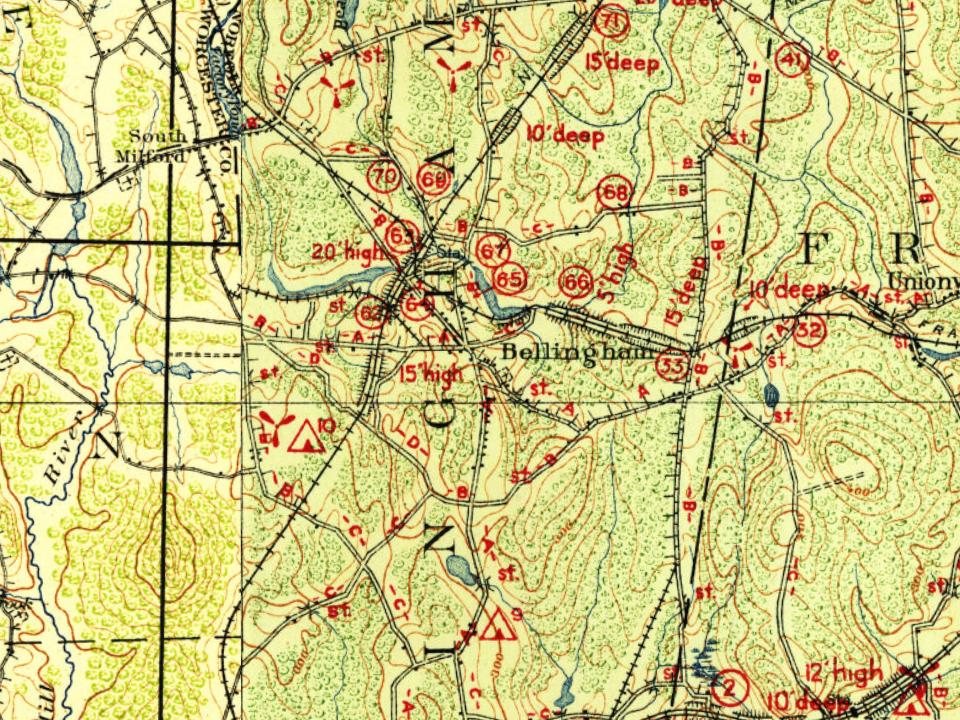
Bellingham, 1713 to 2020
Woven from the archive, old maps, post office records, the National Register and the people born here.
Nothing in the archives for these yearsWeddings on Main Street, storms, parades, school pictures, the old store. If it’s in your family album, it belongs here.
In 1713, according to Wikidata. Bellingham’s post office opened in 1823, and the first U.S. census counted 735 people here in 1790.
How does Bellingham rank for history?
Bellingham is more historic than 79% of U.S. towns, #227 of 283 in Massachusetts. The History grade combines the town’s founding era, the share of homes built before 1940 and its National Register listings. It’s a character grade, so it isn’t part of the overall grade. How it works.
What is on the National Register in Bellingham?
One place: the North Bellingham Cemetery and Oak Hill Cemetery (listed 2012).
How old are the homes in Bellingham?
12% of Bellingham’s homes were built before 1940 (Census estimate, ±3.9 points), against a typical 21% for a Massachusetts town; the median home was built in 1973.
Founding dates: Wikidata, Wikipedia, the U.S. post office records of Blevins & Helbock (CC0) and the Census. Homes by year built: Census ACS 2020–24. National Register of Historic Places: National Park Service (list of May 22, 2026). Old photos, postcards and papers: Wikimedia Commons, the Library of Congress and other public archives, credited on each item’s page. Maps: U.S. Geological Survey historical topographic maps (via Esri) and Sanborn fire-insurance maps (Library of Congress). History text and census tables: Wikipedia (CC BY-SA 4.0). Places that used to be: USGS Geographic Names Information System (2021).
From Wikimedia Commons (6), the National Register of Historic Places (1), Wikipedia, Wikidata and Wikipedia for famous people, U.S. Geological Survey historical maps, U.S. Census counts (via Wikipedia), the US Post Offices dataset (Blevins & Helbock), the USGS Geographic Names Information System and old county and town histories (Internet Archive). Archive images are copied here with their credits and licenses, shown on each photo’s page. Refreshed monthly.




 2010
 2010
 2008
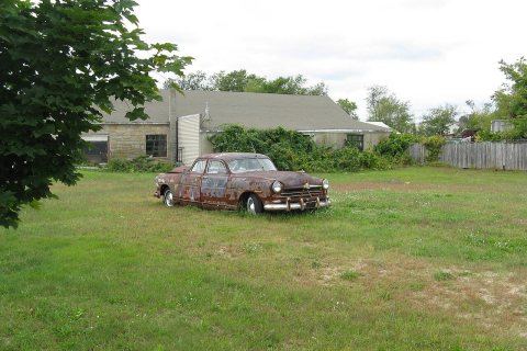 2008
