Foxborough dates to 1704, and 15% of its homes were built before 1940
More historic than 84% of U.S. towns · #189 of 283 in Massachusetts. What drives it
9 places in town are on the National Register, among them two historic districts with 40 buildings between them. Below: 11 old photos and papers, maps from 1946 on, and the census since 1790.
Founding year: Wikidata. First post office: 1805.The full story ↓
History grade
What drives Foxborough’s History grade
On its age, its old homes and the National Register, Foxborough is more historic than 84% of U.S. towns, #189 of 283 in Massachusetts. All 3 inputs are above most U.S. towns; its age ranks highest and its share of homes from before 1940 lowest.
A−
HistoryA character grade: shown, never part of Foxborough’s overall grade.
Massachusetts towns list more on the Register than most of the country (a typical Massachusetts town has 46.0 per 10,000 residents, the U.S. 2.4), so Foxborough’s 26.3 sits near the middle of its state (38% of Massachusetts towns have fewer) while its 49 historic buildings outnumber those of 85% of U.S. towns.
NoteThe founding year comes from Wikidata alone; no second source gives 1704.
How sure. Graded on any two of the three inputs instead, the letter would range from B+ to A. The pre-1940 share is a Census survey estimate (±3.4 points).
Founding year: Wikidata (other dates in Quick answers). Homes: Census ACS 2020–24. National Register: National Park Service, May 2026 list; each listing counted once (boundary changes and added documentation belong to their listing), and a historic district counts its contributing buildings. How TownRatings grades history →
What stands out about Foxborough’s past
Read from the archive, the National Register and the record. The page puts what stands out first.
Settled in 1704 and incorporated in 1778, the town of Foxborough was named for Charles James Fox, a Whig member of Parliament and a staunch supporter of the Colonies in the years leading up to the American Revolution.
The town was once home to the world's largest straw hat factory, erected in 1886. The building became the Bay State Boot and Shoe Company which closed in 1891. In 1894, the building became the Inman and Kimball hat factory. It burned to the ground during a spectacular mid-day fire in 1936. The Foxborough Post Office now stands on the site.
Passages that mention Foxborough, cut from the printed page as they were published.
History of Norfolk County, Massachusetts, 1622-19181918 · page 234Read the page →
Read the text
the intersection of the lines forming the northeast corner of the State of Rhode Island, to a point where the southerly line of Thurston Street in the Town of Wrentham intersects the boundary line between the Town of Wrentham and the Town of Foxborough, is hereby incorporated as a separate town by the name of Plainville, and the said Town of Plainville is hereby vested with all the powers, privileges, rights and immunities, and shall be subject to all the duties and obligations conferred or imposed on towns by the constitution and laws of the Commonwealth.
Text read by machine from the scan; it may contain errors.
History of Norfolk County, Massachusetts, 1622-19181918Read the page →
Read the text
favor of some system of waterworks, and suggested a plan by which the town could be supplied with water. The matter was then taken to the Legislature, and on April 4, 1879, an act was approved, Section 1 of which was as follows: "The inhabitants of the Milage of Foxborough in the County of Norfolk, liable to taxation in the Town of Foxborough, and residing within a radius of half a mile from the center of the public common in" said village, shall constitute a water district and are made a body corporate by the name of The Foxborough Water Supply District, for the purpose of supplying themselves with pure
Text read by machine from the scan; it may contain errors.
History of Norfolk County, Massachusetts, with biographical sketches of many of its pioneers and prominent men1884 · page 677Read the page →
Read the text
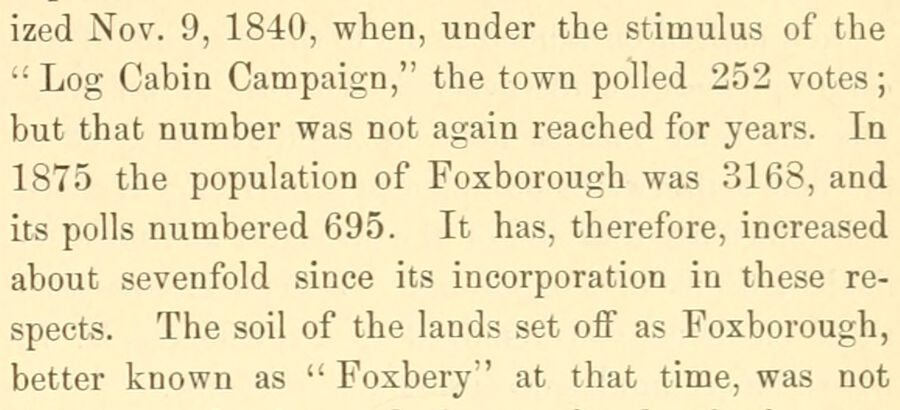
ized Nov. 9, 1840, when, under the stimulus of the ‘Log Cabin Campaign,” the town polled 252 votes; but that number was not again reached for years. In 1875 the population of Foxborough was 3168, and It has, therefore, increased about sevenfold since its incorporation in these respects. The soil of the lands set off as Foxborough, better known as ‘“‘ Foxbery” at that time, was not
Text read by machine from the scan; it may contain errors.
History of Norfolk County, Massachusetts, with biographical sketches of many of its pioneers and prominent men1884 · page 667Read the page →
Read the text
By a colonial census made in 1776 the population of Wrentham was 2879. In 1790, after the setting off of Franklin and also of a part of the town of Foxborough, the population was 1767. By the census of 1800 it was................ 2061 5S cs Cee SHIDO Se etcocnenstaesteccees 2478 6 ef SEW LS 2 ORES Sie cecccestusesseocese: 2801 OG G See BS) SEN tic estincctses cote: 2698
Text read by machine from the scan; it may contain errors.
Scans and text from the Internet Archive. Books published in 1930 or earlier, which are in the public domain.
By decade
Foxborough, decade by decade
3 decades in the archive, from the 1900s to the 1920s. Scroll each row; tap a photo for its story.
Nothing in the archives for these yearsWeddings on Main Street, storms, parades, school pictures, the old store. If it’s in your family album, it belongs here.
In 1704, according to Wikidata. Foxborough’s post office opened in 1805, and the first U.S. census counted 674 people here in 1790.
How does Foxborough rank for history?
Foxborough is more historic than 84% of U.S. towns, #189 of 283 in Massachusetts. The History grade combines the town’s founding era, the share of homes built before 1940 and its National Register listings. It’s a character grade, so it isn’t part of the overall grade. How it works.
What is on the National Register in Foxborough?
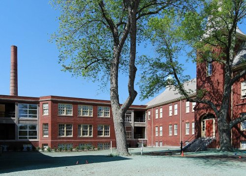
9 listings: 7 buildings, among them the Capt. Josiah Pratt House (listed 1983, the first), and 2 historic districts, the Foxborough State Hospital and the Foxborough Pumping Station, with 40 contributing buildings. 49 historic buildings in all.
How old are the homes in Foxborough?
15% of Foxborough’s homes were built before 1940 (Census estimate, ±3.4 points), against a typical 21% for a Massachusetts town; the median home was built in 1976.
Founding dates: Wikidata, Wikipedia, the U.S. post office records of Blevins & Helbock (CC0) and the Census. Homes by year built: Census ACS 2020–24. National Register of Historic Places: National Park Service (list of May 22, 2026). Old photos, postcards and papers: Wikimedia Commons, the Library of Congress and other public archives, credited on each item’s page. Maps: U.S. Geological Survey historical topographic maps (via Esri) and Sanborn fire-insurance maps (Library of Congress). History text and census tables: Wikipedia (CC BY-SA 4.0). Places that used to be: USGS Geographic Names Information System (2021).
From Wikimedia Commons (11), Wikidata (1), the National Register of Historic Places (9), Wikipedia, Wikidata and Wikipedia for famous people, U.S. Geological Survey historical maps, U.S. Census counts (via Wikipedia), the US Post Offices dataset (Blevins & Helbock), the USGS Geographic Names Information System and old county and town histories (Internet Archive). Archive images are copied here with their credits and licenses, shown on each photo’s page. Refreshed monthly.







 1907–1915
 1907–1915
 1907–1915
 1907–1915
 c. 1909
 c. 1914
 1915–1925
 1915


