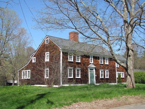
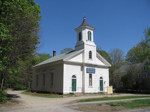
Norfolk dates to 1695, and 7 of its places are on the National Register
More historic than 82% of U.S. towns · #215 of 283 in Massachusetts. What drives it
Most of Norfolk was built recently: 8% of its homes predate 1940 and the median home dates from 1984. 7 places in town are on the National Register, among them three historic districts with 77 buildings between them. Below: 3 old photos and papers, maps from 1887 on, and the census since 1870.
Founding year: Wikidata. First post office: 1826.The full story ↓
History grade
What drives Norfolk’s History grade
On its age, its old homes and the National Register, Norfolk is more historic than 82% of U.S. towns, #215 of 283 in Massachusetts. Its age holds the grade up; its share of homes from before 1940 pulls it down.
A−
HistoryA character grade: shown, never part of Norfolk’s overall grade.
Massachusetts towns list more on the Register than most of the country (a typical Massachusetts town has 46.0 per 10,000 residents, the U.S. 2.4), so Norfolk’s 69.4 sits near the middle of its state (57% of Massachusetts towns have fewer) while its 81 historic buildings outnumber those of 88% of U.S. towns.
NoteThe founding year comes from Wikidata alone; no second source gives 1695.
How sure. Graded on any two of the three inputs instead, the letter would range from B to A. The pre-1940 share (±2.8 points) is firm at this size.
Founding year: Wikidata (other dates in Quick answers). Homes: Census ACS 2020–24. National Register: National Park Service, May 2026 list; each listing counted once (boundary changes and added documentation belong to their listing), and a historic district counts its contributing buildings. How TownRatings grades history →
What stands out about Norfolk’s past
Read from the archive, the National Register and the record. The page puts what stands out first.
Norfolk is a suburban town on the periphery of metropolitan Boston, located on an upper valley of the Charles River. The land was originally part of Dedham, which was incorporated in 1636. There were a half dozen small farms in the area after 1669, the result of a determined effort to populate the colonial frontier, despite the remoteness of the area. Wrentham separated from Dedham in 1673; what is now Norfolk was in the northern part of Wrentham. The farms were abandoned during King Philip's War in 1675–76, but repopulated later that century.
Passages that mention Norfolk, cut from the printed page as they were published.
History of Norfolk, Litchfield County, Connecticut1900 · page 62Read the page →
Read the text
Whereas, the Honorable General Assembly of the Colony of Connecticut aforesaid, did at their session held at New Haven upon the second Thursday of October, A.D. 1758, enact, decree and declare that the township of Norfolk should be incorporated, and did incorporate said township of Norfolk and ordered and decreed that Mr. George Palmer and Mr. Ezra Knap should warn all the inhabitants of said Norfolk to meet at some suitable place in said Norfolk on
Text read by machine from the scan; it may contain errors.
History of Norfolk, Litchfield County, Connecticut1900 · page 345Read the page →
Read the text
"But two out of 256 voters of this town appear to oppose the line through the Green. A petition signed by 204 of 256 voters of this town reads as follows: 'We the undersigned, voters and tax-payers of the town of Norfolk, being desirous of promoting the best interests of the town in the location of the Railroad through said town, and fully believing that the business interests, the protection to private property, the safety to public travel, and proper depot facilities, require that the road be laid out and located on
Text read by machine from the scan; it may contain errors.
Scans and text from the Internet Archive. Books published in 1930 or earlier, which are in the public domain.
Timeline
Norfolk, 1695 to 1973
Woven from the archive, old maps, post office records, the National Register and the people born here.
Nothing in the archives for these yearsWeddings on Main Street, storms, parades, school pictures, the old store. If it’s in your family album, it belongs here.
In 1695, according to Wikidata. Norfolk’s post office opened in 1826, and the census of 1870 counted 1,081 people here.
How does Norfolk rank for history?
Norfolk is more historic than 82% of U.S. towns, #215 of 283 in Massachusetts. The History grade combines the town’s founding era, the share of homes built before 1940 and its National Register listings. It’s a character grade, so it isn’t part of the overall grade. How it works.
What is on the National Register in Norfolk?
7 listings: 3 buildings, among them the Warelands (listed 1977, the first), 3 historic districts, the Wrentham State School, the Sullivan's Corner Historic District and the Rockwood Road Historic District, with 77 contributing buildings, and 1 site. 81 historic buildings in all.
How old are the homes in Norfolk?
8% of Norfolk’s homes were built before 1940 (Census estimate, ±2.8 points), against a typical 21% for a Massachusetts town; the median home was built in 1984.
Founding dates: Wikidata, Wikipedia, the U.S. post office records of Blevins & Helbock (CC0) and the Census. Homes by year built: Census ACS 2020–24. National Register of Historic Places: National Park Service (list of May 22, 2026). Old photos, postcards and papers: Wikimedia Commons, the Library of Congress and other public archives, credited on each item’s page. Maps: U.S. Geological Survey historical topographic maps (via Esri) and Sanborn fire-insurance maps (Library of Congress). History text and census tables: Wikipedia (CC BY-SA 4.0). Places that used to be: USGS Geographic Names Information System (2021).
From Wikimedia Commons (5), the Library of Congress (1), the National Register of Historic Places (7), Wikipedia, Wikidata and Wikipedia for famous people, U.S. Geological Survey historical maps, U.S. Census counts (via Wikipedia), the US Post Offices dataset (Blevins & Helbock), the USGS Geographic Names Information System and old county and town histories (Internet Archive). Archive images are copied here with their credits and licenses, shown on each photo’s page. Refreshed monthly.


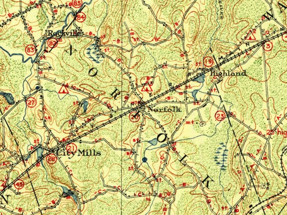


 1936
 2010
 2010
 2007