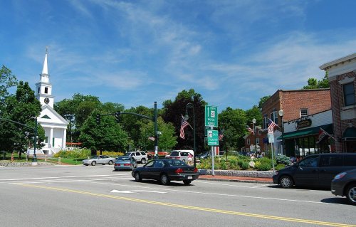
Sharon dates to 1650, and 15% of its homes were built before 1940
More historic than 59% of U.S. towns · #272 of 283 in Massachusetts. What drives it
3 places in town are on the National Register, among them a historic district with 9 buildings. Below: 15 old photos and papers, maps from 1886 on, and the census since 1790.
Founding year: Wikidata. First post office: 1819.The full story ↓
History grade
What drives Sharon’s History grade
On its age, its old homes and the National Register, Sharon is more historic than 59% of U.S. towns, #272 of 283 in Massachusetts. All 2 inputs are above most U.S. towns; its share of homes from before 1940 ranks highest and its National Register listings lowest.
B
HistoryA character grade: shown, never part of Sharon’s overall grade.
Massachusetts towns list more on the Register than most of the country (a typical Massachusetts town has 46.0 per 10,000 residents, the U.S. 2.4), so Sharon’s 6.5 sits below most of its state (25% of Massachusetts towns have fewer) while its 12 historic buildings outnumber those of 77% of U.S. towns.
NoteThe founding year comes from Wikidata alone; no second source gives 1650.
How sure. Graded on two of the three inputs, so a change in either one moves the letter more than it would with three. The pre-1940 share is a Census survey estimate (±3.2 points).
Founding year: Wikidata (other dates in Quick answers). Homes: Census ACS 2020–24. National Register: National Park Service, May 2026 list; each listing counted once (boundary changes and added documentation belong to their listing), and a historic district counts its contributing buildings. How TownRatings grades history →
What stands out about Sharon’s past
Read from the archive, the National Register and the record. The page puts what stands out first.
The Town of Sharon was first settled as part of the Massachusetts Bay Colony in 1637 and was deemed the 2nd precinct of Stoughton in 1740. It was established as the district of Stoughtonham on June 21, 1765, incorporated as the Town of Stoughtonham on August 23, 1775, and was named Sharon on February 25, 1783, after Israel's Sharon plain, due to its high level of forestation. Several towns in New England were given this name. Part of Stoughtonham went to the new town of Foxborough on June 10, 1776. During the American Revolution, the townspeople of Sharon made cannonballs and cannons for the Continental Army at a local foundry.
Passages that mention Sharon, cut from the printed page as they were published.
Medical sketches of the campaigns of 1812, 13, 141816 · page 306Read the page →
Read the text
In the same paper, notice was given, that in compliance with the request of the gentlemen of the town of Sharon, it was my intention to give to the public, a statement of the prevalent epidemic, as it appeared at that place, under its various forms, with the most successful method of practice pursued. After exhibiting ray general practice, it was observed, I had never seen the peripnivmonia notha, as an epidemic in Ibis section of New-England, until I saw the disease at Sharon ; that sporadic cases of
Text read by machine from the scan; it may contain errors.
Medical sketches of the campaigns of 1812, 13, 14 [microform]1816 · page 306Read the page →
Read the text
Gall Sa ge -erner = 306 WINTER EPIDEMIC. OF 1815-16, In the same paper, notice was given, that in compliance with the request of the gentlemen of the town of Sharon, it was my intention to give to the-public, a statement of the prevalent epidemic, as it appeared at that place, under its various forms, with the most successful method of practice pursued. After exhibiting my general practice, it was observed, I had never seen the
Text read by machine from the scan; it may contain errors.
Annals of Sharon, Massachusetts1904 · page 20Read the page →
Read the text
$850. Ill 1826 a number of persons, who were originally inhabitants of Sharon and now residing in Boston and vicinity, made a donation to the town of $1860 which is called the "Sharon Friend School Fund," and committed to the care of trustees annually chosen by the town.
Text read by machine from the scan; it may contain errors.
Annals of Sharon, Massachusetts1904 · page 10Read the page →
Read the text
business details and delivering an address. The writers of her career, however, have scarcely touched upon this subject. The first public notice of Mrs. Gannett as a lecturer appears to have been taken in her own town of Sharon, April 3, 1902, at a banquet in the town hall commemorative of the centenary of the event. On this occasion, afterdinner speeches were made by Mrs. Mary A. Livermore of Melrose, Hon. Alfred S. Roe of Worcester, Mrs. Myra
Text read by machine from the scan; it may contain errors.
Scans and text from the Internet Archive. Books published in 1930 or earlier, which are in the public domain.
By decade
Sharon, decade by decade
5 decades in the archive, from the 1880s to the 1980s. Scroll each row; tap a photo for its story.
Nothing in the archives for these yearsWeddings on Main Street, storms, parades, school pictures, the old store. If it’s in your family album, it belongs here.
Nothing in the archives for these yearsWeddings on Main Street, storms, parades, school pictures, the old store. If it’s in your family album, it belongs here.
In 1650, according to Wikidata. Sharon’s post office opened in 1819, and the first U.S. census counted 1,034 people here in 1790.
How does Sharon rank for history?
Sharon is more historic than 59% of U.S. towns, #272 of 283 in Massachusetts. The History grade combines the town’s founding era, the share of homes built before 1940 and its National Register listings. It’s a character grade, so it isn’t part of the overall grade. How it works.
What is on the National Register in Sharon?
Three places: the Sharon Historic District (listed 1975), the Stoneholm (1980) and the Wilber, Charles R., School (2010).
How old are the homes in Sharon?
15% of Sharon’s homes were built before 1940 (Census estimate, ±3.2 points), against a typical 21% for a Massachusetts town; the median home was built in 1970.
Founding dates: Wikidata, Wikipedia, the U.S. post office records of Blevins & Helbock (CC0) and the Census. Homes by year built: Census ACS 2020–24. National Register of Historic Places: National Park Service (list of May 22, 2026). Old photos, postcards and papers: Wikimedia Commons, the Library of Congress and other public archives, credited on each item’s page. Maps: U.S. Geological Survey historical topographic maps (via Esri) and Sanborn fire-insurance maps (Library of Congress). History text and census tables: Wikipedia (CC BY-SA 4.0). Places that used to be: USGS Geographic Names Information System (2021).
From Wikimedia Commons (15), Wikidata (3), the National Register of Historic Places (3), Wikipedia, Wikidata and Wikipedia for famous people, U.S. Geological Survey historical maps, U.S. Census counts (via Wikipedia), the US Post Offices dataset (Blevins & Helbock), the USGS Geographic Names Information System, Sanborn fire insurance maps (Library of Congress) and old county and town histories (Internet Archive). Archive images are copied here with their credits and licenses, shown on each photo’s page. Refreshed monthly.


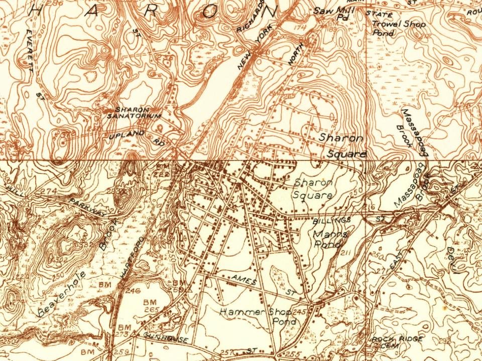


 1907–1915
 1908
 c. 1912
 c. 1930
 c. 1930
 c. 1930
 c. 1930
 1930
 c. 1935
 c. 1937