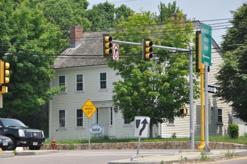
Canton’s post office opened in 1803, and 11% of its homes were built before 1940
More historic than 71% of U.S. towns · #255 of 283 in Massachusetts. What drives it
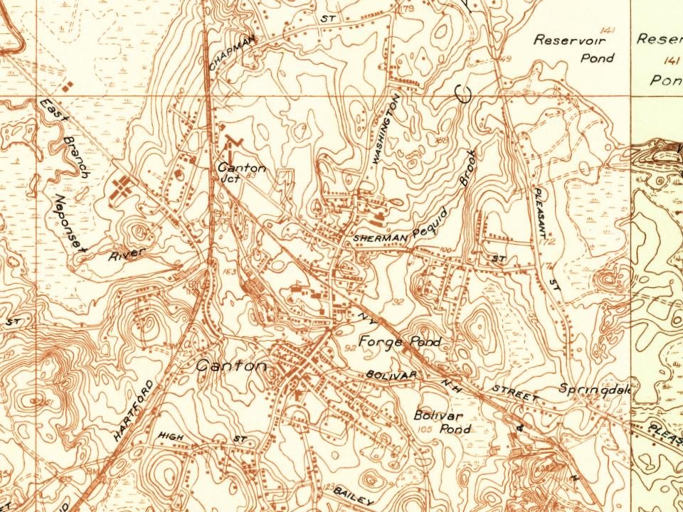
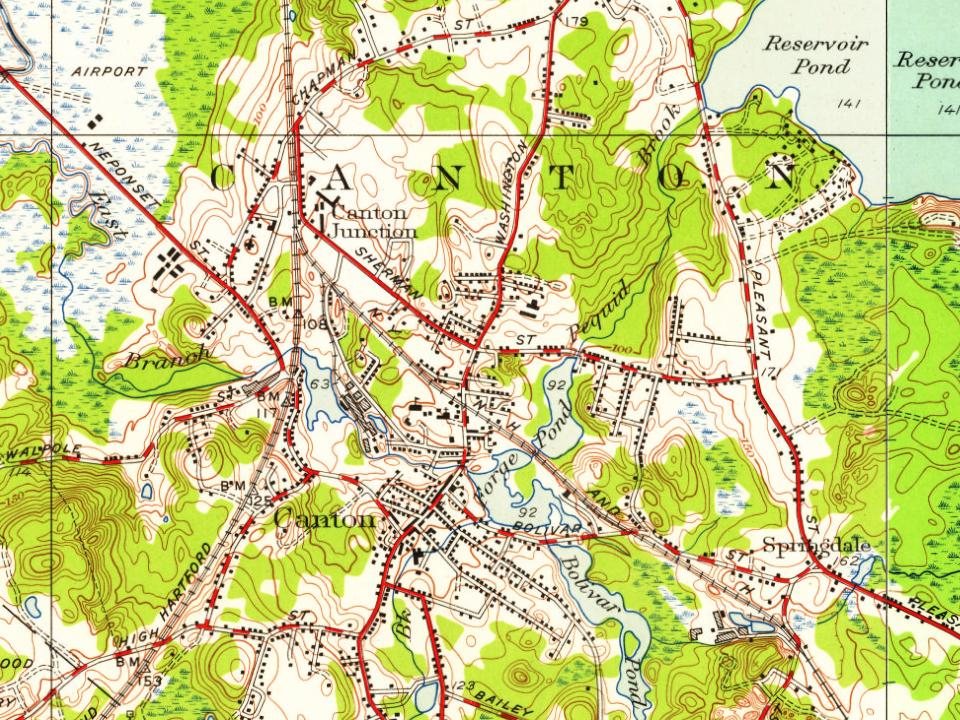
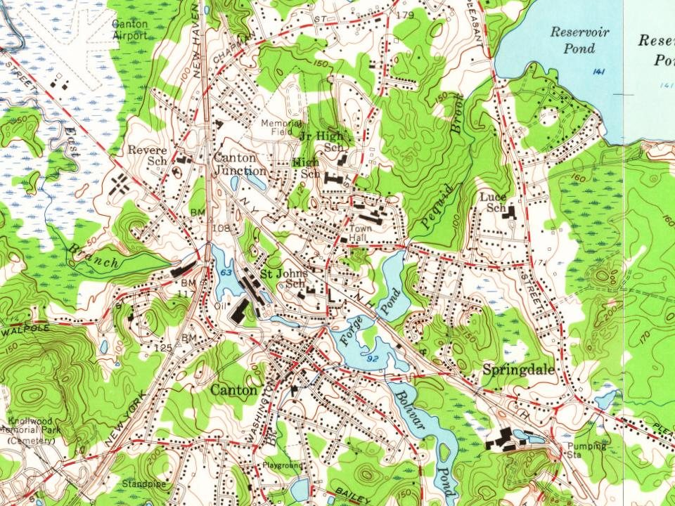
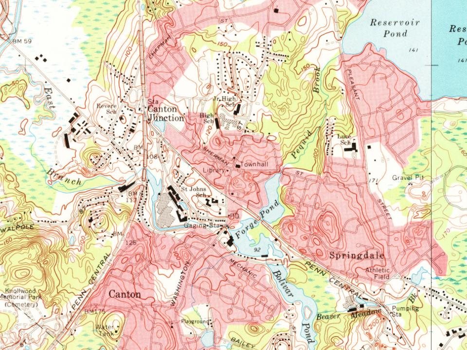
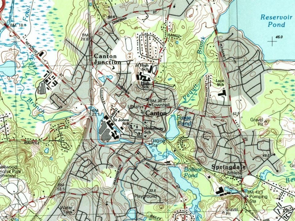
7 places in town are on the National Register, among them the Great Blue Hill Weather Observatory, a National Historic Landmark, and a historic district with 47 buildings. Below: maps from 1885 on and the census since 1850.
The Canton post office opened in 1803, the earliest record of the town by name. Two smaller post offices, Ponkapog (1874) and Canton Junction (1888), opened inside today’s town and later closed.
First census: 2,598 in 18502020 census: 24,370223 years
How historic is Canton?
B+
More historic than 71% of U.S. towns, on its age, its old homes and the National Register.
Founding year: the first Canton post office (Blevins & Helbock, CC0).The full story ↓
History grade
What drives Canton’s History grade
On its age, its old homes and the National Register, Canton is more historic than 71% of U.S. towns, #255 of 283 in Massachusetts. Its age holds the grade up; its share of homes from before 1940 pulls it down.
B+
HistoryA character grade: shown, never part of Canton’s overall grade.
Massachusetts towns list more on the Register than most of the country (a typical Massachusetts town has 46.0 per 10,000 residents, the U.S. 2.4), so Canton’s 21.0 sits near the middle of its state (36% of Massachusetts towns have fewer) while its 52 historic buildings outnumber those of 85% of U.S. towns.
How sure. Graded on any two of the three inputs instead, the letter would range from B to A−. The pre-1940 share (±2.6 points) is firm at this size. The founding year is the first post office, not a stated founding date.
Founding year: the first post office (other dates in Quick answers). Homes: Census ACS 2020–24. National Register: National Park Service, May 2026 list; each listing counted once (boundary changes and added documentation belong to their listing), and a historic district counts its contributing buildings. How TownRatings grades history →
What stands out about Canton’s past
Read from the archive, the National Register and the record. The page puts what stands out first.
The area that is present-day Canton was inhabited for thousands of years prior to European colonization. The Paleo-Indian site Wamsutta, radiocarbon dated to 12,140 years before present, is located within the bounds of modern-day Canton at Signal Hill.
At the time of the Puritan migration to New England in the early 1600s, Canton was seasonally inhabited by the Neponset band of Massachusett under the leadership of sachem Chickatawbut.
From the 1630s to the 1670s, increasing encroachment by year-round English settlers on lands traditionally inhabited only part of the year, devastating virgin soil epidemics, and English colonial policy pushed native people in to Praying Towns, a precursor to modern day Indian reservations.
Passages that mention Canton, cut from the printed page as they were published.
History of Norfolk County, Massachusetts, 1622-19181918Read the page →
Read the text
That was the first school house in what is now the Town of Canton. In Dover the first precinct meetings (1748) were held in a school house "near the dwelling house of Joseph dickering," hence it is probable that the first school was taught prior to that year, while the town was a parish of Dedham.
Text read by machine from the scan; it may contain errors.
History of Norfolk County, Massachusetts, 1622-19181918 · page 419Read the page →
Read the text
On May 29, 1893, the Canton Historical Society was incorporated, though it had been in existence since 1871. This society makes a specialty of biography and genealogy pertaining to the Town of Canton. A few years after it was incorporated a substantial building was erected as a place to preserve the collections belonging to the society. This is one of the most active historical societies in the county.
Text read by machine from the scan; it may contain errors.
History of the town of Canton, Norfolk County, Massachusetts1893Read the page →
Read the text
In 1854 the present schoolhouse, which accommodates the children living between the village of Canton and the Sharon line, was erected. The Hardware, as this portion of the town is sometimes called, had been a part of District No. 3, but in 1835 it was set off as a separate district by itself, and a new schoolhouse was erected, and designated as No. 7. Oct. 2, 1854, in view of the fact that Gen. Richard Gridley had lived, died, and been buried in the vicinity, the
Text read by machine from the scan; it may contain errors.
Scans and text from the Internet Archive. Books published in 1930 or earlier, which are in the public domain.
Timeline
Canton, 1803 to 1993
Woven from the archive, old maps, post office records, the National Register and the people born here.
Fire insurance maps drew every building, what it was made of and what it was used for, so insurers could price the risk of fire. Pick a year, then a sheet.
The Canton post office opened in 1803, the earliest record of the town by name (U.S. post office records).
How does Canton rank for history?
Canton is more historic than 71% of U.S. towns, #255 of 283 in Massachusetts. The History grade combines the town’s founding era, the share of homes built before 1940 and its National Register listings. It’s a character grade, so it isn’t part of the overall grade. How it works.
What is on the National Register in Canton?
7 listings: 5 buildings, among them the Great Blue Hill Weather Observatory (a National Historic Landmark since 1989) and the Parson Barnard House (listed 1974, the first), 1 historic district, the Canton Corner Historic District, with 47 contributing buildings, and 1 structure. 52 historic buildings in all.
How old are the homes in Canton?
11% of Canton’s homes were built before 1940 (Census estimate, ±2.6 points), against a typical 21% for a Massachusetts town; the median home was built in 1980.
Founding dates: Wikidata, Wikipedia, the U.S. post office records of Blevins & Helbock (CC0) and the Census. Homes by year built: Census ACS 2020–24. National Register of Historic Places: National Park Service (list of May 22, 2026). Old photos, postcards and papers: Wikimedia Commons, the Library of Congress and other public archives, credited on each item’s page. Maps: U.S. Geological Survey historical topographic maps (via Esri) and Sanborn fire-insurance maps (Library of Congress). History text and census tables: Wikipedia (CC BY-SA 4.0). Places that used to be: USGS Geographic Names Information System (2021).
From Wikidata (2), the National Register of Historic Places (7), Wikipedia, Wikidata and Wikipedia for famous people, U.S. Geological Survey historical maps, U.S. Census counts (via Wikipedia), the US Post Offices dataset (Blevins & Helbock), the USGS Geographic Names Information System, Sanborn fire insurance maps (Library of Congress) and old county and town histories (Internet Archive). Archive images are copied here with their credits and licenses, shown on each photo’s page. Refreshed monthly.


 ★ Landmark