Norwood dates to 1678, and 25% of its homes were built before 1940
More historic than 82% of U.S. towns · #212 of 283 in Massachusetts. What drives it
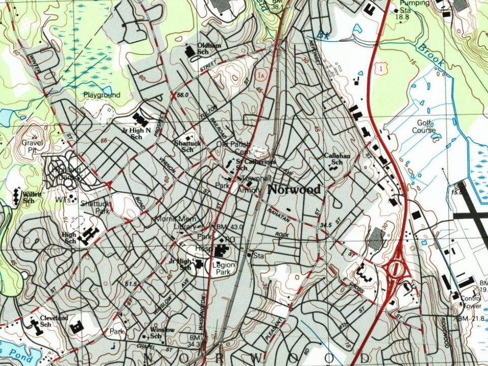
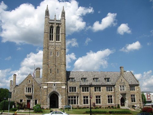
Its Register listings are the Fred Holland Day House and the Norwood Memorial Municipal Building. Below: 8 old photos and papers, maps from 1886 on, and the census since 1880.
Founding year: Wikidata. First post office: 1846.The full story ↓
History grade
What drives Norwood’s History grade
On its age, its old homes and the National Register, Norwood is more historic than 82% of U.S. towns, #212 of 283 in Massachusetts. Its age holds the grade up; its National Register listings pull it down.
A−
HistoryA character grade: shown, never part of Norwood’s overall grade.
Massachusetts towns list more on the Register than most of the country (a typical Massachusetts town has 46.0 per 10,000 residents, the U.S. 2.4), so Norwood’s 1.0 sits below most of its state (8% of Massachusetts towns have fewer) while its 3 historic buildings outnumber those of 65% of U.S. towns.
NoteThe founding year comes from Wikidata alone; no second source gives 1678.
How sure. Graded on any two of the three inputs instead, the letter would range from B to A+. The pre-1940 share (±2.7 points) is firm at this size.
Founding year: Wikidata (other dates in Quick answers). Homes: Census ACS 2020–24. National Register: National Park Service, May 2026 list; each listing counted once (boundary changes and added documentation belong to their listing), and a historic district counts its contributing buildings. How TownRatings grades history →
What stands out about Norwood’s past
Read from the archive, the National Register and the record. The page puts what stands out first.
Fire insurance maps drew every building, what it was made of and what it was used for, so insurers could price the risk of fire. Pick a year, then a sheet.
The Town of Norwood, officially formed in 1872, was until that time part of Dedham, known as the "mother of towns", as fourteen of the present communities of eastern Massachusetts lay within its original borders. Long used as a hunting ground by Native Americans, Norwood was first settled by Ezra Morse in 1678. He set up a sawmill in what is now South Norwood, the part of town to which the first concentration of families, almost all of whom were farmers, migrated over the next half-century.
Passages that mention Norwood, cut from the printed page as they were published.
History of Norfolk County, Massachusetts, with biographical sketches of many of its pioneers and prominent men1884 · page 69Read the page →
Read the text
1866, and Oct. 1, 1866, the Rev. Joseph P. Bixby became the acting pastor. Mr. Bixby remained pastor of the South Church and Parish at the date of the incorporation of the town of Norwood, in 1872. The following interesting description of the appearance of Dedham village in 1818 is found in a sermon delivered by Rev. Dr. Lamson in 1858, being the It
Text read by machine from the scan; it may contain errors.
History of Norfolk County, Massachusetts, with biographical sketches of many of its pioneers and prominent men1884 · page 503Read the page →
Read the text
in Dedham, established by Chapter 24 of the acts of the year 1829, is hereby dissolved, and the rights, privileges, and property of the proprietors vested in the First Congregational Parish in Norwood.” +The appraisers were Messrs. George Haws, of Wrentham, Gen. Josiah S. Fisher, and John Goulding. of Dedham.
Text read by machine from the scan; it may contain errors.
History of Norfolk County, Massachusetts, 1622-19181918Read the page →
Read the text
On October 8, 1730, the present towns of Norwood and Westwood were incorporated by an act of the General Court as the "South Precinct of Dedham." A controversy soon arose in the new precinct over the location of the meeting house, with the result that several petitions were presented to the General Court, asking that body to settle the dispute by sending a committee to view the situation and decide on a location for the said meeting house. In response to one of these petitions, a number of the inhabitants of the South Precinct were "set off* from said Precinct & again layed to the First Precinct in the Town of Dedham.
Text read by machine from the scan; it may contain errors.
History of Norfolk County, Massachusetts, 1622-19181918 · page 232Read the page →
Read the text
Norwood has two banks, a weekly newspaper (the Messenger), a number of prosperous manufacturing establishments, well stocked mercantile houses, a fine public library, good public schools, Baptist, Catholic, Congregational, Methodist Episcopal and Universalist churches, a fine,, new Masonic temple, well paved streets, and many handsome residences. The division of the New York, New Haven & Hartford that runs from Boston to Providence via Wrentham passes through the town, with stations at Ellis, Norwood, Norwood Central and Morrills, and the town is connected with Boston and the adjacent towns by electric
Text read by machine from the scan; it may contain errors.
Scans and text from the Internet Archive. Books published in 1930 or earlier, which are in the public domain.
By decade
Norwood, decade by decade
7 decades in the archive, from the 1880s to the 1950s. Scroll each row; tap a photo for its story.
Nothing in the archives for these yearsWeddings on Main Street, storms, parades, school pictures, the old store. If it’s in your family album, it belongs here.
In 1678, according to Wikidata. Norwood’s post office opened in 1846, and the census of 1880 counted 2,845 people here.
How does Norwood rank for history?
Norwood is more historic than 82% of U.S. towns, #212 of 283 in Massachusetts. The History grade combines the town’s founding era, the share of homes built before 1940 and its National Register listings. It’s a character grade, so it isn’t part of the overall grade. How it works.
What is on the National Register in Norwood?
Two places: the Fred Holland Day House (listed 1977) and the Norwood Memorial Municipal Building (1996).
How old are the homes in Norwood?
25% of Norwood’s homes were built before 1940 (Census estimate, ±2.7 points), against a typical 21% for a Massachusetts town; the median home was built in 1960.
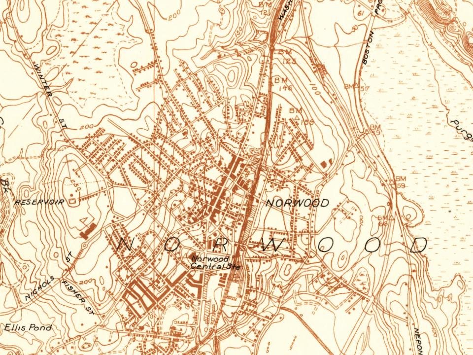
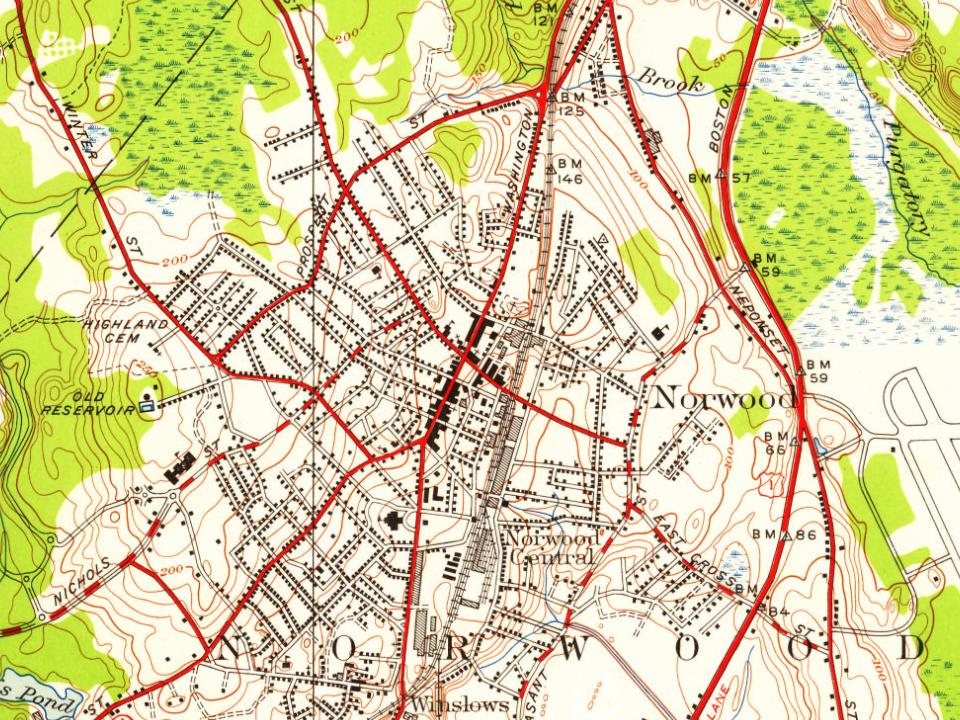
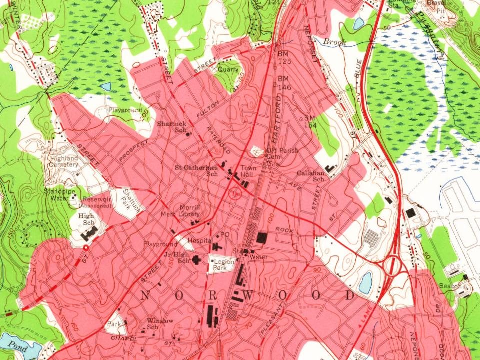
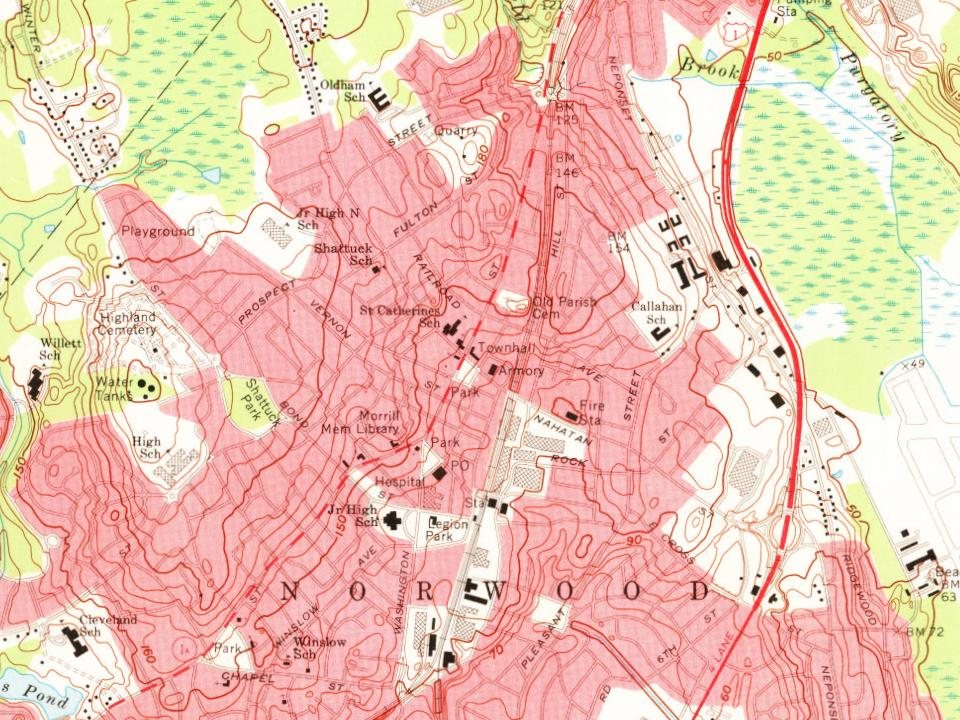
Founding dates: Wikidata, Wikipedia, the U.S. post office records of Blevins & Helbock (CC0) and the Census. Homes by year built: Census ACS 2020–24. National Register of Historic Places: National Park Service (list of May 22, 2026). Old photos, postcards and papers: Wikimedia Commons, the Library of Congress and other public archives, credited on each item’s page. Maps: U.S. Geological Survey historical topographic maps (via Esri) and Sanborn fire-insurance maps (Library of Congress). History text and census tables: Wikipedia (CC BY-SA 4.0). Places that used to be: USGS Geographic Names Information System (2021).
From Wikimedia Commons (10), Wikidata (2), the National Register of Historic Places (2), Wikipedia, Wikidata and Wikipedia for famous people, U.S. Geological Survey historical maps, U.S. Census counts (via Wikipedia), the US Post Offices dataset (Blevins & Helbock), the USGS Geographic Names Information System, Sanborn fire insurance maps (Library of Congress) and old county and town histories (Internet Archive). Archive images are copied here with their credits and licenses, shown on each photo’s page. Refreshed monthly.






 1907–1915
 1950
 2005
 2004
