Guest, Sign inJoin

Post to Andover

We’ll email a one-tap link to publish your post. No password, and nothing is public until you click it.
Already a member? Sign in
A+History
History · Andover

Andover dates to 1642, and 23% of its homes were built before 1940

More historic than 97% of U.S. towns · #57 of 283 in Massachusetts. What drives it

48 places in town are on the National Register, among them seven historic districts with 637 buildings between them. Below: maps from 1886 on and the census since 1790.

1642founded
48on the National Register
23%homes built before 1940
34famous people
Quick answers

How Andover began

When was Andover founded?

1642

Andover dates its founding to 1642 (Wikipedia’s history). It appears in the first U.S. census, 1790.

First census: 2,863 in 17902020 census: 36,569384 years

How historic is Andover?

A+

More historic than 97% of U.S. towns, on its age, its old homes and the National Register.

What drives the grade ↓
Founding year: Wikipedia. First post office: 1795.The full story ↓
History grade

What drives Andover’s History grade

On its age, its old homes and the National Register, Andover is more historic than 97% of U.S. towns, #57 of 283 in Massachusetts. All 3 inputs are above most U.S. towns; its age ranks highest and its share of homes from before 1940 lowest.

A+
HistoryA character grade: shown, never part of Andover’s overall grade.
All U.S. towns we grade (21,289)Ahead of 97%
NewerOlder
Massachusetts towns of 2,500+ (283)Ahead of 80%

Massachusetts towns list more on the Register than most of the country (a typical Massachusetts town has 46.0 per 10,000 residents, the U.S. 2.4), so Andover’s 190 sits above most of its state (75% of Massachusetts towns have fewer) while its 698 historic buildings outnumber those of 98% of U.S. towns.

How sure. Graded on any two of the three inputs instead, the letter would range from A to A+. The pre-1940 share (±2.5 points) is firm at this size. Two sources give 1642.

Founding year: Wikipedia (other dates in Quick answers). Homes: Census ACS 2020–24. National Register: National Park Service, May 2026 list; each listing counted once (boundary changes and added documentation belong to their listing), and a historic district counts its contributing buildings. How TownRatings grades history →

What stands out about Andover’s past

Read from the archive, the National Register and the record. The page puts what stands out first.

★ What stands out · On the National Register

48 listings protect 698 historic buildings

The country’s official list of buildings and places worth saving.

places listed
48
National Historic Landmarks
0
none yet
historic buildings protected
698
each building in a district counts
first listed
1975
Benjamin Abbot House
All 48 listings
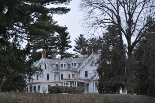
Barnard BlockBuilding · listed 1982Benjamin Jenkins HouseBuilding · listed 1982Bradlee SchoolBuilding · listed 1982Chandler-Bigsby-Abbot HouseBuilding · listed 1982Chandler-Hidden HouseBuilding · listed 1982Chickering HouseBuilding · listed 1982Cochran,Jehiel, HouseBuilding · listed 1982Dascomb HouseBuilding · listed 1982Flint FarmBuilding · listed 1982Follansbee HouseBuilding · listed 1982Harnden FarmBuilding · listed 1982Holt FarmBuilding · listed 1982Holt-Cummings-Davis HouseBuilding · listed 1982J. T. Abbot HouseBuilding · listed 1982Lincolnshire, TheBuilding · listed 1982Manning HouseBuilding · listed 1982Memorial Hall LibraryBuilding · listed 1982Musgrove BlockBuilding · listed 1982Nathan Frye HouseBuilding · listed 1982OrlandoBuilding · listed 1982Osgood FarmBuilding · listed 1982Pillsbury-French HouseBuilding · listed 1982Punchard, Benjamin HouseBuilding · listed 1982Richard Ward HouseBuilding · listed 1982Rogers-Downing HouseBuilding · listed 1982Russell HouseBuilding · listed 1982Third Railroad StationBuilding · listed 1982Timothy P. Bailey HouseBuilding · listed 1982William Perrin HouseBuilding · listed 1982Woodridge HouseBuilding · listed 1982Academy Hill Historic DistrictDistrict · listed 1982Andover Village Industrial DistrictDistrict · listed 1982Ballardvale DistrictDistrict · listed 1982Central Street DistrictDistrict · listed 1982Main Street-LockeDistrict · listed 1982West Parish Center DistrictDistrict · listed 1982Richard Nichols HouseBuilding · listed 1984Abbot-Stinson HouseBuilding · listed 1990Blanchard-Upton HouseBuilding · listed 1990William Foster HouseBuilding · listed 1990

National Park Service, National Register of Historic Places. Photos from Wikimedia Commons, credited on each place’s page.

Timeline

Andover, 1642 to 2020

Woven from the archive, old maps, post office records, the National Register and the people born here.

  1. 17th century
  2. 1642
    FoundingAndover is established
  3. 1685BuiltBenjamin Abbot House is built
  4. 18th century
  5. 1748Born hereSamuel Osgood is born here
  6. 1795Post officeThe Andover post office opens
  7. 19th century
  8. 1807BuiltAbiel Pearson House is built
  9. 1809BuiltAbbot-Battles House is built
  10. 1848Post officeThe Ballard Vale post office opens
  11. 1886On the mapFirst mapped by the U.S. Geological Survey
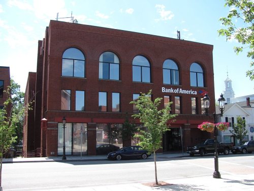
  12. 1890BuiltAndover National Bank is built
  13. 20th century
  14. 1929Born hereMarcia Henderson is born here
  15. 1964Post officeThe Ballard Vale post office closes
  16. 1985Born hereMartin Johnson is born here
  17. 1998Born hereKara Hayward is born here
  18. 21st century
  19. 2020CensusPopulation peaks at 36,569
The story

How Andover came to be

From Wikipedia’s history of Andover.

Read it all →

Native Americans inhabited what is now northeastern Massachusetts for thousands of years prior to European colonization of the Americas. At the time of European arrival, Massachusett and Naumkeag people inhabited the area south of the Merrimack River and Pennacooks inhabited the area to the north. The Massachusett referred to the area that would later be renamed Andover as Cochichawick. Cochichawick was transferred to English settlers on May 16, 1649, by the Sagamore of the Massachusett, Cutshamache. He sold the land known as Cochichawick to Mr. John Woodbrige for the price of 6 pounds and a coat, which he had already received, as well as an agreement that the Massachusett people be allowed to catch alewives in the Cochichawick River.

Text from Wikipedia, licensed CC BY-SA 4.0.

From the old history books

What they wrote about Andover in 1880

Passages that mention Andover, cut from the printed page as they were published.

| Andover was incorporated May 6, 1646. It was named for the town of Andover, in Hants County, England, which had been the home of some of its principal settlers.| The following extract from a letter written by a resident of Andover, England, to a gentleman of our town a few years ago, gives an ide…
Historical sketches of Andover, (comprising the present towns of North Andover and Andover)1880 · page 11Read the page →
Read the text

| Andover was incorporated May 6, 1646. It was named for the town of Andover, in Hants County, England, which had been the home of some of its principal settlers.| The following extract from a letter written by a resident of Andover, England, to a gentleman of our town a few years ago, gives an idea of the mother town as compared with the daughtele “T find that Andover, in America, is of more importance than

Text read by machine from the scan; it may contain errors.
We now turn to the contemporary ministers of the Third Parish of Andover, which was created in 1826. In 1771, when there was talk of building a new meeting-house in the South Parish, some members were desirous to be set off to form a new parish. They represented that they were five or six miles fro…
Historical sketches of Andover, (comprising the present towns of North Andover and Andover)1880 · page 475Read the page →
Read the text

We now turn to the contemporary ministers of the Third Parish of Andover, which was created in 1826. In 1771, when there was talk of building a new meeting-house in the South Parish, some members were desirous to be set off to form a new parish. They represented that they were five or six miles from the meeting-house, and were unwilling to be taxed to pay for the building of a new house of worship, unless it could be located so as to accommodate them better.

Text read by machine from the scan; it may contain errors.

Scans and text from the Internet Archive. Books published in 1930 or earlier, which are in the public domain.

By decade

No old photos in the archives yet

Weddings on Main Street, storms, parades, school pictures, the old store. If it’s in your family album, it belongs here.

Be the first to add onePhotograph a print flat, in daylight, no flash.
Add from your album
On the map

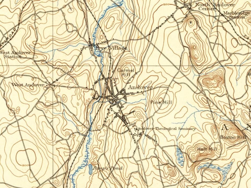
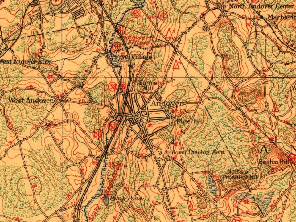
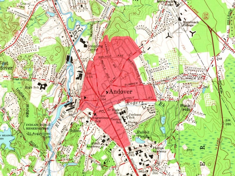
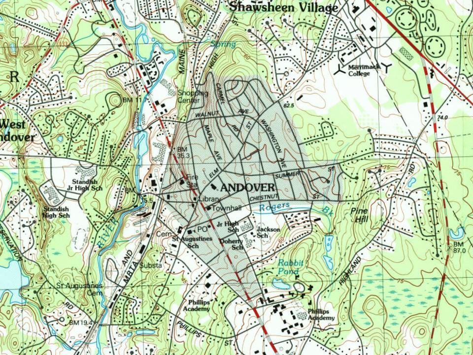
Andover on the map, 1886 to 1987

Every edition of the U.S. Geological Survey’s map of Andover. Tap a year, or press play to watch the town change.

Andover on the 1886 USGS mapAndover on the 1893 USGS mapAndover on the 1918 USGS mapAndover on the 1944 USGS mapAndover on the 1955 USGS mapAndover on the 1966 USGS mapAndover on the 1979 USGS mapAndover on the 1987 USGS map1886Lawrence sheet · 1:62,500

U.S. Geological Survey historical topographic maps (public domain), via Esri’s collection of the scans. The red ring marks the center of Andover.

Every building

Andover, building by building, 1892–1930

Fire insurance maps drew every building, what it was made of and what it was used for, so insurers could price the risk of fire. Pick a year, then a sheet.

Andover fire insurance map, 1892, sheet 11892Sheet 1 of 6
Edition
BrickWoodStone

Sanborn Map Company, via the Library of Congress. Editions published in 1930 or earlier, which are in the public domain.

People over time

Andover, census by census

05,00010,00015,00020,00025,00030,00035,00040,000180018501900195020006,945 in 1850Low: 4,765

Lost a third of its people between 1850 and 1860, then grew 7-fold.

24 censuses, 1790–2020.

U.S. Census Bureau decennial counts, from the census table on Andover’s Wikipedia page.

Famous people

34 famous people were born in Andover

Writers, athletes, leaders and more, ranked by how widely they’re known.

See all →
Places that used to be

Lost post offices, old corners, places now gone and burying grounds

Andover’s post office has been open since 1795. Another post office, Ballard Vale, opened and closed inside today’s town.

Andover
1795–today
Ballard Vale
1848–1964
17901910today
Hamlets and corners on the map
BallardvaleHaggettsLowell JunctionShawsheen HeightsShawsheen VillageWest AndoverWest Parish
Gone or out of use
Abbot Tavernbuilding
7cemeteries and burying grounds inside Andover
Sacred HeartSaint AugustineSaint FrancisSpring GroveSyrianTemple EmanuelWest Parish

US Post Offices dataset (Blevins & Helbock, CC0). Places and cemeteries from the USGS Geographic Names Information System (2021).

Help out

Start Andover’s collection

The first neighbors to add old photos shape how Andover’s history is told.

Decades since 1900 with photos
00s10s20s30s40s50s60s70s80s90s
0 of 10 decades. The empty ones are waiting for someone’s album.
Stories next door

History across the town line

Each neighbor’s History grade, on the same three inputs.

Questions about Andover’s history

What year was Andover founded?

In 1642, according to Wikipedia’s history of the town. Andover’s post office opened in 1795, and the first U.S. census counted 2,863 people here in 1790.

How does Andover rank for history?

Andover is more historic than 97% of U.S. towns, #57 of 283 in Massachusetts. The History grade combines the town’s founding era, the share of homes built before 1940 and its National Register listings. It’s a character grade, so it isn’t part of the overall grade. How it works.

What is on the National Register in Andover?

48 listings: 41 buildings, among them the Benjamin Abbot House (listed 1975, the first), and 7 historic districts with 637 contributing buildings. 698 historic buildings in all.

How old are the homes in Andover?

23% of Andover’s homes were built before 1940 (Census estimate, ±2.5 points), against a typical 21% for a Massachusetts town; the median home was built in 1973.

Memory lane

What the archives can’t tell you, neighbors can.

Town Square →
Start a conversation
Sources

Where this page comes from

Founding dates: Wikidata, Wikipedia, the U.S. post office records of Blevins & Helbock (CC0) and the Census. Homes by year built: Census ACS 2020–24. National Register of Historic Places: National Park Service (list of May 22, 2026). Old photos, postcards and papers: Wikimedia Commons, the Library of Congress and other public archives, credited on each item’s page. Maps: U.S. Geological Survey historical topographic maps (via Esri) and Sanborn fire-insurance maps (Library of Congress). History text and census tables: Wikipedia (CC BY-SA 4.0). Places that used to be: USGS Geographic Names Information System (2021).

From Wikidata (6), the National Register of Historic Places (48), Wikipedia, Wikidata and Wikipedia for famous people, U.S. Geological Survey historical maps, U.S. Census counts (via Wikipedia), the US Post Offices dataset (Blevins & Helbock), the USGS Geographic Names Information System, Sanborn fire insurance maps (Library of Congress) and old county and town histories (Internet Archive). Archive images are copied here with their credits and licenses, shown on each photo’s page. Refreshed monthly.