Mishawaka’s post office opened in 1833, and 20% of its homes were built before 1940
More historic than 89% of U.S. towns · #156 of 593 in Indiana. What drives it
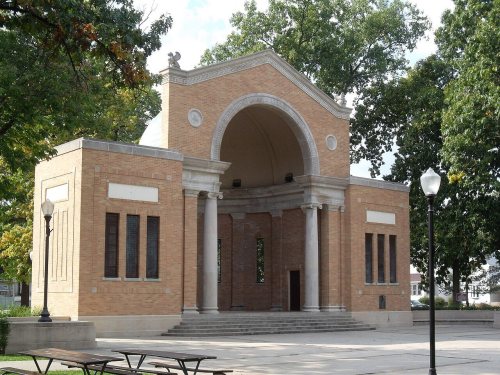
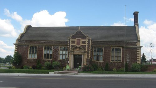
10 places in town are on the National Register, among them two historic districts with 226 buildings between them. Below: maps from 1958 on and the census since 1850.
Founding year: the first Mishawaka post office (Blevins & Helbock, CC0).The full story ↓
History grade
What drives Mishawaka’s History grade
On its age, its old homes and the National Register, Mishawaka is more historic than 89% of U.S. towns, #156 of 593 in Indiana. All 3 inputs are above most U.S. towns; its National Register listings ranks highest and its share of homes from before 1940 lowest.
A
HistoryA character grade: shown, never part of Mishawaka’s overall grade.
Indiana towns list more on the Register than most of the country (a typical Indiana town has 7.9 per 10,000 residents, the U.S. 2.4), so Mishawaka’s 46.3 sits above most of its state (74% of Indiana towns have fewer) while its 236 historic buildings outnumber those of 94% of U.S. towns.
How sure. Graded on any two of the three inputs instead, the letter would range from A− to A. The pre-1940 share (±1.8 points) is firm at this size. The founding year is the first post office, not a stated founding date.
Founding year: the first post office (other dates in Quick answers). Homes: Census ACS 2020–24. National Register: National Park Service, May 2026 list; each listing counted once (boundary changes and added documentation belong to their listing), and a historic district counts its contributing buildings. How TownRatings grades history →
What stands out about Mishawaka’s past
Read from the archive, the National Register and the record. The page puts what stands out first.
Mishawaka's recorded history began with the discovery of bog iron deposits at the beginning of the 1830s. Settlers arriving to mine the deposits founded the town of St. Joseph Iron Works in 1831. Within a few years, the town had a blast furnace, a general store, a tavern, and about 200 residents. Business prospered, and in 1833 St. Joseph Iron Works, Indiana City, and two other adjacent small towns were incorporated to form the city of Mishawaka.
On June 27, 1859, a bridge carrying a train, which had over 150 people on board, collapsed, killing 60.
Passages that mention Mishawaka, cut from the printed page as they were published.
A history of St. Joseph County, Indiana1907 · page 324Read the page →
Read the text
Iron Works had been incorporated, but before the passage of the act of the legislature organizing the several town plats into the one town of Mishawaka, and before the erection of the bridge over the river, we have a ray of light thrown upon the condition of the enterprising community, in a record left by Dr. E. W. H. Ellis, one of the early settlers
Text read by machine from the scan; it may contain errors.
A history of St. Joseph County, Indiana1907 · page 348Read the page →
Read the text
lature, approved February 17, 1838, re-incorporating said town, together with adjoining towns and additions, under the name of the town of Mishawaka, as set out in the first subdivision of this chapter, the i>eople continued for over sixty years to be satisfied with their simple and inexpensive form of government. But as the town grew in population
Text read by machine from the scan; it may contain errors.
History of St. Joseph County, Indiana1880 · page 791Read the page →
Read the text
location, as the water at this point in the river was very swift, and also the land on either side was covered with a dense growth of heavy timber. The Indians had a small tract of iand cleared where their village of Mishawaka stood, and the large corn hills, which were of a conical shape, and about two feet high, remained there for several years after this country was settled.
Text read by machine from the scan; it may contain errors.
History of St. Joseph County, Indiana1880 · page 851Read the page →
Read the text
was situated at the mouth of Bowman's creek, on the St. Joseph river. I think John Wedner got his mill at the mouth of Ullery creek before Studebaker. Along in 1835 or 1836 he got up a twoand-a-half story mill-house about a mile this side of Mishawaka, on the river bank, intending it for a grist-mill. He expected to get his power from the collection of the waters of the big marsh back of Mishawaka into a race carrying it to his mill, but he died before he got anything more done to it, and the mill-house was allowed to
Text read by machine from the scan; it may contain errors.
Scans and text from the Internet Archive. Books published in 1930 or earlier, which are in the public domain.
Timeline
Mishawaka, 1833 to 1995
Woven from the archive, old maps, post office records, the National Register and the people born here.
The Mishawaka post office opened in 1833, the earliest record of the town by name (U.S. post office records).
How does Mishawaka rank for history?
Mishawaka is more historic than 89% of U.S. towns, #156 of 593 in Indiana. The History grade combines the town’s founding era, the share of homes built before 1940 and its National Register listings. It’s a character grade, so it isn’t part of the overall grade. How it works.
What is on the National Register in Mishawaka?
10 listings: 8 buildings, among them the Beiger House (listed 1973, the first), and 2 historic districts, the Battell Park Historic District and the Normain Heights Historic District, with 226 contributing buildings. 236 historic buildings in all.
How old are the homes in Mishawaka?
20% of Mishawaka’s homes were built before 1940 (Census estimate, ±1.8 points), against a typical 14% for an Indiana town; the median home was built in 1975.
Founding dates: Wikidata, Wikipedia, the U.S. post office records of Blevins & Helbock (CC0) and the Census. Homes by year built: Census ACS 2020–24. National Register of Historic Places: National Park Service (list of May 22, 2026). Old photos, postcards and papers: Wikimedia Commons, the Library of Congress and other public archives, credited on each item’s page. Maps: U.S. Geological Survey historical topographic maps (via Esri) and Sanborn fire-insurance maps (Library of Congress). History text and census tables: Wikipedia (CC BY-SA 4.0). Places that used to be: USGS Geographic Names Information System (2021).
From Wikidata (2), the National Register of Historic Places (10), Wikipedia, Wikidata and Wikipedia for famous people, U.S. Geological Survey historical maps, U.S. Census counts (via Wikipedia), the US Post Offices dataset (Blevins & Helbock), the USGS Geographic Names Information System and old county and town histories (Internet Archive). Archive images are copied here with their credits and licenses, shown on each photo’s page. Refreshed monthly.