South Windsor dates to 1652, and 4 of its places are on the National Register
More historic than 89% of U.S. towns · #51 of 155 in Connecticut. What drives it
Most of South Windsor was built recently: 7% of its homes predate 1940 and the median home dates from 1980. 4 places in town are on the National Register, among them three historic districts with 1,090 buildings between them. Below: 6 old photos and papers, maps from 1892 on, and the census since 1850.
Founding year: Wikidata. First post office: 1846.The full story ↓
History grade
What drives South Windsor’s History grade
On its age, its old homes and the National Register, South Windsor is more historic than 89% of U.S. towns, #51 of 155 in Connecticut. Its age holds the grade up; its share of homes from before 1940 pulls it down.
A
HistoryA character grade: shown, never part of South Windsor’s overall grade.
Connecticut towns list more on the Register than most of the country (a typical Connecticut town has 73.3 per 10,000 residents, the U.S. 2.4), so South Windsor’s 406 sits above most of its state (91% of Connecticut towns have fewer) while its 1,093 historic buildings outnumber those of 99% of U.S. towns.
NoteThe founding year comes from Wikidata alone; no second source gives 1652.
How sure. Graded on any two of the three inputs instead, the letter would range from B+ to A+. The pre-1940 share is a Census survey estimate (±3.0 points).
Founding year: Wikidata (other dates in Quick answers). Homes: Census ACS 2020–24. National Register: National Park Service, May 2026 list; each listing counted once (boundary changes and added documentation belong to their listing), and a historic district counts its contributing buildings. How TownRatings grades history →
What stands out about South Windsor’s past
Read from the archive, the National Register and the record. The page puts what stands out first.
Every edition of the U.S. Geological Survey’s map of South Windsor. Tap a year, or press play to watch the town change.
1892Hartford sheet · 1:62,500
U.S. Geological Survey historical topographic maps (public domain), via Esri’s collection of the scans. The red ring marks the center of South Windsor.
In 1659, Thomas Burnham (1617–1688) purchased the tract of land now covered by the towns of South Windsor and East Hartford from Tantinomo, chief sachem of the Podunk Indians. Burnham lived on the land and later willed it to his nine children. Beginning in the middle of the 17th century, a few settlers from Windsor began using land on the east bank of the Connecticut River for grazing and farming purposes. By 1700, a number of families had made their homes in the area. In 1768, the residents of the area were allowed to incorporate as the separate town of East Windsor, though the area was informally referred to as East Windsor before this time. At the time, the town included all of what is now the present-day towns of East Windsor, South Windsor, and Ellington. Known for its agriculture and ship building, the town of East Windsor, including South Windsor, supplied more than 200 volunte…
Passages that mention South Windsor, cut from the printed page as they were published.
History of ancient Windsor, Connecticut, including East Windsor, South Windsor, and Ellington, prior to 1768, the date of their separation from the old town1859 · page 256Read the page →
Read the text
In 1845, the old meeting-house was taken down, and a new one built on nearly the same ground. The same year, by the division of the old town of East Windsor, this church became the First Church of South Windsor. Watts's Psalms and Hymns are still in use in this church. The seasons of comaiunion were quarterly till 1852. Since that time once in two months.
Text read by machine from the scan; it may contain errors.
History of ancient Windsor, Connecticut, including East Windsor, South Windsor, and Ellington, prior to 1768, the date of their separation from the old town1859 · page 226Read the page →
Read the text
ally moved further back in the woodlands, and there cleared away farms and building spots. Of these later settlements, such as the present town of Ellington, the parish of Scantic jn East Windsor, and Wapping in South Windsor, we shall speak more fully in a subsequent portion of our volume. Attempts to obtain a distinct Church Organization.
Text read by machine from the scan; it may contain errors.
Scans and text from the Internet Archive. Books published in 1930 or earlier, which are in the public domain.
By decade
South Windsor, decade by decade
3 decades in the archive, from the 1860s to the 1910s. Scroll each row; tap a photo for its story.
Nothing in the archives for these yearsWeddings on Main Street, storms, parades, school pictures, the old store. If it’s in your family album, it belongs here.
In 1652, according to Wikidata. South Windsor’s post office opened in 1846, and the census of 1850 counted 1,638 people here.
How does South Windsor rank for history?
South Windsor is more historic than 89% of U.S. towns, #51 of 155 in Connecticut. The History grade combines the town’s founding era, the share of homes built before 1940 and its National Register listings. It’s a character grade, so it isn’t part of the overall grade. How it works.
What is on the National Register in South Windsor?
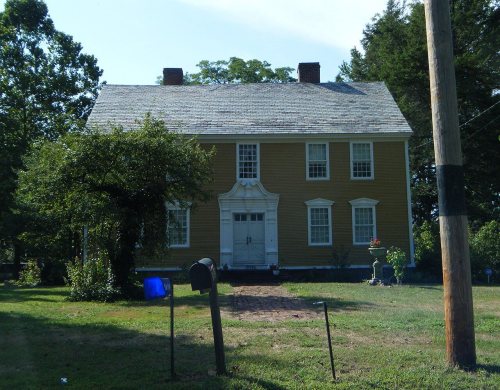
4 listings: 2 buildings, among them the Ebenezer Grant House (listed 1977, the first), and 3 historic districts, the Windsor Farms Historic District, the East Windsor Hill Historic District and the Manchester Historic District, with 1,090 contributing buildings. 1,093 historic buildings in all.
How old are the homes in South Windsor?
7% of South Windsor’s homes were built before 1940 (Census estimate, ±3.0 points), against a typical 15% for a Connecticut town; the median home was built in 1980.
Founding dates: Wikidata, Wikipedia, the U.S. post office records of Blevins & Helbock (CC0) and the Census. Homes by year built: Census ACS 2020–24. National Register of Historic Places: National Park Service (list of May 22, 2026). Old photos, postcards and papers: Wikimedia Commons, the Library of Congress and other public archives, credited on each item’s page. Maps: U.S. Geological Survey historical topographic maps (via Esri) and Sanborn fire-insurance maps (Library of Congress). History text and census tables: Wikipedia (CC BY-SA 4.0). Places that used to be: USGS Geographic Names Information System (2021).
From Wikimedia Commons (3), the Library of Congress (3), the National Register of Historic Places (5), Wikipedia, Wikidata and Wikipedia for famous people, U.S. Geological Survey historical maps, U.S. Census counts (via Wikipedia), the US Post Offices dataset (Blevins & Helbock), the USGS Geographic Names Information System and old county and town histories (Internet Archive). Archive images are copied here with their credits and licenses, shown on each photo’s page. Refreshed monthly.




 1917
 1917
 1917