On its age, its old homes and the National Register, Kensington is more historic than 68% of U.S. towns, #66 of 847 in California. Its share of homes from before 1940 holds the grade up; its National Register listings pull it down.
B+
HistoryA character grade: shown, never part of Kensington’s overall grade.
Few California towns list much on the Register (a typical California town has 0.0 per 10,000 residents, the U.S. 2.4), so Kensington’s 0.0 sits below most of its state (31% of California towns have fewer) while its 0 listings outnumber those of 23% of U.S. towns.
How sure. Graded on two of the three inputs, so a change in either one moves the letter more than it would with three. The pre-1940 share is a Census survey estimate (±5.2 points).
Founding year: our sources. Homes: Census ACS 2020–24. National Register: National Park Service, May 2026 list; each listing counted once (boundary changes and added documentation belong to their listing), and a historic district counts its contributing buildings. How TownRatings grades history →
What stands out about Kensington’s past
Read from the archive, the National Register and the record. The page puts what stands out first.
The area that is now Kensington was originally the territory of the Huchiun band of the Ohlone Indigenous people who occupied much of the East Bay of the San Francisco Bay Area. The Pedro Fages mapping expedition passed through the area in 1772.
In 1823, the Republic of Mexico granted Rancho San Pablo, an extent of land lying north of Cerrito Creek and the Rancho San Antonio, including that portion of land that is now Kensington, to Francisco María Castro, a veteran of the Mexican Army and former alcalde of San José. In 1831, his youngest son, Victor Castro, inherited the southern portion of the rancho, including what is now Kensington.
In 1892, Anson Blake purchased a portion of Castro's land, most of which is now Kensington.
Since the publication of Faulkner's work in 1820, no history of Kensington pretending to accuracy or completeness has been produced. This sumptuous work contains full and descriptive accounts of the parish of Kensington and the adjoining Palace and Gardens, with the changes and improvements of the past half century or more ; notices of Kensington celebrities and of the great national institutions which have sprung up at Kensington Gore and Brompton Park ; and a fund of discursive
Text read by machine from the scan; it may contain errors.
Kensington picturesque & historical1888 · page 9Read the page →
Read the text
Kensington Gore, strictly speaking then, is the triangular space intercepted between the parish boundarj' and the high road.
Text read by machine from the scan; it may contain errors.
Scans and text from the Internet Archive. Books published in 1930 or earlier, which are in the public domain.
Kensington is more historic than 68% of U.S. towns, #66 of 847 in California. The History grade combines the town’s founding era, the share of homes built before 1940 and its National Register listings. It’s a character grade, so it isn’t part of the overall grade. How it works.
How old are the homes in Kensington?
39% of Kensington’s homes were built before 1940 (Census estimate, ±5.2 points), against a typical 3.4% for a California town; the median home was built in 1945.
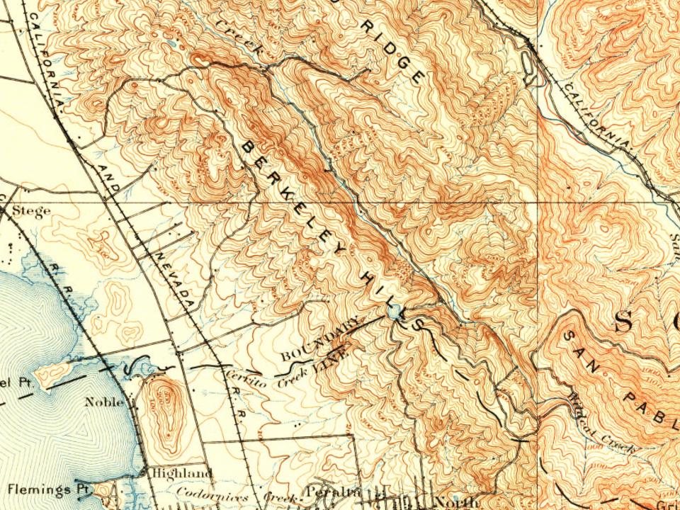
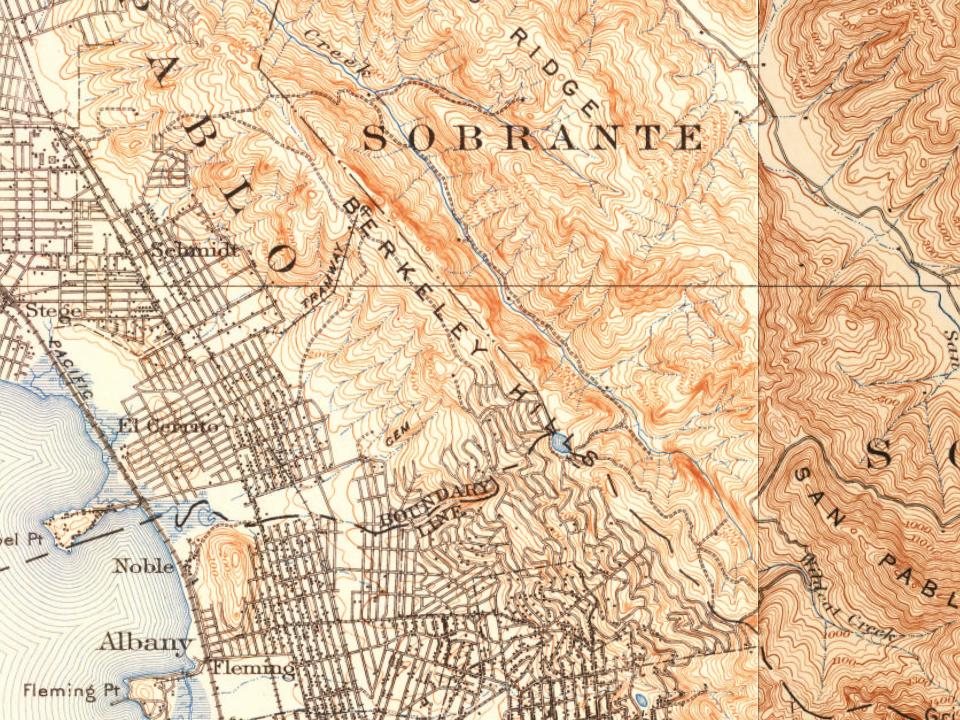
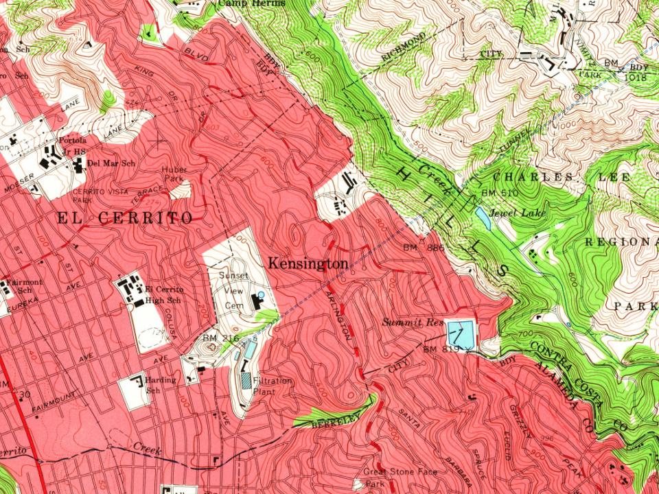
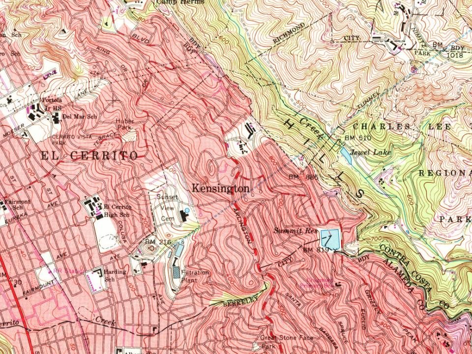
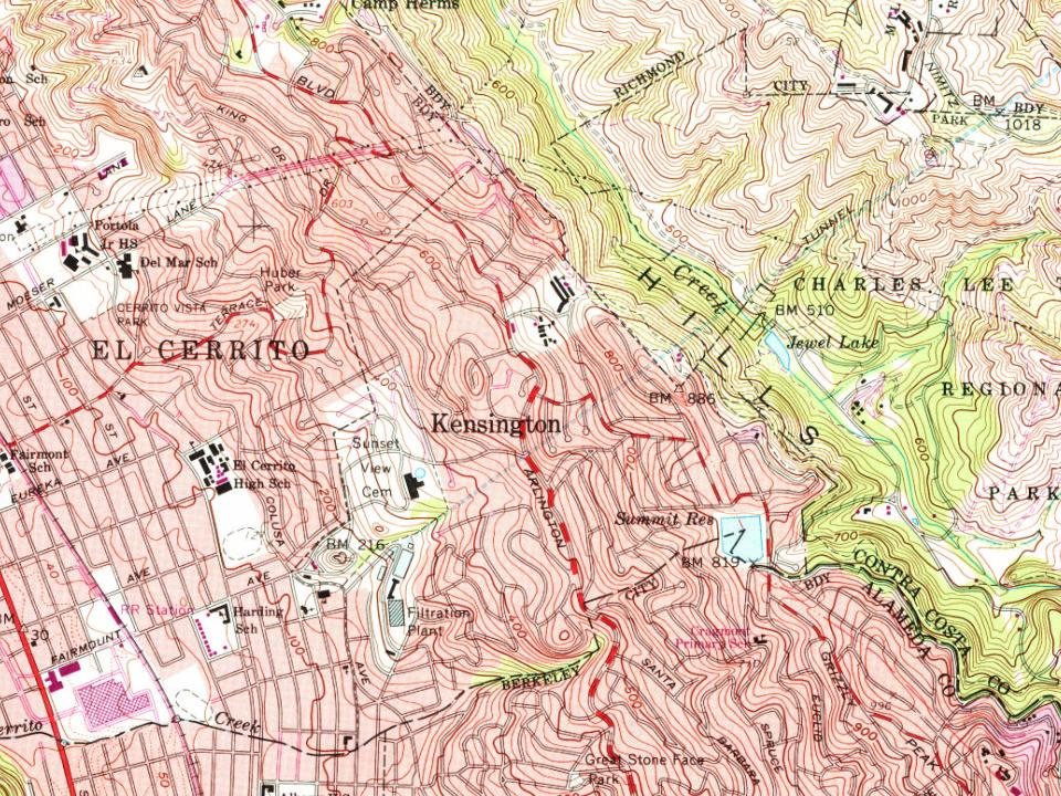
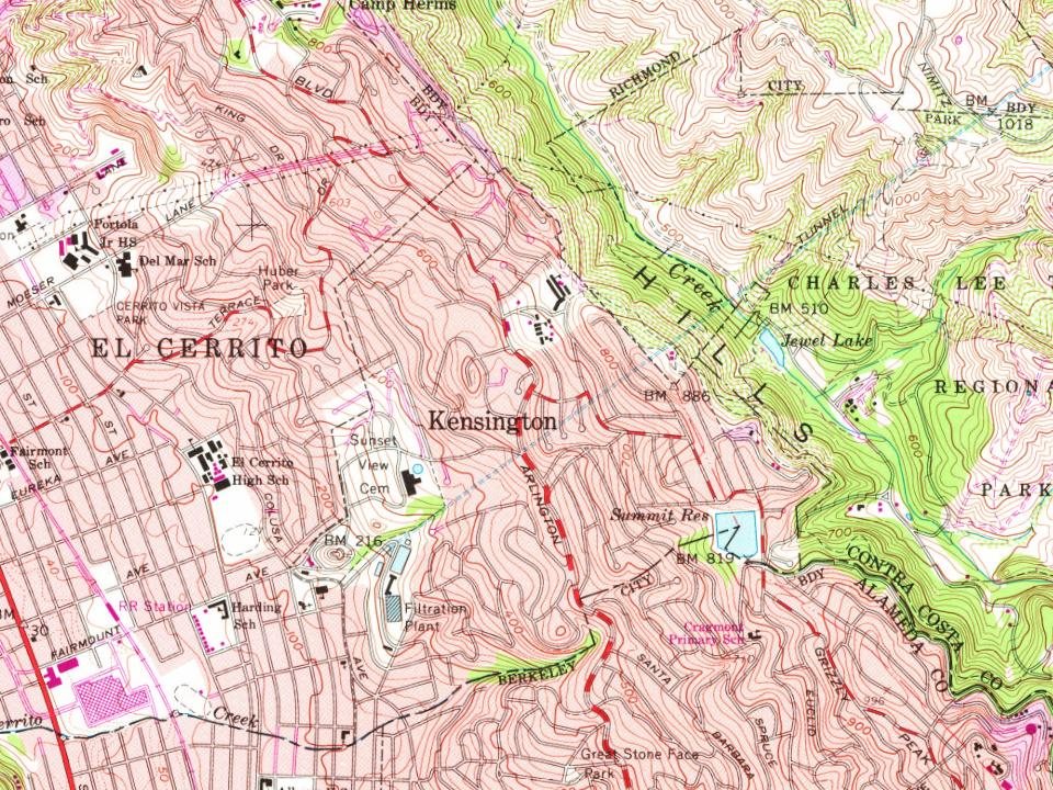
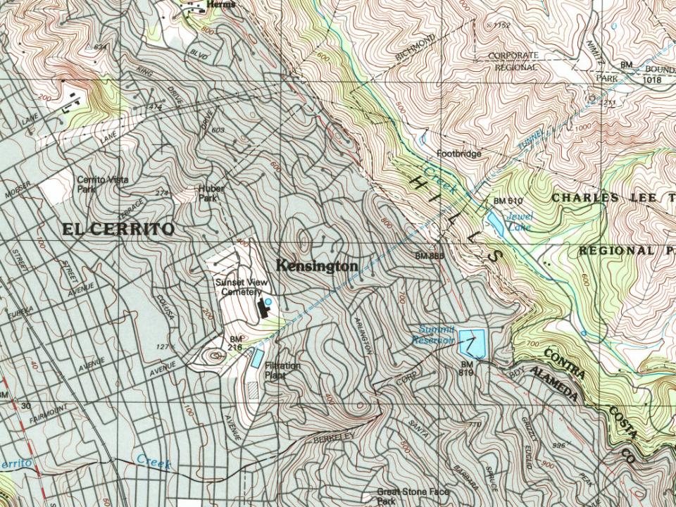
Founding dates: Wikidata, Wikipedia, the U.S. post office records of Blevins & Helbock (CC0) and the Census. Homes by year built: Census ACS 2020–24. National Register of Historic Places: National Park Service (list of May 22, 2026). Old photos, postcards and papers: Wikimedia Commons, the Library of Congress and other public archives, credited on each item’s page. Maps: U.S. Geological Survey historical topographic maps (via Esri) and Sanborn fire-insurance maps (Library of Congress). History text and census tables: Wikipedia (CC BY-SA 4.0). Places that used to be: USGS Geographic Names Information System (2021).
From Wikimedia Commons (12), Wikipedia, U.S. Geological Survey historical maps, U.S. Census counts (via Wikipedia), the USGS Geographic Names Information System and old county and town histories (Internet Archive). Archive images are copied here with their credits and licenses, shown on each photo’s page. Refreshed monthly.




 2022
 2022
 2022
 2022
 2022
 2022
 2022
 2022
 2022
 2022
 2022
 2022


