Wales West Light Railway
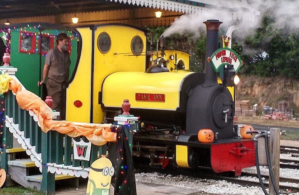
The Wales West Light Railway is a 1.6-kilometre (1 mi) 2 ft (610 mm) narrow gauge tourist railway in Silverhill, Alabama owned by Ann and Ken Zadnichek. It is 6 mi east of Fairhope. Records date it to 2004.

A museum, 6 mi east of Fairhope
Fairhope is the nearest base
Fairhope is 6 miles west, with 17 places to stay. Where to stay ↓
Best months: Feb, Mar, Apr, May, Oct, Nov and Dec
February, March, April, May, October, November and December are the mild months, with highs of 63–84°. When to go ↓
Established in 2004
Wales West Light Railway dates from 2004. About ↓
Written from NOAA 1991–2020 normals, Overture places to stay, Census town figures, Wikidata and Wikipedia.
The year’s weather
Below are typical highs and lows near Wales West Light Railway.
Wales West Light Railway
The Wales West Light Railway is a 1.6-kilometre (1 mi) 2 ft (610 mm) narrow gauge tourist railway in Silverhill, Alabama owned by Ann and Ken Zadnichek. It is built to simulate a Welsh narrow gauge railway. The railway also operates a shorter
7.5" gauge miniature ridable railway. The railway and associated RV park host over 30,000 visitors annually.
- Type
- Museum
- Established
- 2004
- Opened
- 2001
- Wikipedia readers
- 2.2K a year
Bases for Wales West Light Railway
Nearest for a night are Gulf Shores (70) and Foley (31).
Gulf Shores
The closest town with somewhere to stay.
17,394 people · 33% vacation homes
16 mi south of Wales West Light Railway
Compare 8 towns
| Town | From Wales West Light Railway | Drive | Places to stay | People | Typical home | Safety |
|---|---|---|---|---|---|---|
| Gulf Shores 33% vacation homes | 16 mi south | 25 min | 70 57 hotels · 1 motel · 3 lodges & cabins · 4 campgrounds · 5 RV parks | 17,394 | $383K | C− |
| Foley | 10 mi southeast | 15 min | 31 12 hotels · 2 motels · 1 inn or B&B · 1 lodge or cabins · 1 hostel · 4 campgrounds · 10 RV parks | 30,354 | $289K | C+ |
| Fairhope | 6 mi west | 10 min | 17 5 hotels · 1 motel · 7 inns & B&Bs · 3 lodges & cabins · 1 campground | 26,625 | $431K | B− |
| Mobile | 22 mi northwest | 35 min | 109 76 hotels · 11 motels · 8 inns & B&Bs · 6 lodges & cabins · 4 campgrounds · 4 RV parks | 200,824 | $193K | D |
| Orange Beach 50% vacation homes | 18 mi southeast | 30 min | 50 40 hotels · 3 inns & B&Bs · 1 lodge or cabins · 2 campgrounds · 4 RV parks | 8,798 | $502K | C− |
| Daphne | 10 mi northwest | 15 min | 16 13 hotels · 1 motel · 1 inn or B&B · 1 lodge or cabins | 31,396 | $323K | B+ |
| Summerdale | 6 mi east | 10 min | 7 7 RV parks | 1,724 | $275K | D |
| Magnolia Springs | 7 mi south | 10 min | 7 1 inn or B&B · 2 campgrounds · 4 RV parks | 877 | $442K | — |
Getting there
Nearest airports with airline service
Nearby, too
Places worth adding lie within 32 miles.
 Big draw118 mi MuseumUSS Alabama
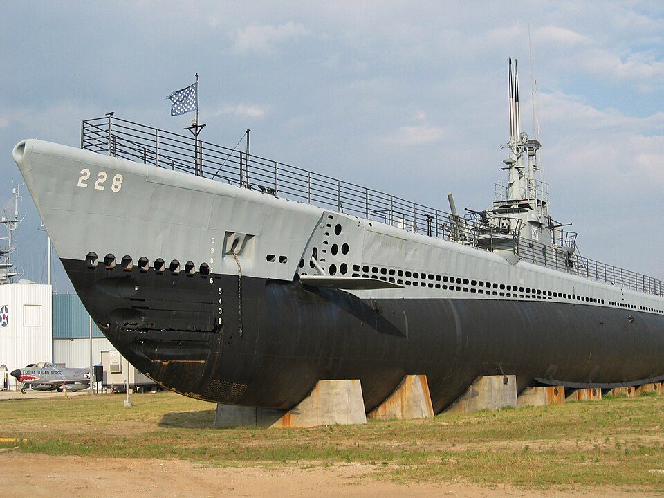 218 mi MuseumUSS Drum
 318 mi MuseumBattleship Memorial Park
 424 mi MuseumFort Morgan
 32 mi LandmarkFort Pickens
 32 mi Ancient siteUSS Massachusetts
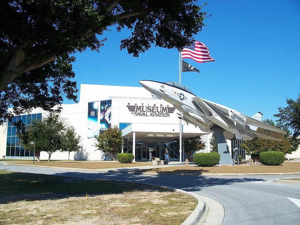 31 mi MuseumNational Naval Aviation Museum523 mi BeachOno Island
Photo credits
USS Alabama: USN, Public domain · USS Drum: Jean-Pierre Martin, CC BY-SA 3.0 · Battleship Memorial Park: Rennett Stowe from USA, CC BY 2.0 · Fort Morgan: Altairisfar, Public domain · Fort Pickens: Notneb82, CC BY-SA 3.0 · USS Massachusetts: Unknown authorUnknown author or not provided, Public domain · National Naval Aviation Museum: Ebyabe, CC BY-SA 3.0


Quick answers on Wales West Light Railway
What town is Wales West Light Railway near?
Fairhope, AL, about 6 miles west.
When is the best time to visit Wales West Light Railway?
February, March, April, May, October, November and December, with highs of 63–84°.
What is the closest airport to Wales West Light Railway?
Mobile Regional (MOB), about 30 miles away. The nearest big hub is Pensacola (PNS), about 36 miles.
Where should I stay near Wales West Light Railway?
Gulf Shores (16 mi, 70 places to stay), Foley (10 mi, 31 places to stay) and Fairhope (6 mi, 17 places to stay).
Inside knowledge from Fairhope
Ask a question, or answer one, in Fairhope’s Town Square.
Sources: National Park Service · ski areas © OpenSkiMap / OpenStreetMap contributors · Wikidata · Wikipedia readership · NOAA climate normals · U.S. Census.