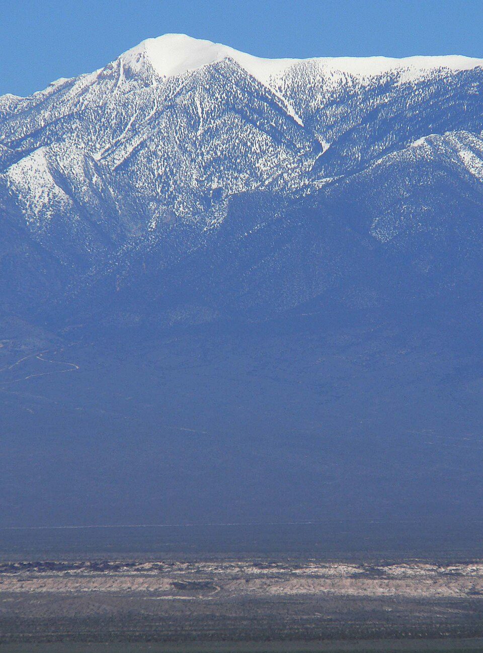
Charleston Peak
Mount Charleston, including Charleston Peak (Nuvagantu, literally "where snow sits", in Southern Paiute or Nüpakatütün in Shoshoni) at 11,916 feet (3,632 m), is the highest mountain in both the Spring Mountains and Clark County, in Nevada, United States. Head 5 mi west of Mount Charleston to reach it. Red Rock Canyon National Conservation Area comes next on our list, 18 mi away.

A mountain, 5 mi west of Mount Charleston
Mount Charleston is the nearest base
Mount Charleston is 5 miles east, with 9 places to stay. Where to stay ↓
Best months: May, Jun, Jul, Aug, Sep and Oct
May, June, July, August, September and October are the mild months, with highs of 62–83°. When to go ↓
Written from NOAA 1991–2020 normals, Overture places to stay, Census town figures, Wikidata and Wikipedia.
Picking a season
Here are the months at Charleston Peak, with their weather.
Charleston Peak
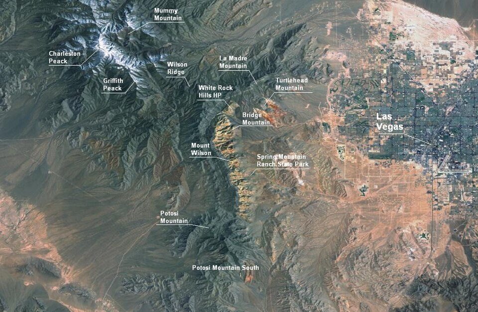
Mount Charleston, including Charleston Peak (Nuvagantu, literally "where snow sits", in Southern Paiute or Nüpakatütün in Shoshoni) at 11,916 feet (3,632 m), is the highest mountain in both the Spring Mountains and Clark County, in Nevada, United States. It is the eighth-highest mountain in the state. Well separated from higher peaks by large, low basins, Charleston Peak is the most topographically prominent peak in Nevada, and the eighth-most-prominent peak in the contiguous United States. It is one of eight ultra-prominent peaks in Nevada. It is located about 35 miles (56 km) northwest of Las Vegas within the Mount Charleston Wilderness, which is within the Spring Mountains National Recreation Area of the Humboldt–Toiyabe National Forest.
- Type
- Mountain
- Elevation
- 11,916 ft
- Wikipedia readers
- 24K a year
Places to stay near Charleston Peak
For a bed close by, look to Las Vegas (113) and Mount Charleston (9).
Las Vegas
The closest town with somewhere to stay.
679,817 people
24 mi east of Charleston Peak
Compare 7 towns
| Town | From Charleston Peak | Drive | Places to stay | People | Typical home | Safety |
|---|---|---|---|---|---|---|
| Las Vegas | 24 mi east | 35 min | 113 82 hotels · 16 motels · 4 inns & B&Bs · 5 lodges & cabins · 5 hostels · 1 campground | 679,817 | $428K | D |
| Mount Charleston 43% vacation homes | 5 mi east | 5 min | 9 3 hotels · 2 lodges & cabins · 4 campgrounds | 465 | $684K | — |
| Pahrump | 17 mi west | 25 min | 17 3 hotels · 3 lodges & cabins · 1 campground · 10 RV parks | 47,347 | $310K | — |
| Spring Valley | 27 mi southeast | 40 min | 21 21 hotels | 219,187 | $434K | — |
| Summerlin South | 23 mi southeast | 35 min | 6 5 hotels · 1 campground | 31,354 | $672K | — |
| Indian Springs | 21 mi north | 30 min | 1 1 RV park | 1,180 | $349K | — |
| Blue Diamond | 23 mi southeast | 35 min | 1 1 campground | 351 | $666K | — |
Day trip from
Straight-line miles.
Getting there
Nearest airports with airline service
Also within reach
Also within 66 miles are these.
 Big draw31 mi Stadium & arenaAllegiant Stadium
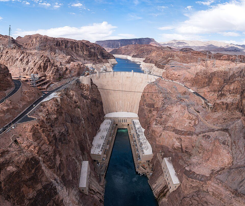 Big draw56 mi DamHoover Dam
 Big draw31 mi Stadium & arenaT-Mobile Arena
 35 mi CaveDevils Hole
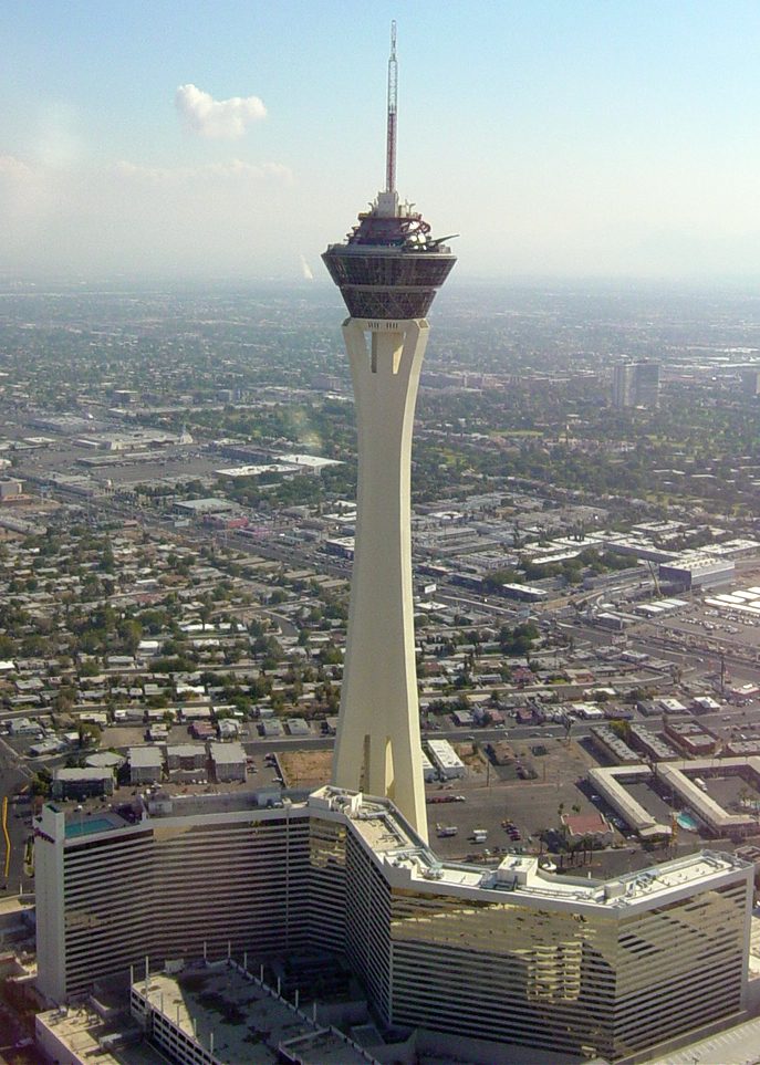 31 mi LookoutThe STRAT Hotel, Casino & SkyPod
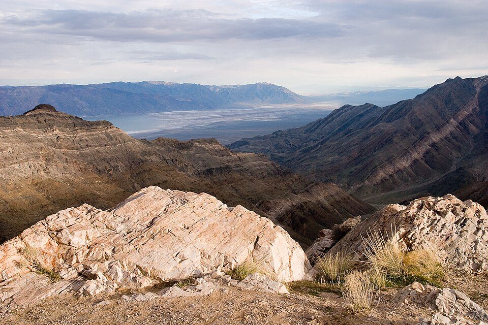 Big draw65 mi National ParkDeath Valley National Park1.3M visitors a year
 32 mi Stadium & arenaMGM Grand Garden Arena
 118 mi Park & preserveRed Rock Canyon National Conservation Area
Photo credits
Allegiant Stadium: Tomás Del Coro, CC BY-SA 2.0 · Hoover Dam: Christian David, CC BY-SA 4.0 · T-Mobile Arena: Tomás Del Coro from Las Vegas, Nevada, USA, CC BY-SA 2.0 · Devils Hole: Stan Shebs, CC BY-SA 3.0 · The STRAT Hotel, Casino & SkyPod: Original uploader was Timjarrett at en.wikipedia, CC BY-SA 3.0 · Death Valley National Park: Greg Willis from Denver, CO, usa, CC BY-SA 2.0 · MGM Grand Garden Arena: Slargent, CC BY 1.0 · Red Rock Canyon National Conservation Area: Asybaris01, Public domain


Questions before you go
What town is Charleston Peak near?
Mount Charleston, NV, about 5 miles east.
When is the best time to visit Charleston Peak?
May, June, July, August, September and October, with highs of 62–83°.
How far is Charleston Peak from Henderson?
About 42 miles southeast of Henderson, as the crow flies.
What is the closest airport to Charleston Peak?
Harry Reid (LAS), about 33 miles away.
Where should I stay near Charleston Peak?
Las Vegas (24 mi, 113 places to stay), Mount Charleston (5 mi, 9 places to stay) and Pahrump (17 mi, 17 places to stay).
Ask people in Mount Charleston
Ask a question, or answer one, in Mount Charleston’s Town Square.
Sources: National Park Service · ski areas © OpenSkiMap / OpenStreetMap contributors · Wikidata · Wikipedia readership · NOAA climate normals · U.S. Census.