
Nevada - Mt. Charleston, 1917
Mount Charleston’s story
Mount Charleston in pictures
Census counts: 285 in 2000, 314 in 2020. The archive holds 12 old photos and papers going back to 1917 and 2 maps from 1957 on.
Explore the history →Each edition grades its towns against each other only.

465 residents make their home in this town in Nevada.
Mount Charleston’s typical journey to work is 34 minutes, above both the Nevada town median (24 minutes) and the median of U.S. towns (25 minutes). Among 43 Nevada towns, just one has a lower midsummer high than Mount Charleston. 99% of the land in Mount Charleston is conserved, above both the Nevada town median (5.2%) and the median of U.S. towns (4.3%). The biggest place to walk is Spring Mountains National Recreation Area, 18,677 acres with 46.5 miles of trail. Mount Charleston has fewer than 1,000 residents, too few for fair grades; the figures below are still real.
In a town this size, neighbors are the best guide. Ask them anything.
Census counts: 285 in 2000, 314 in 2020. The archive holds 12 old photos and papers going back to 1917 and 2 maps from 1957 on.
Explore the history →Mount Charleston is unincorporated, so Clark County and regional agencies provide most services.
EPA SDWIS (Oct 9, 2026) · HIFLD + EIA-861 2025 · Census 2020 ZCTAs · NCES 2024–25 · registration: vote.gov, updated Nov 18, 2024.
Ordered by what stands out in Mount Charleston.
For Mount Charleston, the trail network density is 2.2 miles per square mile. 63 miles of trail wind through 2 parks and preserves.
| Biggest places to walk | Trails | Acres |
|---|---|---|
| 1. Spring Mountains National Recreation Area | 46.5 mi | 18,677 |
| 2. Mount Charleston Wilderness | 16.9 mi | 9,555 |
Trails & parks © OpenStreetMap contributors · Conserved land: USGS PAD-US
| School | Level | Students | Letter |
|---|---|---|---|
| Lundy Earl B ESLargest public elementary schoolGrades PK–5 | Grades PK–5 | – | – |
NCES · EDFacts
The risk rating from FEMA in Mount Charleston is 79 of 100. This Nevada town has had 13 paid flood insurance claims since 1982. Of the losses FEMA expects in the town, 36% come from avalanches and 31% from inland flooding.
FEMA flood insurance claims · FEMA National Risk Index · OpenFEMA
Among 43 Nevada towns, just 4 have a lower share of residents below the poverty line than Mount Charleston. Most working residents leave Mount Charleston for work: only 2% work in town. Also worth knowing: the middle household income for Mount Charleston comes to $109,000. This Nevada town had 78 jobs in 2023, down 152 from 2013.
| Mount Charleston | Nevada towns | U.S. towns | |
|---|---|---|---|
| Median household income | $109,000 | $78,000 | $80,000 |
| Working residents who work in town | 2.5% | 17% | 8% |
| Below the poverty line | 4.5% | 11% | 9.6% |
Census LEHD 2023 · ACS
Only 3 of the 43 Nevada towns we compare have a higher home-ownership rate than Mount Charleston. In the year to September 2026, typical home values slipped 3.3%.
Census ACS, 2020–24 · Zillow Home Value Index · Redfin Data Center
Mount Charleston’s January low is 27°F.
NOAA U.S. Climate Normals, 1991–2020
In Mount Charleston, 16% of adults report frequent mental distress, and 39% have high blood pressure. This Nevada town does better than the Nevada average on 13 of 32 CDC measures and worse on 4. Among adults in the town, 31% feel lonely.
| Mount Charleston | Nevada towns | U.S. towns | |
|---|---|---|---|
| Feel lonely (CDC PLACES) | 31% | 35% | 33% |
| Frequent mental distress (CDC PLACES) | 16% | 19% | 17% |
| High blood pressure (CDC PLACES) | 39% | 35% | 35% |
| Obesity (CDC PLACES) | 30% | 33% | 35% |
| What stands out | Mount Charleston | NV |
|---|---|---|
| Fewer uninsured adults | 8.3% | 14.5% |
| Fewer adults facing food insecurity | 10.6% | 18% |
| More adults who have had cancer | 10.5% | 7.4% |
CDC PLACES 2025 · modeled estimates for adults · CMS · HRSA
Museums, parks, gardens and other places to visit around Mount Charleston. Close and well known come first.
 Big draw27 mi Stadium & arenaAllegiant Stadium
 Big draw27 mi Stadium & arenaT-Mobile Arena
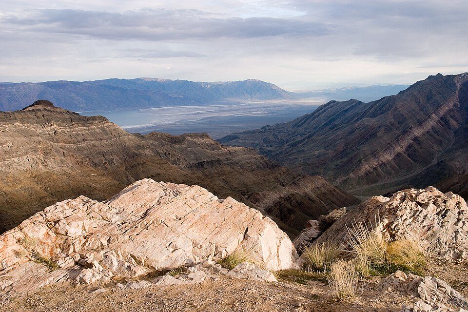 Big draw39 mi National ParkDeath Valley National Park1.3M visitors a year
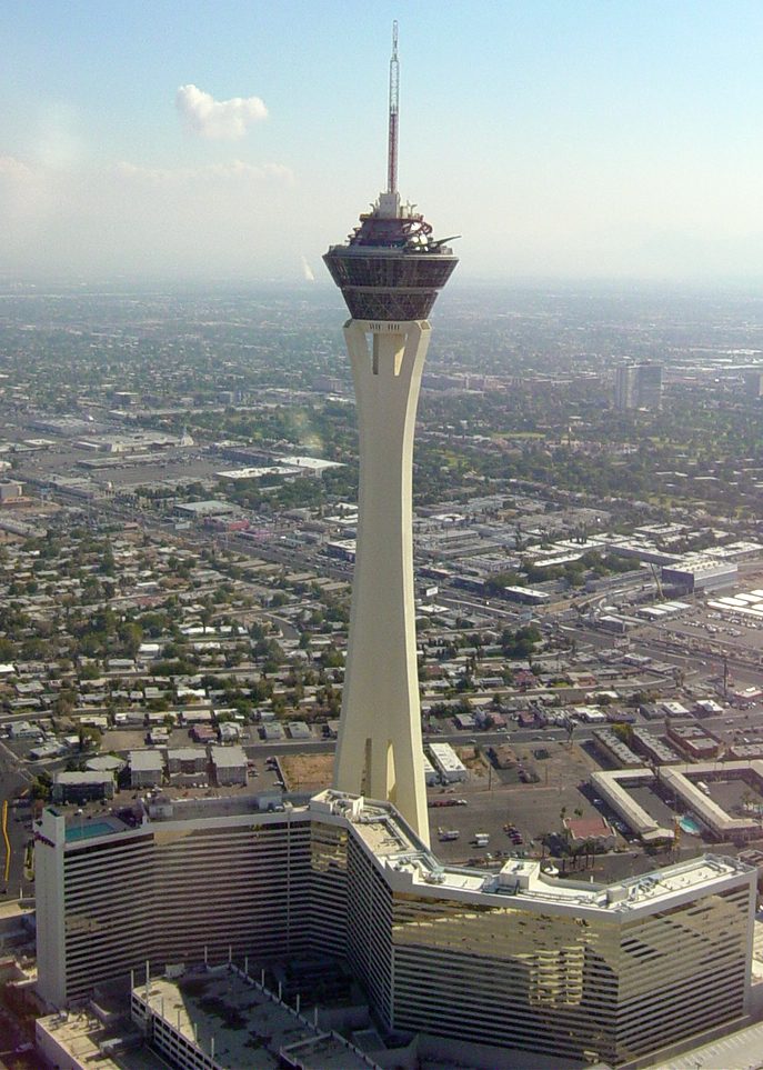 27 mi LookoutThe STRAT Hotel, Casino & SkyPod
 39 mi CaveDevils Hole
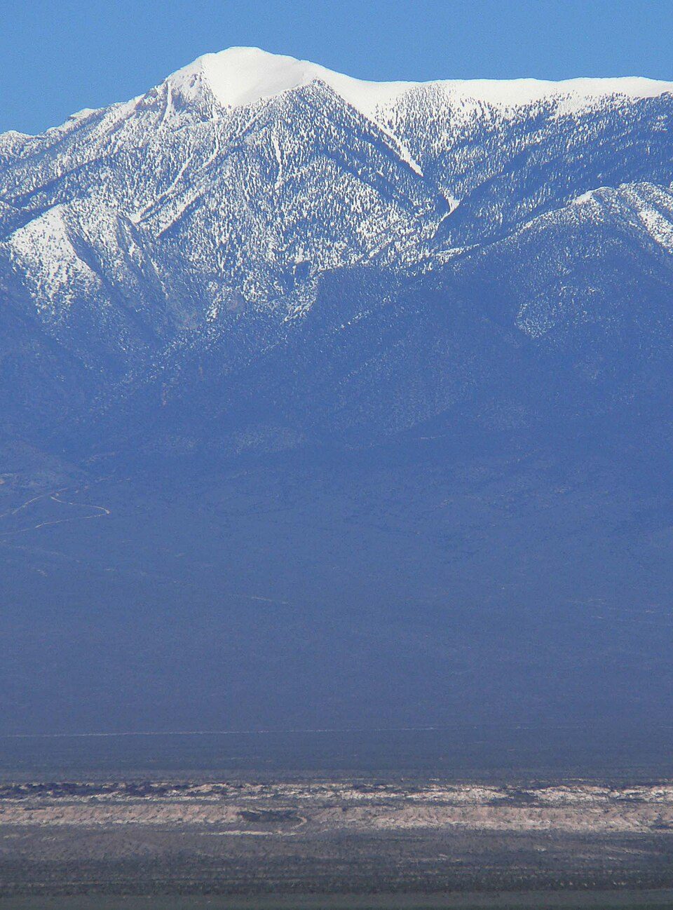 5 mi MountainCharleston Peak
Allegiant Stadium: Tomás Del Coro, CC BY-SA 2.0 · T-Mobile Arena: Tomás Del Coro from Las Vegas, Nevada, USA, CC BY-SA 2.0 · Death Valley National Park: Greg Willis from Denver, CO, usa, CC BY-SA 2.0 · The STRAT Hotel, Casino & SkyPod: Original uploader was Timjarrett at en.wikipedia, CC BY-SA 3.0 · Devils Hole: Stan Shebs, CC BY-SA 3.0 · Charleston Peak: Stan Shebs, CC BY-SA 3.0
None within 15 miles of Mount Charleston; the nearest are
About 1 of every 100 Mount Charleston residents are enrolled in college, against 5 across Nevada.
Where Mount Charleston’s working residents go each day. Line width shows the share.
Census LEHD 2023
Unincorporated town in Nevada, United States
Mount Charleston is an unincorporated town and census-designated place in Clark County, Nevada, United States. The population was 357 at the 2010 census. The town of Mount Charleston is named for nearby Mount Charleston whose Charleston Peak at 11,916 feet (3,632 m) is the highest point in Clark County. The town of Mount Charleston is in a valley of the Spring Mountains to the northwest of Las Vegas, noted for its hiking trails. It is also known for its Retreat on Charleston Peak, a 64-room hotel. At an elevation of approximately 7,500 feet, temperatures are much lower than in Las Vegas, which has an elevation of about 2,000 feet, making it a popular place for Las Vegans to vacation. The me…
From Wikipedia, licensed CC BY-SA 4.0 · facts via Wikidata (CC0)
Short answers, built from the data on this page.
Mount Charleston has fewer than 1,000 residents, too few for fair grades; the figures below are still real.


