Guest, Sign inJoin

Post to Las Vegas

We’ll email a one-tap link to publish your post. No password, and nothing is public until you click it.
Already a member? Sign in
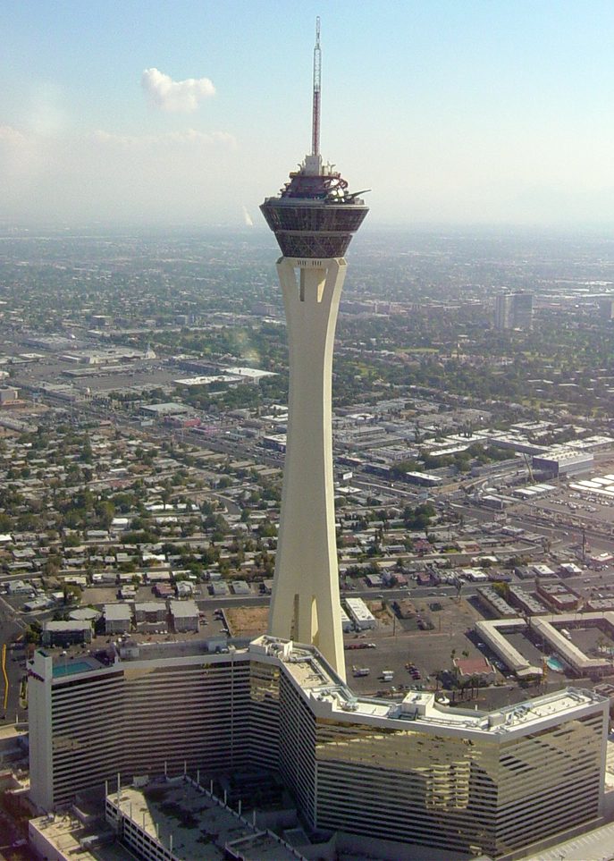
Las Vegas from above (40064746644)
Nevada›Clark County
Photo: Mike McBey · CC BY 2.0
Photo of Las Vegas

Las Vegas, NV · Photo: Mike McBey · CC BY 2.0 · Source ↗

What is it like to live in Las Vegas?

Las Vegas's D covers 679,817 people, and the city's neighborhoods vary far more than any single grade can show. It ranks 38th of 42 graded places in Nevada. It is easier to get around on foot or by transit than 88% of U.S. towns. What weighs on its grade: its police reported 6,972 violent crimes reported to the FBI in 2025, a higher rate per resident than 87% of U.S. towns, and the typical home is worth about $418K, 5.5 years of the Las Vegas metro’s $76K median household income. Las Vegas’ July high is 104°F, where Nevada’s towns sit at 94°F and U.S. towns at 85°F. Its National Register listings include Las Vegas Mormon Fort and Las Vegas Mormon Fort (Boundary Increase). Only 6 of Nevada’s 66 towns score higher on hazard risk.

What makes Las Vegas stand out

Where Las Vegas beats most towns.

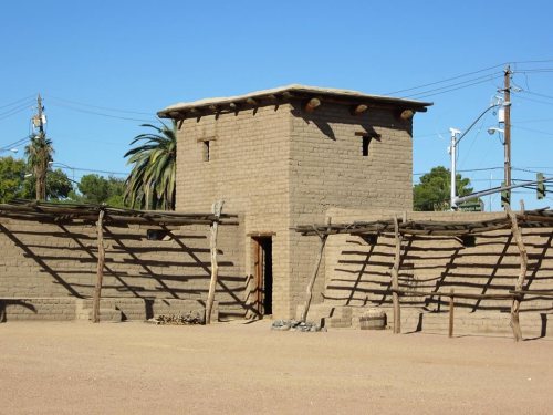
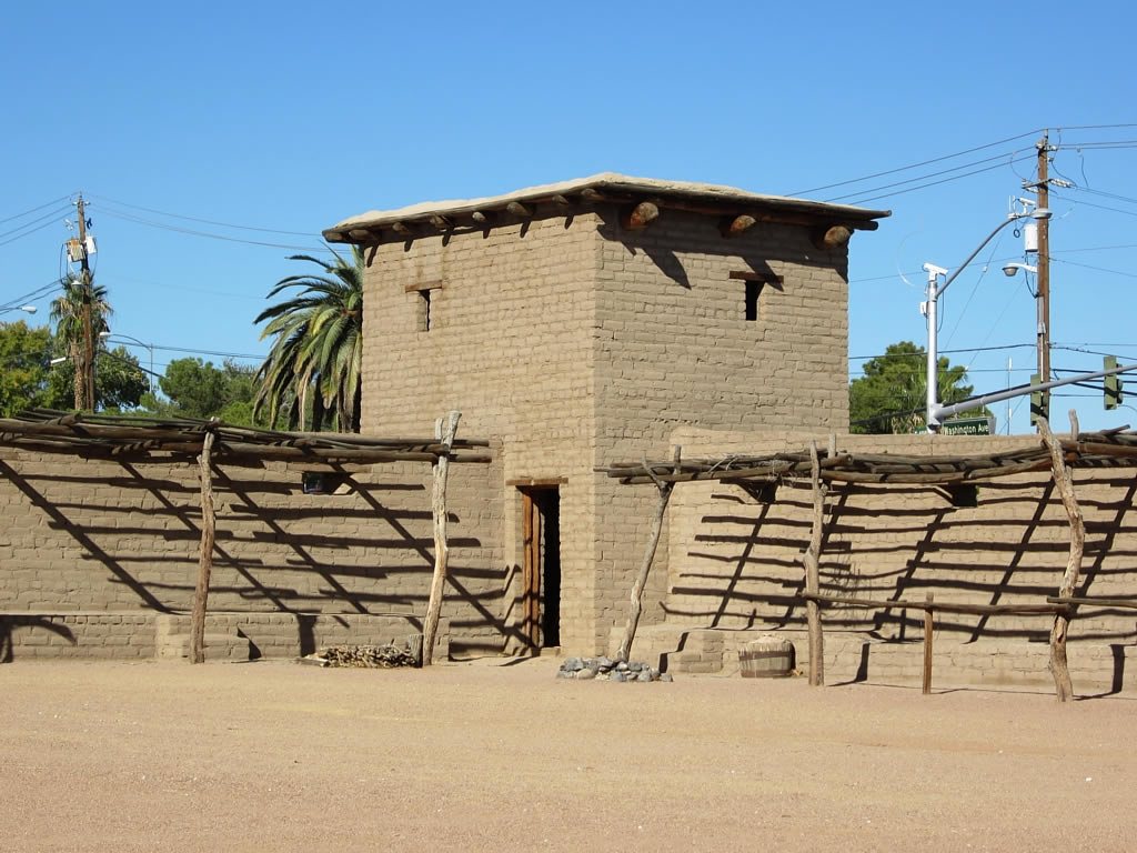
Las Vegas Mormon Fort
Las Vegas Mormon Fort · National Register of Historic Places
Las Vegas’s story

126 years in pictures

Census counts: 25 in 1900, 641,903 in 2020. The archive holds 42 old photos and papers going back to 1905 and 4 maps from 1952 on.

23 places on the National Register of Historic Places.

  • 1900Las Vegas is settled
Explore the history →

How Las Vegas grades

Each subject compared with towns across the country (schools within Nevada), ordered by how far Las Vegas is from typical.

How grading works

Character Graded, but not part of the overall grade.
Described, not graded Taste, not quality: snow or an older crowd is neither good nor bad.

How TownRatings grades towns →

Nearby attractions

Allegiant Stadium and 45 more within 40 miles

Museums, parks, gardens and other places to visit around Las Vegas. Close and well known come first.

All 53 attractions →
Sources: National Park Service · ski areas © OpenSkiMap / OpenStreetMap contributors · Wikidata · Wikipedia readership · photos via Wikimedia Commons
Photo credits

Allegiant Stadium: Tomás Del Coro, CC BY-SA 2.0 · Hoover Dam: Christian David, CC BY-SA 4.0 · The STRAT Hotel, Casino & SkyPod: Original uploader was Timjarrett at en.wikipedia, CC BY-SA 3.0 · T-Mobile Arena: Tomás Del Coro from Las Vegas, Nevada, USA, CC BY-SA 2.0 · MGM Grand Garden Arena: Slargent, CC BY 1.0 · Cashman Field: Antic2, CC BY-SA 4.0

Getting set up

Moving to Las Vegas: who provides what

Who provides power, water and the rest in Las Vegas, and how to reach them.

The full setup list →
PowerNV Energy13.1¢/kWh · EIA 2025HIFLD · EIA
WaterLas Vegas Valley Water DistrictNo health-based violations in 5 years · EPAEPA
Internet9 providers97% of addresses get 100/20 MbpsFCC
Trash & dumpNot on file yetWe don’t have Las Vegas’ trash rules yet
SchoolsClark County School DistrictWhich school depends on your addressNCES
Register to voteOnlineIn Nevada you can register online until 5 days before Election Day, in person up to and including Election Day, or by mail (postmarked 28 days before).vote.gov
Who runs elections hereClark County Registrar of VotersClark County; contacts on the Handbook page.FVAP, Sep 2023
ZIP codes89108, 89129, 89131, 8910189108 11% · 89129 8% · 89131 7% · 89101 7%Census 2020

EPA SDWIS (Oct 9, 2026) · HIFLD + EIA-861 2025 · Census 2020 ZCTAs · NCES 2024–25 · registration: vote.gov, updated Nov 18, 2024.

The data

Ordered by what stands out in Las Vegas.

Las Vegas carries less natural-hazard risk than most of Nevada (mostly inland flooding), has a longer frost-free season than nearly all U.S. towns and has seen reported crime fall by a fifth or more.

SafetyD

Compared with most of Nevada and the rest of the country, property crime in Las Vegas is higher

Reported crimes fell from 59,323 to 48,102 over the last three FBI years, a drop beyond ordinary year-to-year swings.

Las Vegas’ property crime rate is 24 per 1,000 residents. Las Vegas reports more crime per resident than most U.S. towns we grade: about 87% report less. Las Vegas’ violent crime rate is 4.1 per 1,000 residents.

13%of U.S. towns report more crimeDSafety Grade
Las VegasNevada townsU.S. towns
Property crimes per 1,000 (2025)24 per 1,000 residents14.89.9
Violent crimes per 1,000 (2025)4.1 per 1,000 residents3.61.6

Violent crime per 1,000 residents

Las Vegas4.1
Nevada3.8
U.S.3.3

Property crime per 1,000 residents

Las Vegas24
Nevada20.3
U.S.15.5
13th
percentile among U.S. towns we grade
6,972
violent crimes reported in 2025
41,130
property crimes reported in 2025

FBI crime data, 2025 · crimes reported to police

SchoolsC

Las Vegas’ public schools trail 74% of Nevada districts

Its public schools are run by the Clark County school district. Three of its 173 schools are below, each with why it’s listed.

26%of NV districts it outscoresCSchool Grade
SchoolLevelStudentsLetter
Rogich Sig MSLargest public middle schoolGrades 6–8Grades 6–81,636A
Arbor View HSLargest public high schoolGrades 9–12Grades 9–123,069B+
College of So NV HS WestTop results in townGrades 11–12Grades 11–12218A+

NCES · EDFacts · graded within NV on state tests and graduation

OutdoorsA

Conserved land covers 23.9% of Las Vegas

277 miles of trail in 118 parks and preserves. Tule Springs Fossil Beds National Monument, at 6,151 acres with 32.9 miles of trail, is the biggest park or preserve. The trail density in Las Vegas is 2.0 miles per square mile.

#22for trails in NV
23.9%
conserved · 21,628 of 90,451 acres
277 mi
of trails · 2 per sq mi
Biggest places to walkTrailsAcres
1. Tule Springs Fossil Beds National Monument32.9 mi6,151
2. Floyd Lamb Park at Tule Springs24.6 mi832
3. Lone Mountain Regional Park5.3 mi147

Trails & parks © OpenStreetMap contributors · Conserved land: USGS PAD-US

HealthC

Las Vegas is less healthy than 66% of U.S. towns

Las Vegas beats the Nevada average on 0 of 32 CDC measures and trails it on 6. 17% of Las Vegas adults 18 to 64 have no health insurance.

34%healthier than U.S. townsCHealth Grade
Las VegasNevada townsU.S. towns
No health insurance, 18–64 (CDC PLACES)17%12%8.1%
Sleep under 7 hours (CDC PLACES)41%38%36%
Feel lonely (CDC PLACES)37%35%33%
Food insecurity (CDC PLACES)22%16%14%
32 measures vs. Nevada
0 better26 too close to call6 worse
What stands outLas VegasNV
More older adults who have lost all their teeth15.5%11.6%
More adults facing a utility shut-off11.9%9.7%
More adults without reliable transportation11.9%9.9%
Mountainview Hospital
1.6 mi away · emergency room
2 of 3
care shortages: primary care, dental
34th
percentile among NV towns

CDC PLACES 2025 · modeled estimates for adults · CMS · HRSA

Climate

In Las Vegas, expect mild winters and hot summers

The N Las Vegas weather station, 8 miles away, records that the frost-free season runs about 311 days, longer than in 96% of U.S. towns. The N Las Vegas weather station, 8 miles away, records that about 142 days a year reach 90°, more than in 99% of U.S. towns.

Las Vegas has mild winters and scorching summers, with very little rain. July afternoons reach 104°, January nights drop to 35° and snow is almost unheard of.

104°summer high

Typical low → high °F

Winter36–59°
Spring52–78°
Summer73–101°
Fall53–81°
Dec 10
typical first frost
Jan 24
typical last frost
+1.8°
vs. the 20th-century average
104°
typical summer high

NOAA U.S. Climate Normals, 1991–2020

Work & commuteJobs & income grade B−

About one in three working residents works right in Las Vegas

About one in 3 of Las Vegas’s working residents works in town. Jobs based in Las Vegas grew to 265,110 in 2023, 48,413 more than in 2013. 14% of residents live below the poverty line in Las Vegas.

34%work in town
Las VegasNevada townsU.S. towns
Working residents who work in town34%16%8%
Below the poverty line14%11%9.6%
Work from home12%9%11%
Average trip to work26 minutes24 minutes25 minutes

Where working residents work

In Las Vegas34%
Paradise24%
North Las Vegas9%
Spring Valley7%
Henderson5%
8 mi
median commute distance
265,110
jobs based in Las Vegas
Balanced
jobs vs. working residents
A
Walkability grade: more walkable than 88% of U.S. towns

Census LEHD 2023 · ACS

Natural hazardsHazard risk grade B

Inland flooding leads a low hazard risk in Las Vegas

FEMA rates its natural-hazard risk lower than 85% of Nevada towns, with expected losses of about $314 per resident a year; that rating is what its B for hazard risk is built on.

Since 1978, 121 flood insurance claims have been paid out in Las Vegas.

39risk score of 100
FEMA risk score
39Low riskLowerHigher
Inland floodingHeat wavesEarthquakes
121
paid flood claims since 1978
2
federal disasters paid out here

FEMA flood insurance claims · FEMA National Risk Index · OpenFEMA

HousingCost of living grade D

Las Vegas earns a D for cost of living

The typical Las Vegas home is worth about $418,000, down 2.8% in a year, 5% below the Nevada typical home.

$418KZillow home value
Las VegasNevada townsU.S. towns
Households that own their home57%70%73%
Renters paying 30%+ of income on rent59%53%48%
Median rent$1,563 a month$1,404 a month$1,185 a month

Typical home value

Las Vegas$418K
Nevada$441K
Market temperature
BalancedA seller's marketBuyer’sSeller’s
50
days on market
98.3%
sale-to-list price
−2.8%
value change, 1 year
786
homes sold in May

Zillow Home Value Index · Redfin Data Center

Who lives here

An age mix much like Nevada’s

No broad age group is more than 4 points off the Nevada average. Las Vegas has grown 5.3% since 2020, to 679,817 residents in the Census Bureau’s 2025 estimate. 28% of adults 25 and older have a bachelor’s degree or more, vs 28% across Nevada.

38.6median age · NV 39.1
Las VegasNevada townsU.S. towns
Aged 65 or older16%20%18%
Median age38.6 years40.4 years40.5 years
Under 1822%21%22%
Bachelor’s degree or more, 25+28%22%29%
Las VegasNevadaUnited States

Ages · share of residents

Education · adults 25 and older

No diploma14%
High school27%
Some college23%
Associate’s8%
Bachelor’s18%
Graduate10%

Women and men · all residents

50.2% women, 49.8% men

That’s an even split within the survey’s margin of ±0.3 points. Across Nevada, 49.6% of residents are women. Median age: women 39.2, men 38.1.

Ages and education in Las Vegas
Las VegasNVU.S.
Under 1011.6%11.4%11.6%
10 to 1710.8%10.3%10.3%
18 to 248.3%8%9.1%
25 to 3414.3%14.4%13.7%
35 to 4413.9%13.9%13.2%
45 to 5412.8%12.6%12.2%
55 to 6412.3%12.4%12.7%
65 to 749.4%10.3%10.2%
75 and older6.6%6.7%7%
No diploma13.9%12.5%10.4%
High school27%27.6%26%
Some college23.2%23.3%19.1%
Associate’s8.2%8.8%8.8%
Bachelor’s17.5%18.1%21.6%
Graduate10.1%9.8%14.1%

Census population estimates, 2025 · U.S. Census Bureau · ACS 2020-2024 5-year estimates

Keep exploring

Everything we know about Las Vegas

19pages on Las Vegas
After high school

Colleges nearby

6 within 15 miles of the center of Las Vegas

College town

College of Southern Nevada calls Las Vegas home

2 colleges in town.

College Scorecard · IPEDS

Landmarks

23 places in Las Vegas on the National Register of Historic Places.

All landmarks →

About Las Vegas

Most populous city in Nevada, United States

Official town website ↗

Las Vegas, colloquially shortened to Vegas, is the most populous city in the U.S. state of Nevada and the county seat of Clark County. It is the 24th-most populous city in the United States, with 641,903 residents at the 2020 census. The Las Vegas metropolitan area has an estimated 2.4 million residents and is the 29th-largest metropolitan area in the country. Las Vegas is an internationally renowned major resort city, known primarily for its gambling, shopping, fine dining, entertainment, and nightlife. Most of these venues are located in downtown Las Vegas or on the Las Vegas Strip, which is outside city limits in the unincorporated towns of Paradise and Winchester. The Las Vegas Valley s…

From Wikipedia, licensed CC BY-SA 4.0 · facts via Wikidata (CC0)

Established
1905
Area
134 sq mi
Elevation
2,001 ft
ZIP code
89101, 89102, 89103
Area code
702

Las Vegas’s neighbors

6 towns share a border with Las Vegas.

Explore the map →

All 6 graded towns on its borders grade higher than its D; Sunrise Manor (D) is closest.

How the neighbors grade
TownNV rankOverallCostSafetySchoolsHealth
Las Vegas#38DDDCC
Winchester#35DC+—CD
Sunrise Manor#37DC—CD
North Las Vegas#34DC−C−CC
Spring Valley#31C−D—CB−
Summerlin South#13C+D−—CA
Paradise#36DC−—CC−

Winchester, Sunrise Manor, Spring Valley, Summerlin South and Paradise report no FBI crime data of their own. Compare Las Vegas with a neighbor →

Questions about Las Vegas

Short answers, built from the data on this page.

Is Las Vegas, NV a good place to live?

Las Vegas grades D overall, better than 7% of U.S. towns and #38 of 42 in Nevada. It grades C for health, D for safety and C for schools. Safety is its weak spot, with a D.

Is Las Vegas, NV expensive?

Yes. Cost of living, which also weighs rents, property taxes and how many households pay 30% or more of their income for housing, grades D.