
Production. Magnesium, 1943
Henderson’s story
85 years in pictures
Census counts: 3,643 in 1950, 317,610 in 2020. The archive holds 12 old photos and papers going back to 1943 and 3 maps from 1952 on.
- 1941Henderson is settled
Each edition grades its towns against each other only.

A city of 353,289, settled in 1941. Home to Nevada State University.
For a city of 353,289, Henderson does unevenly: it grades C−, 29th of 42 graded towns in Nevada. CDC estimates put its residents' health ahead of 69% of the country. The trade-off: the typical home is worth about $478K, 6.3 years of the Las Vegas metro’s $76K median household income. Henderson’s midsummer high is 105°F, against 94°F in Nevada’s towns and 85°F across U.S. towns. On hazard risk, just 5 of Nevada’s 66 towns do better. Henderson is home to Nevada State University.
Where Henderson beats most towns.
| College | Students |
|---|---|
| Nevada State University | 6,043 |
| Roseman University of Health Sciences | 1,359 |
| Touro University Nevada | 1,263 |
 Brandon Flowers
257,729 counted in 2010 and 317,610 in 2020; an estimated 353,289 in 2025.
Growth hasn’t slowed: 11.5% since 2020, after 23.2% in the decade before.
U.S. Census 2010 & 2020 counts · Census Bureau estimate, July 1, 2025
Each subject compared with towns across the country (schools within Nevada), ordered by how far Henderson is from typical.
How TownRatings grades towns →
Census counts: 3,643 in 1950, 317,610 in 2020. The archive holds 12 old photos and papers going back to 1943 and 3 maps from 1952 on.
Museums, parks, gardens and other places to visit around Henderson. Close and well known come first.
 Big draw16 mi DamHoover Dam
 Big draw11 mi Stadium & arenaAllegiant Stadium
 Big draw11 mi Stadium & arenaT-Mobile Arena
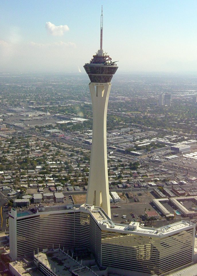 12 mi LookoutThe STRAT Hotel, Casino & SkyPod
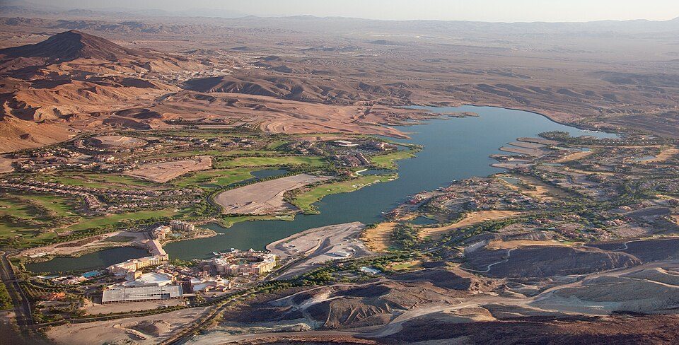 in town LakeLake Las Vegas
 11 mi Stadium & arenaMGM Grand Garden Arena
Hoover Dam: Christian David, CC BY-SA 4.0 · Allegiant Stadium: Tomás Del Coro, CC BY-SA 2.0 · T-Mobile Arena: Tomás Del Coro from Las Vegas, Nevada, USA, CC BY-SA 2.0 · The STRAT Hotel, Casino & SkyPod: Original uploader was Timjarrett at en.wikipedia, CC BY-SA 3.0 · Lake Las Vegas: Carol M. Highsmith, Public domain · MGM Grand Garden Arena: Slargent, CC BY 1.0
Who provides power, water and the rest in Henderson, and how to reach them.
EPA SDWIS (Oct 9, 2026) · HIFLD + EIA-861 2025 · Census 2020 ZCTAs · NCES 2024–25 · registration: vote.gov, updated Nov 18, 2024.
Ordered by what stands out in Henderson.
Henderson carries less natural-hazard risk than most of Nevada (mostly inland flooding) and has more 90° days than nearly all U.S. towns, but it has homes that cost more against local pay than most of Nevada.
Henderson’s trail network density is 3.0 miles per square mile. 366 miles of trail wind through 92 parks and preserves. Also worth knowing: the biggest place to walk is Heritage Park, 164 acres with 2.5 miles of trail.
| Biggest places to walk | Trails | Acres |
|---|---|---|
| 1. Whitney Mesa Park | 5.8 mi | 159 |
| 2. Henderson Bird Viewing Preserve | 3.4 mi | 100 |
| 3. Arroyo Grande Sports Complex | 2.6 mi | 58 |
Trails & parks © OpenStreetMap contributors · Conserved land: USGS PAD-US
Public schools: the Clark County school district. Three of its 70 schools are below, each with the reason it’s listed. 6 public schools serve Henderson, with 6,336 students in all.
| School | Level | Students | Letter |
|---|---|---|---|
| Webb Del E MSLargest public middle schoolGrades 6–8 | Grades 6–8 | 1,684 | A |
| Liberty HSLargest public high schoolGrades 9–12 | Grades 9–12 | 3,203 | B |
| College of So NV HS SouthTop results in townGrades 11–12 | Grades 11–12 | 157 | A+ |
NCES · EDFacts · graded within NV on state tests and graduation
Jobs based here grew from 68,534 in 2013 to 105,743.
In Henderson, nearly a quarter of working residents work locally. Employers in Henderson added 37,209 jobs between 2013 and 2023, to 105,743. Only 2 of the 42 Nevada towns we compare have a higher share of workers working from home than Henderson. For Henderson, the median household income is $90,000.
| Henderson | Nevada towns | U.S. towns | |
|---|---|---|---|
| Working residents who work in town | 23% | 16% | 8% |
| Work from home | 18% | 9% | 11% |
| Median household income | $90,000 | $78,000 | $80,000 |
| Below the poverty line | 9% | 11% | 9.6% |
Census LEHD 2023 · ACS
Reported crimes fell from 7,934 to 6,168 over the last three FBI years, a drop beyond ordinary year-to-year swings.
Within Nevada, it does better than 70% of towns. For Henderson, the rate of reported violence is 2.3 per 1,000 residents.
| Henderson | Nevada towns | U.S. towns | |
|---|---|---|---|
| Violent crimes per 1,000 (2025) | 2.3 per 1,000 residents | 3.6 | 1.6 |
| Property crimes per 1,000 (2025) | 14.9 per 1,000 residents | 14.8 | 9.9 |
FBI crime data, 2025 · crimes reported to police
In Henderson, three quarters of adults had a checkup this year, and 13% smoke cigarettes. CDC measures, 32 in all: Henderson beats Nevada on 11 and trails on 1. Henderson: 29% of adults have obesity. Among 42 Nevada towns, just 4 have a lower share of adults who say their health is fair or poor than Henderson.
| Henderson | Nevada towns | U.S. towns | |
|---|---|---|---|
| Obesity (CDC PLACES) | 29% | 33% | 35% |
| Yearly checkup (CDC PLACES) | 75% | 74% | 79% |
| Smoke cigarettes (CDC PLACES) | 13% | 16% | 14% |
| Get no exercise (CDC PLACES) | 22% | 26% | 25% |
| What stands out | Henderson | NV |
|---|---|---|
| Fewer adults facing food insecurity | 12.7% | 18% |
| Fewer uninsured adults | 10.3% | 14.5% |
| More adults who have had cancer | 8.6% | 7.4% |
CDC PLACES 2025 · modeled estimates for adults · CMS · HRSA
The Las Vegas Mccarran Ap weather station, 9 miles away, records that about 137 days a year reach 90°, more than in 99% of U.S. towns. July afternoons average 105.1°, hotter than in 100% of U.S. towns; January nights average 39.8°.
The January low here is 40°F. It almost never snows.
NOAA U.S. Climate Normals, 1991–2020
FEMA rates its natural-hazard risk lower than 88% of Nevada towns, with expected losses of about $308 per resident a year; that rating is what its B+ for hazard risk is built on.
The natural-hazard score from FEMA for Henderson comes to 34 of 100. Since 1980, 33 flood insurance claims have been paid out here. FEMA puts 43% of the town’s expected hazard losses down to inland flooding, and 38% to heat waves.
FEMA flood insurance claims · FEMA National Risk Index · OpenFEMA
37% of adults 25 and older hold at least a bachelor’s degree, against 28% across Nevada. Adults 18 to 34 are 18% of residents (22% statewide). Population is up 12% in Henderson since 2020, to 353,289 by the Census Bureau’s 2025 estimate. The share of residents in Henderson who are 65 or older: 21%.
| Henderson | Nevada towns | U.S. towns | |
|---|---|---|---|
| Bachelor’s degree or more, 25+ | 37% | 22% | 29% |
| Aged 65 or older | 21% | 17% | 18% |
| Median age | 42.8 years | 39.9 years | 40.5 years |
50.6% women, 49.4% men
About 98 men for every 100 women. Across Nevada, 49.6% of residents are women. Median age: women 42.6, men 43.0.
| Henderson | NV | U.S. | |
|---|---|---|---|
| Under 10 | 10.4% | 11.4% | 11.6% |
| 10 to 17 | 10.4% | 10.3% | 10.3% |
| 18 to 24 | 6% | 8% | 9.1% |
| 25 to 34 | 12.4% | 14.4% | 13.7% |
| 35 to 44 | 13.7% | 13.9% | 13.2% |
| 45 to 54 | 13.1% | 12.6% | 12.2% |
| 55 to 64 | 13.2% | 12.4% | 12.7% |
| 65 to 74 | 11.9% | 10.3% | 10.2% |
| 75 and older | 8.9% | 6.7% | 7% |
| No diploma | 6.4% | 12.5% | 10.4% |
| High school | 23.3% | 27.6% | 26% |
| Some college | 24% | 23.3% | 19.1% |
| Associate’s | 8.8% | 8.8% | 8.8% |
| Bachelor’s | 23.4% | 18.1% | 21.6% |
| Graduate | 14% | 9.8% | 14.1% |
Census population estimates, 2025 · U.S. Census Bureau · ACS 2020-2024 5-year estimates
At 6.3 years of the Las Vegas metro’s $76K median household income, the typical home (about $478K) costs more against local pay than in 78% of Nevada towns; that ratio is one input to that grade.
Henderson’s rent at the middle of the market comes in at $1,824 a month. Zillow values the typical Henderson home at about $478,000, down 2.3% in a year, 8% above the Nevada typical home. Homes sold in Henderson spent a median 60 days on the market.
| Henderson | Nevada towns | U.S. towns | |
|---|---|---|---|
| Median rent | $1,824 a month | $1,404 a month | $1,185 a month |
| Renters paying 30%+ of income on rent | 57% | 53% | 48% |
| Households that own their home | 66% | 70% | 73% |
Census ACS, 2020–24 · Zillow Home Value Index · Redfin Data Center
8 within 15 miles of the center of Henderson
About 5 of every 100 Henderson residents are enrolled in college, about the same as Nevada.
4 colleges in town.
19 notable people were born in Henderson.
City in Nevada, United States
Henderson is a city in Clark County, Nevada, United States, about 16 miles (26 km) southeast of Las Vegas. It is the 2nd most populous city in Nevada, after Las Vegas, with 317,610 residents as of the 2020 census. The city is part of the Las Vegas Valley metropolitan area. Henderson has an extensive system of outdoor recreation facilities, including over 220 miles (350 km) of trails and 72 parks. Incorporated in 1953, Henderson was originally known for its role in magnesium production during World War II. Since then, it has grown rapidly through the development of master planned communities starting with the large Green Valley neighborhood, redevelopment and reinvestment after the PEPCON di…
From Wikipedia, licensed CC BY-SA 4.0 · facts via Wikidata (CC0)
4 towns share a border with Henderson.
| Town | NV rank | Overall | Cost | Safety | Schools | Health |
|---|---|---|---|---|---|---|
| Henderson | #29 | C− | D | C | C | B+ |
| Enterprise | #21 | C | D | — | C | B+ |
| Paradise | #36 | D | C− | — | C | C− |
| Boulder City | #9 | C+ | C | B | C | B |
| Whitney | #33 | D | C | — | C | C− |
Enterprise, Paradise and Whitney report no FBI crime data of their own. Compare Henderson with a neighbor →
Short answers, built from the data on this page.
Henderson grades C− overall, better than 21% of U.S. towns and #29 of 42 in Nevada. It grades B+ for health, C for safety and C for schools. Cost of living is its weak spot, with a D.
Within Nevada, it does better than 70% of towns.
Yes. Cost of living, which also weighs rents, property taxes and how many households pay 30% or more of their income for housing, grades D.
19 notable people were born here, including Brandon Flowers and Danny Musovski.


