Guest, Sign inJoin

Post to Charleston

We’ll email a one-tap link to publish your post. No password, and nothing is public until you click it.
Already a member? Sign in
AHistory
History · Charleston

Charleston dates to 1786, and 26% of its homes were built before 1940

More historic than 94% of U.S. towns · #8 of 61 in West Virginia. What drives it

57 places in town are on the National Register, among them ten historic districts with 1,741 buildings between them. Below: 5 old photos and papers, maps from 1884 on, and the census since 1850.

1786founded
57on the National Register
26%homes built before 1940
5old photos & papers
48famous people
Quick answers

How Charleston began

When was Charleston founded?

1786

Charleston dates its founding to 1786 (Wikidata). The census first counted it in 1850.

First census: 1,050 in 18502020 census: 48,864240 years

How historic is Charleston?

A

More historic than 94% of U.S. towns, on its age, its old homes and the National Register.

What drives the grade ↓
Founding year: Wikidata. First post office: 1800.The full story ↓
History grade

What drives Charleston’s History grade

On its age, its old homes and the National Register, Charleston is more historic than 94% of U.S. towns, #8 of 61 in West Virginia. All 3 inputs are above most U.S. towns; its National Register listings ranks highest and its age lowest.

A
HistoryA character grade: shown, never part of Charleston’s overall grade.
All U.S. towns we grade (21,289)Ahead of 94%
NewerOlder
West Virginia towns of 2,500+ (61)Ahead of 88%

West Virginia towns list more on the Register than most of the country (a typical West Virginia town has 29.6 per 10,000 residents, the U.S. 2.4), so Charleston’s 382 sits above most of its state (83% of West Virginia towns have fewer) while its 1,812 historic buildings outnumber those of 99% of U.S. towns.

How sure. Graded on any two of the three inputs instead, the letter would range from A− to A. The pre-1940 share (±2.0 points) is firm at this size. Two sources give 1786.

Founding year: Wikidata (other dates in Quick answers). Homes: Census ACS 2020–24. National Register: National Park Service, May 2026 list; each listing counted once (boundary changes and added documentation belong to their listing), and a historic district counts its contributing buildings. How TownRatings grades history →

What stands out about Charleston’s past

Read from the archive, the National Register and the record. The page puts what stands out first.

★ What stands out · On the National Register

57 listings protect 1,812 historic buildings

The country’s official list of buildings and places worth saving. Boundary changes and added documentation are counted with their listing.

places listed
57
National Historic Landmarks
0
none yet
historic buildings protected
1,812
each building in a district counts
first listed
1970
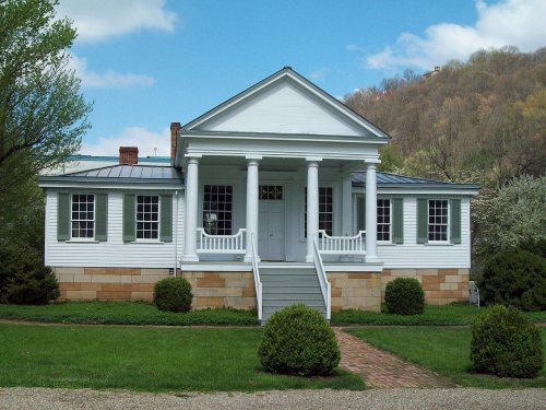
Craik-Patton House
BuildingsDistricts

Architectural styles listings

Colonial Revival7
Classical Revival6
Neo-Classical Revival5
American Four Square4
Art Deco4
Greek Revival3
All 57 listings
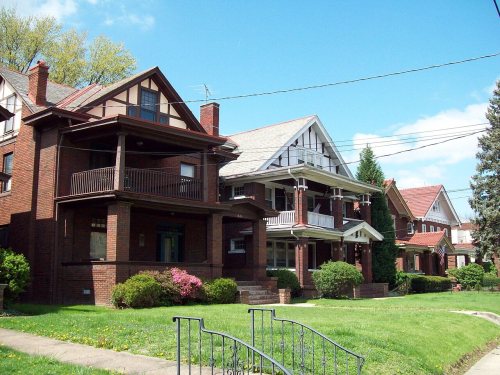
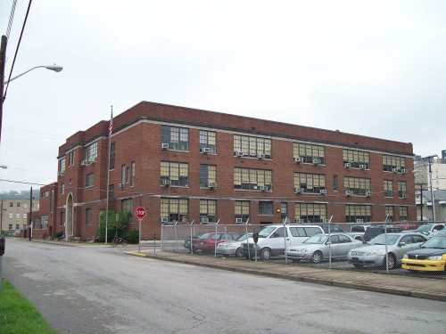
Col. Henry Hewitt Wood HouseBuilding · listed 1980Kearse TheaterBuilding · listed 1980BreezemontBuilding · listed 1982Littlepage Stone MansionBuilding · listed 1982Grosscup Road Historic DistrictDistrict · listed 1984Daniel Boone HotelBuilding · listed 1984Barnes-Wellford HouseBuilding · listed 1984Bird HavenBuilding · listed 1984Bougemont ComplexBuilding · listed 1984BriarwoodBuilding · listed 1984Chesapeake and Ohio DepotBuilding · listed 1984Cox-Morton HouseBuilding · listed 1984Cox-Parks HouseBuilding · listed 1984Crawford-Gardner HouseBuilding · listed 1984DalgainBuilding · listed 1984Danner-Fletcher HouseBuilding · listed 1984Gilliland, William S., Log Cabin and CemeteryBuilding · listed 1984McAndrews-Gallaher HouseBuilding · listed 1984StoneleighBuilding · listed 1984Thomas-McJunkin-Love HouseBuilding · listed 1984W. E. II Chilton HouseBuilding · listed 1984Spring Hill Cemetery Historic DistrictDistrict · listed 1985Plaza TheatreBuilding · listed 1985Loewenstein and Sons Hardware BuildingBuilding · listed 1985Samuel Starks HouseBuilding · listed 1988Charleston City HallBuilding · listed 1988Elizabeth Harden Gilmore HouseDistrict · listed 1988St. John's Episcopal ChurchBuilding · listed 1989Edgewood Historic DistrictDistrict · listed 1989Garnet High SchoolBuilding · listed 1990Young-Noyes HouseBuilding · listed 1991Simpson Memorial Methodist Episcopal ChurchBuilding · listed 1991Mattie V. Lee HomeBuilding · listed 1992United Carbon BuildingBuilding · listed 1994Woodrums' BuildingBuilding · listed 1996Charleston Municipal AuditoriumBuilding · listed 1999Charleston Baptist TempleBuilding · listed 2000Sterrett Brothers' Dry Goods StoreBuilding · listed 2001Smith-Giltinan HouseBuilding · listed 2002Maple Terrace Court and Walton ApartmentsBuilding · listed 2002Downtown Charleston Historic DistrictDistrict · listed 2006Luna Park Historic DistrictDistrict · listed 2012Summers HouseBuilding · listed 2015Charmco BuildingBuilding · listed 2020Elk City Historic DistrictDistrict · listed 2008Five Corners Historic DistrictDistrict · listed 2022Tiskelwah SchoolBuilding · listed 2023Beni Kedem Shrine TempleBuilding · listed 2024Kanawha & Michigan Railway Depot WarehouseBuilding · listed 2024

National Park Service, National Register of Historic Places. Photos from Wikimedia Commons, credited on each place’s page.

Places that used to be

Lost post offices, old corners, places now gone and burying grounds

Charleston’s post office has been open since 1879. 11 other post offices opened and closed inside today’s town.

Kanawha
1800–1879
Charleston
1879–today
Kanawha City
1891–1904
Arbutus
1892–1909
Garnet
1894–1930
Blackhawk
1902–1908
Bownemont
1907–1950
Campbell
1914–1915
Riverview
1914–1951
Libow
1919–1926
18001910today
Hamlets and corners on the map
Airport VillageBlackhawkEast SideEdgewoodEdgewood AcresElkForest HillsFort HillHillsdaleIvydaleJoplinKanawha CityKanawha EstatesLoudon HeightsNorth CharlestonOakwoodRiverviewSouth HillsSouth ParkSouth RuffnerVandaliaWest Side
Gone or out of use
Airport SchoolschoolBigley SchoolschoolCharleston High SchoolschoolConquerors Christian SchoolschoolFernbank Public SchoolschoolFort Hill Elementary SchoolschoolFort LeemilitaryFort ScammonmilitaryFruth SchoolschoolHillcrest SanitariumhospitalHubbard SchoolschoolJackson High SchoolschoolJefferson Junior High SchoolschoolKanawha County JailbuildingKanawha Valley Memorial HospitalhospitalLincoln SchoolschoolLittlepage SchoolschoolMartin Schoolschool
8cemeteries and burying grounds inside Charleston
AdkinsHessHopeHunt - DonnallyMount JoySaint Matthews ChurchSpring HillSwannor Watts Hill

US Post Offices dataset (Blevins & Helbock, CC0). Places and cemeteries from the USGS Geographic Names Information System (2021).

The story

How Charleston came to be

From Wikipedia’s history of Charleston.

Read it all →

After the American Revolutionary War, pioneers began making their way across the Appalachian Mountains into western Virginia. Virginian militia officer William Morris built the first permanent settlement in the Kanawha Valley, named Fort Morris, in 1773. It was about 20 mi (32 km) upstream of modern Charleston, at the confluence of Kellys Creek, and was used extensively during the American Revolution.

Text from Wikipedia, licensed CC BY-SA 4.0.

From the old history books

What they wrote about Charleston, 1876–1911

Passages that mention Charleston, cut from the printed page as they were published.

Act of Jan. 19, 1818, incorporating the town of Charleston. — "Be it enacted," etc., "that the town of Charleston, in the county of Kanawha, including the same as laid out, including the shores and bank between Front street and Kanawha river, is hereby erected into a town corporate, to be known by …
History of Charleston and Kanawha County, West Virginia1911 · page 165Read the page →
Read the text

Act of Jan. 19, 1818, incorporating the town of Charleston. — "Be it enacted," etc., "that the town of Charleston, in the county of Kanawha, including the same as laid out, including the shores and bank between Front street and Kanawha river, is hereby erected into a town corporate, to be known by the name of Charleston" and provision was made to elect by bal-

Text read by machine from the scan; it may contain errors.
RAILROADS IN KANAWHA Kanawha and Charleston have numerous railroads, which may be mentioned as the Chesapeake and Ohio Railroad, the Kanawha and Michigan Railroad, the Virginian Railroad, The Coal and Coke Railroad, the Kanawha and West Virginia Railroad and the Coal River Railroad. The branches of…
History of Charleston and Kanawha County, West Virginia1911 · page 208Read the page →
Read the text

RAILROADS IN KANAWHA Kanawha and Charleston have numerous railroads, which may be mentioned as the Chesapeake and Ohio Railroad, the Kanawha and Michigan Railroad, the Virginian Railroad, The Coal and Coke Railroad, the Kanawha and West Virginia Railroad and the Coal River Railroad. The branches of these various rail-

Text read by machine from the scan; it may contain errors.
The exact year that Mr. George Clendennin moved upon the land which he purchased from Mr. Bullitt is a matter of uncertainty. It seems to be generally admitted, however, that he was the first settler within the limits of the present city of Charleston, and that it was either in the fall of 1786 or …
History of Kanawha County1876 · page 53Read the page →
Read the text

The exact year that Mr. George Clendennin moved upon the land which he purchased from Mr. Bullitt is a matter of uncertainty. It seems to be generally admitted, however, that he was the first settler within the limits of the present city of Charleston, and that it was either in the fall of 1786 or spring of 1787 that he built the fort on the river bank near Brooks’ landing, which took his name. ' This could not have been later than 1787, for the reason that Lewis Tackett settled at the mouth of Coal river during that year, and the year following his home

Text read by machine from the scan; it may contain errors.

Scans and text from the Internet Archive. Books published in 1930 or earlier, which are in the public domain.

Timeline

Charleston, 1786 to 1966

Woven from the archive, old maps, post office records, the National Register and the people born here.

  1. 18th century
  2. 1786
    FoundingCharleston is established
  3. 19th century
  4. 1800Post officeThe Kanawha post office opens
  5. 1862In the archiveCharleston battle2
  6. 1879Post officeThe Kanawha post office closes
  7. 1879Post officeThe Charleston post office opens
  8. 1891Post officeThe Kanawha City post office opens
  9. 20th century
  10. 1902In the archiveRev, Arthur Kirby Fenton
  11. 1904Post officeThe Kanawha City post office closes
  12. 1905BuiltChesapeake and Ohio Depot is built
  13. 1909On the mapFirst mapped by the U.S. Geological Survey
  14. 1920Born hereGeorge Armitage Miller is born here
  15. 1927BuiltDaniel Boone Hotel is built
  16. 1929BuiltGarnet High School is built
  17. 1929Born hereGeorge Crumb is born here
  18. 1940BuiltUnited Carbon Building is built
  19. 1951Born hereJim Justice is born here
  20. 1960CensusPopulation peaks at 85,796
  21. 1966Born hereRandy Barnes is born here
By decade

Charleston, decade by decade

2 decades in the archive, from the 1860s to the 1900s. Scroll each row; tap a photo for its story.

1910s–1990snothing yet
Nothing in the archives for these yearsWeddings on Main Street, storms, parades, school pictures, the old store. If it’s in your family album, it belongs here.
Add from your album
On the map

Charleston on the map, 1909 to 1996

Every edition of the U.S. Geological Survey’s map of Charleston. Tap a year, or press play to watch the town change.

Charleston on the 1909 USGS mapCharleston on the 1931 USGS mapCharleston on the 1958 USGS mapCharleston on the 1971 USGS mapCharleston on the 1996 USGS map1909Charleston sheet · 1:62,500

U.S. Geological Survey historical topographic maps (public domain), via Esri’s collection of the scans. The red ring marks the center of Charleston.

Every building

Charleston, building by building, 1884–1912

Fire insurance maps drew every building, what it was made of and what it was used for, so insurers could price the risk of fire. Pick a year, then a sheet.

Charleston fire insurance map, 1884, sheet 11884Sheet 1 of 3
Edition
BrickWoodStone

Sanborn Map Company, via the Library of Congress. Editions published in 1930 or earlier, which are in the public domain.

Then & now

Stand where they stood

No then-and-now pairs yet. Take a photo from the same spot as an old one and they appear here side by side.

Charleston battle2
Retake this viewCharleston battle2, 1862

Find the spot, match the angle, and add your photo. It becomes the first then-and-now pair on Charleston’s page.

Retake this view · +15
People over time

Charleston, census by census

020,00040,00060,00080,0001850190019502000Peak: 85,796

Peaked at 85,796 in 1960; 48,864 people lived here in 2020.

18 censuses, 1850–2020.

U.S. Census Bureau decennial counts, from the census table on Charleston’s Wikipedia page.

Famous people

48 famous people were born in Charleston

Writers, athletes, leaders and more, ranked by how widely they’re known.

See all →
Help out

Finish Charleston’s story

Most archives stop around 1920. The photos from after that are in family albums, not libraries.

Decades since 1900 with photos
00s10s20s30s40s50s60s70s80s90s
1 of 10 decades. The empty ones are waiting for someone’s album.
Stories next door

History across the town line

Each neighbor’s History grade, on the same three inputs.

Questions about Charleston’s history

What year was Charleston founded?

In 1786, according to Wikidata. Charleston’s post office opened in 1800, and the census of 1850 counted 1,050 people here.

How does Charleston rank for history?

Charleston is more historic than 94% of U.S. towns, #8 of 61 in West Virginia. The History grade combines the town’s founding era, the share of homes built before 1940 and its National Register listings. It’s a character grade, so it isn’t part of the overall grade. How it works.

What is on the National Register in Charleston?

57 listings: 47 buildings, among them the Craik-Patton House (listed 1970, the first), and 10 historic districts with 1,741 contributing buildings. 1,812 historic buildings in all.

How old are the homes in Charleston?

26% of Charleston’s homes were built before 1940 (Census estimate, ±2.0 points), against a typical 13% for a West Virginia town; the median home was built in 1957.

Memory lane

What the archives can’t tell you, neighbors can.

Town Square →
Start a conversation
Sources

Where this page comes from

Founding dates: Wikidata, Wikipedia, the U.S. post office records of Blevins & Helbock (CC0) and the Census. Homes by year built: Census ACS 2020–24. National Register of Historic Places: National Park Service (list of May 22, 2026). Old photos, postcards and papers: Wikimedia Commons, the Library of Congress and other public archives, credited on each item’s page. Maps: U.S. Geological Survey historical topographic maps (via Esri) and Sanborn fire-insurance maps (Library of Congress). History text and census tables: Wikipedia (CC BY-SA 4.0). Places that used to be: USGS Geographic Names Information System (2021).

From Wikimedia Commons (5), Wikidata (1), the National Register of Historic Places (57), Wikipedia, Wikidata and Wikipedia for famous people, U.S. Geological Survey historical maps, U.S. Census counts (via Wikipedia), the US Post Offices dataset (Blevins & Helbock), the USGS Geographic Names Information System, Sanborn fire insurance maps (Library of Congress) and old county and town histories (Internet Archive). Archive images are copied here with their credits and licenses, shown on each photo’s page. Refreshed monthly.