The village was named for the wild rose bushes growing in a dale near the original town site. The village is also known for the Sisson Peony Garden which has been an impact to the village throughout the years.
Passages that mention Rosendale, cut from the printed page as they were published.
The history of Fond du Lac County, Wisconsin, containing ... war record, biographical sketches ... history of Wisconsin ... etc1880 · page 423Read the page →
Read the text
tion of the people of Fond du Lac County was early called to the necessity of constructing plank roads. Companies were chartered and the work commenced. In 1852, a plank road was finished and brought into use from the city of Fond du Lac to the city of Sheboygan on Lake Michigan. In 1853, this road was continued northwesterly from Fond du Lac to Rosendale, and although contemplated to pass through the villages of Ripon and Ceresco to Fox River, it was never completed farther than the east line of the town of Rosendale. After being used a few years, it was suffered to fall to decay and was finally declared by the proper authority a free public highway and such it has since remained. "This road, ""wrote a citizen of Fond du Lac,
Text read by machine from the scan; it may contain errors.
The history of Fond du Lac County, Wisconsin1880 · page 768Read the page →
Read the text
This little hamlet is not wholly in the town of Rosendale, the South Side being in Springvale. The first hotel was built by Daugherty & Woodruff, on the Springvale side, in 1847. In 1850, Wheeler & Humphrey erected a larger hotel where Blackburn's hotel now stands, in Rosendale. The builders were the first landlords. In 1878, J. R. Blackburn rebuilt and enlarged this hotel, making a large, comfortable and well-appointed hostelry of it.
Text read by machine from the scan; it may contain errors.
The history of Fond du Lac County, Wisconsin, containing ... war record, biographical sketches ... history of Wisconsin ... etc1880 · page 768Read the page →
Read the text
This little hamlet is not wholly in the town of Rosendale, the South Side being in Springvale. The first hotel was built by Daugherty & Woodruff, on the Springvale side, in 1847. In 1850, Wheeler & Humphrey erected a larger hotel where Blackburn's hotel now stands, in Rosendale. The builders were the first landlords. In 1878, J. B. Blackburn rebuilt and enlarged this hotel, making -^ large, comfortable and well-.appointed hostelry of it.
Text read by machine from the scan; it may contain errors.
The history of Fond du Lac County, Wisconsin1880 · page 425Read the page →
Read the text
tion of the people of Fond du Lao County was early called to the necessity of constructing plank roads. Companies were chartered and the work commenced. In 1852, a plank road was finished and brought into use from the city of Fond du Lac to the city of Sheboygan on Lake Michigan. In 18.5-3, this road was continued northwesterly from Fond du Lac to Rosendale, and although contemplated to pass through the villages of Ripon and Ceresco to Fox River, it was never completed farther than the east line of the town of Rosendale. After being used a few years, it was suffered to fall to decay and was finally declared by the proper authority a free public highway and such it has since remained. "This road," wrote a citizen of Fond du Lac,
Text read by machine from the scan; it may contain errors.
Scans and text from the Internet Archive. Books published in 1930 or earlier, which are in the public domain.
Timeline
Rosendale, 1850 to 1964
Woven from the archive, old maps, post office records, the National Register and the people born here.
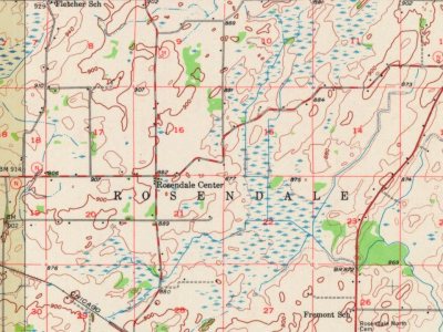
Founding dates: Wikidata, Wikipedia, the U.S. post office records of Blevins & Helbock (CC0) and the Census. Homes by year built: Census ACS 2020–24. National Register of Historic Places: National Park Service (list of May 22, 2026). Old photos, postcards and papers: Wikimedia Commons, the Library of Congress and other public archives, credited on each item’s page. Maps: U.S. Geological Survey historical topographic maps (via Esri) and Sanborn fire-insurance maps (Library of Congress). History text and census tables: Wikipedia (CC BY-SA 4.0). Places that used to be: USGS Geographic Names Information System (2021). How TownRatings grades history →
From Wikimedia Commons (5), Wikidata (1), Wikipedia, Wikidata and Wikipedia for famous people, U.S. Geological Survey historical maps, U.S. Census counts (via Wikipedia), the US Post Offices dataset (Blevins & Helbock), the USGS Geographic Names Information System and old county and town histories (Internet Archive). Archive images are copied here with their credits and licenses, shown on each photo’s page. Refreshed monthly.


 2014
 2014
 2012
 2012
 2012

