The Eldorado post office opened in 1849, the earliest record of the town by name. Another post office, El Dorado (1849), opened inside today’s town and later closed.
2020 census: 1,399177 years
How historic is Eldorado?
A
More historic than 86% of U.S. towns, on its age, its old homes and the National Register.
Founding year: the first Eldorado post office (Blevins & Helbock, CC0).
History grade
What drives Eldorado’s History grade
On its age, its old homes and the National Register, Eldorado is more historic than 86% of U.S. towns. All 3 inputs are above most U.S. towns; its share of homes from before 1940 ranks highest and its National Register listings lowest.
A
HistoryA character grade: shown, never part of Eldorado’s overall grade.
Wisconsin towns list more on the Register than most of the country (a typical Wisconsin town has 3.0 per 10,000 residents, the U.S. 2.4), so Eldorado’s 7.0 sits above most of its state (70% of Wisconsin towns have fewer) while its 1 listings outnumber those of 51% of U.S. towns.
How sure. Graded on any two of the three inputs instead, the letter would range from B+ to A. The pre-1940 share is a Census survey estimate (±8.1 points). The founding year is the first post office, not a stated founding date.
Founding year: the first post office (other dates in Quick answers). Homes: Census ACS 2020–24. National Register: National Park Service, May 2026 list; each listing counted once (boundary changes and added documentation belong to their listing), and a historic district counts its contributing buildings. How TownRatings grades history →
What stands out about Eldorado’s past
Read from the archive, the National Register and the record. The page puts what stands out first.
Wikipedia doesn’t have a history of Eldorado yet. The photos, dates and memories neighbors add here are how it gets written.
Eldorado is a town in Fond du Lac County, Wisconsin, United States. The population was 1,399 at the 2020 census. The unincorporated community of Eldorado is located in the town.
Its first post office opened in 1849. Between the 2010 and 2020 censuses its population fell from 1,462 to 1,399 (-4%).
Intro from Wikipedia. Population: U.S. Census Bureau.
From the old history books
What they wrote about Eldorado in 1880
Passages that mention Eldorado, cut from the printed page as they were published.
The history of Fond du Lac County, Wisconsin, containing ... war record, biographical sketches ... history of Wisconsin ... etc1880 · page 320Read the page →
Read the text
West Branches of the Fond du Lac River, belong wholly to the county. Of these, the West Branch is the larger. It has three principal sources — one on Section 14, town of Metomen ; -one on Section 14, town of Ripon, and the other on Section 7, town of Rosendale. It is nowhere a navigable stream. It is dammed in the town of Eldorado, where it turns during a portion of the year the Scribner flouring-mill, and in the town of Fond du Lac, where it turns the John C. Bishop mill. It unites with the East Branch in the city of Fond du Lac, a half-mile from where it empties into Lake Winnebago.
Text read by machine from the scan; it may contain errors.
The history of Fond du Lac County, Wisconsin1880 · page 750Read the page →
Read the text
This, one of the most level and unbroken towns in the county, was, previous to being erected into its present proportions, a portion of Eldorado. An act by the Legislature, approved February 1, 1849, set off so much of the territory of Eldorado as was in Township 16 north. Range 17 east, into a separate town called Friendship, the first election to bo held at Lyman Walker's house. Friendship lies along the west shore of Lake Winnebago, and contains but seventeen full sections of land, the balance being shore-marsh and lake. In this town the State owns some overflowed lands in Sections 3 and 10. The town contains but few springs and streams. Its soil is very deep and rich ; its timber tracts of excellent quality ; its crops varied and profitable,
Text read by machine from the scan; it may contain errors.
The history of Fond du Lac County, Wisconsin, containing ... war record, biographical sketches ... history of Wisconsin ... etc1880 · page 323Read the page →
Read the text
These marshes are to be found in every town in the county, but they are usually small and more than one-half of them have been reclaimed by the drain and plow. The largest one •of them is called the " Eldorado Marsh," and is mostly within the town of Eldorado. It is cut in twain by the West Branch of the Fond du Lac River, and is all in use as pasture or meadow land, mostly the latter. The next in size is the Lamartine Peat Marsh, situated in the town of Lamartine. It takes its name from large quantities of peat which underlie its surface. A ■company was fornied in Fond du Lac for the manufacture— ^that is, digging and drying — of peat, but the enterprise was long since abandoned.
Text read by machine from the scan; it may contain errors.
Scans and text from the Internet Archive. Books published in 1930 or earlier, which are in the public domain.
By decade
No old photos in the archives yet
Weddings on Main Street, storms, parades, school pictures, the old store. If it’s in your family album, it belongs here.
Be the first to add onePhotograph a print flat, in daylight, no flash.
The Eldorado post office opened in 1849, the earliest record of the town by name (U.S. post office records).
How does Eldorado rank for history?
Eldorado is more historic than 86% of U.S. towns. The History grade combines the town’s founding era, the share of homes built before 1940 and its National Register listings. It’s a character grade, so it isn’t part of the overall grade. How it works.
What is on the National Register in Eldorado?
One place: the Peniel Chapel (listed 2026).
How old are the homes in Eldorado?
29% of Eldorado’s homes were built before 1940 (Census estimate, ±8.1 points), against a typical 12% for a Wisconsin town; the median home was built in 1974.
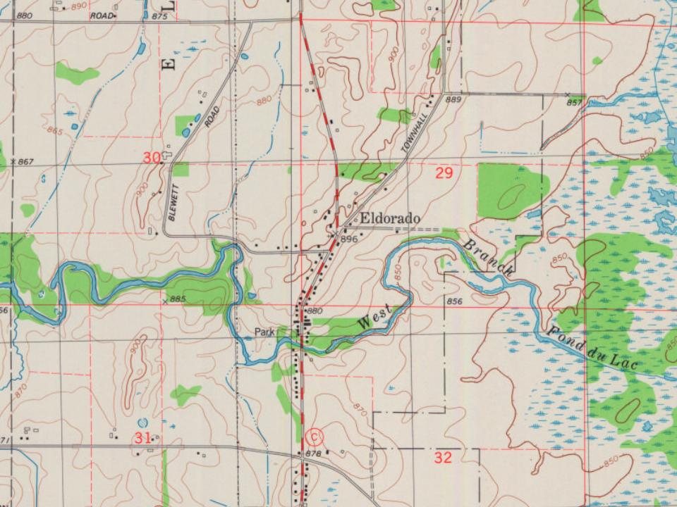
Founding dates: Wikidata, Wikipedia, the U.S. post office records of Blevins & Helbock (CC0) and the Census. Homes by year built: Census ACS 2020–24. National Register of Historic Places: National Park Service (list of May 22, 2026). Old photos, postcards and papers: Wikimedia Commons, the Library of Congress and other public archives, credited on each item’s page. Maps: U.S. Geological Survey historical topographic maps (via Esri) and Sanborn fire-insurance maps (Library of Congress). History text and census tables: Wikipedia (CC BY-SA 4.0). Places that used to be: USGS Geographic Names Information System (2021).
From the National Register of Historic Places (1), U.S. Geological Survey historical maps, the US Post Offices dataset (Blevins & Helbock), the USGS Geographic Names Information System and old county and town histories (Internet Archive). Archive images are copied here with their credits and licenses, shown on each photo’s page. Refreshed monthly.