The village received its name; many years later, Edward Brodhead explained its derivation: "He (Mazomanie) was an Indian chief in our state and was well known to the old gentleman, H.L. Dousman, who said the Indians pronounced it as though it was spelled Man-zo-ma-nie and the English of it is Iron Horse, which I adopted for the name of a railroad town and also f…
How historic is Mazomanie?
A−
More historic than 81% of U.S. towns, on its age, its old homes and the National Register.
On its age, its old homes and the National Register, Mazomanie is more historic than 81% of U.S. towns. All 2 inputs are above most U.S. towns; its National Register listings ranks highest and its share of homes from before 1940 lowest.
A−
HistoryA character grade: shown, never part of Mazomanie’s overall grade.
Wisconsin towns list more on the Register than most of the country (a typical Wisconsin town has 3.0 per 10,000 residents, the U.S. 2.4), so Mazomanie’s 64.7 sits above most of its state (91% of Wisconsin towns have fewer) while its 6 historic buildings outnumber those of 72% of U.S. towns.
How sure. Graded on two of the three inputs, so a change in either one moves the letter more than it would with three. The pre-1940 share is a Census survey estimate (±6.1 points).
Founding year: our sources. Homes: Census ACS 2020–24. National Register: National Park Service, May 2026 list; each listing counted once (boundary changes and added documentation belong to their listing), and a historic district counts its contributing buildings. How TownRatings grades history →
What stands out about Mazomanie’s past
Read from the archive, the National Register and the record. The page puts what stands out first.
Lost a third of its people between 1870 and 1930, then more than doubled.
16 censuses, 1860–2020.
U.S. Census Bureau decennial counts, from the census table on Mazomanie’s Wikipedia page.
Every building
Mazomanie, building by building, 1886–1915
Fire insurance maps drew every building, what it was made of and what it was used for, so insurers could price the risk of fire. Pick a year, then a sheet.
1886Sheet 1 of 1
Edition
Sheets
BrickWoodStone
Sanborn Map Company, via the Library of Congress. Editions published in 1930 or earlier, which are in the public domain.
What precipitated the birth of the town was the advent of the Milwaukee and Mississippi Railroad in 1855, which passed through the region to connect Milwaukee with La Crosse. The superintendent of the railroad was Edward Brodhead.
By the nation's centennial, Mazomanie had grown to 1,100 people, making it the second largest community in Dane County. Since that time, the village has gained only 350 people, but its small size and slow growth has preserved its nineteenth century character. The village has thirty-four commercial buildings on the National Register of Historic Places, the best known among these being the Mazomanie Railroad Depot which has, with minor changes, remained as it was when it was built in 1857.
Passages that mention Mazomanie, cut from the printed page as they were published.
History of Dane County, Wisconsin ... preceded by a history of Wisconsin, statistics of the state, and an abstract of its laws and constitution and of the Constitution of the United States1880 · page 915Read the page →
A history of Madison, the capital of Wisconsin1874 · page 401Read the page →
Read the text
The village of Mazomanie is a thriving place of business ; located on sections 9 and 16, and is a station of the Milwaukee & St. Paul Railroad, which road passes through sections 16, 17 and 18, in the southwest part of the town. It contains two grist mills, an Episcopal, Baptist, Roman Catholic, Primitive Methodist and Congregational Churches; a good school house, 4 public houses, 2 nurseries, a brewery, and a number of stores and shops.
Text read by machine from the scan; it may contain errors.
Madison, Dane County and surrounding towns1877 · page 495Read the page →
Read the text
corner of this county; is bounded on the north by the town of West Point, in Coliinibia couDty, on the east jby the towij of Dane, on the Bouth by the town of Berry, and on the west by the town of Mazomanie and the town of Prairie du Sac, in Sauk county. It is not quite a full township, the Wisconsin river cutting ott* the northwest corner of section six.
Text read by machine from the scan; it may contain errors.
History of Dane County, Wisconsin ... preceded by a history of Wisconsin, statistics of the state, and an abstract of its laws and constitution and of the Constitution of the United States1880 · page 609Read the page →
Read the text
This railway enters Dane Coujity in the town of Albion, passes through Dunkirk, Pleasant Springs, Dunn, Blooming Grove, Madison, to the city of Madison, thence, after leaving the city and the town of Madison, it passes through Middleton, Cross Plains and Black Earth, leaving the county from the town of Mazomanie. Its general course is northwest from the point of entering the county to the place of leaving it. Along the line within Dane County, are the following stations, with their distances from the city of Madison : McFarland, six miles; Stoughton, sixteen miles; Middleton, seven miles; Cross Plains, fifteen miles; Black Earth, twenty miles ; Mazomanie, twenty-three miles.
Text read by machine from the scan; it may contain errors.
Scans and text from the Internet Archive. Books published in 1930 or earlier, which are in the public domain.
Timeline
Mazomanie, 1863 to 2020
Woven from the archive, old maps, post office records, the National Register and the people born here.
Mazomanie is more historic than 81% of U.S. towns. The History grade combines the town’s founding era, the share of homes built before 1940 and its National Register listings. It’s a character grade, so it isn’t part of the overall grade. How it works.
What is on the National Register in Mazomanie?
Two places: the Adam Dunlap Farmstead (listed 2001) and the John and Margarethe Kemp Cabin (2008).
How old are the homes in Mazomanie?
14% of Mazomanie’s homes were built before 1940 (Census estimate, ±6.1 points), against a typical 12% for a Wisconsin town; the median home was built in 1980.
Founding dates: Wikidata, Wikipedia, the U.S. post office records of Blevins & Helbock (CC0) and the Census. Homes by year built: Census ACS 2020–24. National Register of Historic Places: National Park Service (list of May 22, 2026). Old photos, postcards and papers: Wikimedia Commons, the Library of Congress and other public archives, credited on each item’s page. Maps: U.S. Geological Survey historical topographic maps (via Esri) and Sanborn fire-insurance maps (Library of Congress). History text and census tables: Wikipedia (CC BY-SA 4.0). Places that used to be: USGS Geographic Names Information System (2021).
From Wikimedia Commons (4), Wikidata (2), the National Register of Historic Places (2), Wikipedia, Wikidata and Wikipedia for famous people, U.S. Geological Survey historical maps, U.S. Census counts (via Wikipedia), the USGS Geographic Names Information System, Sanborn fire insurance maps (Library of Congress) and old county and town histories (Internet Archive). Archive images are copied here with their credits and licenses, shown on each photo’s page. Refreshed monthly.


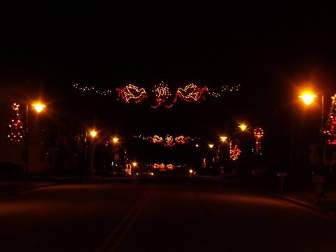 2011
 2008
 2007
 2007


