Founding year: Wikidata. First post office: 1852.The full story ↓
History grade
What drives Sauk City’s History grade
On its age, its old homes and the National Register, Sauk City is more historic than 87% of U.S. towns, #53 of 362 in Wisconsin. All 3 inputs are above most U.S. towns; its National Register listings ranks highest and its share of homes from before 1940 lowest.
A
HistoryA character grade: shown, never part of Sauk City’s overall grade.
Wisconsin towns list more on the Register than most of the country (a typical Wisconsin town has 3.0 per 10,000 residents, the U.S. 2.4), so Sauk City’s 23.0 sits above most of its state (83% of Wisconsin towns have fewer) while its 8 historic buildings outnumber those of 74% of U.S. towns.
How sure. Graded on any two of the three inputs instead, the letter would still be A−. The pre-1940 share is a Census survey estimate (±6.1 points). Two sources give 1840.
Founding year: Wikidata (other dates in Quick answers). Homes: Census ACS 2020–24. National Register: National Park Service, May 2026 list; each listing counted once (boundary changes and added documentation belong to their listing), and a historic district counts its contributing buildings. How TownRatings grades history →
What stands out about Sauk City’s past
Read from the archive, the National Register and the record. The page puts what stands out first.
Every edition of the U.S. Geological Survey’s map of Sauk City. Tap a year, or press play to watch the town change.
1895Baraboo sheet · 1:62,500
U.S. Geological Survey historical topographic maps (public domain), via Esri’s collection of the scans. The red ring marks the center of Sauk City.
Every building
Sauk City, building by building, 1892–1915
Fire insurance maps drew every building, what it was made of and what it was used for, so insurers could price the risk of fire. Pick a year, then a sheet.
1892Sheet 1 of 1
Edition
Sheets
BrickWoodStone
Sanborn Map Company, via the Library of Congress. Editions published in 1930 or earlier, which are in the public domain.
A large village of the Sauk people stood beside the Wisconsin River on the site of Sauk City before the first European-Americans settled there. The Sauk probably arrived around 1746, driven from previous homes in the Fox River valley. In 1766 the explorer Jonathan Carver visited the village, and described what he called the "Great Town of the Saukies": This is the largest and best built Indian town I ever saw. It contains about ninety houses, each large enough for several families. These are built of hewn plank neatly jointed, and covered with bark so compactly as to keep out the most penetrating rains. Before the doors are placed comfortable sheds, in which the inhabitants sit, when the weather will permit, and smoak their pipes. The streets are regular and spacious; so that it appears more like a civilized town than the abode of savages. The land near the town is very good. In their …
Passages that mention Sauk City, cut from the printed page as they were published.
The history of Sauk County, Wisconsin, containing an account of its settlement, growth, development and resources ... biographical sketches ..1880 · page 330Read the page →
Read the text
The village of Prairie du Sac was laid out by David B. Crocker, Calvin Frink and John La Mesuere, in 1840, two miles above Sauk City. This village was settled chiefly by Americans, and when Crocker came here, in 1839, he brought with him a stock of goods, and opened here the first store in the county. The location of these two villages so near together engendered a spirit of rivalry, which was maintained for many years.
Text read by machine from the scan; it may contain errors.
A standard history of Sauk County, Wisconsin1918 · page 846Read the page →
Read the text
in' the year 1844 left their land for the United States, making a long and perilous voyage across the Atlantic in a frail sailing vessel. Arrived in this countr5% they made their way to Milwaukee, from whence they came by wagon to what is now the town of Sauk City, then a little settlement of but a few houses. In that community they remained while the father completed negotiations for the purchase of government land on Otto Creek, in Sauk County, to which they soon removed. Several years later they went to Sumpter Township and again took up land from the-
Text read by machine from the scan; it may contain errors.
Scans and text from the Internet Archive. Books published in 1930 or earlier, which are in the public domain.
Timeline
Sauk City, 1840 to 1939
Woven from the archive, old maps, post office records, the National Register and the people born here.
In 1840, according to Wikidata. Sauk City’s post office opened in 1852, and the census of 1880 counted 917 people here.
How does Sauk City rank for history?
Sauk City is more historic than 87% of U.S. towns, #53 of 362 in Wisconsin. The History grade combines the town’s founding era, the share of homes built before 1940 and its National Register listings. It’s a character grade, so it isn’t part of the overall grade. How it works.
What is on the National Register in Sauk City?
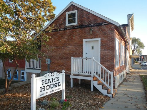
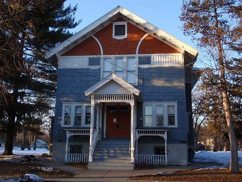
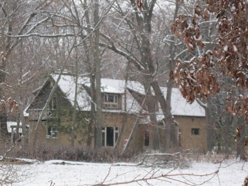
7 listings: 7 buildings, among them the Freethinkers` Hall (listed 1988, the first). 8 historic buildings in all.
How old are the homes in Sauk City?
20% of Sauk City’s homes were built before 1940 (Census estimate, ±6.1 points), against a typical 12% for a Wisconsin town; the median home was built in 1974.
Founding dates: Wikidata, Wikipedia, the U.S. post office records of Blevins & Helbock (CC0) and the Census. Homes by year built: Census ACS 2020–24. National Register of Historic Places: National Park Service (list of May 22, 2026). Old photos, postcards and papers: Wikimedia Commons, the Library of Congress and other public archives, credited on each item’s page. Maps: U.S. Geological Survey historical topographic maps (via Esri) and Sanborn fire-insurance maps (Library of Congress). History text and census tables: Wikipedia (CC BY-SA 4.0). Places that used to be: USGS Geographic Names Information System (2021).
From Wikimedia Commons (7), Wikidata (5), the National Register of Historic Places (7), Wikipedia, Wikidata and Wikipedia for famous people, U.S. Geological Survey historical maps, U.S. Census counts (via Wikipedia), the US Post Offices dataset (Blevins & Helbock), the USGS Geographic Names Information System, Sanborn fire insurance maps (Library of Congress) and old county and town histories (Internet Archive). Archive images are copied here with their credits and licenses, shown on each photo’s page. Refreshed monthly.




 2009
 2009
 2009
 2008
 2008
 2004