Guest, Sign inJoin

Post to Seattle

We’ll email a one-tap link to publish your post. No password, and nothing is public until you click it.
Already a member? Sign in
Seattle Center as night falls
Washington›King County
Photo: Jeffery Hayes · CC BY-SA 3.0
Photo of Seattle

Seattle, WA · Photo: Jeffery Hayes · CC BY-SA 3.0 · Source ↗

What is it like to live in Seattle?

Some subjects shine; others lag. On health it is strong: it is healthier than 98% of U.S. towns. Its weakest subject is safety — its crime rate is higher than 98% of U.S. towns, with 5,530 violent crimes reported to the FBI in 2025. It lags on cost of living as well (D): the typical home is worth about $823K, 7.1 years of the Seattle metro’s $115K median household income. The overall grade lands at B−, 128th of 285 in Washington. Set against the rest, it does better than 50% of U.S. towns. Its National Register listings include Virginia V and RELIEF (lightship). Just over two thirds of adults 25 and older hold a bachelor’s degree or more locally, against 30% in Washington’s towns and 29% across U.S. towns.

Figures: health, CDC PLACES · FBI crime data, 2025 · home values, Zillow · incomes, Census ACS, 2020–24 · National Register of Historic Places.

What makes Seattle stand out

Where Seattle beats most towns, and one thing worth knowing.

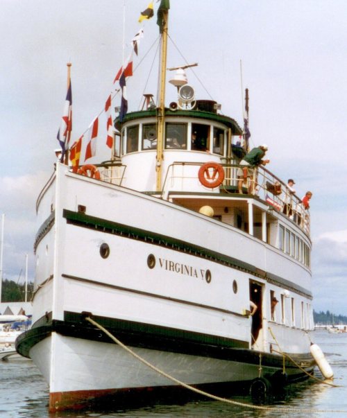
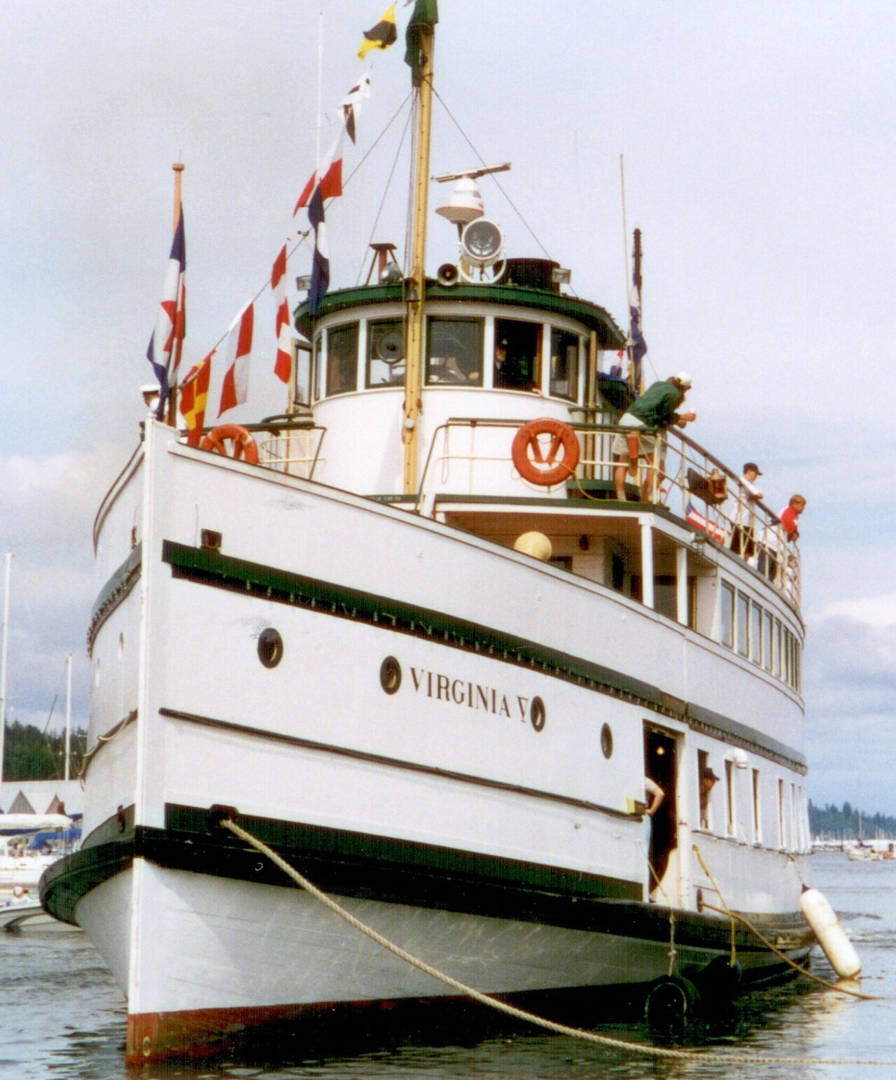
Virginia V
Virginia V · National Register of Historic Places
Seattle’s story

175 years in pictures

Virginia V is one of 8 National Historic Landmarks here, the National Register’s top tier. Its founding year, 1851, comes before those of 94% of the Washington towns we grade with a known year.

Census counts: 188 in 1860, 737,015 in 2020. The archive holds 17 old photos and papers going back to 1860 and 5 maps from 1894 on.

227 places on the National Register of Historic Places.

  • 1851Seattle is settled
Explore the history →

How Seattle grades

Each subject compared with towns across the country (schools within Washington), ordered by how far Seattle is from typical.

How grading works

Its grades run from A+ for walkability (better than 99% of comparable towns) to D− for safety (better than 2%), so the B− overall blends very different results.

Character Graded, but not part of the overall grade.
Described, not graded Taste, not quality: snow or an older crowd is neither good nor bad.

How TownRatings grades towns →

Nearby attractions

Space Needle and 136 more within 40 miles

Museums, parks, gardens and other places to visit around Seattle. Close and well known come first.

All 157 attractions →
Sources: National Park Service · ski areas © OpenSkiMap / OpenStreetMap contributors · Wikidata · Wikipedia readership · photos via Wikimedia Commons
Photo credits

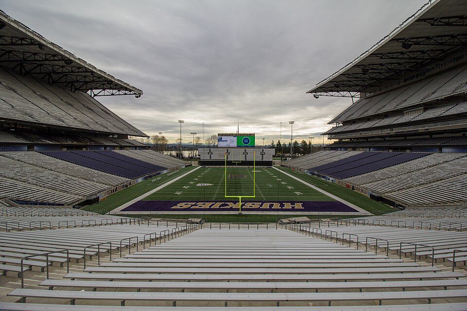
Space Needle: Another Believer, CC BY-SA 4.0 · Climate Pledge Arena: Sea Cow, CC BY-SA 4.0 · Lumen Field: "Smart Destinations", GoSeattleCard.com, and Go Seattle Card Blog, CC BY-SA 2.0 · T-Mobile Park: MyName (Cacophony), CC BY-SA 3.0 · Seattle Underground: Mark Hursh, CC BY-SA 3.0 · Husky Stadium: Atomic Taco, CC BY-SA 2.0

Getting set up

Moving to Seattle: who provides what

Who provides power, water and the rest in Seattle, and how to reach them.

The full setup list →
PowerCity of Seattle14.7¢/kWh · EIA 2025HIFLD · EIA
WaterSeattle Public UtilitiesNo health-based violations in 5 years · EPAEPA
Internet7 providers100% of addresses get 100/20 MbpsFCC
Trash & dumpTown’s haulerWaste Management and Recology picks up at the curb for every homeTown site
SchoolsSeattle Public SchoolsWhich school depends on your addressNCES
Register to voteOnlineIn Washington you can register online until 8 days before Election Day, in person up to and including Election Day, or by mail (received 8 days before).vote.gov
Who runs elections hereKing County ElectionsKing County; contacts on the Handbook page.FVAP, Sep 2021
ZIP codes98115, 98103, 98105, 9811898115 7% · 98103 7% · 98105 7% · 98118 6%Census 2020

EPA SDWIS (Oct 9, 2026) · HIFLD + EIA-861 2025 · Census 2020 ZCTAs · NCES 2024–25 · registration: vote.gov, updated Sep 30, 2026.

The data

Ordered by what stands out in Seattle.

Seattle draws workers from Bellevue and beyond and has fewer 90° days than nearly all U.S. towns, but it reports violent crime at about twice the Washington rate.

HealthA+

A smaller share of adults have diabetes in Seattle than in most of Washington or the rest of the country

Its widest gap with Washington is COPD: 2.9% of its 630,174 adults have COPD, against 5.1% statewide.

In Seattle, 6.5% of adults smoke cigarettes. On the CDC’s 31 measures, Seattle is ahead of Washington on 22 and behind on 3. Two figures for adults in the town: 8.8% report frequent physical distress, 24% have high blood pressure.

98%healthier than U.S. townsA+Health Grade
SeattleWashington townsU.S. towns
Obesity (CDC PLACES)22%33%35%
Frequent physical distress (CDC PLACES)8.8%13%14%
High blood pressure (CDC PLACES)24%31%35%
Yearly checkup (CDC PLACES)68%71%79%
31 measures vs. Washington
22 better6 too close to call3 worse
What stands outSeattleWA
Fewer adults with COPD2.9%5.1%
Fewer adults with heart disease3.4%5.4%
More binge drinkers19%16.6%
Virginia Mason Medical Center
1.3 mi away · emergency room
2 of 3
care shortages: primary care, mental health
93rd
percentile among WA towns

CDC PLACES 2025 · modeled estimates for adults · CMS · HRSA

SchoolsA

Seattle’s schools rank ahead of 87% of Washington districts

Its A for schools comes with a D for cost of living: the typical home is worth about $823K.

Below: Two of its 191 schools, each with why it was picked. The Seattle School District No. 1 runs its public schools. 6 public schools serve Seattle, with 3,445 students in all.

87%of WA districts it outscoresASchool Grade
SchoolLevelStudentsLetter
Eckstein Middle SchoolLargest public middle schoolGrades 6–8Grades 6–81,024–
Lincoln High SchoolLargest public high schoolGrades 9–12Grades 9–121,770–

NCES · EDFacts · graded within WA on state tests and graduation

SafetyD−

Violent crime in Seattle is higher than in the typical Washington or U.S. town

Violent crime runs at 7 per 1,000 residents, about twice the Washington rate; the Safety Grade counts each violent crime four times, so this weighs most on its D−. Property crime runs at 44.2 per 1,000 residents, about twice the Washington rate, most of it theft.

Among 132 Washington towns, just 3 have a higher property offense rate than Seattle.

2%of U.S. towns report more crimeD−Safety Grade
SeattleWashington townsU.S. towns
Violent crimes per 1,000 (2025)7 per 1,000 residents1.51.6
Property crimes per 1,000 (2025)44.2 per 1,000 residents159.9

Violent crime per 1,000 residents

Seattle7
Washington2.9
U.S.3.3

Property crime per 1,000 residents

Seattle44.2
Washington20.2
U.S.15.5
2nd
percentile among U.S. towns we grade
3rd
percentile among WA towns
5,530
violent crimes reported in 2025
34,981
property crimes reported in 2025

FBI crime data, 2025 · crimes reported to police

Work & commuteJobs & income grade A−

More than half of Seattle’s working residents work in town

613,163 jobs are based in Seattle, 1.7 for every working resident, so most of the people who work here commute in. Jobs based here grew from 469,568 in 2013 to 613,163.

Half the trips to work are shorter than 6 miles. Since 2013, Seattle has added 143,595 jobs, to 613,163 in 2023. For workers in the town, the share who work remotely from home is 35%. The top destinations are Bellevue (8%), Redmond (6%) and Kirkland (2%).

60%work in town
SeattleWashington townsU.S. towns
Work from home35%15%11%
Median household income$124,000$98,000$80,000
Below the poverty line9.9%7.9%9.6%
Average trip to work26 minutes27 minutes25 minutes

Where working residents work

In Seattle60%
Bellevue8%
Redmond6%
Kirkland2%
Renton2%
6 mi
median commute distance
613,163
jobs based in Seattle
A job hub
jobs vs. working residents
A+
Walkability grade: among the most walkable U.S. towns

Census LEHD 2023 · ACS

OutdoorsA

Seattle has set aside 6.7% of its land for conservation

Discovery Park, at 569 acres with 22.3 miles of trail, is the biggest park or preserve. Trails total 194 miles in 272 parks and preserves. The trail density in Seattle is 1.4 miles per square mile.

#78for trails in WA
SeattleWashington townsU.S. towns
Miles of trail per square mile1.4 miles per square mile0.80.4
Conserved land6.7%4%4.3%
6.7%
conserved · 6,067 of 90,297 acres
194 mi
of trails · 1.4 per sq mi
Biggest places to walkTrailsAcres
1. Discovery Park22.3 mi569
2. Warren G. Magnuson Park10.8 mi293
3. Washington Park Arboretum8.9 mi227

Trails & parks © OpenStreetMap contributors · Conserved land: USGS PAD-US

HousingCost of living grade D

Seattle’s grade for cost of living is a D

At 7.1 years of the Seattle metro’s $115K median household income, the typical home (about $823K) costs more against local pay than in 76% of Washington towns; that ratio is one input to that grade. The typical value, about $823K, is 10% below its June 2022 peak.

Over the 12 months to September 2026, the typical home lost 1.8% of its value. Seattle’s midpoint rent comes in at $2,030 a month. Among households in the town, 44% are owner-occupiers.

$823KZillow home value
SeattleWashington townsU.S. towns
Households that own their home44%71%73%
Median rent$2,030 a month$1,737 a month$1,185 a month
Renters paying 30%+ of income on rent44%51%48%

Typical home value

Seattle$823K
Washington$588K
Market temperature
Seller’s marketA seller's marketBuyer’sSeller’s
11
days on market
100.8%
sale-to-list price
−1.8%
value change, 1 year
799
homes sold in May

Census ACS, 2020–24 · Zillow Home Value Index · Redfin Data Center

Natural hazardsHazard risk grade C−

Top of a high hazard risk in Seattle: earthquakes

156 flood insurance claims have been filed here, and 19 properties have flooded more than once.

Expected damage from storms and floods is higher here than in 76% of U.S. communities. Since 1978, 156 flood insurance claims have been paid out in Seattle. Federal aid has come to Seattle households in 13 declared disasters; the latest was in 2025.

76risk score of 100
FEMA risk score
76High riskLowerHigher
EarthquakesInland flooding
156
paid flood claims since 1978
13
federal disasters paid out here

FEMA flood insurance claims · FEMA disaster declarations and aid · FEMA National Risk Index · OpenFEMA

Climate

In Seattle, expect mild winters and pleasant summers

The Seattle Sand Pt Wsfo weather station, 6 miles away, records that about 2 days a year reach 90°, fewer than in 95% of U.S. towns. July afternoons average 76.7°, cooler than in 97% of U.S. towns; January nights average 36.8°.

In Seattle, the January low is 37°F. About 4 inches of snow falls in a winter.

4″snow a winter
SeattleWashington townsU.S. towns
July high77°F77°F85°F
January low37°F35°F22°F

Typical low → high °F

Winter36–48°
Spring43–60°
Summer55–75°
Fall46–61°
Nov 23
typical first frost
Mar 8
typical last frost
+1.3°
vs. the 20th-century average

NOAA U.S. Climate Normals, 1991–2020

Keep exploring

Everything we know about Seattle

20pages on Seattle
After high school

Colleges nearby

24 within 15 miles of the center of Seattle

A growing town

Seattle has grown 29% since 2010

608,660 counted in 2010 and 737,015 in 2020; an estimated 784,777 in 2025.

Growth hasn’t slowed: 6.5% since 2020, after 21.1% in the decade before.

608,6602010
737,0152020
784,7772025 est.

U.S. Census 2010 & 2020 counts · Census Bureau estimate, July 1, 2025

Landmarks

227 places in Seattle on the National Register of Historic Places.

All landmarks →

Famous people from Seattle

25 notable people were born in Seattle.

See all 25 →

About Seattle

City in Washington, United States

Official town website ↗

Seattle ( see-AT-əl) is the most populous city in the U.S. state of Washington and the Pacific Northwest region of North America. It is the 18th-most populous city in the United States with a population of 784,777 in 2025, while the Seattle metropolitan area at over 4.15 million residents is the 15th-most populous metropolitan area in the nation. The city is the county seat of King County, the most populous county in Washington. Seattle's growth rate of 21.1% between 2010 and 2020 made it one of the country's fastest-growing large cities. Seattle is situated on an isthmus between Puget Sound, an inlet of the Pacific Ocean, and Lake Washington. It is the northernmost major city in the United…

From Wikipedia, licensed CC BY-SA 4.0 · facts via Wikidata (CC0)

Established
1851
Area
143 sq mi
Elevation
131 ft
ZIP code
98101, 98102, 98103
Area code
206

Seattle’s neighbors

10 towns share a border with Seattle.

Explore the map →
How the neighbors grade
TownWA rankOverallCostSafetySchoolsHealth
Seattle#128B−DD−AA+
Bainbridge Island#8ADB+A+A+
Mercer Island#6AD−BA+A+
Tukwila#236C−C−D−C+A−
Kirkland#28A−D−B−A+A+
Boulevard Park#142B−C−—A−B−
White Center#191CD—C−A−
Bryn Mawr-Skyway#152C+D—C+A

Boulevard Park, White Center and Bryn Mawr-Skyway report no FBI crime data of their own. Compare Seattle with a neighbor →

Questions about Seattle

Short answers, built from the data on this page.

Is Seattle, WA a good place to live?

Seattle grades B− overall, better than 50% of U.S. towns and #128 of 285 in Washington. It grades A+ for health, D− for safety and A for schools. Safety is its weak spot, with a D−.

Is Seattle, WA expensive?

Yes. Cost of living, which also weighs rents, property taxes and how many households pay 30% or more of their income for housing, grades D.

What is Seattle, WA known for?

25 notable people were born here, including Bill Gates and Jimi Hendrix.