4 places in town are on the National Register, among them a historic district with 18 buildings. Below: 7 old photos and papers, maps from 1895 on, and the census since 1880.
Founding year: the first West Rutland post office (Blevins & Helbock, CC0).The full story ↓
History grade
What drives West Rutland’s History grade
On its age, its old homes and the National Register, West Rutland is more historic than 93% of U.S. towns. All 3 inputs are above most U.S. towns; its share of homes from before 1940 ranks highest and its National Register listings lowest.
A
HistoryA character grade: shown, never part of West Rutland’s overall grade.
Vermont towns list more on the Register than most of the country (a typical Vermont town has 147 per 10,000 residents, the U.S. 2.4), so West Rutland’s 98.2 sits near the middle of its state (58% of Vermont towns have fewer) while its 22 historic buildings outnumber those of 80% of U.S. towns.
How sure. Graded on any two of the three inputs instead, the letter would range from A− to A+. The pre-1940 share is a Census survey estimate (±12.7 points). The founding year is the first post office, not a stated founding date.
Founding year: the first post office (other dates in Quick answers). Homes: Census ACS 2020–24. National Register: National Park Service, May 2026 list; each listing counted once (boundary changes and added documentation belong to their listing), and a historic district counts its contributing buildings. How TownRatings grades history →
What stands out about West Rutland’s past
Read from the archive, the National Register and the record. The page puts what stands out first.
The town of Rutland was originally granted in 1761 as one of the New Hampshire Grants and named after Rutland, Massachusetts, the home of the first grantee, John Murrey. It was one of the most successful of those grants because of excellent farmland and gentle topography.
In 1863, there was rioting in West Rutland after the state instituted a draft.
During a strike in 1868, owners evicted Irish-Catholic workers from company-owned homes, then imported dozens of French-Canadian Catholic "strikebreakers" to replace them.
West Rutland petitioned the Vermont legislature to separate from East Rutland. On November 19, 1886, West Rutland was incorporated as its own town.
Peaked at 3,680 in 1890; 2,214 people lived here in 2020.
15 censuses, 1880–2020.
U.S. Census Bureau decennial counts, from the census table on West Rutland’s Wikipedia page.
From the old history books
What they wrote about West Rutland in 1886
Passages that mention West Rutland, cut from the printed page as they were published.
History of Rutland County, Vermont, with illustrations and biographical sketches of some of its prominent men and pioneers1886 · page 377Read the page →
Read the text
The Rev. Z. Druon came here as a missionary in 1854, and in 1S55 established St. Bridget's Church at West Rutland, and St. Peter's Church in East Rutland, both being in one parish. He remained until January 5, 1857, at which time the parish was divided into two separate parishes. During the year 1855 a small church was erected in the St. Peter's parish, which was used until 1869, when, on the 5th of July, the corner-stone of the beautiful and commodious stone edifice, Rutland, was laid by the bishop of the diocese of Burlington ; it was finished in 1873 and cost nearly $60,000. Under the very
Text read by machine from the scan; it may contain errors.
History of Rutland County, Vermont, with illustrations and biographical sketches of some of its prominent men and pioneers1886 · page 911Read the page →
Read the text
Charles H. Slason received his education at Castleton, Vt., and later attended Burr Seminary, and Burton's Seminary at Manchester, Vt. At the age of sixteen he began work in his father's store at West Rutland, and early developed rare capacity for business. In 1844 he struck the first blow that led to opening the first marble quarry in West Rutland (now owned by Sheldon &: Son), in company with Dr. Lorenzo Sheldon, David Morgan, William Barnes and his father, Francis Slason. This firm became in 1850 Sheldon & Slason, remaining such until the fall of 1881, when he sold his interest to the present firm of Sheldon & Sons.
Text read by machine from the scan; it may contain errors.
Scans and text from the Internet Archive. Books published in 1930 or earlier, which are in the public domain.
Timeline
West Rutland, 1826 to 1941
Woven from the archive, old maps, post office records, the National Register and the people born here.
Nothing in the archives for these yearsWeddings on Main Street, storms, parades, school pictures, the old store. If it’s in your family album, it belongs here.
Nothing in the archives for these yearsWeddings on Main Street, storms, parades, school pictures, the old store. If it’s in your family album, it belongs here.
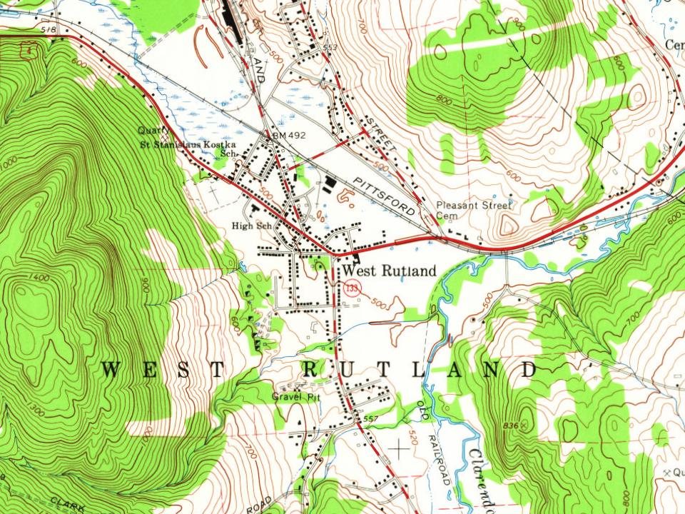
Fire insurance maps drew every building, what it was made of and what it was used for, so insurers could price the risk of fire. Pick a year, then a sheet.
The West Rutland post office opened in 1826, the earliest record of the town by name (U.S. post office records).
How does West Rutland rank for history?
West Rutland is more historic than 93% of U.S. towns. The History grade combines the town’s founding era, the share of homes built before 1940 and its National Register listings. It’s a character grade, so it isn’t part of the overall grade. How it works.
What is on the National Register in West Rutland?
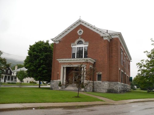
4 listings: 3 buildings, among them the West Rutland Town Hall (listed 1983, the first), and 1 historic district, the Marble Street Historic District, with 18 contributing buildings. 22 historic buildings in all.
How old are the homes in West Rutland?
52% of West Rutland’s homes were built before 1940 (Census estimate, ±12.7 points), against a typical 22% for a Vermont town; the median home was built in 1938.
Founding dates: Wikidata, Wikipedia, the U.S. post office records of Blevins & Helbock (CC0) and the Census. Homes by year built: Census ACS 2020–24. National Register of Historic Places: National Park Service (list of May 22, 2026). Old photos, postcards and papers: Wikimedia Commons, the Library of Congress and other public archives, credited on each item’s page. Maps: U.S. Geological Survey historical topographic maps (via Esri) and Sanborn fire-insurance maps (Library of Congress). History text and census tables: Wikipedia (CC BY-SA 4.0). Places that used to be: USGS Geographic Names Information System (2021).
From Wikimedia Commons (11), the Library of Congress (4), Wikidata (3), the National Register of Historic Places (4), Wikipedia, U.S. Geological Survey historical maps, U.S. Census counts (via Wikipedia), the US Post Offices dataset (Blevins & Helbock), the USGS Geographic Names Information System, Sanborn fire insurance maps (Library of Congress) and old county and town histories (Internet Archive). Archive images are copied here with their credits and licenses, shown on each photo’s page. Refreshed monthly.







 1941
 1941
 1941
 Date?
 Date?
 2010
 2010
 2010
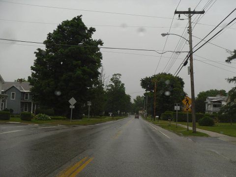 2010
 2010
 2010
 2004
 2004


